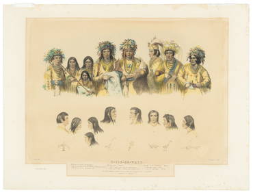
ATLAS of ANTIENT GEOGRAPHY by SAMUEL BUTLER 1843John McInnis Auctioneers,LLC4.5(505)See Sold PriceFeb 24, 2024
18TH C. ANTIQUE MAP: FRENCH & INDIAN WAR, FRAMEDThomaston Place Auction Galleries4.4(393)See Sold PriceFeb 24, 2024
Rand McNally Railroad Map Cabinet w/ 21 Railroad MapsRail & Road Auctions4.6(165)See Sold PriceMar 08, 2024
Keith Haring - Ink on New York Map, Best Buddies, Inscribed, Signed, and DatedSapphire Auction Gallery4(67)See Sold PriceMar 02, 2024
LATE 17TH C. FRENCH MAP OF THE NEW WORLD BY ALEXIS-HUBERT JAILLOT (1632-1712)Thomaston Place Auction Galleries4.4(393)See Sold PriceFeb 24, 2024
Central Railroad of New Jersey Map of Sandy Hook Route-ca. 1903JM Hobby Supply and Railroad Artifact Auctions4.4(127)See Sold PriceFeb 24, 2024
Lot of Six Mixed Atlas Box Cars-HO Scale-New in BoxJM Hobby Supply and Railroad Artifact Auctions4.4(127)See Sold PriceFeb 25, 2024
Rand McNally/Santa Fe Railroad Map of Iowa-1912JM Hobby Supply and Railroad Artifact Auctions4.4(127)See Sold PriceFeb 24, 2024
NICOLAES VISSCHER (NETHERLANDS, 1618-1709) MAP OF THE NEW WORLDThomaston Place Auction Galleries4.4(393)See Sold PriceFeb 24, 2024
17TH C. WORLD MAP BY NICOLAES VISSCHER (NETHERLANDS, 1618-1709)Thomaston Place Auction Galleries4.4(393)See Sold PriceFeb 24, 2024
Lot of Six Mixed Atlas Cabooses-HO Scale-New in BoxJM Hobby Supply and Railroad Artifact Auctions4.4(127)See Sold PriceFeb 25, 2024
Sold1869 Mitchell Map of Plains States and Colorado --Title/Content of Map: 1869 Mitchell Map of Plains States and Colorado -- XVIII Kansas, Colorado, New Mexico and Indian Territory [verso] XVI Minnesota and Dakota [also] XVII Nebraska Cartographer: S MSee Sold Price
Sold1869 Mitchell Map of Atlantic States from MassachusettsTitle/Content of Map: 1869 Mitchell Map of Atlantic States from Massachusetts to Delaware [verso] Map of New York, New Jersey, Pennsylvania & Delaware -- IX Massachusetts, Rhode Island and ConnecticutSee Sold Price
Sold1869 Mitchell Map of CaliforniaTitle/Content of Map: 1869 Mitchell Map of California -- County Map of the State of California Date Printed: 1869, Philadelphia Cartographer: S. Mitchell Size: 21.2 x 14.6 in. An excellent large map oSee Sold Price
Mitchell: Antique Map of California, 1869Title/Content of Map: 1869 Mitchell Map of California -- County Map of the State of California Date Printed: 1869, Philadelphia Cartographer: S. Mitchell Size: 21.2 x 14.6 in. An excellent large map oSee Sold Price
1869 Mitchell Map of the Northern and [verso] WesternTitle/Content of Map: 1869 Mitchell Map of the Northern and [verso] Western Portions of South America -- XXV Venezuela, United States of Columbia and Ecuador [verso] XXVII Peru and Bolivia CartographeSee Sold Price
1869 Mitchell Map of US [verso] Maine, New Hamshire andTitle/Content of Map: 1869 Mitchell Map of US [verso] Maine, New Hamshire and Vermont -- VII Map of the United States [verso] VIII Maine, New Hamshire and Vermont Cartographer: S Mithchell Year/Place:See Sold Price
1869 Mitchell Map of Much of Western Europe -- XXXII Prussia the German States Holland & BelgiumTitle: 1869 Mitchell Map of Much of Western Europe -- XXXII Prussia the German States Holland & Belgium [verso] XXXIII France, Spain, Portugal and Belgium Cartographer: S Mithchell Year/Place: 1869, PSee Sold Price
1869 Mitchell Map of US [verso] Maine, New Hamshire andTitle: 1869 Mitchell Map of US [verso] Maine, New Hamshire and Vermont -- VII Map of the United States [verso] VIII Maine, New Hamshire and Vermont Cartographer: S Mithchell Year / Place: 1869, PhiladSee Sold Price
1869 Mitchell Map of Much of Western Europe -- XXXIITitle: 1869 Mitchell Map of Much of Western Europe -- XXXII Prussia the German States Holland & Belgium [verso] XXXIII France, Spain, Portugal and Belgium Cartographer: S Mithchell Year / Place: 1869,See Sold Price
1869 Mitchell Map of the Northern and [verso] WesternTitle: 1869 Mitchell Map of the Northern and [verso] Western Portions of South America -- XXV Venezuela, United States of Columbia and Ecuador [verso] XXVII Peru and Bolivia Cartographer: S MithchellSee Sold Price
Austrian Empire, Italian States, Turkey in Europe & Greece. MITCHELL 1869 mapTITLE/CONTENT OF MAP: 'Map of the Austrian Empire, Italian States, Turkey in Europe, and Greece // Maltese Islands' DATE PRINTED: 1869 IMAGE SIZE: Approx 29.0 x 36.0cm, 11.5 x 14.25 inches (Large) TYPSee Sold Price
Austrian Empire, Italian States, Turkey in Europe & Greece. MITCHELL 1869 mapTITLE/CONTENT OF MAP: 'Map of the Austrian Empire, Italian States, Turkey in Europe, and Greece // Maltese Islands' DATE PRINTED: 1869 IMAGE SIZE: Approx 29.0 x 36.0cm, 11.5 x 14.25 inches (Large) TYPSee Sold Price
Prussia & German States. Unification era MapPrussia & German States. Unification era Map 1869 Augustus S. Mitchell 15" x 12" Hand colored engraved Map. Published in Philadelphia. From 'MItchell's New General Atlas.' Please note that this lot haSee Sold Price
Mitchell: Antique Map of Prussia & German States, 1869Title/Content of Map: Prussia & German States Date Printed: 1869 Cartographer: Augustus S. Mitchell Material/Medium: Paper Size: 15" x 12" Hand colored engraved Map. From his 'Mitchell's New General ASee Sold Price
SoldMitchell: Antique Map of New York State & Cities, 1869Title/Content of Map: New York by Mitchell City views on sides Date Printed: 1869 Cartographer: Augustus S. Mitchell Material/Medium: Paper Size: 23 1/3" x 15 1/3" Hand colored steel engraved Map. PubSee Sold Price
Mitchell: Antique Map of New York State, 1869Title/Content of Map: New York State by Mitchell Date Printed: 1869 Cartographer: Augustus S. Mitchell Material/Medium: Paper Size: 23 1/2" x 15 1/4" Condition: Excellent Hand colored engraved Map. PuSee Sold Price
SoldMitchell, County Map of California, 1669Heading: Author: Mitchell, Samuel Augustus Title: County Map of the State of California Place Published: [Philadelphia] Publisher: Date Published: 1869 Description: LithogrSee Sold Price
SoldColton: Map of California Nevada Utah Colorado ArizonaColton's Map of California, Nevada, Utah, Colorado, Arizona & New Mexico, 1865/1869. Early edition of Colton's map of the Southwestern United States. Unlike in the prior edition, Nevada is no longer tSee Sold Price
Sold1869 Mineral wealth of Colorado w/ 2 mapsHeading: (Colorado) Author: Whitney, Joel P. Title: Colorado, In the United States of America. Schedule of Ores contributed by Sundry Persons to the Paris Universal Exposition of 1867, with some inforSee Sold Price
Sold1869 Mitchell Map of Texas -- XIII TexasReserve Reduced! Map Title/Content: 1869 Mitchell Map of Texas -- XIII Texas Cartographer: S Mitchell Year / Place: 1869, Philadelphia Map Dimension (in.): 8.4 X 10.6 in. This is a very nice Texas mapSee Sold Price
Sold1869 Mitchell Map of Texas -- XIII TexasTitle/Content of Map: 1869 Mitchell Map of Texas -- XIII Texas Cartographer: S Mitchell / Butler Co. Year/Place: 1869, Philadelphia Size: 8.7 X 10.8 in. This is an excellent map of Texas, filled withSee Sold Price
Sold1869 Mitchell Map of Western US [verso] Mexico andTitle: 1869 Mitchell Map of Western US [verso] Mexico and Central America -- XIX California, Oregon, Idaho, Utah, Nevada, Arizona and Washington [verso] XX Mexico and Central America Cartographer: S MSee Sold Price
Rand McNally Railroad Map of Colorado-1929JM Hobby Supply and Railroad Artifact Auctions4.4(127)See Sold PriceFeb 24, 2024
Vintage County Map Of NY State Plate EngravingThe Benefit Shop Foundation Inc.4.3(2.9k)See Sold PriceFeb 28, 2024
1849 Mitchell School ATLAS 24 MAPS America Holy Land France Africa Egypt AsiaSchilb Antiquarian Rare Books4.8(428)See Sold PriceMar 31, 2024
Putnam - First Map of the State of Ohio by Rufus PutnamTrillium Antique Prints & Rare Books4.5(32)See Sold PriceFeb 24, 2024
Mitchell - Map of the City of Washington (Washington, DC)Trillium Antique Prints & Rare Books4.5(32)See Sold PriceFeb 24, 2024
7 Val St Lambert State Plain footed tumblersInternational Auction Gallery4.6(780)See Sold PriceFeb 26, 2024
Early Native American Plains Blackfoot Beaded MoccasinsArtemis Fine Arts4.8(1.4k)See Sold PriceFeb 26, 2024
Cooke, George 1801 Antique Map. United States of AmericaAlbion Auctions4.6(341)See Sold PriceMar 01, 2024
[Spokane, Washington State] Maps, Pins & More (8)Grant Zahajko Auctions, LLC4.7(1k)See Sold PriceMar 06, 2024


![1869 Mitchell Map of the Northern and [verso] Western (1 of 2)](https://p1.liveauctioneers.com/5584/179019/90117893_1_x.jpg?height=282&quality=70&version=1600206230)
![1869 Mitchell Map of US [verso] Maine, New Hamshire and (1 of 2)](https://p1.liveauctioneers.com/5584/179983/90569379_1_x.jpg?height=282&quality=70&version=1601417445)

![1869 Mitchell Map of US [verso] Maine, New Hamshire and (1 of 2)](https://p1.liveauctioneers.com/5584/195879/98794792_1_x.jpg?height=282&quality=70&version=1614724478)

![1869 Mitchell Map of US [verso] Maine, New Hamshire and (1 of 2)](https://p1.liveauctioneers.com/5584/190355/95871752_1_x.jpg?height=282&quality=70&version=1609884614)

![1869 Mitchell Map of the Northern and [verso] Western (1 of 2)](https://p1.liveauctioneers.com/5584/194427/98040333_1_x.jpg?height=282&quality=70&version=1613575397)


![1869 Mitchell Map of Western US [verso] Mexico and (1 of 2)](https://p1.liveauctioneers.com/5584/188299/94765046_1_x.jpg?height=282&quality=70&version=1608072723)


![[Spokane, Washington State] Maps, Pins & More (8) (1 of 5)](https://p1.liveauctioneers.com/5755/320282/172114031_1_x.jpg?height=282&quality=70&version=1708463029)

