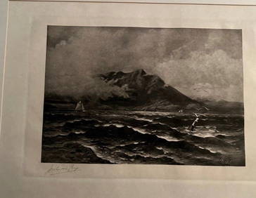
ATLAS of ANTIENT GEOGRAPHY by SAMUEL BUTLER 1843John McInnis Auctioneers,LLC4.6(502)See Sold PriceFeb 24, 2024
18TH C. ANTIQUE MAP: FRENCH & INDIAN WAR, FRAMEDThomaston Place Auction Galleries4.4(386)See Sold PriceFeb 24, 2024
Rand McNally Railroad Map Cabinet w/ 21 Railroad MapsRail & Road Auctions4.6(165)See Sold PriceMar 08, 2024
Keith Haring - Ink on New York Map, Best Buddies, Inscribed, Signed, and DatedSapphire Auction GallerySee Sold PriceMar 02, 2024
LATE 17TH C. FRENCH MAP OF THE NEW WORLD BY ALEXIS-HUBERT JAILLOT (1632-1712)Thomaston Place Auction Galleries4.4(386)See Sold PriceFeb 24, 2024
Central Railroad of New Jersey Map of Sandy Hook Route-ca. 1903JM Hobby Supply and Railroad Artifact Auctions4.4(126)See Sold PriceFeb 24, 2024
Lot of Six Mixed Atlas Box Cars-HO Scale-New in BoxJM Hobby Supply and Railroad Artifact Auctions4.4(126)See Sold PriceFeb 25, 2024
Rand McNally/Santa Fe Railroad Map of Iowa-1912JM Hobby Supply and Railroad Artifact Auctions4.4(126)See Sold PriceFeb 24, 2024
NICOLAES VISSCHER (NETHERLANDS, 1618-1709) MAP OF THE NEW WORLDThomaston Place Auction Galleries4.4(386)See Sold PriceFeb 24, 2024
17TH C. WORLD MAP BY NICOLAES VISSCHER (NETHERLANDS, 1618-1709)Thomaston Place Auction Galleries4.4(386)See Sold PriceFeb 24, 2024
Lot of Six Mixed Atlas Cabooses-HO Scale-New in BoxJM Hobby Supply and Railroad Artifact Auctions4.4(126)See Sold PriceFeb 25, 2024
SoldColton: Map of California Nevada Utah Colorado ArizonaColton's Map of California, Nevada, Utah, Colorado, Arizona & New Mexico, 1865/1869. Early edition of Colton's map of the Southwestern United States. Unlike in the prior edition, Nevada is no longer tSee Sold Price
SoldCOLTON, G.W. & C.B. Colton's Map of California, Nevada,COLTON, G.W. & C.B. Colton's Map of California, Nevada, Utah, Colorado, Arizona & New Mexico. Large double-page lithographed map of the American southwest. 17¼x27¾ inches sheet size, upper mSee Sold Price
Colton's Map of California, Nevada, Utah, Colorado,Reserve Reduced! Title/Content of Map: Colton's Map of California, Nevada, Utah, Colorado, Arizona & New Mexico Date: c1869 Cartographer: COLTON, G.W. & C.B. Publisher: G.W. & C.B. COLTON & CO. Size:See Sold Price
Colton's Map of California, Nevada, Utah, Colorado,Title/Content of Map: Colton's Map of California, Nevada, Utah, Colorado, Arizona & New Mexico. Date Printed: 1865-1869 ca. Cartographer: COLTON, GEORGE WOOLWORTH Size: 17X24.3 Present day boundariesSee Sold Price
SoldColton's Map of California 1855Title: Colton's Map of California, Nevada, Utah, New Mexico, Colorado, Arizona & New Mexico Author: Colton, J.H. Description: Lithographed map, hand-colored. 38.2x62.2 cm. (15x24½") plus decorative bSee Sold Price
Sold1839 Western States – unsettled borders, ColtonOregon, Washington, California, Colorado, Nevada, Utah, New Mexico and Arizona, J. H. Colton. 1839 copyright date found in 1864 Colton school atlas. This hand colored map was created before most westeSee Sold Price
SoldColton's California, Nevada, Utah, Colorado,Arizona andColton, George Woolworth and C.B. & Co. Colton's California, Nevada, Utah, Colorado, Arizona and New Mexico. NY: 1873200 mile scaleDimensions:15" X 24 1/4"Inv.18See Sold Price
Gray's Atlas Map of California, Nevada, Utah, Colorado,Map: Gray's Atlas Map of California, Nevada, Utah, Colorado, Arizona & New Mexico Publication Date: 1873 Cartographer: Gray, O.W. Publisher: Gray, O.W. Size (inches): 15.5X25.3 Map with counties separSee Sold Price
SoldCalifornia Southwest Antique MapEarly map: California, also Utah, Nevada, Colorado, New Mexico and Arizona. Map by A.J. Johnson, New York, c. 1870. 18" x 26 1/2".See Sold Price
California, New Mexico, Arizona, Utah, Colorado,Title/Content of Map: California, New Mexico, Arizona, Utah, Colorado, Nevada. Date: 1861 Cartographer: Johnson Material/Medium: steel engraved Size: 28x18” Provenance: New York Additional Info: HanSee Sold Price
SoldA CIVIL WAR ERA MAP, "Johnson's California withA CIVIL WAR ERA MAP, "Johnson's California with Territories of Utah, Nevada, Colorado, New Mexico and Arizona," NEW YORK, CIRCA 1866, colored cerography on paper, a fragment from Johnson's Family AtlaSee Sold Price
Sold[1864 JOHNSON & WARD MAP]135. [1864 JOHNSON & WARD MAP] Johnson's California, with Territories of Utah, Nevada, Colorado, New Mexico,and Arizona. Hand-colored, ornately bordered lithograph map, 23½"x17", overall 26½"x18", NSee Sold Price
Johnson: Antique Map of California Territories, 18632-page Johnson’s 1863 Calif. Territories of N. Mexico Arizona Colorado Nevada & Utah. One of the most detailed accurate commercial maps of the era. One of the scarcest and most historically sigSee Sold Price
USA 1903 Lot of 6 State Maps. WA, AZ, CA, CO, NV, UTWashington, Nevada/Utah, Colorado, Arizona/New Mexico, California North and South. Lithograph Maps Published 1903 by Adam & Charles Black, Edinburgh & London for "Encyclopaedia Brittannica" Tenth EditSee Sold Price
USA 1903 Lot of 6 State Maps. WA, AZ, CA, CO, NV, UTWashington, Nevada/Utah, Colorado, Arizona/New Mexico, California North and South. Lithograph Maps Published 1903 by Adam & Charles Black, Edinburgh & London for "Encyclopaedia Brittannica" Tenth EditSee Sold Price
SoldRare Colton folding map of Pacific Slope 1862Heading: Author: Colton, Joseph Hutchins Title: Colton's Map of the Pacific States California and Oregon with the Territories of Nevada, Utah, New Mexico, Colorado and Washington, in connection withSee Sold Price
SoldJohnson’s Map of California Territories, 18631863 Johnson’s California Territories of New Mexico, Arizona, Colorado, Nevada and Utah. Johnson and Ward, 17 x 24.5 inches. Late 1863 transitional map with New Mexico and Arizona divided verticallySee Sold Price
SoldJohnson's Map of California, Utah, &c. 1864Title: Johnson's California, with Territories of Utah, Nevada, Colorado, New Mexico, and Arizona Author: Johnson and Ward Description: Hand-colored lithograph map. 43x59.5 cm. (17x23½"), including bSee Sold Price
Sold1863 colored map Johnson's California & the westTitle: Johnson's California, Territories of New Mexico, Arizona, Colorado, Nevada and Utah Author: Johnson & Ward Description: Lithographed map, hand-colored. 40.2x59 cm. (15¾x23¼"), plus border andSee Sold Price
Johnson's California with Utah, Nevada, Colorado, New Mexico & Arizona 1866 mapTitle: Johnson's California with Utah, Nevada, Colorado, New Mexico & Arizona 1866 map Description: Johnson's California, with Utah, Nevada, Colorado, New Mexico and Arizona' by Alvin Jewett Johnson (See Sold Price
SoldMap of Arizona, California, Colorado, Nevada, NewTitle: Map of Arizona, California, Colorado, Nevada, New Mexico, and Utah. Publication Date: 1889 Cartographer: JOHNSON, ALVIN JEWETT Publisher: A.J. Johnson & Co. Height: 8.5 Width: 12.1 "Drawn and eSee Sold Price
Map of Arizona, California, Colorado, Nevada, NewTitle/Content of Map: Map of Arizona, California, Colorado, Nevada, New Mexico, and Utah. Cartographer: JOHNSON, ALVIN JEWETT Date: 1889 Publisher: A.J. Johnson & Co. Size: 8.5Height - 12.1Width "DrawSee Sold Price
Sold1864 WESTERN UNITED STATES MAP1864 WESTERN UNITED STATES MAP, hand-colored engraving on paper, titled "Johnson's California, with Utah, Nevada, Colorado, New Mexico, and Arizona", by Johnson and Ward, 1864. Third quarter 19th centSee Sold Price
SoldJohnson's California & West hand-colored map 1866Title: Johnson's California, Also Utah, Nevada, Colorado, New Mexico, and Arizona Author: Johnson Description: Hand-colored lithographed map. 39.4x56.2 cm. (15½x22"), plus decorative border.Various GSee Sold Price
Bill Rasley (IO,CA,AZ,1902-1984) oil paintingBroward Auction Gallery4.8(277)See Sold PriceMar 10, 2024
Bill Rasley (IO,CA,AZ,1902-1984) oil paintingBroward Auction Gallery4.8(277)See Sold PriceMar 10, 2024
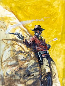
James Collender (AZ,CO,CA,1935-2011) gouache paintingBroward Auction Gallery4.8(277)See Sold PriceMar 10, 2024
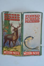
Western Pacific RR Finned Furred Feathered Brochure-1912JM Hobby Supply and Railroad Artifact Auctions4.4(126)See Sold PriceFeb 24, 2024
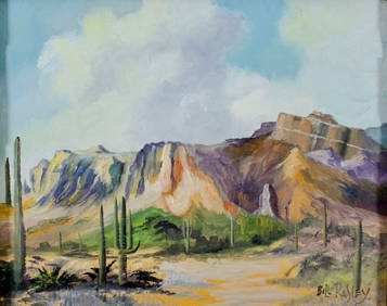
Michael Shankman (CA,CO,b 1980) oil paintingBroward Auction Gallery4.8(277)See Sold PriceMar 31, 2024
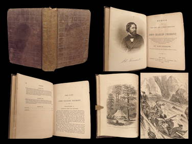
1856 CALIFORNIA 1st ed Memoir John C. Fremont Expeditions Oregon Trail IndiansSchilb Antiquarian Rare Books4.8(421)See Sold PriceMar 10, 2024
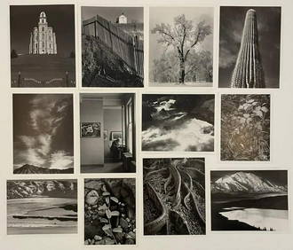
Picturesque California, by John Muir, Volume 3, Imperial Japan EditionThe Scanlan Collection4.4(22)See Sold PriceFeb 24, 2024
War Diary of 354th Infantry - 89th Division 1919North American Artifact Auctions4.6(182)See Sold PriceApr 20, 2024
Michael McCarthy (CA,AZ,b 1951) oil paintingBroward Auction Gallery4.8(277)See Sold PriceMay 05, 2024
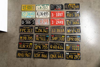
Lot of 12 Vintage 1954 General Mills Promotional Tin License PlatesBodnar's Auction Sales4.6(609)See Sold PriceMar 28, 2024
Francis McNally - Antique Map of Washington, Oregon, Idaho, Nevada, Utah & ArizonaProverde Auctions4.3(3)See Sold PriceFeb 28, 2024


![[1864 JOHNSON & WARD MAP] (1 of 1)](https://p1.liveauctioneers.com/135/654/296743_1_x.jpg?height=282&quality=70)