ATLAS of ANTIENT GEOGRAPHY by SAMUEL BUTLER 1843John McInnis Auctioneers,LLC4.6(502)See Sold PriceFeb 24, 2024
18TH C. ANTIQUE MAP: FRENCH & INDIAN WAR, FRAMEDThomaston Place Auction Galleries4.4(386)See Sold PriceFeb 24, 2024
Rand McNally Railroad Map Cabinet w/ 21 Railroad MapsRail & Road Auctions4.6(165)See Sold PriceMar 08, 2024
Keith Haring - Ink on New York Map, Best Buddies, Inscribed, Signed, and DatedSapphire Auction Gallery4(67)See Sold PriceMar 02, 2024
LATE 17TH C. FRENCH MAP OF THE NEW WORLD BY ALEXIS-HUBERT JAILLOT (1632-1712)Thomaston Place Auction Galleries4.4(386)See Sold PriceFeb 24, 2024
Central Railroad of New Jersey Map of Sandy Hook Route-ca. 1903JM Hobby Supply and Railroad Artifact Auctions4.4(126)See Sold PriceFeb 24, 2024
Lot of Six Mixed Atlas Box Cars-HO Scale-New in BoxJM Hobby Supply and Railroad Artifact Auctions4.4(126)See Sold PriceFeb 25, 2024
Rand McNally/Santa Fe Railroad Map of Iowa-1912JM Hobby Supply and Railroad Artifact Auctions4.4(126)See Sold PriceFeb 24, 2024
NICOLAES VISSCHER (NETHERLANDS, 1618-1709) MAP OF THE NEW WORLDThomaston Place Auction Galleries4.4(386)See Sold PriceFeb 24, 2024
17TH C. WORLD MAP BY NICOLAES VISSCHER (NETHERLANDS, 1618-1709)Thomaston Place Auction Galleries4.4(386)See Sold PriceFeb 24, 2024
Lot of Six Mixed Atlas Cabooses-HO Scale-New in BoxJM Hobby Supply and Railroad Artifact Auctions4.4(126)See Sold PriceFeb 25, 2024
SoldAntique John Adlum Map of Pennsylvania"Map Exhibiting A General View of the Roads and Inland Navigation of Pennsylvania and part of the adjacent states respectfully inscribed to Thomas Mifflin, Governor, and the General Assembly of the CoSee Sold Price
Sold[James Wilson]. Manuscript Plat Map of Luzerne C[James Wilson]. Manuscript Plat Map of Luzerne County, Pennsylvania with Autograph Endorsement SignedSee Sold Price
SoldADLUM, John; and John WALLIS. A Map exhibiting aADLUM, John; and John WALLIS. A Map exhibiting a General View of the Roads and Inland Navigation of Pennsylvania, and part of the adjacent states.[Philadelphia: c. 1792]. Engraved map, hand-cSee Sold Price
Sold2 EARLY MAPS TO INCLUDE "STATE OF PENNSYLVANIA,1796 FROM THE LATEST SURVEYS" PUBLISHED BY JOHN REID, NEW YORK. ENGRAVING WITH HAND COLORING, AFTER A MAP DRAWN BY D. MARTIN. SHEET SIZE 17" X 20". SHOWS MINOR LOSS TO PUBLISHERS NAME AND MINOR DISCOLSee Sold Price
New England Map by Cary, 1807Original copperplate engraving of New England, New York, Pennsylvania, New Jersey and Virginia by John Cary, 1807. Custom framed. Dimensions: 30 x 30 inches.See Sold Price
SoldJ. Cary New Map of Part of the USJohn Cary, English, 1754-1835. Hand colored engraved map entitled "A New Map of Part of the United States of America, Exhibiting The Western Territory, Kentucky, Pennsylvania, Maryland, Virginia &c. ASee Sold Price
Sold3 Early PA Documents, incl. John Penn SignedThree (3) archival documents pertaining to early Pennsylvania, including land document signed by John Penn (1729-1795), last governor of colonial Pennsylvania. 1st item: John Penn (1729-1795), last goSee Sold Price
3 Early PA Documents, incl. John Penn SignedThree (3) archival documents pertaining to early Pennsylvania, including land document signed by John Penn (1729-1795), last governor of colonial Pennsylvania. 1st item: John Penn (1729-1795), last goSee Sold Price
Sold19Pcs Antique Maps PENNSYLVANIA MAPS ACCOMPANYING THEDetails: This lot consists of the “Pennsylvania Maps Accompanying the Report of the Secretary of Internal Affairs on the Boundaries of the Commonwealth, 1887â€. Nineteen large folding maps aSee Sold Price
SoldMeyer: Antique Map of Pennsylvania, 1845Neueste Karte von Pennsylvania The beautifully detailed and colored map of Pennyslvania "with its canals, railroads, etc.," from the 1856 edition of Meyer's Hand-Atlas. Includes a profile of PennsylvaSee Sold Price
SoldAntique Map of PennsylvaniaHand-painted copper engraved antique map, "A Map of Pennsylvania Exhibiting not only The Improved Parts of that Province, but also its Extensive Frontiers. Laid down from actual surveys, and chiefly fSee Sold Price
SoldCirca. 1875 Antique Map of Pennsylvania.Antique Map of Pennsylvania. Rare hand colored map of Pennsylvania by Gray. Circa 1875. Sight size: 15-1/2" x 25-1/2". In a burl wood frame. 24-1/2" x 34-1/2"overall. Condition: Very good.See Sold Price
SoldColton: Antique Map of Pennsylvania, 1861Title/Content of Map: Colton's Pennsylvania Date Printed: 1861 Cartographer: J. H. Colton Material/Medium: Paper Size: 17 1/2" x 14" Condition: Excellent Hand colored, steel engraved. From 'Colton's GSee Sold Price
SoldMitchell: Antique Map of Pennsylvania, 1870Title/Content of Map: 1870 Mitchell Map of Pennsylvania -- County Map of the State of Pennsylvania Date Printed: 1870, Philadelphia Cartographer: S Mitchell Size: 14 X 21.5 in. A very nice large, pastSee Sold Price
Sold1878 Mitchell Antique Map of PennsylvaniaTitle/Content of Map: 1878 Mitchell Map of Pennsylvania -- County Map of the State of Pennsylvania Date Printed: 1878, Philadelphia Cartographer: S Mitchell Size: 13.5 x 21.3 in. A very nice, large maSee Sold Price
Tanner: Antique Map of Pennsylvania, 1843Title/Content of Map: Pennsylvania by Tanner Date Printed: 1843 Cartographer: H.C. Tanner Material/Medium: Paper Size: 17" x 14" Hand colored engraved Map based on the work of H.C. Tanner from the firSee Sold Price
SDUK: Antique Map of Pennsylvania, New Jersey, DC, 1844Title/Content of Map: 'NORTH AMERICA, SHEET VII., Pennsylvania, New Jersey, Maryland, Delaware, Columbia, Virginia' Date Printed: This map was originally published by Baldwin & Cradock in 1833; this dSee Sold Price
SoldJohnson: Antique Map of Pennsylvania & New Jersey, 1868Title/Content of Map: Pennsylvania & New Jersey by Johnson Date Printed: 1868 Cartographer: A.J. Johnson Material/Medium: Paper Size: 24" x 18" Hand colored steel engraved Map. From Johnson's New IlluSee Sold Price
SoldBradford: Antique Map of Pennsylvania, 1838Title/Content of Map: Pennsylvania by Bradford Date Printed: 1838/1841 Cartographer: Thomas G. Bradford Material/Medium: Paper Size: 16 1/2" x 13" Hand colored. A General Atlas of the World with a SepSee Sold Price
SoldBradford: Antique Map of Pennsylvania & New Jersey 1835Title/Content of Map: Pennsylvania & New Jersey Date Printed: 1835 Cartographer: T.G. Bradford Material/Medium: Paper Size: 13" x 10" Condition: Excellent Hand colored outlines. Published in PhiladelpSee Sold Price
SoldMELISH, JOHN. Map of Pennsylvania, constructedMELISH, JOHN. Map of Pennsylvania, constructed from the County Surveys authorized by the State. Large engraved map on 6 sheets, joined, dissected and laid on linen, forming 40 sections, 1890x1290 mm;See Sold Price
SoldMELISH, JOHN. Map of Pennsylvania, constructedMELISH, JOHN. Map of Pennsylvania, constructed from the County Surveys authorized by the State. Large engraved map on 6 sheets, joined, dissected and laid on linen, forming 40 sections, 1890x1290 mm;See Sold Price
SoldMELISH, John. Map of Pennsylvania, constructed frMELISH, John. Map of Pennsylvania, constructed from the County Surveys authorized by the State; and other original Documents.Philadelphia: B. Tanner, [1826]. Engraved map printed on six sheetSee Sold Price
SoldTanner: Antique Map of Pennsylvania, 1869Title/Content of Map: Pennsylvania by Tanner Date Printed: 1869 Cartographer: Augustus S. Mitchell Size: 14" x 16" Material/Medium: Paper Provenance: New York Published in Philadelphia in 'Mitchell'sSee Sold Price
1855 NOTES ON CENTRAL AMERICA by E. G. Squier antique w/ MAPSJasper524.5(9.8k)See Sold PriceFeb 27, 2024
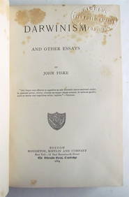
1897 DARWIN AND AFTER DARWIN by GEORGE JOHN ROMANES antique Vol. IIJasper524.5(9.8k)See Sold PriceFeb 27, 2024
1675 Horae Hebraicae et Talmudicae by John Lightfoot antique JUDAICAJasper524.5(9.8k)See Sold PriceFeb 27, 2024
RUSSIAN BRONZE ICON of SELECTED SAINTS ST. JOHN BASIL & GREGORY antiqueJasper524.5(9.8k)See Sold PriceFeb 27, 2024
RUSSIAN TRADITIONAL ICON of JOHN THE BAPTIST ANTIQUE late17th-early 18th cent.Jasper524.5(9.8k)See Sold PriceFeb 27, 2024
Guthrie, William 1812 Antique Map. Spain and PortugalAlbion Auctions4.6(336)See Sold PriceMar 01, 2024
ANTIQUE 1686 OPERA OMNIA BY JOHN LIGHTFOOT TELLIMA BOUND FOLIO WITH ISRAEL MAPNY Elizabeth 4.3(84)See Sold PriceMar 03, 2024
John Gretzer (IA,PA,KS,1920-2004) oil painting antiqueBroward Auction Gallery4.8(277)See Sold PriceMay 19, 2024
George F. Cram - Historical Map of Pittsburgh Allegheny PennsylvaniaProverde Auctions4.3(3)See Sold PriceFeb 28, 2024
Vintage Street Map of Pittsburgh, Pennsylvania - Rand McNallyProverde Auctions4.3(3)See Sold PriceFeb 28, 2024
Antique Pennsylvania Map Fragment incl Wellersburg and New CentervilleCordier Auctions4.4(1.5k)See Sold PriceMar 02, 2024


![[James Wilson]. Manuscript Plat Map of Luzerne C (1 of 3)](https://p1.liveauctioneers.com/906/86611/44529635_1_x.jpg?height=282&quality=70&version=1458833472)