Marc Chagall-Limited Edition -Paris Opera Ceiling after ChagallArt Legacy Auctions4.5(223)See Sold PriceFeb 24, 2024
Salvador Dali Pantagruel Limited Edition Lithograph Hand signed and numberedArt Legacy Auctions4.5(223)See Sold PriceFeb 24, 2024
Pablo Picasso Bouquet of Peace Collection Domaine Picasso Limited Edition on paper.Art Legacy Auctions4.5(223)See Sold PriceFeb 24, 2024
A RARE MAXFIELD PARRISH JACK AND THE BEANSTALK PRINTSoulis Auctions4.8(953)See Sold PriceFeb 24, 2024
LARGE MECHANICAL PRINT 'STARS' AFTER MAXFIELD PARRISHSoulis Auctions4.8(953)See Sold PriceFeb 24, 2024
Heinrich Aldegrever, etc. 15 old master prints. 16th-17th centuries. Aldegrever works include "ManTremont Auctions4.5(297)See Sold PriceFeb 25, 2024
SoldJ. Cary New Map of Part of the USJohn Cary, English, 1754-1835. Hand colored engraved map entitled "A New Map of Part of the United States of America, Exhibiting The Western Territory, Kentucky, Pennsylvania, Maryland, Virginia &c. ASee Sold Price
Cary's New Map of England and Wales 1794Heading: Author: Cary, J. Title: Cary's New map of England and Wales, With Part of Scotland. On which are carefully laid down all the direct and principal cross roads, the course of the rivers and thSee Sold Price
Sold1812 John Cary Map ofTitled "A New Map of Part of the United States of North America", published by J. Cary, London, 1812. There are a few small pinholes, and one small hole in the bottom center along the center fold.See Sold Price
SoldCary's New Map Of England And Wales 1830 EditionCary's New Map Of England And Wales with part of Scotland. On which are carefully laid down.....Published Ma 1st, 1824 G & J Cary, Engraver and Map Seller. Second Edition Corrected to 1830. 11 1/2" XSee Sold Price
Cary, John Cary's New Map of England and Wales withCary, John Cary's New Map of England and Wales with part of Scotland London: J. Cary, 1794. 4to, hand-coloured single-page map of England and Wales, diagram to illustrate scale and 76 map sections, haSee Sold Price
Cary's New Map of EnglandCary's New Map of England and Wales with part of Scotland...CARY, John (1755-1835). London: J. Cary, June 11th, 1794. 4to., (11 6/8 x 9 3/8 inches). Engraved title-page, dedication leaf, Explanations,See Sold Price
SoldCary: US Western Territory/Great Lakes Region Map, 1805Map: A New Map of Part of the United States of North America, exhibiting the Western Territory, Kentucky, Pennsylvania, Maryland, Virginia &c., also the lakes Superior, Michigan, Huron, Ontario & ErieSee Sold Price
SoldUS Map and Book Plate MapUS Map and Book Plate Map. A New Map of Part of the United States by John Cary; c. 1819; Some foxing and toning; 21" x 23". Small Book Plate Map of North America; London: published by G. Virtue; 13" xSee Sold Price
SoldJohn Cary U.S. map,"A New Map of Part of the United States of North America, containing the Carolinas and Georgia also the Floridas…", published by John Cary, London, 1819, copper plate engraving, hand colored, centerSee Sold Price
Mexico and Central AmericaTitle/Content of Map: Mexico and Central America Date Printed: 1863 Cartographer: WELL, J./SHERMAN, G.E. Size: 8.3X10.5 Map showing southern part of U.S. Arizona is lower half of New Mexico. MarginalSee Sold Price
1812 Cary Map of London -- Cary's New and Accurate Plan of London and Westminster, the Borough ofTitle: 1812 Cary Map of London -- Cary's New and Accurate Plan of London and Westminster, the Borough of Southwark and Parts Adjacent Cartographer: J Cary Year / Place: 1812 London Map Dimension (in.)See Sold Price
SoldLarge Colton map of U.S. 1852Heading: (United States) Author: Colton, J.H. Title: Map of the United States of America, the British Provinces, Mexico, the West Indies and Central America, with Part of New Granada and Venezuela PlaSee Sold Price
SoldNew Map of the Russian Empire 1799[Russia]. J. Cary. A New Map Of The Russian Empire, Divided into its Governments, From the Latest Authorities. Two double-page sheets, Russia extending from Poland to the Bering Strait. Lon: 1799. EacSee Sold Price
SoldA New Map Of The Russian Empire, 1799.[Russia]. J. Cary. A New Map Of the Russian Empire. Divided into its Governments. Double-page engraving. Lon: John Cary, 1799. 18 x 39 3/4 in. Contemporary hand-coloring, with mountain ridges and swamSee Sold Price
SoldCary Map of the Southeast, 1821, inc. AlabamaJohn Cary: A NEW MAP OF PART OF THE UNITED STATES OF NORTH AMERICA, CONTAINING THE CAROLINAS and GEORGIA, ALSO THE FLORIDAS AND PART OF THE BAHAMA ISLANDS & C., 1821. Scarce map, the only edition of CSee Sold Price
SoldA collection of Eastern counties engraved maps.A collection of Eastern counties engraved maps. J.Cary, A New Map of Northamptonshire, hand coloured engraving, 51 x 57cm; R.Morden, Maps of Bedfordshire and Huntingdonshire; together with various smaSee Sold Price
SoldCARY, JOHN. A New Map of Part of the United StCARY, JOHN. A New Map of Part of the United States of North America, exhibiting the Western Territory, Kentucky, Pennsylvania, Maryland, Virginia &c. Double-page engraved map, 520x600 mm, wide marginsSee Sold Price
SoldCARY, JOHN. A New Map of Part of the United States ofCARY, JOHN. A New Map of Part of the United States of North America, Exhibiting the Western Territory, Kentucky, Pennsylvania, Maryland, Virginia &c. Double-page engraved map of the Great Lakes and WeSee Sold Price
SoldCARY, JOHN. A New Map of Part of the United StCARY, JOHN. A New Map of Part of the United States of North America. Engraved map, 510x575 mm, wide margins; hand-colored; minor scattered soiling. London, 1806 New York, Vermont, New Hampshire, MassaSee Sold Price
SoldCary (J) A New Map of the Circle of AustriaCary (John) A New Map of the Circle of Austria,Austria and environs, engraved map with original hand-colouring, 460 x 515mm., central vertical fold, slightly discoloured, one or 2 minor marginSee Sold Price
Sold[Denmark]. Cary, J. A New Map Of The Kingdom Of D[Denmark]. Cary, J. A New Map Of The Kingdom Of Denmark. Lon: J. Cary, 1801. Measures 18x21 with wide margins. Copperplate engraved map; title oval offset to North Sea; toning to vacant Sweden and cenSee Sold Price
Cary (John) - A New Map of Part of the United States offrom New Brunswick to North Carolina, engraved map with original hand-colouring in outline, 520 x 580mm., central vertical fold, some faint offsetting, 1806.See Sold Price
Sold1 piece. Hand-Colored Engraved Map. Cary, John. A1 piece. Hand-Colored Engraved Map. Cary, John. A New Map of Part of The United States of North America Containing the Carolinas and Georgia, also The Floridas and Part of The Bahama Islands & C." LonSee Sold Price
SoldEngland & Wales.- Cary (John) Cary's New Map of EnglandEngland & Wales.- Cary (John) Cary's New Map of England & Wales with Part of Scotland..., unsual format with map presented as loose plates in slipcase, including title, general map, and sheets 1-80, lSee Sold Price
Central Railroad of New Jersey Map of Sandy Hook Route-ca. 1903JM Hobby Supply and Railroad Artifact Auctions4.4(127)See Sold PriceFeb 24, 2024
1849 THE NEW-ENGLAND MERCANTILE UNIONNorth American Artifact Auctions4.7(198)See Sold PriceApr 20, 2024
[ARCTIC]. BOWEN, Emanuel. A New & Accurate Map of the North...Potter & Potter Auctions4.6(545)See Sold PriceMar 07, 2024
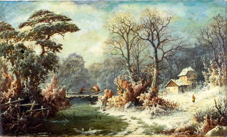
John Zang (NY,CA,GA,1859-?) oil painting antiqueBroward Auction Gallery4.7(292)See Sold PriceMay 05, 2024
Map: A 19thC engraved and hand coloured map of Buckingham titled A New Map of BuckinghamshireClaydon Auctioneers Ltd4.3(125)See Sold PriceFeb 26, 2024
Map of Part of the West Indies, Etc., Showing the Exact Position Of The U.S. War Steamer SanJasper524.5(9.9k)See Sold PriceFeb 27, 2024
ATTR Harriet J Holbrook (NY,19/20C) oil painting antiqueBroward Auction Gallery4.7(292)See Sold PriceMay 19, 2024
Black and white map of part of New York City (mostly Manhattan)Proverde Auctions4.3(3)See Sold PriceFeb 28, 2024
Herman Moll A New Map of Ye North Parts of AmericaWillow Auction House4.5(289)See Sold PriceMar 14, 2024


![[Denmark]. Cary, J. A New Map Of The Kingdom Of D (1 of 1)](https://p1.liveauctioneers.com/179/2417/1045237_1_x.jpg?height=282&quality=70)


![[ARCTIC]. BOWEN, Emanuel. A New & Accurate Map of the North... (1 of 1)](https://p1.liveauctioneers.com/928/318880/171360917_1_x.jpg?height=282&quality=70&version=1707501302)