ATLAS of ANTIENT GEOGRAPHY by SAMUEL BUTLER 1843John McInnis Auctioneers,LLC4.6(502)See Sold PriceFeb 24, 2024
18TH C. ANTIQUE MAP: FRENCH & INDIAN WAR, FRAMEDThomaston Place Auction Galleries4.4(386)See Sold PriceFeb 24, 2024
Rand McNally Railroad Map Cabinet w/ 21 Railroad MapsRail & Road Auctions4.6(165)See Sold PriceMar 08, 2024
Keith Haring - Ink on New York Map, Best Buddies, Inscribed, Signed, and DatedSapphire Auction Gallery4(67)See Sold PriceMar 02, 2024
LATE 17TH C. FRENCH MAP OF THE NEW WORLD BY ALEXIS-HUBERT JAILLOT (1632-1712)Thomaston Place Auction Galleries4.4(386)See Sold PriceFeb 24, 2024
Central Railroad of New Jersey Map of Sandy Hook Route-ca. 1903JM Hobby Supply and Railroad Artifact Auctions4.4(126)See Sold PriceFeb 24, 2024
Lot of Six Mixed Atlas Box Cars-HO Scale-New in BoxJM Hobby Supply and Railroad Artifact Auctions4.4(126)See Sold PriceFeb 25, 2024
Rand McNally/Santa Fe Railroad Map of Iowa-1912JM Hobby Supply and Railroad Artifact Auctions4.4(126)See Sold PriceFeb 24, 2024
NICOLAES VISSCHER (NETHERLANDS, 1618-1709) MAP OF THE NEW WORLDThomaston Place Auction Galleries4.4(386)See Sold PriceFeb 24, 2024
17TH C. WORLD MAP BY NICOLAES VISSCHER (NETHERLANDS, 1618-1709)Thomaston Place Auction Galleries4.4(386)See Sold PriceFeb 24, 2024
Lot of Six Mixed Atlas Cabooses-HO Scale-New in BoxJM Hobby Supply and Railroad Artifact Auctions4.4(126)See Sold PriceFeb 25, 2024
Maps, Philipp Cluver(lot of 2) Philipp Cluver (German, 1580-1622), "Achaia quae et Hellas hodie Livadia (with inset of Athens and Thebes)," and "Chersonesi quae hodie Natolia Descriptio," 1697, hand-colored engravings, sSee Sold Price
SoldMaps, Philipp Cluver(lot of 2) Philipp Cluver (German, 1580-1622), "Veteris Cornithi," and "Macedoniae et Thessaliae Regiones," copper engraved maps with hand coloring, image (each): 7.75"h x 10"w, overall (with mat): 25See Sold Price
SoldMaps, Philipp Cluver and Sieur Robert(lot of 2) Philipp Cluver (German, 1580-1622), "Russia cum Confinijs," and Sieur Robert (French,1688-1766), "A New and Accurate Map of the Kingdom of Prussia and Polish Prussia," copper engraved mapsSee Sold Price
Maps, Philipp Cluver(lot of 2) Philipp Cluver (German, 1580-1622), "Achaia quae et Hellas hodie Livadia (with inset of Athens and Thebes)," and "Chersonesi quae hodie Natolia Descriptio," 1697, hand-colored engravings, sSee Sold Price
SoldMaps, Philipp Cluver(lot of 2) Philipp Cluver (German, 1580-1622), "Achaia quae et Hellas hodie Livadia (with inset of Athens and Thebes)," and "Chersonesi quae hodie Natolia Descriptio," 1697, hand-colored engravings, sSee Sold Price
Two maps by Philipp CluverHeading: (Cluver, Philipp) Author: Title: Helvetia [with] Persia Sive Sophorum Regnum cum Armenia, Assyria, Mesopotamia et Babylonia Place Published: No place Publisher: Date Published: No dSee Sold Price
SoldPhilipp Cluver map- LithuaniaPhilipp Cluver- ''Lithuania''- hand-colored copper engraving from the atlas- ''Introductionis in Universam Geogruphiam'', ca. 1676. 7 5/8 x 10 1/2''See Sold Price
SoldGrp: 11 Maps of ItalyGroup of eleven maps of Italy. Philipp Cluver map of Italy "Italiae Antiquae Delineatio" W. Poyntell & Co.; Barlow map of "Italy from the Best Authorities" C.Brightly & T.Kinnersley, Suffolk, 1806; JeSee Sold Price
Antique Map Print - Europe - Map of Switzerland - Zurich - Philipp Cluver - 1701Title/Artist: Antique Map Print - Europe - Map of Switzerland - Zurich - Philipp Cluver - 1701 Date: 1701 Material: Paper Dimensions: 14 cm x 13 cm Additional Information: A detailed small map from &#See Sold Price
Antique Map Print - Europe - Map of Cisrhenian Germans - Philipp Cluver - 1701Title/Artist: Antique Map Print - Europe - Map of Cisrhenian Germans - Philipp Cluver - 1701 Date: 1701 Material: Paper Dimensions: 14 cm x 13 cm Additional Information: A detailed small map from RSee Sold Price
Sold(MAP, SCANDINAVIA) CLUVER, PHILIPP 24 1/2 x 32 1/2(MAP, SCANDINAVIA) CLUVER, PHILIPP Svecia, Dania et Norvegia, from an edition of Cluver's Introductio in universalem geographiam. (Amsterdam: J. Wolters, 1697). Engraved map of Scandinavia, borders ouSee Sold Price
SoldSitus Chorographia et Flumina Paradisi in Terra CanaaSitus Chorographia et Flumina Paradisi in Terra Canaan. An antique map of the Garden of Eden by Philipp Cluver. The map covers the region from Armenia through the Arabian Peninsula with north orientedSee Sold Price
Sold2pc Philipp Cluver, Imperii Sinarum Maps of China2pc Philipp Cluver, Imperii Sinarum Nova Descriptio Maps of China. Both have impressions measuring 8.25x10.25'', sheets measure approx 13x14.5'' and 9.5x11''. Appear to be late 17th century, however cSee Sold Price
Antique Map Print - Europe - Map of Germany - Central Europe - Philipp CluverTitle/Artist: Antique Map Print - Europe - Map of Germany - Central Europe - Philipp Cluver Date/Period: 1701 Material: Paper Dimensions: 15 cm x 13 cm Description: A detailed small map from ”InSee Sold Price
Antique Map Print - Europe - Map of Low German - Hamburg - Philipp Cluver - 1701Title/Content: Antique Map Print - Europe - Map of Low German - Hamburg - Philipp Cluver - 1701 Date: 1701 Material: Paper Dimensions: 6” x 5” inches / 14 cm x 13 cm Description: A detaileSee Sold Price
Antique Map Print - Europe - Italy's Latest Registration - Philipp Cluver - 1701Title/Artist: Antique Map Print - Europe - Italy's Latest Registration - Philipp Cluver - 1701 Date/Period: 1701 Material: Paper Dimensions: 15 cm x 13 cm Description: A detailed small map from ”See Sold Price
Antique Map Print - Europe - Map of Liguria - Region of Italy - Philipp CluverTitle: Antique Map Print - Europe - Map of Liguria - Region of Italy - Philipp Cluver Date: 1701 Material: Paper Dimensions: 6” x 5” inches / 15 cm x 13 cm Descritpion: A detailed small maSee Sold Price
SoldCluver Double Hemisphere Map of the WorldTypus Orbis Terrarum. Philipp Cluver (1580-1622). Engraved map with hand color in full. Amsterdam, c. 1697. 7 1/4 x 12 1/4 inches visible, 15 1/4 x 20 1/2 inches framed. Double Hemisphere map of the wSee Sold Price
Antique Map - Asia - China Japan Korea Taiwan Vietnam - Philipp Cluver 1701Title/Artist: Antique Map - Asia - China Japan Korea Taiwan Vietnam - Philipp Cluver 1701 Date/Period: 1701 Material: Paper Dimensions: 15 cm x 13 cm Description: A detailed small map from ”IntrSee Sold Price
SoldMap of the Holy Land and Phoenicia. Philipp Cluver.Palaestina et Phoenice cum parte coele Syria. Miniature map of the Holy Land, Phoenicia, and part of Syria. The Israelites' journey in the desert. Copperplate engraving. By Philipp Cluver. From: IntroSee Sold Price
SoldGrp: 7 Maps of Sicily Italy 18th/19th c. Blair ClGroup of seven maps of Sicily. Includes Rev. John Blair, "Sicilia Antiqua quae at Sicania et Trinacria dicta;" Philipp Cluver, "Siciliae Antiquae Descriptio," Leiden, 1697, which features a stunninglySee Sold Price
SoldPhilipp Cluver "Sicilia Antiqua" 1619Philipp Cluver (1580-1622), "Sicilia Antiqua; cum minoribus insulis, ei adjacentibus. Item, Sardinia et Corsica," 1619. A fine volume on historical Sicily with lovely maps. SKU: 02087See Sold Price
SoldMAP, Baltic, CluverBaltic. Philipp Cluver, Prussiae Nova Tabula, from Introductio in Universam Geographicam, 1697 (published). Hand Color. This finely engraved map covers northeastern Poland from about Gdansk to LithuanSee Sold Price
SoldPhilipp Cluver Geographium Orig 1686 Vol with MapsPhilippi Cluverii Introductionis in Universam Geographiam Tam veterem quam novam Libra VI, Amsterdam Apud Henr. Wetstenium 1686. Rare. 355 pgs plus Roman Emperors, then a printed index with a bound-inSee Sold Price
Crams Township and Railroad Map of New York-1890JM Hobby Supply and Railroad Artifact Auctions4.4(126)See Sold PriceFeb 24, 2024
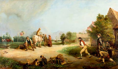
ATTR Philipp Loutherbourg (UK,Germany,1740-1812) oil painting antiqueBroward Auction Gallery4.8(277)See Sold PriceMar 31, 2024
1885 CIVIL WAR 1ed Famous Memoirs US Grant Sheridan Sherman 6v RARE LOT MapsSchilb Antiquarian Rare Books4.8(421)See Sold PriceMar 10, 2024
Large lot of assorted prints. 18th-20th century. To include: North American and other maps, CivilTremont Auctions4.6(293)See Sold PriceFeb 25, 2024
Large Assortment of Railroad Items - Insulators, Globes, Hand Bell, Posters, Maps, Timetables,Rail & Road Auctions4.6(165)See Sold PriceMar 07, 2024
Collection of Allied Military Silk Printed Maps, WWII Era and LaterMaterial Culture4.6(765)See Sold PriceFeb 29, 2024
Rand McNally Railroad Map Cabinet w/ 21 Railroad MapsRail & Road Auctions4.6(165)See Sold PriceMar 08, 2024
Willem Blaeu, Etc. 17th C. Antiquarian Maps, 2Auctions at Showplace4.5(726)See Sold PriceMar 17, 2024
Putnam - First Map of the State of Ohio by Rufus PutnamTrillium Antique Prints & Rare Books4.5(30)See Sold PriceFeb 24, 2024
Carey, pub. 1796 - Map of the Tennassee State formerly part of North Carolina (Tennessee)Trillium Antique Prints & Rare Books4.5(30)See Sold PriceFeb 24, 2024
De Jode, Rare, pub. 1593 - Map of Africa (Africae Vera Forma, et Situs)Trillium Antique Prints & Rare Books4.5(30)See Sold PriceFeb 24, 2024
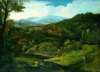
ATTRIBUTED TO PHILIPP PETER ROOS/ROSA DA TIVOLI (C.1655/57-1706) "PASTORAL LANDSCAPE".Amelia Jeffers, Auctioneers & Appraisers4.6(101)See Sold PriceMar 07, 2024