ATLAS of ANTIENT GEOGRAPHY by SAMUEL BUTLER 1843John McInnis Auctioneers,LLC4.6(502)See Sold PriceFeb 24, 2024
18TH C. ANTIQUE MAP: FRENCH & INDIAN WAR, FRAMEDThomaston Place Auction Galleries4.4(386)See Sold PriceFeb 24, 2024
Rand McNally Railroad Map Cabinet w/ 21 Railroad MapsRail & Road Auctions4.6(165)See Sold PriceMar 08, 2024
Keith Haring - Ink on New York Map, Best Buddies, Inscribed, Signed, and DatedSapphire Auction Gallery4(67)See Sold PriceMar 02, 2024
LATE 17TH C. FRENCH MAP OF THE NEW WORLD BY ALEXIS-HUBERT JAILLOT (1632-1712)Thomaston Place Auction Galleries4.4(386)See Sold PriceFeb 24, 2024
Central Railroad of New Jersey Map of Sandy Hook Route-ca. 1903JM Hobby Supply and Railroad Artifact Auctions4.4(126)See Sold PriceFeb 24, 2024
Lot of Six Mixed Atlas Box Cars-HO Scale-New in BoxJM Hobby Supply and Railroad Artifact Auctions4.4(126)See Sold PriceFeb 25, 2024
Rand McNally/Santa Fe Railroad Map of Iowa-1912JM Hobby Supply and Railroad Artifact Auctions4.4(126)See Sold PriceFeb 24, 2024
NICOLAES VISSCHER (NETHERLANDS, 1618-1709) MAP OF THE NEW WORLDThomaston Place Auction Galleries4.4(386)See Sold PriceFeb 24, 2024
17TH C. WORLD MAP BY NICOLAES VISSCHER (NETHERLANDS, 1618-1709)Thomaston Place Auction Galleries4.4(386)See Sold PriceFeb 24, 2024
Lot of Six Mixed Atlas Cabooses-HO Scale-New in BoxJM Hobby Supply and Railroad Artifact Auctions4.4(126)See Sold PriceFeb 25, 2024
Sold1899 Map of Empires of China, Japan and KoreaAuthor: Miller Title: 1899 Map of Empires of China, Japan and Korea Medium: Ink on Paper Dimensions: 16"X11" Description: Map of the empires of China, Japan and Korea dated 1899. Published by J. MartiSee Sold Price
Sold1899 Map of the Empires of China, Japan and KoreaAuthor: Miller Title: 1899 Map of the Empires of China, Japan and Korea Medium: Ink on Paper Dimensions: 16.5"X11" Map of the empires of China, Japan and Korea dated 1899. Published by J. Martin MilleSee Sold Price
SoldEmpires of China Japan and Korea | the North PoleTitle: Empires of China Japan and Korea | the North Pole Region. Publication Date: 1906 Cartographer: MATTHEWS-NORTHRUP CO. Publisher: L.G. STAHL Size: 10.25Height - 15Width Description: Copyright bySee Sold Price
EAST ASIA. 'Chinese Empire & Japan'. China Korea Formosa. BARTHOLOMEW 1876 mapTITLE/CONTENT OF MAP: 'Chinese Empire & Japan' DATE PRINTED: 1876 IMAGE SIZE: Approx 23.5 x 31.0cm, 9.25 x 12 inches (Large); Please note that this is a folding map. TYPE: Antique colour map CONDITIONSee Sold Price
MAP - China, Korea & Japan. CluverChina, Korea & Japan. Philipp Cluver, Imperii Sinarum Nova Descriptio, 1711 (published). Hand Color. Handsome small map based on the important Martini/Blaeu map of the Chinese Empire. It shows a fairSee Sold Price
Original Antique Map - China - Korea - Japan - 19th Century - East Asia - LapieA fine first edition example of M. Lapie's 1832 map of the Chinese empire and Japan. The map covers all of China, Korea, and Japan from Asiatic Russia to India and the Sea of China and from IndependenSee Sold Price
MAP, China, Korea & Japan, CluverChina, Korea & Japan. Philipp Cluver, Imperii Sinarum Nova Descriptio, 1667 (circa). Black & White. Handsome small map based on the important Martini/Blaeu map of the Chinese Empire. It shows a fair nSee Sold Price
MAP - China, Korea & Japan. CluverChina, Korea & Japan. Philipp Cluver, Imperii Sinarum Nova Descriptio, 1667 (circa). Black & White. Handsome small map based on the important Martini/Blaeu map of the Chinese Empire. It shows a fair nSee Sold Price
Antique Map of East Asia - China - Japan - 19th Century - Korea - Central AsiaA fine first edition example of M. Lapie's 1832 map of the Chinese empire and Japan. The map covers all of China, Korea, and Japan from Asiatic Russia to India and the Sea of China and from IndependenSee Sold Price
EAST ASIA China Chinese Turkistan Tibet Korea Japan.TITLE/CONTENT OF MAP: 'Chinese Empire & Japan; Inset maps of Canton; Peking' DATE PRINTED: 1912 IMAGE SIZE: Approx 32.5 x 43.0cm, 12.75 x 17 inches (Large); Please note that this is a folding map. TYPSee Sold Price
EAST ASIA China Chinese Turkistan Tibet Korea Japan.TITLE/CONTENT OF MAP: 'Chinese Empire & Japan; Inset maps of Canton; Peking' Date: 1912 IMAGE SIZE: Approx 32.5 x 43.0cm, 12.75 x 17 inches (Large); Please note that this is a folding map. TYPE: AntiqSee Sold Price
EAST ASIA China Chinese Turkistan Tibet Korea Japan. Hong Kong Peking 1912 mapTITLE/CONTENT OF MAP: 'Chinese Empire & Japan; Inset maps of Canton; Peking' DATE PRINTED: 1912 IMAGE SIZE: Approx 32.5 x 43.0cm, 12.75 x 17 inches (Large); Please note that this is a folding map. TYPSee Sold Price
EAST ASIA. China Chinese Turkistan Tibet Korea Japan. HK Peking Beijing 1901 mapTITLE/CONTENT OF MAP: 'Chinese Empire & Japan; Inset maps of Canton; Peking' DATE PRINTED: 1901 IMAGE SIZE: Approx 32.0 x 43.0cm, 12.75 x 17 inches (Large); Please note that this is a folding map. TYPSee Sold Price
SoldFRENCH BONNE MAP OF CHINA, KOREA & JAPAN, 18TH C.Framed engraving with hand coloring on paper, map of China, Korea, and Japan, "Empire De La Chine, Rme De Coree et Isles Du Japon," Rigobert Bonne (French, 1727-1794) cartographer, engraved by PietroSee Sold Price
Sold1792 Elwe Map of China, Japan, Korea and theTitle/Content of Map: 1792 Elwe Map of China, Japan, Korea and the Philippines -- Partie de la Nouvelle Grande Carte des Indes Orientales Contenant les Empires de la Chine, du Japon, les Isles PhilippSee Sold Price
SoldRussia.- Lotter (Tobias Conrad) Spatiosissimum ImperiumRussia.- Lotter (Tobias Conrad) Spatiosissimum Imperium Russiae Magnae..., map of the Russian Empire, covering the region from Norway to part of Japan, including China, Korea, and the northern part ofSee Sold Price
Original Antique Map of Asia - China - Japan - 19th Century - East Asia - LapieA fine first edition example of M. Lapie's 1832 map of the Chinese empire and Japan. The map covers all of China, Korea, and Japan from Asiatic Russia to India and the Sea of China and from IndependenSee Sold Price
SoldMAP, China, Korea & Japan, Bonne/LattreChina, Korea & Japan. Bonne/Lattre, L'Empire de la Chine d'Apres l'Atlas Chinois, avec les Isles du Japon, from Atlas Moderne, 1787 (circa). Hand Color. Beautifully engraved, decorative map of the ChiSee Sold Price
SoldBonne map of China, Korea & Japan c.1780Title: Empire de la Chine, Rme de Corée et Isles du Japon Author: Bonne, Rigobert Description: Copper-engraved map, hand-colored (later). 23.5x34.5 cm. (9¼x13½"); hinged to mat, framed under plexigSee Sold Price
China.- Bonne (Rigobert) L'Empire de la ChineChina.- Bonne (Rigobert) L'Empire de la Chine d'après lAtlas Chinois, avec les Isles du Japon, decorative map of the Chinese Empire, extending to include Taiwan, Hainan, Korea, and Japan, with deSee Sold Price
Empire de la Chine, Royaume de Corée & Japon. ChinaTITLE/CONTENT OF MAP: Empire de la Chine, Royaume de Corée et Isles du Japon [The Empire of China, the Kingdom of Korea and the islands of Japan] The top image on the right hand side shows the entireSee Sold Price
"Impero della China colle isole del Giappone". ChinaTITLE/CONTENT OF MAP: 'Impero della China colle isole del Giappone' The Empire of China including Formosa (Taiwan), Korea and the islands of Japan The top image on the right hand side shows the entireSee Sold Price
Impero della China colle isole del Giappone. ChinaTITLE/CONTENT OF MAP: 'Impero della China colle isole del Giappone' The Empire of China including Formosa (Taiwan), Korea and the islands of Japan DATE PRINTED: Published in 1785. Engraved in 1784 (thSee Sold Price
Impero della China colle isole del Giappone. ChinaTITLE/CONTENT OF MAP: 'Impero della China colle isole del Giappone' The Empire of China including Formosa (Taiwan), Korea and the islands of Japan DATE PRINTED: Published in 1785. Engraved in 1784 (thSee Sold Price
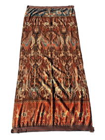
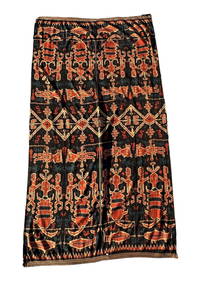
A Fine RARE Antique Woven ikat Pictorial TextilePremier Auction Galleries4.3(329)See Sold PriceMar 09, 2024
Pair of Alpine Black Swallowtail in Framed Showing Its Spring and Summer FormWeatherham Estate Treasures3.9(157)See Sold PriceFeb 29, 2024
Famous Dealer Spink 1997 Form & Function Furniture from China Japan and KoreaSunburst Auction4.4(19)See Sold PriceFeb 24, 2024
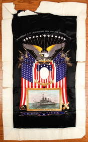
(Early 20th c) MEMENTO of the U.S.S. MONTANAJohn McInnis Auctioneers,LLC4.6(502)See Sold PriceFeb 25, 2024
Blackie (Pub) 1882 Folio Map. Chinese Empire and JapanAlbion Auctions4.6(336)See Sold PriceMar 01, 2024
Perry, Matthew C. 1856 Large Map. Shah Bay, Lew Chew I. JapanAlbion Auctions4.6(336)See Sold PriceMar 01, 2024
ANTIQUE ILLUSTRATED HANDBOOK OF GEOGRAPHY AND TRAVEL IN ASIA, VOLUME 2, 1896NY Elizabeth 4.3(84)See Sold PriceMar 03, 2024
Henri Plon - Set of 20 topographical prints depicting Asia - Japan - China - Religious building -Proverde Auctions4.3(3)See Sold PriceFeb 28, 2024