ATLAS of ANTIENT GEOGRAPHY by SAMUEL BUTLER 1843John McInnis Auctioneers,LLC4.6(504)See Sold PriceFeb 24, 2024
18TH C. ANTIQUE MAP: FRENCH & INDIAN WAR, FRAMEDThomaston Place Auction Galleries4.4(389)See Sold PriceFeb 24, 2024
Rand McNally Railroad Map Cabinet w/ 21 Railroad MapsRail & Road Auctions4.6(165)See Sold PriceMar 08, 2024
Keith Haring - Ink on New York Map, Best Buddies, Inscribed, Signed, and DatedSapphire Auction Gallery4.1(67)See Sold PriceMar 02, 2024
LATE 17TH C. FRENCH MAP OF THE NEW WORLD BY ALEXIS-HUBERT JAILLOT (1632-1712)Thomaston Place Auction Galleries4.4(389)See Sold PriceFeb 24, 2024
Central Railroad of New Jersey Map of Sandy Hook Route-ca. 1903JM Hobby Supply and Railroad Artifact Auctions4.4(126)See Sold PriceFeb 24, 2024
Lot of Six Mixed Atlas Box Cars-HO Scale-New in BoxJM Hobby Supply and Railroad Artifact Auctions4.4(126)See Sold PriceFeb 25, 2024
Rand McNally/Santa Fe Railroad Map of Iowa-1912JM Hobby Supply and Railroad Artifact Auctions4.4(126)See Sold PriceFeb 24, 2024
NICOLAES VISSCHER (NETHERLANDS, 1618-1709) MAP OF THE NEW WORLDThomaston Place Auction Galleries4.4(389)See Sold PriceFeb 24, 2024
17TH C. WORLD MAP BY NICOLAES VISSCHER (NETHERLANDS, 1618-1709)Thomaston Place Auction Galleries4.4(389)See Sold PriceFeb 24, 2024
Lot of Six Mixed Atlas Cabooses-HO Scale-New in BoxJM Hobby Supply and Railroad Artifact Auctions4.4(126)See Sold PriceFeb 25, 2024
SoldVery rare map set. New Court - Russian Empire 18591.) Plan Estates Nowy Dvor Lieutenant Ivan Bulgak Lieutenant Guards Artillery Minsk Governorates of Slutsk County. Compiled in 1859. План ИмениSee Sold Price
SoldA SET OF FIVE ANTIQUE MAPS OF RUSSIAThe lot includes:1. Russia or Muscovy in Europe from the Latest Authorities. Engraved for New Encyclopedia, published by J. Low, New York.2. The Russian Empire in Asia. Published in October 1801 by RoSee Sold Price
SoldRARE Hand colored map by Charles DeSilver c. 1859RARE original hand colored map of California and the territories of Oregon, Washington, Utah and New Mexico, by Charles DeSilver, in frame, circa 1859, image measuring 16.75" xSee Sold Price
SoldNew Map of the Russian Empire 1799[Russia]. J. Cary. A New Map Of The Russian Empire, Divided into its Governments, From the Latest Authorities. Two double-page sheets, Russia extending from Poland to the Bering Strait. Lon: 1799. EacSee Sold Price
SoldA New Map Of The Russian Empire, 1799.[Russia]. J. Cary. A New Map Of the Russian Empire. Divided into its Governments. Double-page engraving. Lon: John Cary, 1799. 18 x 39 3/4 in. Contemporary hand-coloring, with mountain ridges and swamSee Sold Price
A New Map of the Russian Empire, divided into itsAmsterdam, 1640s. Image Size: 38,4x52,8 cm. The copper engraving, watercolors painting. From the drawing of Isaac Massa.See Sold Price
SoldCary (John) A New Map of the Russian EmpireCary (John) A New Map of the Russian Empire divided into its Governments, engraved map of the Russian Empire on 2 sheets, joined, with original hand-colouring, 460 x 1005mm., some soiling to uSee Sold Price
SoldCary: Antique Map of Russia Under the Czars, 1799Title/Content of Map: 1799 Cary Map of Russia Under the Czars -- A New Map of the Russian Empire, Divided into its Governments; from the Latest Authorities Date Printed: 1799 London Cartographer: J. CSee Sold Price
Cary: Map of Russia Under the Czars, 1799Map: 1799 Cary Map of Russia Under the Czars -- A New Map of the Russian Empire, Divided into its Governments; from the Latest Authorities Cartographer: J. Cary Year / Place: 1799 London Map DimensionSee Sold Price
Cary: Antique Map of Russia Under the Czars, 1799Map: 1799 Cary Map of Russia Under the Czars -- A New Map of the Russian Empire, Divided into its Governments; from the Latest Authorities Cartographer: J. Cary Year / Place: 1799 London Dimensions: 1See Sold Price
John Cary: Map of the Russian Empire, 1799Map: A New Map of the Russian Empire, Divided into its Governments; from the Latest Authorities Maker: John Cary Date: 1799 Origin: London Size: 18 x 40 inches A magnificent map of the Russian EmpireSee Sold Price
Cary Map of Russia Under the Czars, 1799Map: 1799 Cary Map of Russia Under the Czars -- A New Map of the Russian Empire, Divided into its Governments; from the Latest Authorities Cartographer: J. Cary Year / Place: 1799 London Map DimensionSee Sold Price
Cary Map of Russia Under the Czars, 17991799 Cary Map of Russia Under the Czars -- A New Map of the Russian Empire, Divided into its Governments; from the Latest Authorities. A magnificent map of the Russian Empire in its zenith. Great detaSee Sold Price
SoldTHREE MAPS. - unframed.THREE MAPS. A New Map of the Russian Empire. London, J. Cary, 1799, two sheets. Partie Meridionale des Etats de Castille. Paris, Robert de Vaugondy, 1757. The Road from London to Weymouth, London, JohSee Sold Price
Map Russian Empire, 1799, antique"A New Map Of the Russian Empire", 1799, J. Cary, engraverSee Sold Price
SoldRare French or Russian Empire set of 6 chairs Ex-Sotheby’sBeautiful set of 6 Russian or French empire gilt bronze mounted chairs. Ex-Sotheby’s lot. Some ware. Old repairSee Sold Price
Sold"A Newe Mape of Tartary 1626" Framed Map"A Newe Mape of Tartary 1626" Framed Map of Tartary Drawn by John Speed & Engraved by Dirck Grijp - This rare piece is a highly decorative map of the Russian Empire, finely engraved by Dirck Gryp forSee Sold Price
SoldBowen, Map of Russia, to Bering Strait, c.1747[Russia]. Emanuel Bowen. A New & Accurate Map Of The Whole Russian Empire, As Contain'd Both In Europe And Asia. Drawn from authentic Journals, Surveys, and most approved Modern Maps, and Regulated bySee Sold Price
HAND COLORED MAP OF THE RUSSIAN EMPIREHAND COLORED MAP OF THE RUSSIAN EMPIRE BY EMANUEL BOWEN [Russian Empire Hand Colored Map] " A New and Accurate Map of the Whole Russian Empire as contain'd both in Europe and Asia 18 ½" x 16 ½". TheSee Sold Price
SoldEdward Wells, 13 Maps incl. AfricaThirteen (13) Edward Wells (English, 1667-1727) maps plus title page from his rare atlas, A NEW SET OF MAPS BOTH OF ANCIENT AND PRESENT GEOGRAPHY, circa 1700-1712. All with decorative cartouches, dediSee Sold Price
SoldCary's Traveller's Companion, or, a Delineation ofJohn Cary, Cary's Traveller's Companion, or, a Delineation of the Turnpike Roads of England and Wales... on a New Set of County Maps (London: John Cary, Jan. 1, 1790), 4.5 x 7 4.5 x 7See Sold Price
SoldRussian Empire SetRussian Empire Set. Russian Silver glass diamonds, ruby enamel perfume bottle and rare stamp 84 and some Russian hollmarks.See Sold Price
SoldRussian Empire , Map from John Thomson's New Generalpublished in London, Edinburgh, and Dublin, circa 1814-1817, outline color. Unframed. DOA 20.75 x 28 in. Additional high-resolution photos are available at LelandLittle.comSee Sold Price
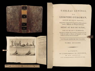
1788 1ed Ottoman Empire MUSLIM Muezzin PRAYER Sultan Selim II TURKS dOhssonSchilb Antiquarian Rare Books4.8(422)See Sold PriceMar 10, 2024
Erie Railway Tourist Book/Magazine-1874JM Hobby Supply and Railroad Artifact Auctions4.4(126)See Sold PriceFeb 24, 2024
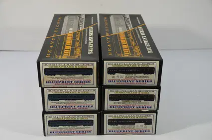
Chesapeake and Ohio RR 6-pack Branchline Pullman Sleepers-HO Scale-New in BoxJM Hobby Supply and Railroad Artifact Auctions4.4(126)See Sold PriceFeb 25, 2024
1885 CIVIL WAR 1ed Famous Memoirs US Grant Sheridan Sherman 6v RARE LOT MapsSchilb Antiquarian Rare Books4.8(422)See Sold PriceMar 10, 2024
WILLIAM TURNER Herball Pair Original c1568 Etchings Framed Leafs RARE!Luis Porretta Fine Arts4.3(10)See Sold PriceMar 02, 2024
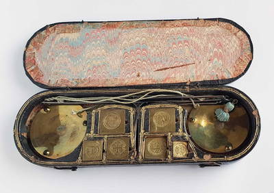
Mongolian/Chinese traveling kits: a cutting knife and two sets of chopsticksChina Luban Art & Antique, Inc.4.4(78)See Sold PriceFeb 24, 2024
Mitchell - Map of the City of Washington (Washington, DC)Trillium Antique Prints & Rare Books4.5(30)See Sold PriceFeb 24, 2024
Audubon, NYSE Best Watercolor Ed - Pair: Brown Pelican & Reddish EgretTrillium Antique Prints & Rare Books4.5(30)See Sold PriceFeb 24, 2024
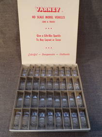
Lot of 36 Vintage 1950's Varney HO Scale Model Vehicles in Box.Westside Traders Emporium4.5(34)See Sold PriceFeb 27, 2024
ANTIQUE ILLUSTRATED HANDBOOK OF GEOGRAPHY AND TRAVEL IN ASIA, VOLUME 2, 1896NY Elizabeth 4.3(85)See Sold PriceMar 03, 2024