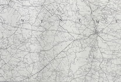
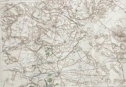
Sold7 Ordnance Survey maps7 Ordnance Survey maps,sheets 7, 46, 50-52, 65, and one unnumbered, engraved maps, some later hand-colouring, each c.620 x 920mm., dissected and linen-backed, in cloth bound slipcase c.1805-1See Sold Price
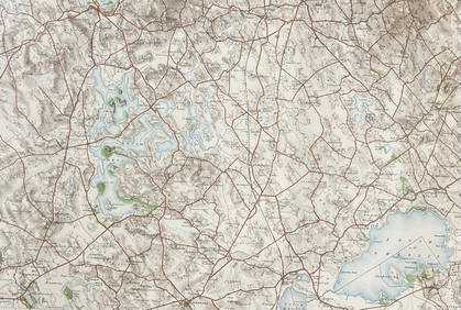
The German Offensive on the Lys - April 1918 MapThe German Offensive on the Lys - April 1918 World War I One. Linen backed. Map 7 - Ordnance Survey - Large Map with Scale Publisher British Dated: 1919See Sold Price
ORDNANCE SURVEYORDNANCE SURVEY A collection of approximately 250 Ordnance Survey Maps, mostly of Edinburgh and environs 1943-54. Scale: 1: 1250 or 50-688 inches 1 mile, but with 7 of the 1931-32 revision scale 25.34See Sold Price
SoldMaps: A collection of 7 maps. Including: Bartholomew'sMaps: A collection of 7 maps. Including: Bartholomew's Contoured Road Map of England and Wales , Fourth edition, mounted on cloth. An Ordnance Survey One- Inch map of Great Britain ; London N.W . SeveSee Sold Price
SoldMaps: A collection of 7 maps. Including: Bartholomew'sMaps: A collection of 7 maps. Including: Bartholomew's Contoured Road Map of England and Wales , Fourth edition, mounted on cloth. An Ordnance Survey One- Inch map of Great Britain ; London N.W . SeveSee Sold Price
SoldMaps: A collection of 7 maps. Including: Bartholomew'sMaps: A collection of 7 maps. Including: Bartholomew's Contoured Road Map of England and Wales , Fourth edition, mounted on cloth. An Ordnance Survey One- Inch map of Great Britain ; London N.W . SeveSee Sold Price
Sold-. Stanford (Edward) Ordnance Survey of Nigeria-. Stanford (Edward) Ordnance Survey of Nigeria,7 sheets, including 50-52, 61-63, 73-74, colour printed maps, each sheet c.545 x 730mm., dissected and linen-backed, with red marbled endpapers,See Sold Price
SoldIreland.- Ordnance Survey of Ireland. A set of TowIreland.- Ordnance Survey of Ireland. A set of Townland Survey Index Maps of Ulster,7 county maps of Armagh, Antrim, Donegal, Down, Fermanagh, Londonderry and Tyrone, engraved maps with originSee Sold Price
Ordnance Survey of Ireland. A set of Townland SurvOrdnance Survey of Ireland. A set of Townland Survey Index Maps of Ulster,7 county maps of Armagh, Antrim, Donegal, Down, Fermanagh, Londonderry and Tyrone, engraved maps with original hand-coSee Sold Price
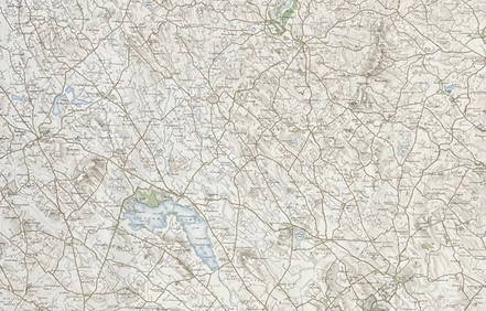
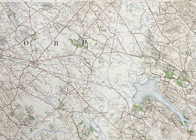
SoldOrdnance Survey.- NorfolkOrdnance Survey.- Norfolk, sheets 129-131, 145-147, 159, only, 7 engraved maps, coloured in outline, dissected and mounted on linen, together in cloth slip-case, [1906].See Sold Price
SoldOrdnance Survey. Wiltshire and SomersetOrdnance Survey. Wiltshire and Somerset,the former on 3 sheets, XIV, XV and XXXIV, the latter on 4 sheets, XVIII-XXI, 7 electrotype map sheets, 665 x 830mm. to 660 x 980mm., all dissected andSee Sold Price
Ordnance Survey. Wiltshire and SomersetOrdnance Survey. Wiltshire and Somerset,the former on 3 sheets, XIV, XV and XXXIV, the latter on 4 sheets, XVIII-XXI, 7 electrotype map sheets, 665 x 830mm. to 660 x 980mm., all dissected andSee Sold Price
SoldOrdnance Survey maps,South West England and Wales, late 19th century, double page coastal maps/charts, including Falmouth Harbour, Menai Strait 1464, Newquay to Holyhead 1411, Milford Haven, Bristol Channel 1179, TrevoseSee Sold Price
SoldEngland.- A group of 16 Ordnance Survey maps, mainlyEngland.- A group of 16 Ordnance Survey maps, including a Col. Mudge map of Kent showing Whitstable, Ramsgate and Dover, 4 Col. Colby maps sold by Letts, Son & Co. of Essex, Kent, Berkshire, and HampsSee Sold Price
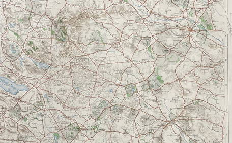
SoldOrdnance Survey maps,West Coast of Scotland, late 19th century with some revisions, approx 60 sheets, some with vignettes, including Lochs, Western Isles, Skye, Harris, Hebrides etc, condition varies (c.60)See Sold Price
SoldCruchley's Reduced Ordnance Survey Map of DevonshireTitle/Content of Map: Cruchley's Reduced Ordnance Survey Map of Devonshire and adjoining areas Date Printed: 1840 ca. Cartographer: CRUCHLEY, C.F. Material/Medium: C.F. CRUCHLEY, mapseller and globe mSee Sold Price
SoldWilliam Collins Ordnance Survey Map of the CountrWilliam Collins divided coloured engraving, Ordnance Survey Map of the Country Thirty Miles round London, 1841, and three other maps.See Sold Price
SoldA quantity of folding ordnance survey maps, includingA quantity of folding ordnance survey maps, including examples by Bacon, Ward, Lock & Co., Gall & Inglis and Bartholomew. To include, Motoring and Touring Map of England, Map and Guide to London, HertSee Sold Price
Sold2 boxes of ordnance survey maps including library2 boxes of ordnance survey maps including library editions.See Sold Price
SoldCOUNTY SERIES ORDNANCE SURVEY MAPSA metal case of County Series Ordnance Survey 1 to 2500 scale maps of Scottish, Welsh and Cotswold counties, mainly EdwardianSee Sold Price
SoldBox containing a collection of Ordnance Survey maps ofBox containing a collection of Ordnance Survey maps of the U.K. from 1920 / '30's, approximately fiftySee Sold Price
SoldBooks Vintage Ordnance Survey Maps and Others20th century AD. A mixed group of travel documents comprising: an Ordnance Survey map sheet 38 (Solent, Isle of Wight), 1912 edition; Bartholomew's reduced survey map, sheet 20 (Suffolk); one similar,See Sold Price
Approximately fifty Ordnance Survey maps, mostly ofApproximately fifty Ordnance Survey maps, mostly of Scotland, Landranger Series (1980's) also three plant kits by Airfix.See Sold Price
Nottingham.- Ordnance Survey Office (publisher) Collection 8 geological maps on the environs ofForum Auctions4.3(53)See Sold PriceFeb 29, 2024
INDIA WITHIN THE GANGES SUSAN GOLE ILLUSTRATED MAPS EARLY CARTOGRAPHYJasper524.5(9.8k)See Sold PriceFeb 27, 2024
ORDNANCE SURVEY OF IRELAND/ Sheet No. 79/ CAVAN, LEITRIM, LONGFORD, MEATH & WESTMEATH Revised 1899Churchill Galleries3.7(216)See Sold PriceFeb 26, 2024
ORDNANCE SURVEY OF IRELAND/ Sheet No. 80/ CAVAN, MEATH & MONAGHAN/ Surveyed 1837 - 39. Printed inChurchill Galleries3.7(216)See Sold PriceFeb 26, 2024
ORDNANCE SURVEY OF IRELAND/ Sheet No. 89/ LONGFORD, MEATH & WESTMEATH/ Published in 1903Churchill Galleries3.7(216)See Sold PriceFeb 26, 2024
ORDNANCE SURVEY OF IRELAND/ Sheet No. 89/ LONGFORD, MEATH & WESTMEATH/ Published in 1903Churchill Galleries3.7(216)See Sold PriceFeb 26, 2024
ORDNANCE SURVEY OF IRELAND/ Sheet No. 89/ LONGFORD, MEATH & WESTMEATH/ Published in 1903Churchill Galleries3.7(216)See Sold PriceFeb 26, 2024
ORDNANCE SURVEY OF IRELAND/ Sheet No. 89/ LONGFORD, MEATH & WESTMEATH/ Published in 1903Churchill Galleries3.7(216)See Sold PriceFeb 26, 2024
ORDNANCE SURVEY OF IRELAND/ Sheet No.90/ MEATH & WESTMEATH/ Published in 1903Churchill Galleries3.7(216)See Sold PriceFeb 26, 2024
ORDNANCE SURVEY OF IRELAND/ Sheet No.90/ MEATH & WESTMEATH/ Published in 1903Churchill Galleries3.7(216)See Sold PriceFeb 26, 2024
ORDNANCE SURVEY OF IRELAND/ Sheet No.90/ MEATH & WESTMEATH/ Published in 1903Churchill Galleries3.7(216)See Sold PriceFeb 26, 2024
ORDNANCE SURVEY OF IRELAND/ Sheet No.90/ MEATH & WESTMEATH/ Published in 1903Churchill Galleries3.7(216)See Sold PriceFeb 26, 2024
ORDNANCE SURVEY OF IRELAND/ Sheet No.90/ MEATH & WESTMEATH/ Published in 1903Churchill Galleries3.7(216)See Sold PriceFeb 26, 2024
ORDNANCE SURVEY OF IRELAND/ Sheet No.99/ KILDARE, MEATH, KINGS & WESTMEATH/ Published in 1902Churchill Galleries3.7(216)See Sold PriceFeb 26, 2024
ORDNANCE SURVEY OF IRELAND/ Sheet No.100/ KILDARE, MEATH & WESTMEATH/ Published in 1903Churchill Galleries3.7(216)See Sold PriceFeb 26, 2024
ORDNANCE SURVEY OF IRELAND/ Sheet No.100/ KILDARE, MEATH & WESTMEATH/ Published in 1903Churchill Galleries3.7(216)See Sold PriceFeb 26, 2024
ORDNANCE SURVEY OF IRELAND/ Sheet No.100/ KILDARE, MEATH & WESTMEATH/ Published in 1903Churchill Galleries3.7(216)See Sold PriceFeb 26, 2024
ORDNANCE SURVEY OF IRELAND/ Sheet No.100/ KILDARE, MEATH & WESTMEATH/ Published in 1903Churchill Galleries3.7(216)See Sold PriceFeb 26, 2024
ORDNANCE SURVEY OF IRELAND/ Sheet No.100/ KILDARE, MEATH & WESTMEATH/ Published in 1903Churchill Galleries3.7(216)See Sold PriceFeb 26, 2024
ORDNANCE SURVEY OF IRELAND/ SHEET NO.109/ KING CO. & CO. WESTMEATH. / PUBLISHED IN 1900Churchill Galleries3.7(216)See Sold PriceFeb 26, 2024