SoldOrdnance Survey maps,South West England and Wales, late 19th century, double page coastal maps/charts, including Falmouth Harbour, Menai Strait 1464, Newquay to Holyhead 1411, Milford Haven, Bristol Channel 1179, TrevoseSee Sold Price
SoldEngland.- A group of 16 Ordnance Survey maps, mainlyEngland.- A group of 16 Ordnance Survey maps, including a Col. Mudge map of Kent showing Whitstable, Ramsgate and Dover, 4 Col. Colby maps sold by Letts, Son & Co. of Essex, Kent, Berkshire, and HampsSee Sold Price
SoldOrdnance Survey maps,West Coast of Scotland, late 19th century with some revisions, approx 60 sheets, some with vignettes, including Lochs, Western Isles, Skye, Harris, Hebrides etc, condition varies (c.60)See Sold Price
SoldOrdnance Survey coastal maps/charts, late 19th century,mostly Ireland, engraved by J & C Walker, Davies et al., sheets 2046 (Waterford Harbour), 1787 (Wexford and Wicklow), 45 & 46 (Larne to Bloody Foreland), 1825B Irish Channel, 44 Dundalk Bay, 1468 (DubSee Sold Price
SoldMaps from the Ordnance Survey of Palestine by Wilson,A portfolio of maps, being the second part of the "Ordnance Survey of Palestine" conducted by Captain Charles William Wilson (1836-1905), in 1864. Contains five folding, cloth-backed maps, including tSee Sold Price
SoldLondon.- Ordnance Survey.- Mudge (Lt. Col. William)London.- Mudge (Lt. Col. William) Four Ordnance Survey maps covering the environs of London, numbered I, VI, VII, and VIII, showing from Great Marlow to the mouth of the River Medway, and East GrinsteSee Sold Price
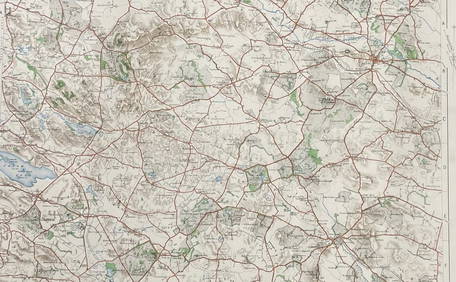
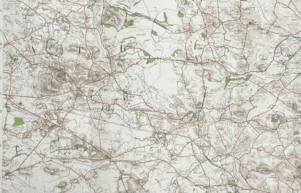
SoldOrdnance Survey.- A group of 70 folding mapsOrdnance Survey.- A group of 70 folding maps,with various counties and areas of the British Isles, lithographed maps, many printed in colour, v.s., all folding into contemporary paper covers,See Sold Price
SoldA quantity of books including Ordnance Survey, Atlas ofA quantity of books including Ordnance Survey, Atlas of England and Wales, Phillips Student Atlas, Phillips Handy General Atlas of the World, two bound volumes of The London Illustrated News and JohnsSee Sold Price
Geological Survey of Scotland Ordnance Survey ofReserve Reduced! Title: Geological Survey of Scotland Ordnance Survey of Scotland Inveraray Sheet 37 Publication Date: 1908 Cartographer: PEACH, B. N. et al. Publisher: ORDNANCE SURVEY Size: 18.75X26.See Sold Price
SoldCruchley's Reduced Ordnance Survey Map of DevonshireTitle/Content of Map: Cruchley's Reduced Ordnance Survey Map of Devonshire and adjoining areas Date Printed: 1840 ca. Cartographer: CRUCHLEY, C.F. Material/Medium: C.F. CRUCHLEY, mapseller and globe mSee Sold Price
SoldWilson. Ordnance Survey of JerusalemWilson (Capt. Charles W.) Ordnance Survey of Jerusalem,the portfolio of plans only, five folding plans, dissected and linen-backed, in original roan-backed portfolio, general title pasted insiSee Sold Price
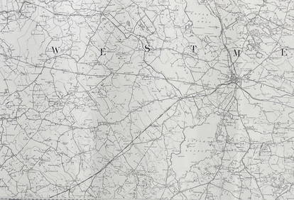
SoldOrdnance Survey. South East EnglandOrdnance Survey. South East England,index map of England and Wales, and sheets 1-16, covering S. Essex, Kent, E. and W. Sussex, Middlesex, Surrey, S. Buckingham, Hampshire, Berkshire, S. WiltsSee Sold Price
SoldOrdnance Survey.- - [The Ordnance Survey of England andindex map in 2 sheets and 111 maps, numbered 1 to 110, lacking sheet 100, the Isle of Man, but with sheet 68 in 2 parts and sheet 110 supplied in 2 states, 113 engraved map sheets, the index maps withSee Sold Price
SoldMcDonald (Sgt James) Ordnance Survey of JerusalemMcDonald (Sgt James) Ordnance Survey of Jerusalema group of ten photographs from the series, comprising Eastern View of the Platform from the Golden Gate, a 3-part panorama, overall 17 x 67 cmSee Sold Price
SoldOrdnance Survey.- the British IslesOrdnance Survey.- a bound collection of the British Isles,the complete set of 40 sheets for England and Wales, each in 2 editions (except the Isle of Man in the earlier edition only) for 1906-See Sold Price
SoldMudge - Ordnance Survey map sheets of the coast of( Lt. Col. William) Ordnance Survey map sheets of the coast of Kent, Sussex and Hampshire , sheets IV, V, IX, X and XI, New Romney, Lewes, Chichester, Isle of Wight and Southampton, respectively, 5 enSee Sold Price
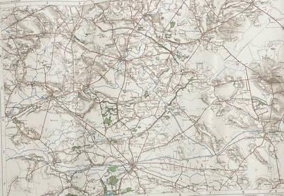
SoldOrdnance Survey. The West CountryOrdnance Survey. The West Country,sheets 17-33, covering Somerset, Devon and Cornwall, by Lt. Col. Mudge, Major Colby, and others, bearing original issue dates, but updated to include some raiSee Sold Price
SoldOVER 60 WW2 ORDNANCE SURVEY, BRITISH ARMY AND RAF MAPSA large group of over 60 assorted WW2-era Ordnance Survey, British Army and Royal Air Force maps of the United Kingdom and parts of Continental Europe. Most of the maps cover parts of the UK in detailSee Sold Price
SoldWilliam Collins Ordnance Survey Map of the CountrWilliam Collins divided coloured engraving, Ordnance Survey Map of the Country Thirty Miles round London, 1841, and three other maps.See Sold Price
SoldIreland.- Ordnance Survey of Ireland. A set of TowIreland.- Ordnance Survey of Ireland. A set of Townland Survey Index Maps of Ulster,7 county maps of Armagh, Antrim, Donegal, Down, Fermanagh, Londonderry and Tyrone, engraved maps with originSee Sold Price
SoldOrdnance Survey. Kent, Sussex, SurreyOrdnance Survey. Kent, Sussex, Surrey,4 sheets by Col. Mudge, V, VI, VIII and IX, East and West Sussex each with a folding extension, engraved maps, each c.645 x 960mm., dissected, linen-backeSee Sold Price
SoldOrdnance Survey Folding MapsOrdnance Survey Folding Maps,various editions and scales, other publisher's maps, including cycling and railways, 19th./20th. C., v.s. (qty.)See Sold Price
SoldOrdnance Survey. - England and Wales,index map in 2 sheets for England and Wales, and Part of Scotland, on a scale of 10 miles to an inch, and 107 of 111 sheets for England and Wales, only, on a scale of 1 inch to a mile, numbered I to CSee Sold Price
SoldOrdnance Survey.- - Seventh Series,one inch to a mile, 2-part index map and 189 unbound sheets of 190, lacking sheet 187, colour-printed maps sheets, occasional minor surface dirt and handling creases but generally crisp and clean, eacSee Sold Price
BOTH TITLE PAGES OF COLLINS" COASTAL SURVEY, 1776, IN MATCHING FRAMESThomaston Place Auction Galleries4.4(389)See Sold PriceFeb 24, 2024
Rand McNally & Co's New Ideal State and County Survey and Atlas 1911North American Artifact Auctions4.6(184)See Sold PriceApr 20, 2024
Birds of the World: A Survey of the Twenty-Seven Orders and One Hundred and Fifty-Five FamiliesNorth American Artifact Auctions4.6(184)See Sold PriceApr 20, 2024
1955 Gough Island Tristan Da Cunha Cover To England Scientific Survey BlackMynt Auctions4.6(689)See Sold PriceFeb 27, 2024
Nottingham.- Ordnance Survey Office (publisher) Collection 8 geological maps on the environs ofForum Auctions4.3(53)See Sold PriceFeb 29, 2024
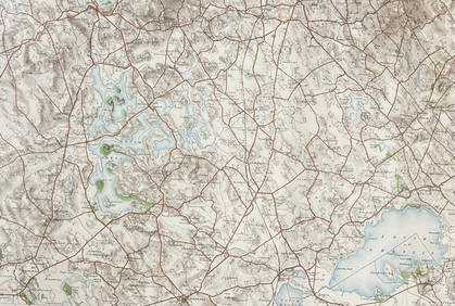
ORDNANCE SURVEY OF IRELAND/ Sheet No. 79/ CAVAN, LEITRIM, LONGFORD, MEATH & WESTMEATH Revised 1899Churchill Galleries3.7(216)See Sold PriceFeb 26, 2024
ORDNANCE SURVEY OF IRELAND/ Sheet No. 80/ CAVAN, MEATH & MONAGHAN/ Surveyed 1837 - 39. Printed inChurchill Galleries3.7(216)See Sold PriceFeb 26, 2024
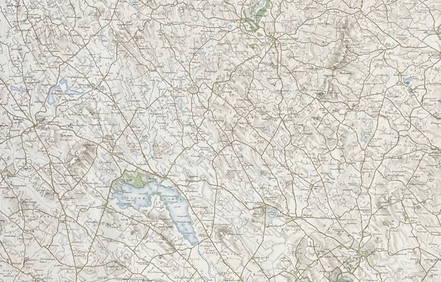
ORDNANCE SURVEY OF IRELAND/ Sheet No. 89/ LONGFORD, MEATH & WESTMEATH/ Published in 1903Churchill Galleries3.7(216)See Sold PriceFeb 26, 2024
ORDNANCE SURVEY OF IRELAND/ Sheet No. 89/ LONGFORD, MEATH & WESTMEATH/ Published in 1903Churchill Galleries3.7(216)See Sold PriceFeb 26, 2024
ORDNANCE SURVEY OF IRELAND/ Sheet No. 89/ LONGFORD, MEATH & WESTMEATH/ Published in 1903Churchill Galleries3.7(216)See Sold PriceFeb 26, 2024
ORDNANCE SURVEY OF IRELAND/ Sheet No. 89/ LONGFORD, MEATH & WESTMEATH/ Published in 1903Churchill Galleries3.7(216)See Sold PriceFeb 26, 2024
ORDNANCE SURVEY OF IRELAND/ Sheet No.90/ MEATH & WESTMEATH/ Published in 1903Churchill Galleries3.7(216)See Sold PriceFeb 26, 2024
ORDNANCE SURVEY OF IRELAND/ Sheet No.90/ MEATH & WESTMEATH/ Published in 1903Churchill Galleries3.7(216)See Sold PriceFeb 26, 2024
ORDNANCE SURVEY OF IRELAND/ Sheet No.90/ MEATH & WESTMEATH/ Published in 1903Churchill Galleries3.7(216)See Sold PriceFeb 26, 2024
ORDNANCE SURVEY OF IRELAND/ Sheet No.90/ MEATH & WESTMEATH/ Published in 1903Churchill Galleries3.7(216)See Sold PriceFeb 26, 2024
ORDNANCE SURVEY OF IRELAND/ Sheet No.90/ MEATH & WESTMEATH/ Published in 1903Churchill Galleries3.7(216)See Sold PriceFeb 26, 2024
ORDNANCE SURVEY OF IRELAND/ Sheet No.99/ KILDARE, MEATH, KINGS & WESTMEATH/ Published in 1902Churchill Galleries3.7(216)See Sold PriceFeb 26, 2024
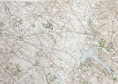
ORDNANCE SURVEY OF IRELAND/ Sheet No.100/ KILDARE, MEATH & WESTMEATH/ Published in 1903Churchill Galleries3.7(216)See Sold PriceFeb 26, 2024
ORDNANCE SURVEY OF IRELAND/ Sheet No.100/ KILDARE, MEATH & WESTMEATH/ Published in 1903Churchill Galleries3.7(216)See Sold PriceFeb 26, 2024
ORDNANCE SURVEY OF IRELAND/ Sheet No.100/ KILDARE, MEATH & WESTMEATH/ Published in 1903Churchill Galleries3.7(216)See Sold PriceFeb 26, 2024
ORDNANCE SURVEY OF IRELAND/ Sheet No.100/ KILDARE, MEATH & WESTMEATH/ Published in 1903Churchill Galleries3.7(216)See Sold PriceFeb 26, 2024
ORDNANCE SURVEY OF IRELAND/ Sheet No.100/ KILDARE, MEATH & WESTMEATH/ Published in 1903Churchill Galleries3.7(216)See Sold PriceFeb 26, 2024
ORDNANCE SURVEY OF IRELAND/ SHEET NO.109/ KING CO. & CO. WESTMEATH. / PUBLISHED IN 1900Churchill Galleries3.7(216)See Sold PriceFeb 26, 2024