ATLAS of ANTIENT GEOGRAPHY by SAMUEL BUTLER 1843John McInnis Auctioneers,LLC4.5(505)See Sold PriceFeb 24, 2024
18TH C. ANTIQUE MAP: FRENCH & INDIAN WAR, FRAMEDThomaston Place Auction Galleries4.4(393)See Sold PriceFeb 24, 2024
Rand McNally Railroad Map Cabinet w/ 21 Railroad MapsRail & Road Auctions4.6(165)See Sold PriceMar 08, 2024
Keith Haring - Ink on New York Map, Best Buddies, Inscribed, Signed, and DatedSapphire Auction Gallery4(67)See Sold PriceMar 02, 2024
LATE 17TH C. FRENCH MAP OF THE NEW WORLD BY ALEXIS-HUBERT JAILLOT (1632-1712)Thomaston Place Auction Galleries4.4(393)See Sold PriceFeb 24, 2024
Central Railroad of New Jersey Map of Sandy Hook Route-ca. 1903JM Hobby Supply and Railroad Artifact Auctions4.4(127)See Sold PriceFeb 24, 2024
Lot of Six Mixed Atlas Box Cars-HO Scale-New in BoxJM Hobby Supply and Railroad Artifact Auctions4.4(127)See Sold PriceFeb 25, 2024
Rand McNally/Santa Fe Railroad Map of Iowa-1912JM Hobby Supply and Railroad Artifact Auctions4.4(127)See Sold PriceFeb 24, 2024
NICOLAES VISSCHER (NETHERLANDS, 1618-1709) MAP OF THE NEW WORLDThomaston Place Auction Galleries4.4(393)See Sold PriceFeb 24, 2024
17TH C. WORLD MAP BY NICOLAES VISSCHER (NETHERLANDS, 1618-1709)Thomaston Place Auction Galleries4.4(393)See Sold PriceFeb 24, 2024
Lot of Six Mixed Atlas Cabooses-HO Scale-New in BoxJM Hobby Supply and Railroad Artifact Auctions4.4(127)See Sold PriceFeb 25, 2024
SoldR. Wilkinson Antique Hand Colored Map of SwabiaDescription: R. Wilkinson antique, hand colored map of Swabia. Swabia was a medieval Duchy in southwest Germany, that also included part of Poland. Possibly circa 1822 as indicated by original owner.See Sold Price
R. Wilkinson United States MapRobert Wilkinson, London, 18th/19th Century. Hand colored engraved map of "The United States of America: Confirmed by the Treaty 1783". Not examined out of the frame. Minor foxing. Image is 12" x 10"See Sold Price
Wilkinson: Terra Veteribus Nota Antique Map, 1814Terra Veteribus Nota, Wilkinson 1814. Original hand-colored copperplate engraved map from An Atlas of Ten Select Maps of Ancient Geography, Both Sacred and Profane to accompany Mayo’s Ancient GeograSee Sold Price
SoldAntique Mappe Monde Hand Colored EngravingAntique Mappe Monde Hand Colored Engraving. This antique map of the world by R & J Ottens is hand colored. Art measures 21.25 inches x 25.25 inches.See Sold Price
SoldAntique Mappe Monde Hand Colored EngravingAntique Mappe Monde Hand Colored Engraving. This antique map of the world by R & J Ottens is hand colored. Art measures 21.25 inches x 25.25 inches.See Sold Price
SoldFramed Antique 18th C R Reynolds Map of AfricaFramed Antique 18th C R Reynolds Map of Africa. Antique 18th century hand colored engraving. With certificate in envelope on back. Measures 13.5 x 16.75 inches.See Sold Price
Sold3 18th C. maps incl. R. Vaugondy and J. BaylyItem 1: Robert de Vaugondy hand colored map "Amerique septen trionale." French, 1750. 6 3/8" H x 6 1/2" W. Item 2: Robert de Vaugondy hand colored map "Mappe Monde" French, 1750. 6 3/8" H x 12 1/8" W.See Sold Price
SoldR. Bonne, Partie Occidentale du CanadaRigobert Bonne, French, 1727-1795. Hand colored engraved map entitled "Partie Occidentale du Canada", including the Great Lakes. Not examined out of the frame. Some minor foxing, toning, and creasing.See Sold Price
SoldHand-Colored WALL MAP OF CAYUGA AND SENECA COUNTIES NEWDetails: This lot consists of the antique wall map shown in the corresponding images.This map of Cayuga and Seneca Counties, New York, was published by A. R. Z. Dawson in Philadelphia, 1859. It is haSee Sold Price
SoldAntique Railroad Map, Fall River LineHand-colored copper engraved map depicting the "Fall River Line, Old Colony R.R. & Steamboat Co.'s and Connections," engraved and printed by R.A. Supply Co. (Boston, MA), overall (framed): 15.5"h x 19See Sold Price
SoldR. De Vaugondy MapRobert De Vaugondy, Didier, French, 1723-1786. Engraved map with Hand colored outlines depicts "Partie de l'Amerique Septent? qui comprend la Nouvelle France ou le Canada". Not examined out of the fraSee Sold Price
SoldAntique 1669 map of Chile by Sanson, "Le Chile, DiviseAntique 1669 map of Chile by Sanson, "Le Chile, Divise en ses Treize Iurisdictions Tire du R.P. Also de Oualle…1669", hand colored, minor loss left margin, map is 18" by 24"See Sold Price
Sold"The County of Cambridge and the Isle of Ely" Map,"The County of Cambridge and the Isle of Ely" Map, by R.G. Baker, Bluntisham,1821. A large antique wall map backed with linen and affixed to a wooden top rail. Hand colored and embellished with engravSee Sold Price
SoldPisces Constellation Map, 1821By: R. Phillips & Co. Date: 1821 (circa) Dimensions: 6.5 x 10.5 inches (16.51 cm x 26.7 cm) This authentic antique engraving is from a group depicting constellations. In this lovely hand-colored printSee Sold Price
SoldAN ANTIQUE FINLAND MAP, "Finmarchiæ et Laplandiæ,"AN ANTIQUE FINLAND MAP, "Finmarchiæ et Laplandiæ," 17TH/18TH CENTURY, hand colored ink engraving on paper, after Frederik de Wit (Dutch 1630-1706) hand numbered in ink 131 U/R, plate: 19 1/2See Sold Price
SoldAN ANTIQUE MAP OF SOUTHEAST ENGLAND, "Regni Angliæ,"AN ANTIQUE MAP OF SOUTHEAST ENGLAND, "Regni Angliæ," 17TH/18TH CENTURY, hand colored copper plate engraving on paper, a page fragment from a larger atlas, hand numbered 86 L/R, with theatrical curtaiSee Sold Price
SoldAN ANTIQUE RUSSIA BARENT SEA MAP, "Russiæ et Novæ ZemlæAN ANTIQUE RUSSIA BARENT SEA MAP, "Russiæ et Novæ Zemlæ Maritimæ, Apud F. de Wit," CIRCA 1680, hand colored ink engraving on paper, after Frederik de Wit (Dutch 1630-1706) hand numbered 132 U/R;See Sold Price
SoldAntique MapTOTIUS AFRICAE, c.1715, hand colored engraving by Johan Baptiste Homann, published by R & J Ottens in Atlas Maior, Amsterdam, c.1740, sight 19 ¼ x 22 ¼”, framed with glass, creases at left sheet eSee Sold Price
AN ANTIQUE MAP OF SOUTHEAST ENGLAND, "Regni Angliæ,"AN ANTIQUE MAP OF SOUTHEAST ENGLAND, "Regni Angliæ," 17TH/18TH CENTURY, hand colored copper plate engraving on paper, a page fragment from a larger atlas, hand numbered 86 L/R, with theatrical curtaiSee Sold Price
Sold2 North American MapsTwo late 18th century Maps by R. Bonne (Paris). A 1780 "Amerique Septentrionale" and a 1780 "Partie Occidentale Du Canada". Hand colored engravings. Both with central fold lines (one 3/4 torn) some diSee Sold Price
SoldAntique Hand-colored MapAntique Hand-colored Map of Russia and Neighboring Countries: Russiae, Moscoviae et Tartariae Descriptio, 1562 by Anthony Jenkinson. Size: 14.25" x 18", 36 x 46 cm (sight); 22.25" x 26", 57 x 66 cm (fSee Sold Price
Sold2 Antique Hand Colored Maps East & West Indies2 Antique Hand Colored Maps of The East & West Indies. Including map of Batavia and Jamaica Map measures 17 inches high x 21 inches wide. Frame measures 19 inches high x 23 inches wide.See Sold Price
SoldAN ANTIQUE HAND COLORED MAP, "Republic of Mexico andAN ANTIQUE HAND COLORED MAP, "Republic of Mexico and Texas," hand colored engraving on paper, "London, James Wyld, Charing Gros.," plate number 46, originally printed for Popular Atlas of the World (See Sold Price
SoldAntique Hand-colored Map: Landt Carte Vonden DanischenAntique Hand-colored Map: Landt Carte Vonden Danischen Walde, c. 1650. Size: 9.75" x 12.25", 25 x 31 cm (sheet); 14.5" x 16.75", 37 x 43 cm (frame). Provenance: Estate of Eileen Ford, Tewksbury, New JSee Sold Price
Johann Homann Hand-Colored Map Engraving, c. 1730Auctions at Showplace4.6(740)See Sold PriceMar 17, 2024
Framed Hand Colored Antique Map of the Department of Nord, FranceDonny Malone Auctions4.4(1.8k)See Sold PriceMar 04, 2024
Mitchell - Map of the City of Washington (Washington, DC)Trillium Antique Prints & Rare Books4.5(32)See Sold PriceFeb 24, 2024
Albin - Bald or Vulturine Eagle. 2-3Trillium Antique Prints & Rare Books4.5(32)See Sold PriceFeb 24, 2024
Albin - King Vulture or Warwounen. 2-4Trillium Antique Prints & Rare Books4.5(32)See Sold PriceFeb 24, 2024
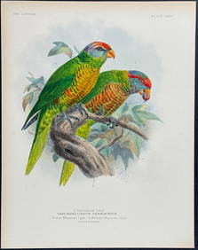
Mivart & Keulemans - Mitchell's LoryTrillium Antique Prints & Rare Books4.5(32)See Sold PriceFeb 24, 2024
Mivart & Keulemans - Verreaux's LoryTrillium Antique Prints & Rare Books4.5(32)See Sold PriceFeb 24, 2024
Mivart & Keulemans - Tahiti Lory, Ultramarine LoryTrillium Antique Prints & Rare Books4.5(32)See Sold PriceFeb 24, 2024
Mivart & Keulemans - Black-capped Lory & Red-breasted LoryTrillium Antique Prints & Rare Books4.5(32)See Sold PriceFeb 24, 2024
1849 Hand Colored Blair Map of World in HemispheresMatthew Bullock Auctioneers4.7(1.8k)See Sold PriceMar 02, 2024
1849 Orr & Co. Hand Colored Southern Germany MapMatthew Bullock Auctioneers4.7(1.8k)See Sold PriceMar 02, 2024