SoldMap "Europa Religionis Christianae Morum..."Map Europa Religionis Christianae Morum Et Pacis Ac Belli... Matthaus Seutter (1678-1756) who worked in Augsburg ca 1730. 19.25 x 22.5 in.See Sold Price
SoldMatthaus Seutter hand colored engraved mapMatthaus Seutter hand colored engraved map, early 18th c., inscribed Europa Religionis Christianae Morum et Pacis ac Belli Artium Cultu Omnium Terrarum Orbis Partium Praestantiss...., 20'' x 23''. ProSee Sold Price
SoldDetailed Map of Europe by SeutterEuropa Religionis Christianae Morum et Pacis ac Belli Artium Cultu Omnium Terrarum Orbis Partium Praestantiss....Matthaus Seutter (1678-1757). Engraved Map with original hand color in part. Ausburg, cSee Sold Price
SoldSeutter Map of EuropeSeutter, Matthaus (1678-1757). Europa Religionis Christianae Morum et Pacis ac Belli Artium Cultu Omnium Terrarum Orbis Partium Praestantiss.... Engraved map with original hand color in part. Ausburg,See Sold Price
SEUTTER, MATTHIAS, EUROPA RELIGIONIS, 1730Seutter, Matthias EUROPA RELIGIONIS CHRISTIANAE MORUM ET PACIS AC BELLI ARTIUM CULTU OMNIUM TERRARTM ORBIS PARTIUM PRAESTANTISS IUXTARE ENTISSIMA EXEMPLARIA [Augsburg, 1730] H. 50.2cm W. 57.7cm EngravSee Sold Price
SoldMaps, Matthaus Seutter and Frederick de Wit(lot of 2) Matthaus Seutter (German, 1678-1757), "Europa Religionis Christianae," copper engraved map with hand coloring and Frederick De Wit (Dutch,1630-1706), "Novissima et Accuratissima totius ItalSee Sold Price
SoldFRAMED EUROPEAN MAPEUROPEAN MAP, MATTED AND FRAMED UNDER GLASS. MARKED EUROPA RELIGIONIS MATTH. SEUTTERO. AGE UNKNOWN. 26" x 22 1/2" IN FRAME.See Sold Price
SoldFramed Antique Map, EuropaFramed antique map of Europe. Plate marks visible. hand-colored. Hand-written information along verso Of frame. Map is set behind glass in wood frame in two-tone wood style frame. Measures approximateSee Sold Price
SoldEARLY MAP EUROPAColor engraving of Europe in 1595; Clariss D. Nicolao, toning; 17" x 21", F-GSee Sold Price
SoldMap: Europa TabulaMap titled "Europa Tabula." Dimensions: Sight: 19.5" H x 23" W; Frame: 25.5" H x 29" W; See Sold Price
SoldEuropean School Chart / Map - Europa von 1918-1945European School Chart / Map - Europa von 1918-1945 - 55 in tall x 90 when openSee Sold Price
Sold18TH C HANDCOLORED MAP - EUROPA, ASIA & AFRICAMEASURES 20"T X 23"W - CORNER MOUNTED TO CARDBOARDSee Sold Price
SoldGrotius, Veritate Religionis Christianae, 1718GROTIUS, Hugo. Veritate Religionis Christianae. The Hague: Isaac Vaillant, 1718. Sm 8vo. [14],368pp. Early full sheep, 6-panel gilt-decorated spine. Very Good, lacking ffep, one corner margin missing,See Sold Price
SoldVincent Louis Gotti, Veritas Religionis Christianae,Heading: Author: Gotti, Vincent Louis Title: Veritas Religionis Christianae et librorum quibus innititur contra Atheos, Polytheos, Idolatros, Mahometanos et Judaeos demonstrata Place Published: RomaeSee Sold Price
SoldGrotius (Hugo) De Veritate Religionis ChristianaeGrotius (Hugo) De Veritate Religionis Christianae,first Glasgow edition, contemporary calf, chipped red morocco label to spine in compartments, joints splitting, but holding firm, corners a liSee Sold Price
Grozio, Ugo. De Veritate Religionis Christianae EdGrozio, Ugo. De Veritate Religionis Christianae Editio Novissima.Amsterdam, Daniel Elzevier, 1680. In 12°. Marca tipografica al frontespizio in rosso e nero, testatine e capilettera xilogSee Sold Price
SoldTwo framed maps including Johann Mattheus, Hasio,Two framed maps including Johann Mattheus, Hasio, Continental 18th century hand colored engraving map Europa (19 1/2'' x 22'') and a Status Ecclesiae at Magni Ducatus Hetruriae Math Sutter August VindSee Sold Price
SoldMenke: Antique Map of Europe at time of OdovacarsTitle/Content of Map: Europa Zur Zeit Odovacars (476-493.) Date Printed: 1874 Cartographer: MENKE, TH. Publisher: JUSTUS PERTHES 1874 GOTHA Size: Quarto – 12.80 H x 15.75 W Inches "Von Th. Menke..."See Sold Price
SoldDated 1709 Hugo Grotius ''Veritate ReligionisDated 1709 Hugo Grotius ''Veritate Religionis Christianae'' Leatherbound Book 6.5''x4''. Original leather binding. Tear in spine.See Sold Price
SoldMornay, Sieur du Plessis-Marly, Philippe de: De veMornay, sieur du Plessis-Marly, Philippe de. De veritate religionis Christianae liber, adversus Atheos, Epicureos, Ethnicos, Judaeos, Mahumedistas (et) caeteros infideles. 18 Bl., 791 S. 17,5 x 11 cm.See Sold Price
SoldCourcelles (Étienne) Opera Theologica,[Courcelles (Étienne)] Opera Theologica, quorum pars praecipua Institutio Religionis Christianae,vignette title printed in red and black, marginal wormholes, contemporary vellum, rather worn,See Sold Price
Guilielmo Blaeuw Antique Map Of Europe Vintage ReprintGuilielmo Blaeuw Antique Map Of Europe Vintage ReprintVintage reproduction of an antique map Europa recens descripta à Guilielmo Blaeuw which was first published in Amsterdam c 1630 by Willem JanszooSee Sold Price
SoldGrotius (Hugo) AnnotationesGrotius (Hugo) Annotationes ad Libros de Veritate Religionis Christianae,device on title, little spotting, contemporary mottled vellum, 12mo, Leiden, Joannes Maire, 1640 Pritius (Johann GeorSee Sold Price
EUROPE ANCIENT.Europa.Germania Gallia Hispania Sarmatia &c.ARROWSMITH 1828 mapTITLE/CONTENT OF MAP: 'Europa; Cum Insulis et Regionibus intra Paludem Maeotida et Mare Hyrcanum sitis' DATE PRINTED: 1828 IMAGE SIZE: Approx 26.0 x 32.0cm, 10.25 x 12.5 inches (Large) TYPE: Antique cSee Sold Price
Central Railroad of New Jersey Map of Sandy Hook Route-ca. 1903JM Hobby Supply and Railroad Artifact Auctions4.4(126)See Sold PriceFeb 24, 2024
Cincinnati Hamilton and Dayton RR Map -USGC 1889JM Hobby Supply and Railroad Artifact Auctions4.4(126)See Sold PriceFeb 24, 2024
Northern Pacific RR Washington and Northern Idaho Map Folder-1941JM Hobby Supply and Railroad Artifact Auctions4.4(126)See Sold PriceFeb 24, 2024
Rand McNally/Santa Fe Railroad Map of Iowa-1912JM Hobby Supply and Railroad Artifact Auctions4.4(126)See Sold PriceFeb 24, 2024
17TH C. WORLD MAP BY NICOLAES VISSCHER (NETHERLANDS, 1618-1709)Thomaston Place Auction Galleries4.4(386)See Sold PriceFeb 24, 2024
LATE 17TH C. FRENCH MAP OF THE NEW WORLD BY ALEXIS-HUBERT JAILLOT (1632-1712)Thomaston Place Auction Galleries4.4(386)See Sold PriceFeb 24, 2024
18TH C. ANTIQUE MAP: FRENCH & INDIAN WAR, FRAMEDThomaston Place Auction Galleries4.4(386)See Sold PriceFeb 24, 2024
NICOLAES VISSCHER (NETHERLANDS, 1618-1709) MAP OF THE NEW WORLDThomaston Place Auction Galleries4.4(386)See Sold PriceFeb 24, 2024
Nova Totius Full Color Geographical World MapThe Benefit Shop Foundation Inc.4.3(2.9k)See Sold PriceFeb 28, 2024
Civil War Map, Positions of the Army of the Ohio Front oh Dalton GA Dated 1864 34"L x 24"TSwisher Bros. Auction LLC4.4(241)See Sold PriceFeb 24, 2024
Keith Haring - Ink on New York Map, Best Buddies, Inscribed, Signed, and DatedSapphire Auction Gallery4(67)See Sold PriceMar 02, 2024
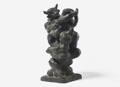
Jacques Lipchitz (American/French, 1891-1973) - Variation of the Rape of Europa GFreeman's | Hindman4.5(158)See Sold PriceFeb 27, 2024
Rand McNally Railroad Map Cabinet w/ 21 Railroad MapsRail & Road Auctions4.6(165)See Sold PriceMar 08, 2024
Willem Blaeu, Etc. 17th C. Antiquarian Maps, 2Auctions at Showplace4.5(726)See Sold PriceMar 17, 2024
Putnam - First Map of the State of Ohio by Rufus PutnamTrillium Antique Prints & Rare Books4.5(30)See Sold PriceFeb 24, 2024
De Jode, Rare, pub. 1593 - Map of Africa (Africae Vera Forma, et Situs)Trillium Antique Prints & Rare Books4.5(30)See Sold PriceFeb 24, 2024