ATLAS of ANTIENT GEOGRAPHY by SAMUEL BUTLER 1843John McInnis Auctioneers,LLC4.5(505)See Sold PriceFeb 24, 2024
18TH C. ANTIQUE MAP: FRENCH & INDIAN WAR, FRAMEDThomaston Place Auction Galleries4.4(393)See Sold PriceFeb 24, 2024
Rand McNally Railroad Map Cabinet w/ 21 Railroad MapsRail & Road Auctions4.6(165)See Sold PriceMar 08, 2024
Keith Haring - Ink on New York Map, Best Buddies, Inscribed, Signed, and DatedSapphire Auction Gallery4.1(67)See Sold PriceMar 02, 2024
LATE 17TH C. FRENCH MAP OF THE NEW WORLD BY ALEXIS-HUBERT JAILLOT (1632-1712)Thomaston Place Auction Galleries4.4(393)See Sold PriceFeb 24, 2024
Central Railroad of New Jersey Map of Sandy Hook Route-ca. 1903JM Hobby Supply and Railroad Artifact Auctions4.4(127)See Sold PriceFeb 24, 2024
Lot of Six Mixed Atlas Box Cars-HO Scale-New in BoxJM Hobby Supply and Railroad Artifact Auctions4.4(127)See Sold PriceFeb 25, 2024
Rand McNally/Santa Fe Railroad Map of Iowa-1912JM Hobby Supply and Railroad Artifact Auctions4.4(127)See Sold PriceFeb 24, 2024
NICOLAES VISSCHER (NETHERLANDS, 1618-1709) MAP OF THE NEW WORLDThomaston Place Auction Galleries4.4(393)See Sold PriceFeb 24, 2024
17TH C. WORLD MAP BY NICOLAES VISSCHER (NETHERLANDS, 1618-1709)Thomaston Place Auction Galleries4.4(393)See Sold PriceFeb 24, 2024
Lot of Six Mixed Atlas Cabooses-HO Scale-New in BoxJM Hobby Supply and Railroad Artifact Auctions4.4(127)See Sold PriceFeb 25, 2024
SoldTwo framed maps including Johann Mattheus, Hasio,Two framed maps including Johann Mattheus, Hasio, Continental 18th century hand colored engraving map Europa (19 1/2'' x 22'') and a Status Ecclesiae at Magni Ducatus Hetruriae Math Sutter August VindSee Sold Price
SoldTwo framed maps including Carte Du Golfe Du Mexique etTwo framed maps including Carte Du Golfe Du Mexique et Des Isles Antilles (sight size: 13" x 17") and Orbis Universal map of the world with plaque: David Rockefeller In appreciation for your tirelessSee Sold Price
SoldTwo framed maps including Abraham Ortelius CypriTwo framed maps including Abraham Ortelius Cypri Insulae Nova Descript 1573 hand colored engraved map and La Judee ou Palestine, George du Rey Paris map. sight size 11 1/4" x 13" and 14" x 19 1/2"See Sold Price
SoldTwo framed and engraved maps including County Map ofTwo framed and engraved maps including County Map of the State of Texas, drawn and engraved by W.H. Gamble, entered by Mitchell 1879, ss 14 3/4" x 22" and Johnson's Texas published by A.H. Johnson, NeSee Sold Price
SoldTwo early framed engraved maps including "Carte de laTwo early framed engraved maps including "Carte de la Nouvelle Angleterre Nouvelle Yorck et Pennsylvania" (sight size 9 1/2" x 13 1/2") and "A Map of the Colony of Rhode Island with the Adjacent partsSee Sold Price
SoldGroup of four framed maps including two J.H. ColtonGroup of four framed maps including two J.H. Colton maps, South Carolina and Wisconsin and two maps of Turkey in Europe & Asia. ssw 12" x 10" to 16 3/4" x 13 3/4" Provenance: Property from the CreditSee Sold Price
SoldTwo Framed Maps of Revolutionary War Interest, incTwo Framed Maps of Revolutionary War Interest, including the Battle of Bunker Hill published in 1796, the other, a "Representation of the Engagement between Admiral Graves and Count de Grasse", late 1See Sold Price
Two Framed Vintage ChartsTwo framed vintage charts, including map of the Western Gulf of California circa 1960s, and wheel projections circa the 19th century; map in overall good condition, projections with some fading, waterSee Sold Price
SoldTwo framed 18th century hand colored engraved mapsTwo framed 18th century hand colored engraved maps including Schwaben Circulus Sueviae Continens ducatum Wirtenbergensen, 18th century map and Charte von dem Königreich PreuBen 1795.See Sold Price
SoldTwo Framed Hand-colored Engraved Maps, 19th/20thTwo Framed Hand-colored Engraved Maps, 19th/20th Century, Including a map of Morea olim Peloponnesus by Gerardus Mercator and of Deventer by Johannes Blaeu. Largest framed dimensions: h: 21 1/2 x w: 2See Sold Price
SoldTwo Framed Maps George Washington's MapIncluding Gerorge Washington's Map of Mount Vernon Estate drawn by him in 1793 and based on his own surveys, copyright of 1931 by the Huntington Library and published by th Mount Vernon Ladies AssociaSee Sold Price
TWO FRAMED MAPS. One is an early engraviTWO FRAMED MAPS. One is an early engraving with handcoloring of the eastern U. S. including Pennsylvania, Kentucky, and the "Western Territory". Also the "River St. Laurence" by J. & G. Menzies. Edin.See Sold Price
Two framed maps, Egypt, 19th centuryincluding: 1) "Carte du Golfe du Arabie, Depuis Suez a Bab-el-Mandeb" showing the routes of Bruce in search of the source of the Nile, engraving; and 2) "Usages, Sciences, Arts, et Monuments de l'EgypSee Sold Price
SoldWWII US FIJI ISLAND SOLDIER ART MAPS SHORT SNORTERWorld War Two framed lot including a printed map of the Fiji Islands and a soldier's rendition of Vita Levu Fiji Islands along with currency including a short snorter note with 17 names below the typeSee Sold Price
Three antique hand coloured road maps in...Three antique hand coloured road maps including two by John Owen Emmanuel Bowen, mounted, framed and glazed, two framed as one, the largest 18.5cm x 12cm excluding the mount and frameSee Sold Price
SoldTwo Small Framed Early Mapsincluding Connecticut and Virginia. Not examined out of frames. Largest frame size: 11 1/3" high, 13 3/4" wide. Stains, toning, creases. Provenance: Property of a Madison, CT Collector. VirSee Sold Price
SoldTwo Large Framed Nevada Maps Plus Sutro Tunnel YardlongThree framed items from Nevada. 1) A large Map of the Comstock Lode, Lyon and Storey Counties, 1923. Frame measures 27" X 34". Shows all the claims of the Comstock including Devil's Gate and ChinatownSee Sold Price
SoldFRAMED 19TH C MAP & TWO FRAMED PORTRAITSLot including a framed 19th century map of the West Indies, and two framed photograph portraits (old man and old woman). Condition: map show creases and signs of age/wear, discoloration, heavy signs oSee Sold Price
Sold2 FRAMED HARRY POTTER MAPSLOT OF TWO FRAMED HARRY POTTER MAPS. THE MARAUDERS MAP 11 IN X 18 1/4 IN IN FRAME, & DIAGON ALLEY 21 IN X 10 IN INCLUDING FRAMESee Sold Price
SoldTwo Early Framed Hand Colored Mapscomprising Johann Baptist Homann (German, 1664-1724), "Nova Anglia" and a smaller unsigned map, "Dania Regnum." Not examined out of frames. Stains, toning. Largest: 27 1/2" high, 30 1/2" wide. ProvenaSee Sold Price
SoldArtwork Ansel Adams Aerial maps12 pieces of framed artwork including two aerial maps of Silicon Valley, Ansel Adams print, Monet, Cezanne, etc. BANKRUPTCY AUCTION: Must leave $300 deposit in order to bid on any lot. Please call 888See Sold Price
SoldPair of late 17th/early 18th Century Maps-Denmark andPair of late 17th/early 18th century maps including; 1.) Framed map titled "Tabula Generalis Iutiae" by Johann Baptist Homann (1664-1724). This hand-colored map of Denmark was published in 1710 and meSee Sold Price
Vietnam War MemorabiliaLot consists of a small box of US awards including the National Defense medal, a Navy Occupation Service medal, and more as well as some photos, two framed pictures, and a map. Overall good condition.See Sold Price
SoldTwo French Engravings of African Subjectsincluding "Afrique" and map. Framed, not examined out of frames. Largest frame size: 9 3/4" high, 11 3/4" wide. Stains, toning. Provenance: Property of a Madison, CT Collector.See Sold Price
RARE 1638 HONDIUS MAP OF BERMUDA, FRAMEDThomaston Place Auction Galleries4.4(393)See Sold PriceFeb 24, 2024
EARLY 18TH C. MAP OF ITALY, FRAMEDThomaston Place Auction Galleries4.4(393)See Sold PriceFeb 24, 2024
17TH C. ENGLISH LINEAR MAP BY OGILBY, FRAMEDThomaston Place Auction Galleries4.4(393)See Sold PriceFeb 24, 2024
Jerusalem Map for British Soldiers in Palestine - WW2Levy Auction House4.3(11)See Sold PriceFeb 27, 2024
1855 Map of New York & Erie Railroad and 1917 Trespassing On Railway Property Is A MisdemeanorRail & Road Auctions4.6(165)See Sold PriceMar 07, 2024
Pair of Early Railroad Maps - 1874 Delaware, Lackawanna & Western and 1876 Pennsylvania RailroadRail & Road Auctions4.6(165)See Sold PriceMar 07, 2024
Pair of Early Railroad Maps - 1862 Pittsburgh, Ft. Wayne & Chicago Railway and 1873 PennsylvaniaRail & Road Auctions4.6(165)See Sold PriceMar 07, 2024
Hand Colored Map of the city of Amsterdam 1720Global Auctions Company4.3(36)See Sold PriceMar 03, 2024
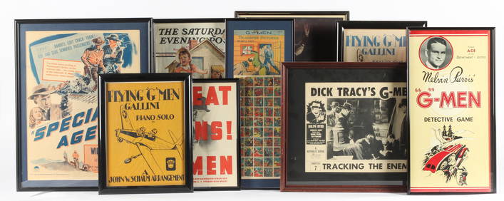
Eight Vintage Framed G-Man & FBI Related Posters & EphemeraHoch LTD.4.6(79)See Sold PriceFeb 25, 2024
Two (2) Antique 18th C. Copper Engraved Framed Maps - America & EuropeMagnusson Art Group4.5(53)See Sold PriceMar 14, 2024
Framed Space Age Rand McNally Map of Planets Poster, 1958PUBLIC SALE4.7(226)See Sold PriceMar 02, 2024
Two Hand-Colored 19th Century Maps of New Orleans and Louisiana, Larger- H.- 12 1/2 in., W.- 15 1/2Crescent City Auction Gallery4.3(231)See Sold PriceMar 08, 2024
OLD ILLUSTRATED 1902 CROSS-COVERED LANDS JOURNEY TO CALCUTTA, INDIA, 2 VOLUMESNY Elizabeth 4.2(86)See Sold PriceMar 03, 2024
[Constructivism]. The general plan of reconstruction of Moscow. - Moscow: Moscow Worker, 1936. -ARTMAXIMUM4.3(4)See Sold PriceMar 14, 2024


![[Constructivism]. The general plan of reconstruction of Moscow. - Moscow: Moscow Worker, 1936. - (1 of 6)](https://p1.liveauctioneers.com/6171/320219/172084257_1_x.jpg?height=282&quality=70&version=1708525949)


