ATLAS of ANTIENT GEOGRAPHY by SAMUEL BUTLER 1843John McInnis Auctioneers,LLC4.6(502)See Sold PriceFeb 24, 2024
18TH C. ANTIQUE MAP: FRENCH & INDIAN WAR, FRAMEDThomaston Place Auction Galleries4.4(386)See Sold PriceFeb 24, 2024
Rand McNally Railroad Map Cabinet w/ 21 Railroad MapsRail & Road Auctions4.6(165)See Sold PriceMar 08, 2024
Keith Haring - Ink on New York Map, Best Buddies, Inscribed, Signed, and DatedSapphire Auction Gallery4(67)See Sold PriceMar 02, 2024
LATE 17TH C. FRENCH MAP OF THE NEW WORLD BY ALEXIS-HUBERT JAILLOT (1632-1712)Thomaston Place Auction Galleries4.4(386)See Sold PriceFeb 24, 2024
Central Railroad of New Jersey Map of Sandy Hook Route-ca. 1903JM Hobby Supply and Railroad Artifact Auctions4.4(126)See Sold PriceFeb 24, 2024
Lot of Six Mixed Atlas Box Cars-HO Scale-New in BoxJM Hobby Supply and Railroad Artifact Auctions4.4(126)See Sold PriceFeb 25, 2024
Rand McNally/Santa Fe Railroad Map of Iowa-1912JM Hobby Supply and Railroad Artifact Auctions4.4(126)See Sold PriceFeb 24, 2024
NICOLAES VISSCHER (NETHERLANDS, 1618-1709) MAP OF THE NEW WORLDThomaston Place Auction Galleries4.4(386)See Sold PriceFeb 24, 2024
17TH C. WORLD MAP BY NICOLAES VISSCHER (NETHERLANDS, 1618-1709)Thomaston Place Auction Galleries4.4(386)See Sold PriceFeb 24, 2024
Lot of Six Mixed Atlas Cabooses-HO Scale-New in BoxJM Hobby Supply and Railroad Artifact Auctions4.4(126)See Sold PriceFeb 25, 2024
Sold18th Century French Maps of the United States andboth by Louis Brion de la Tour, Paris, circa 1790, copperplate engravings with outline color. In modern black wooden frames. DOA 11.5 x 14.5 in. From the Collection of Colette Gaudron, Southeast AsiaSee Sold Price
Sold[Greece/Turkey]. 14 Maps [18th-19th Century]. 12[Greece/Turkey]. 14 Maps [18th-19th Century]. 12 x 8 to 13 x 16 inches. Few in outline/wash color. Includes du Bocage's Plan of the Pass of Thermopylae, 1784; Bowen's Accurate Map Of Asia Minor; BowenSee Sold Price
SoldGrp: 17 Maps from Nicolas Bellin "Le Petit AtlasThis lot includes 17 Jacques Nicolas Bellin (1703-1772) (Publisher: Didot, Paris) 18th Century Maps from "Le Petit Atlas Maritime Recueti de Cartes et Plans des Quatre Parlies du Monde en Cinq VolumesSee Sold Price
SoldNouveau Plan Routier de la Ville et Faubourgs de ParisDetails: HENAUT & RAPILLY (publishers). 18th century map of Paris Nouveau Plan Routier de la Ville et Faubourgs de Paris. 1773. Engraved plan, cut into sections, but now mounted on a single sheet ofSee Sold Price
SoldArab Decoration A Double Jeu Lithograph, 1885Arab Decoration - Enamelled ceramic 'a double jeu'. Lithograph from Arab Art by Prisse D'Avesnes, Paris 1885 18th century - 14.75 x 10.5 inches Please note that this lot has a confidential reserve.See Sold Price
SoldHenri Soules' Revolutionary War Map retracingUntitled Revolutionary War Map Showing Rochambeau’s March from Boston to the Chesapeake.Henri Soules (18th century). Engraved Map. Paris, 1787. 10 x 35 1/2 inches visible, 18 x 43 inches framed. FasSee Sold Price
SoldDaniel Stoopendaal & Jacob Keur 1702 Holy LandDaniel Stoopendaal & Jacob Keur 1702 Holy Land Jerusalem Tinted Map 14''x18.5'' Impression. An 18th century hand tinted map titled ''De Gelegentheyt van 't Paradys ende 't Land Canaan mitsgaders de eeSee Sold Price
Sold"Carte des Provinces Unies..." G.M. Cassini, map"Carte des Provinces Unies..." G.M. Cassini, map, 18th Century, "Carte des Provinces Unies des Pays Bas", Royal Academy of Sciences, Paris, 1702, with some hand coloring, 19.5" x 25" (sight), framed uSee Sold Price
SoldSix framed engraved and colored celestial maps,Six framed engraved and colored celestial maps late 18th century Executed for Ignace Gaston Pardies; together with two printed indices. Approx 13 1/2 x 14 in. (visible print size) PROVENANCE: PropertySee Sold Price
SoldMaps, Sevil, Florence Tresnoble Cite(lot of 2) framed maps, ''Sevilla'' (18th Century) and ''Florence Tresnoble Cite,'' circa 1890, after Francois de Belleforest (French, 1530-1583), sight: 14''h x 19''w, overall: 15''h x 20''wSee Sold Price
SoldAn 18th Century Map of the Polish Empire, ExtendingHenri Abraham Chatelain (1684-1743), Paris 1712, title reads 'Carte De Pologne Avec La Chronologie Des Rois Et Des Ducs De Lithuanie, Ainsi Que Des Grands Maitres De L'Ordre Teutonique Les Evechez etSee Sold Price
Sold2 Maps of US - 18th century1st item: AMERIQUE SEPTENTRION LE DIVISEE EN SES PRINCIPAUX ETATS; A PARIS CHEZ DELAMARCHE GEO. 1783. French engraved and handcolored map of North America, with major American cities noted. 7 3/4" x 1See Sold Price
SoldAn 18th Century Map of Poland,Guillaume De L'Isle, published paris, c.1702, with cartouche which reads 'La Pologne Dressee sur ce qu'en ont donne Starovolsk, Beauplan, Hartnoch . . .', copper engraving, uncoloured, verso plane, diSee Sold Price
SoldJohn Rocque, A Map of London, 18th Century, laterJohn Rocque, A Map of London, 18th Century, later Hand-Coloured, 20" x 26". Along with a Plan of Langborne Ward and Candlewick Ward, 12" x 14", and a Plan of Bishopsgate Ward, 9" x 15", (3).See Sold Price
Sold18th Century Map of Caribbean: faded, in 2 parts, 11 x18th Century Map of Caribbean: faded, in 2 parts, 11 x 14-1/2 inchesSee Sold Price
SoldCaspian Sea Antique Maps (2 parts)Caspian Sea map in two separate parts, north and south:. Carte Marine de la Mer Caspiene. Guillaume Delisle, Paris, 18th Century. Engravings uncolored. Center fold as issued.19 3/4" x 26".See Sold Price
SoldBellin's 18th Century Map of the CarolinasBellin's 18th Century Map of the CarolinasLa Caroline dans l'Amérique Septentrionale Suivant les Cartes Angloises from Le Petit Atlas Maritime (Paris, 1764), copperplate engraving with outline coloSee Sold Price
Sold17TH / 18TH CENTURY MAP OF LORRIANE, FRANCEA variant of the Bleau map. Dimensions: (Frame) H 20.5" x W 25.75", (Sight) H 14.75" x W 19.75" Condition: Old creases. Some frame wear.See Sold Price
Sold18th Century Map of Southeastern United StatesRigobert Bonne, Paris, circa 1780. engraving on paper of Southeast including Virginia, North and South Carolina, and Georgia. framed. 8 3/4" x13" (plate)See Sold Price
Sold18TH CENTURY MAP OF THE UNITED STATES.An Accurate Map of the United States of America According to the Treaty of Paris 1783, Engraving on paper, London, H.D. Symonds, 1794. Fold lines, minor losses. 15 1/2"h. 19 1/4"w. Engraved by John RuSee Sold Price
Sold18th century map of the United States,[An Accurate Map of the United States of America according to the Treaty of Peace of 1783], engraved by A. Anderson, published by Smith, Reid and Wayland, New York, circa 1796, image 14-1/2 x 18 in.,See Sold Price
SoldWorld MapParis, 18th century, [Mappe monde ou Description Du Globe Terrestre?,] by Gilles and Didier Robert De Vaugondy, double-hemisphere map, boundaries of North America, Australia, and New Zealand, publisheSee Sold Price
SoldA Late 18th Century Map of Monterey Bay.A Late 18th Century Map of Monterey Bay. La Perouse map published in 1797, engraved by L. Ambert, with later hand coloring. Matted and unframed Sight: 14.25" x 20" Mat: 20" x 26"See Sold Price
SoldBellin: Antique Map of Isthmus of Panama, 1754Title: Carte de l'Isthme de Panama et des Provinces de Veragua Terre Ferme et Darien. Detailed mid-18th century map of the Isthmus of Panama Map maker: Jacques Nicolas Bellin Place and Year: Paris, 17See Sold Price
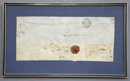
1777 French Military Commission DocumentSchmidt's Antiques Inc. Since 19114.8(431)See Sold PriceMar 02, 2024
Large gilt carved wood barometer by "Balthazar Horloger du Roy" in Paris, 18th century.GOLDFIELD AUCTION4.3(32)See Sold PriceMar 02, 2024
Very Rare Sundial 18 Century signed Macquart ,PARISBasel Auction House4.4(43)See Sold PriceFeb 24, 2024
1758 MAP PARTIE DE LA MER GLACIALE contenants La Nouvelle Zemble RUSSIA antiqueJasper524.5(9.8k)See Sold PriceFeb 27, 2024
1749 MAP CARTE DE LA TARTARIE ORIENTALE RUSSIA & CHINA antique EASTERN TARTARYJasper524.5(9.8k)See Sold PriceFeb 27, 2024
18th century MAP of ARMENIA GEORGIA NATOLIA BLACK SEA ASIA MINOR antiqueJasper524.5(9.8k)See Sold PriceFeb 27, 2024
États du Roi de Maroc… d’Alger, Tunis & Tripoli. North Africa. BONNE 1790 mapJasper524.5(9.8k)See Sold PriceFeb 28, 2024
Le Canal de Mosambique, l'Isle de Madagascar… Mozambique. Africa. BONNE 1788 mapJasper524.5(9.8k)See Sold PriceFeb 28, 2024
Royaumes, Etats et Pays de la Haute Guinée. Gulf of Guinea. BONNE 1788 old mapJasper524.5(9.8k)See Sold PriceFeb 28, 2024
Le Royaume d’Adel… Ajan & Zanguebar. Adal Ajuran. Kenya Tanzania. BONNE 1788 mapJasper524.5(9.8k)See Sold PriceFeb 28, 2024
Le Canal de Mosambique, l'Isle de Madagascar… Mozambique. Africa. BONNE 1790 mapJasper524.5(9.8k)See Sold PriceFeb 28, 2024
Partie Occidentale de l’Afrique. West Africa coast Canary islands BONNE 1788 mapJasper524.5(9.8k)See Sold PriceFeb 28, 2024
Le Royaume d’Adel… Ajan & Zanguebar. Adal Ajuran. Kenya Tanzania. BONNE 1790 mapJasper524.5(9.8k)See Sold PriceFeb 28, 2024
États du Roi de Maroc… d’Alger, Tunis & Tripoli. North Africa. BONNE 1788 mapJasper524.5(9.8k)See Sold PriceFeb 28, 2024
Egypte, Nubie et Abissinie. Egypt, Nubia & Abyssinia. Sudan. BONNE 1788 mapJasper524.5(9.8k)See Sold PriceFeb 28, 2024
Late 18th century map of England and Wales sampler and two printsFellows4.3(159)See Sold PriceMar 05, 2024
1774: AN ANTIQUE ILLUSTRATED TWO-VOLUME HISTORY OF PERUVIAN DISCOVERY AND CONQUEST WITH MAPNY Elizabeth 4.3(84)See Sold PriceMar 03, 2024
1792 OLD INDIA HISTORY ANTIQUE ILLUSTRATED WITH MAPS OF THE EIGHTEENTH CENTURY IN FRENCHNY Elizabeth 4.3(84)See Sold PriceMar 03, 2024
Denis Diderot (1713 - 1784) & Jean Le Rond d’Alembert (1717 - 1783) - Set of 10 Military Prints -Proverde Auctions4.3(3)See Sold PriceFeb 28, 2024
Denis Diderot (1713-1784) & Jean Le Rond d’Alembert - Set of 10 Military Prints - Empty frame [forProverde Auctions4.3(3)See Sold PriceFeb 28, 2024
FRENCH LOUIS XV ORMOLU BRONZE CLOCK BY ETIENNE LE NOIR A PARIS, 18TH CENTURYLos Angeles Antiques 4.3(12)See Sold PriceMar 10, 2024


![[Greece/Turkey]. 14 Maps [18th-19th Century]. 12 (1 of 0)](https://p1.liveauctioneers.com/dist/images/placeholder.jpg?height=282&quality=70)