ATLAS of ANTIENT GEOGRAPHY by SAMUEL BUTLER 1843John McInnis Auctioneers,LLC4.6(504)See Sold PriceFeb 24, 2024
18TH C. ANTIQUE MAP: FRENCH & INDIAN WAR, FRAMEDThomaston Place Auction Galleries4.4(389)See Sold PriceFeb 24, 2024
Rand McNally Railroad Map Cabinet w/ 21 Railroad MapsRail & Road Auctions4.6(165)See Sold PriceMar 08, 2024
Keith Haring - Ink on New York Map, Best Buddies, Inscribed, Signed, and DatedSapphire Auction Gallery4.1(67)See Sold PriceMar 02, 2024
LATE 17TH C. FRENCH MAP OF THE NEW WORLD BY ALEXIS-HUBERT JAILLOT (1632-1712)Thomaston Place Auction Galleries4.4(389)See Sold PriceFeb 24, 2024
Central Railroad of New Jersey Map of Sandy Hook Route-ca. 1903JM Hobby Supply and Railroad Artifact Auctions4.4(126)See Sold PriceFeb 24, 2024
Lot of Six Mixed Atlas Box Cars-HO Scale-New in BoxJM Hobby Supply and Railroad Artifact Auctions4.4(126)See Sold PriceFeb 25, 2024
Rand McNally/Santa Fe Railroad Map of Iowa-1912JM Hobby Supply and Railroad Artifact Auctions4.4(126)See Sold PriceFeb 24, 2024
NICOLAES VISSCHER (NETHERLANDS, 1618-1709) MAP OF THE NEW WORLDThomaston Place Auction Galleries4.4(389)See Sold PriceFeb 24, 2024
17TH C. WORLD MAP BY NICOLAES VISSCHER (NETHERLANDS, 1618-1709)Thomaston Place Auction Galleries4.4(389)See Sold PriceFeb 24, 2024
Lot of Six Mixed Atlas Cabooses-HO Scale-New in BoxJM Hobby Supply and Railroad Artifact Auctions4.4(126)See Sold PriceFeb 25, 2024
1818 Neele Map of Kent -- KentTitle/Content of Map: 1818 Neele Map of Kent -- Kent Date: 1818, London Cartographer: S Neele Size: 9.8 X 7.8 in. This is a nice and rather scarce map of Kent, a county in south-east England, includinSee Sold Price
1818 Neele Map of Kent -- KentReserve Reduced! Title/Content of Map: 1818 Neele Map of Kent -- Kent Date: 1818, London Cartographer: S Neele Size: 9.8 X 7.8 in. This is a nice and rather scarce map of Kent, a county in south-eastSee Sold Price
1818 Neele Map of Kent -- KentTitle/Content of Map: 1818 Neele Map of Kent -- Kent Date: 1818, London Cartographer: S Neele Size: 9.8 X 7.8 in. This is a nice and rather scarce map of Kent, a county in south-east England, includinSee Sold Price
Sold1818 Neele Map of Kent -- KentTitle/Content of Map: 1818 Neele Map of Kent -- Kent Date: 1818, London Cartographer: S Neele Size: 9.8 X 7.8 in. This is a nice and rather scarce map of Kent, a county in south-east England, includinSee Sold Price
1818 Neele Map of Kent -- KentTitle/Content of Map: 1818 Neele Map of Kent -- Kent Date: 1818, London Cartographer: S Neele Size: 9.8 X 7.8 in. This is a nice and rather scarce map of Kent, a county in south-east England, includinSee Sold Price
Morden: Antique Couty Map of Kent, 1772TITLE/CONTENT OF MAP: 'Kent' Kent county map by ROBERT MORDEN from Camden's Britannia Date: 1772 IMAGE SIZE: Approx 37.5 x 65.0cm, 14.75 x 25.5 inches (Large); Please note that this is a folding map.See Sold Price
Sold"Provincia di Kent". Kent county map. ZATTA 1779 oldTITLE/CONTENT OF MAP: 'Provincia di Kent di nuova projezione' The county of Kent The top image on the right hand side shows the entire map. To view a close up of the map showing the level of printed dSee Sold Price
Provincia di Kent. Kent county map. ZATTA 1779 oldReserve Reduced! TITLE/CONTENT OF MAP: 'Provincia di Kent di nuova projezione' The county of Kent DATE PRINTED: Published in 1779. Engraved in 1779 (this date is printed on the map). IMAGE SIZE: ApproSee Sold Price
-. Symonson (Philip) A New Description of Kent-. Symonson (Philip) A New Description of Kent,map showing Kent, with inset vignette views of Dover Castle, and Rye, with decorative cartouche lower right, and a key with distances lower left,See Sold Price
SoldWilliam Kip & John Norden map of Kent, CANTIUM QuodWilliam Kip & John Norden map of Kent, CANTIUM Quod nunc Kent, coloured engraving, circa 1637, H.28cm W.38cmSee Sold Price
SoldKent.- Speed (John) Kent, engraved map, [c. 1676].Kent.- Speed (John) Kent, county map with inset maps of Rochester and Canterbury, engraving with original hand-colouring, platemark 380 x 510 mm (15 x 20 in), sheet 420 x 545 mm (16 1/2 x 21 1/2 in),See Sold Price
Sold[Blaeu (J & W)] Cantium vernacule KentKent.- [Blaeu (J & W)] Cantium vernacule Kent, engraved map of Kent, decorative cartouche and coats-of-arms, with hand-colouring, 390 x 535mm., Dutch text on verso, tear to edge of plate, withSee Sold Price
SoldKent.- Morden (Robert) Kent, [c. 1695].Kent.- Morden (Robert) Kent, county map, engraving with some outline hand-colouring on laid paper, platemark 360 x 640 mm. (14 1/4 x 25 1/8 in), sheet 415 x 655 mm. (16 1/4 x 25 3/4 in), folds as issuSee Sold Price
Kent.- Drayton (Michael) - Map of Kent,from Drayton's 'Poly-olbion', showing rivers and other topographical features, richly populated with nymphs, maidens and other allegorical figures, engraved map, 255 x 325mm., central vertical fold, tSee Sold Price
SoldJan Blaeu (1598-1673) - Coloured engraving - "Cantivm VJan Blaeu (1598-1673) - Coloured engraving - "Cantivm Vernacule Kent" - Map of the County of Kent depicting eight armorials to top edge, 15.25ins x 21ins (thought to be published in the Atlas Novus 16See Sold Price
Sold(3) antique and decorative Maps: Kent, Paris, NY(3) antique and decorative Maps: Kent, Paris, NY, 19th and 20th c., Kent: 8.5"h x 8.5"w (sight)See Sold Price
Soldd'Anville, Jean Baptiste C1760 Map Kent English ChannelMap of Kent, showing Isle of Thanet, Dover, Canterbury, Hythe. Also showing Northern France - Calais, Boulogne etc. Copper Engraved Map Published 1736-1808, Paris for "Histoire de l'Acade?mie royale dSee Sold Price
MAP, Kent, England, SpeedKent, England. John Speed, Kent with Her Cities and Earles Described and Observed, 1611 (circa). Hand Color. This highly decorative map of Kent provides fascinating detail of the county, with London sSee Sold Price
MAP, Kent, England, SpeedKent, England. John Speed, Kent with Her Cities and Earles Described and Observed, from The Theatre of the Empire of Great Britaine, 1611 (circa). Hand Color. This highly decorative map of Kent providSee Sold Price
KENT. County map. Downs. Railways in use/underTITLE/CONTENT OF MAP: 'Kent' DATE: 1863 IMAGE SIZE: Approx 31.0 x 43.0cm, 12.25 x 16.75 inches (Large) TYPE: Antique map with original outline colour CONDITION: Good; suitable for framing. This map waSee Sold Price
18th C. Maps, Kent, Surrey, by Emanuel BowenEmanuel Bowen's 18th Century maps of Kent and Surrey are original engravings printed upon eighteenth century, hand-made, laid paper and with full margins as published in London by W. Owen in 1756 forSee Sold Price
SoldOriginal Travel Poster Kent Fast Frequent TrainsOriginal vintage travel poster issued by the British Railways showing a fun map of Kent - Served by Fast and Frequent Trains. Kent is a county in South East England and one of the home counties. It boSee Sold Price
SoldMap Of Kent Framed PrintPrint is professionally framed with light brown toned wooden frame. Top right corner reads “MAPP OF KENT”. Measures approx 20 inches long 18 inches tall. Frame has some scratches. Wall art home deSee Sold Price
SoldEngraved Map of Kent and France by Frix c.1730Engraved Map of Kent and France by Fricx, c.1730, engraving with hand-coloring on paper titled, 'Carte Particuliere D'Une Partie D'Angleterre Sur la Copie de Bruxelles par E:H: Fricx Sur la Copie de BSee Sold Price
Vintage "Perspecta" Walnut Sideboard by Kent CoffeyA1 Consignment and Auction Gallery Inc4.4(16)See Sold PriceMar 07, 2024
Josiah HENSCHELL c1828 Engraving Quay At Ramsgate Kent FramedLuis Porretta Fine Arts4.3(10)See Sold PriceMar 02, 2024
Large Stone Age Twydall Knapped Flint Scraper ToolTimeLine Auctions Ltd.4.6(182)See Sold PriceMar 07, 2024
General Books - Victoria County History of Kent - Vol ITimeLine Auctions Ltd.4.6(182)See Sold PriceMar 08, 2024
Numismatic Books - Fowles & Legg - John Aubrey's Monumenta Britannica, Part III and IndexTimeLine Auctions Ltd.4.6(182)See Sold PriceMar 09, 2024
Portraits of American artists and notables. 20th century. To include: 1) Stow Wengenroth etching byTremont Auctions4.6(294)See Sold PriceFeb 25, 2024
1818 RARE Geography Made Easy MAPS Jedidiah Morse Boston Indians Atlas AsiaSchilb Antiquarian Rare Books4.8(422)See Sold PriceMar 31, 2024
Wonderful Early Tall Case Grandfather Clock, made by Richard Chalken Wrotham Kent 92"T 22"W 12"DSwisher Bros. Auction LLC4.4(251)See Sold PriceFeb 24, 2024
Sister Mary USM Modernist Serigraph Silk-screen Abstract Ltd Ed Signed 1959Global Auctions Company4.3(36)See Sold PriceMar 03, 2024
Sister Corita Kent - I Love You Very Much, Hand Inscribed PrintSapphire Auction Gallery4.1(67)See Sold PriceMar 02, 2024
Corita (Sister Mary) Kent (1918-1986), "Gravity, Commission - Ellwood Kieser," 1973, Screenprint inJohn Moran Auctioneers, Inc.4.7(459)See Sold PriceFeb 27, 2024
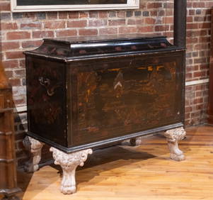
19th C English William Kent Style Chinoserie TrunkAshcroft and Moore LLC4.5(272)See Sold PriceMar 12, 2024
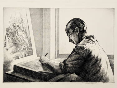
[SHIPWRECKS]. Manuscript testimony (court duplicate) of Thomas Kent, a Black man aboard theFreeman's | Hindman4.4(1.6k)See Sold PriceFeb 27, 2024
Kent & Sussex.- Moss (W.G.) The History and Antiquities of the Town and Port of Hastings, 1824; andForum Auctions4.3(53)See Sold PriceFeb 29, 2024
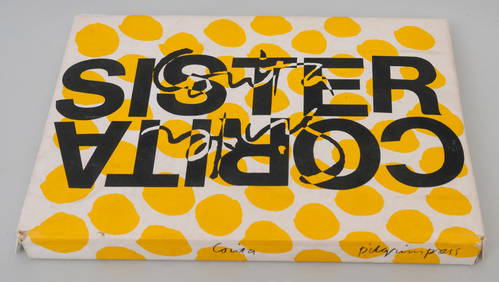
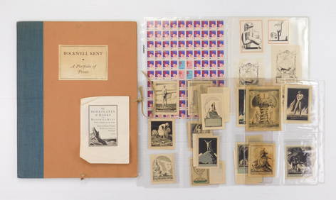
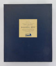
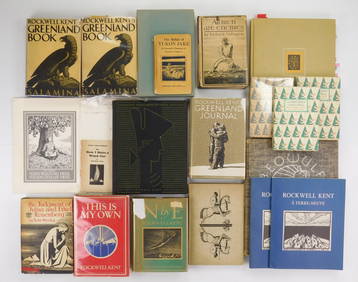
Rockwell Kent (1882-1971) illustrated ShakespeareRachel Davis Fine Arts4.7(476)See Sold PriceMar 02, 2024
17 Books illustrated by Rockwell Kent (1881-1972)Rachel Davis Fine Arts4.7(476)See Sold PriceMar 02, 2024
Clarke & Neele 1815 Map. Europe - Recent Political ChangesAlbion Auctions4.6(341)See Sold PriceMar 01, 2024


![Kent.- Speed (John) Kent, engraved map, [c. 1676]. (1 of 1)](https://p1.liveauctioneers.com/5458/268810/140590916_1_x.jpg?height=282&quality=70&version=1668514381)
![[Blaeu (J & W)] Cantium vernacule Kent (1 of 1)](https://p1.liveauctioneers.com/410/3027/1300451_1_x.jpg?height=282&quality=70)
![Kent.- Morden (Robert) Kent, [c. 1695]. (1 of 1)](https://p1.liveauctioneers.com/5458/156131/78785369_1_x.jpg?height=282&quality=70&version=1574849334)


![[SHIPWRECKS]. Manuscript testimony (court duplicate) of Thomas Kent, a Black man aboard the (1 of 5)](https://p1.liveauctioneers.com/197/319238/171468014_1_x.jpg?height=282&quality=70&version=1707520367)