ATLAS of ANTIENT GEOGRAPHY by SAMUEL BUTLER 1843John McInnis Auctioneers,LLC4.5(505)See Sold PriceFeb 24, 2024
18TH C. ANTIQUE MAP: FRENCH & INDIAN WAR, FRAMEDThomaston Place Auction Galleries4.4(394)See Sold PriceFeb 24, 2024
Rand McNally Railroad Map Cabinet w/ 21 Railroad MapsRail & Road Auctions4.6(165)See Sold PriceMar 08, 2024
Keith Haring - Ink on New York Map, Best Buddies, Inscribed, Signed, and DatedSapphire Auction Gallery4.1(67)See Sold PriceMar 02, 2024
LATE 17TH C. FRENCH MAP OF THE NEW WORLD BY ALEXIS-HUBERT JAILLOT (1632-1712)Thomaston Place Auction Galleries4.4(394)See Sold PriceFeb 24, 2024
Central Railroad of New Jersey Map of Sandy Hook Route-ca. 1903JM Hobby Supply and Railroad Artifact Auctions4.4(127)See Sold PriceFeb 24, 2024
Lot of Six Mixed Atlas Box Cars-HO Scale-New in BoxJM Hobby Supply and Railroad Artifact Auctions4.4(127)See Sold PriceFeb 25, 2024
Rand McNally/Santa Fe Railroad Map of Iowa-1912JM Hobby Supply and Railroad Artifact Auctions4.4(127)See Sold PriceFeb 24, 2024
NICOLAES VISSCHER (NETHERLANDS, 1618-1709) MAP OF THE NEW WORLDThomaston Place Auction Galleries4.4(394)See Sold PriceFeb 24, 2024
17TH C. WORLD MAP BY NICOLAES VISSCHER (NETHERLANDS, 1618-1709)Thomaston Place Auction Galleries4.4(394)See Sold PriceFeb 24, 2024
Lot of Six Mixed Atlas Cabooses-HO Scale-New in BoxJM Hobby Supply and Railroad Artifact Auctions4.4(127)See Sold PriceFeb 25, 2024
SoldMoll's Atlas Manuale with 43 double-page maps, 1713Heading: Author: Moll, Herman Title: Atlas Manuale: or, A new sett of maps of all the parts of the earth... Wherein geography is rectify'd, by reforming the old maps according to the modern observatiSee Sold Price
Moll's Atlas Manuale with 43 double-page maps, 1713Heading: Author: Moll, Herman Title: Atlas Manuale: or, A new sett of maps of all the parts of the earth... Wherein geography is rectify'd, by reforming the old maps according to the modern observatiSee Sold Price
Migeon (J.) Atlas MigeonMigeon (J.) Atlas Migeon, Géographie Universelle, 43 double-page maps, including double-hemisphere celestial and terrestrial maps, also the world on Mercator's projection, most with inset vignSee Sold Price
SoldMoll (Herman) Composite atlasMoll (Herman) Composite atlas,comprising 30 large, mostly double-page maps, the majority by Moll, including A Map of the East Indies, Map of North America, Map of Africa, Map of Moscovy, PolanSee Sold Price
SoldAtlas of the City and County of San Francisco fro215 pp. With 64 hand-colored maps (on 60 sheets), including 43 double-page maps (1 of which is folding); engraved title page. (Folio) 17½x14½, original ¼ black sheep and brown cloth, front cover leSee Sold Price
SoldANDRIVEAU-GOUJON, EUGENE. Atlas Classique et UANDRIVEAU-GOUJON, EUGENE. Atlas Classique et Universel de Geographie Ancienne et Moderne . . . Nouvelle Edition. 41 (of 43) engraved double-page or folding maps and plates (lacking the plates of waterSee Sold Price
SoldVandermaelen. Atlas Universel III AfricaVandermaelen (P.M.G.) Atlas Universel de Géographie, vol. 5 only, of 6, South America, title, key map and 40 double-page maps, only, of 43, but with a variant state of sheet 16 in addition, 41See Sold Price
An Atlas of Ancient GeographySmith (William) and George Grove, editors. An Atlas of Ancient Geography,43 partly hand-coloured in outline maps, mostly double-page, tear to 1 f., contemporary half calf, worn & repaired, uppSee Sold Price
SoldAn Atlas of Ancient GeographySmith (William) and George Grove, editors. An Atlas of Ancient Geography,43 partly hand-coloured in outline maps, mostly double-page, tear to 1 f., contemporary half calf, worn & repaired, uppSee Sold Price
SoldButler (Samuel)Butler (Samuel) A General Atlas of Ancient and Modern Geography, engraved title and Index f., 43 engraved maps (1 double-page), all but 1 hand-coloured in outline, plate guards, some maps loosSee Sold Price
SoldMitchell's New General Atlas, Containing Maps ofAuthor: Mitchell, S[amuel] Augustus With 76 total hand-colored maps and plans including insets (4 are double-page); all on 43 map-sheets. 15½x13, original half sheep and brown cloth, front cover lettSee Sold Price
SoldWorld.- Butler (Samuel) A General Atlas of Ancient andWorld.- Butler (Samuel) A General Atlas of Ancient and Modern Geography, engraved title, index and 43 maps, by Sidney Hall, including a double-page double hemisphere map of the World, and with ancientSee Sold Price
World.- Butler (Samuel) A General Atlas of Ancient andWorld.- Butler (Samuel) A General Atlas of Ancient and Modern Geography, engraved title, index and 43 maps, by Sidney Hall, including a double-page double hemisphere map of the World, and with ancientSee Sold Price
Butler (Samuel) A General Atlas of Ancient and ModButler (Samuel) A General Atlas of Ancient and Modern Geography,engraved title, index and 43 maps, by Sidney Hall, including a double-page double hemisphere map of the World, and with ancientSee Sold Price
SoldMOLL, HERMAN. A New Map of the Baltick &c.MOLL, HERMAN. A New Map of the Baltick &c. Double-page engraved map of northern Europe centered on the Baltic Sea. 22x25¼ inches sheet size, wide margins; original hand-color in outline; originalSee Sold Price
Sold3 Maps from the British Isles Including Pont, Timothy,Praefectura Renfroana... the Baronie of Renfrow, double page engraved map, hand coloured in outline, 48 x 61cm., double glazed; Collins, Greenville The Isle of Man. [1693], engraved by H. Moll, hand-cSee Sold Price
SoldWorld.- Moll (Herman) Thirty Two New and Accurate MapsWorld.- Moll (Herman) Thirty Two New and Accurate Maps of the Geography of the Ancients, additional double-page engraved title, 32 engraved double-page and folding maps, occasional small tears to foldSee Sold Price
SoldWyld (James) A General AtlasWyld (James) A General Atlas,engraved vignette title, 44 maps on 43 sheets (a few double-page) and 2 tables, all hand-coloured in outline, hand-coloured vignettes, some offsetting, 'Eastern HeSee Sold Price
Wyld (James) A General AtlasWyld (James) A General Atlas,engraved vignette title, 44 maps on 43 sheets (a few double-page) and 2 tables, all hand-coloured in outline, hand-coloured vignettes, some offsetting, 'Eastern HeSee Sold Price
Berkshire: Bark Shire Map by Robert Morden, 1772Map: Berkshire: 'Bark Shire' by Robert Morden from Camden's Britannia, 1772 Old Map. Date Printed: 1772 Image Size: Approx 39.0 x 43.0cm, 15.25 x 17 inches (Large) Type: Double page folio folding coppSee Sold Price
SoldHOMANN HEIRS; after MOLL, HERMAN. Dominia Anglorum inHOMANN HEIRS; after MOLL, HERMAN. Dominia Anglorum in America Septentrionali. Four maps of North America on an engraved double-page folio sheet. 20¾x24 inches sheet size, ample margins; originalSee Sold Price
SoldMOLL HermanBowles's atlas minor ... 65 maps, hand coloured in outline, some doublepage and some folding, later half roan, marbled boards, rubbed, some joints of maps strengthened, 4to., London: Carrington BowlesSee Sold Price
Korea.- Yojido atlasKorea.- Yojido atlas, 13 double-page maps, including 'doughnut' shanhaijing world map, China, the Korean peninsula, the Ryukyu Islands, Japan, and 8 provinces, with several text leaves, woodblSee Sold Price
SoldMissouri Territory formerly Louisianaby Mathew Carey, Philadelphia, 1814, from Carey's [General Atlas], a double-page map, hand-colored in outline, the large format edition, depicting from Louisiana to the Pacific coast, with important dSee Sold Price
Rock Island RR Iowa and Minnesota Lakes Country Brochure-1926JM Hobby Supply and Railroad Artifact Auctions4.4(127)See Sold PriceFeb 24, 2024
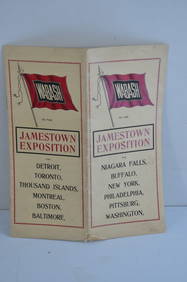
Wabash RR 1907 Jamestown Exposition BrochureJM Hobby Supply and Railroad Artifact Auctions4.4(127)See Sold PriceFeb 24, 2024
Chicago and Northwestern RY April 20, 1906 Public TimetableJM Hobby Supply and Railroad Artifact Auctions4.4(127)See Sold PriceFeb 24, 2024
Chicago Burlington and Quincy RR July 1, 1903 Public TimetableJM Hobby Supply and Railroad Artifact Auctions4.4(127)See Sold PriceFeb 24, 2024
COVENS & MORTIER 1745 MAP OF THE GLOBEThomaston Place Auction Galleries4.4(394)See Sold PriceFeb 24, 2024
17TH C. MAP OF THE BERKSHIRES BY JOHN SPEED, FRAMEDThomaston Place Auction Galleries4.4(394)See Sold PriceFeb 24, 2024
WILLEM JANSZOON BLAEU (NETHERLANDS, 1571-1638) MAP OF UMBRIAThomaston Place Auction Galleries4.4(394)See Sold PriceFeb 24, 2024
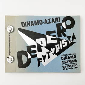
UN COUP DE DES JAMAIS N'ABOLIRA LE HASARD 1961John McInnis Auctioneers,LLC4.5(505)See Sold PriceFeb 25, 2024
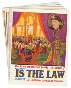
21st Annual Announcement Fox Film Corporation. Film Yearboo...Potter & Potter Auctions4.6(550)See Sold PriceMar 07, 2024
[CIVIL WAR]. LAWLER, David F. (1841-1919). An Archive of Pv...Potter & Potter Auctions4.6(550)See Sold PriceMar 07, 2024
[DIDEROT, Denis (1713-1784), association]. BENARD, Robert, ...Potter & Potter Auctions4.6(550)See Sold PriceMar 07, 2024
[CIVIL RIGHTS]. Ledger recording "colored voters" registered at the Floyd County, VA Court House,Freeman's | Hindman4.4(1.6k)See Sold PriceFeb 27, 2024
PINK FLOYD: THE WALL (1982) - Draft Script with Pair of Crew T-ShirtsPropstore4.3(7)See Sold PriceMar 13, 2024


![[CIVIL WAR]. LAWLER, David F. (1841-1919). An Archive of Pv... (1 of 11)](https://p1.liveauctioneers.com/928/318880/171360939_1_x.jpg?height=282&quality=70&version=1707501302)
![[DIDEROT, Denis (1713-1784), association]. BENARD, Robert, ... (1 of 1)](https://p1.liveauctioneers.com/928/318880/171360968_1_x.jpg?height=282&quality=70&version=1707501302)

![[CIVIL RIGHTS]. Ledger recording "colored voters" registered at the Floyd County, VA Court House, (1 of 4)](https://p1.liveauctioneers.com/197/319238/171467857_1_x.jpg?height=282&quality=70&version=1707520367)