SoldANDRIVEAU-GOUJON, EUGENE. Atlas Classique et UANDRIVEAU-GOUJON, EUGENE. Atlas Classique et Universel de Geographie Ancienne et Moderne . . . Nouvelle Edition. 41 (of 43) engraved double-page or folding maps and plates (lacking the plates of waterSee Sold Price
SoldAndriveau-Goujon, E Atlas classique et universel deAndriveau-Goujon, E With 30 engr. maps on 31 sheets. - Contemp. half calf, title to spine and board (burst, corners and head and tail of spine bumped, rubbing and staining). - Some browning and fingerSee Sold Price
SoldAndriveau-Goujon, E Atlas 1845Atlanten - - Andriveau-Goujon, E. Atlas classique et universel de Géographique ancienne et moderne contenant les decouvertes et les divisions les plus nouvelles. Édition usuelle. Mit 30 kol. gestochSee Sold Price
SoldAtlas of the world by Andriveau-Goujon, 1835Heading: Author: Andriveau-Goujon, J. Title: Atlas Classique et Universel de Géographie Ancienne et Moderne contenant les Découvertes et les Divisions les plus Nouvelles dans les Cinq Parties du MoSee Sold Price
SoldAndriveau-Goujon Atlas Classique & UniverselAndriveau-Goujon (J) Atlas Classique & Universel de Géographie Ancienne et Moderne,engraved title and 30 double-page or folding maps, hand-coloured in outline, some offsetting, contemporarSee Sold Price
Andriveau Goujon, J. Atlas Classique & Universel deAndriveau Goujon, J. Atlas Classique & Universel de Géographie Ancienne et Moderne. Paris: 1856. Con 44 mapas.See Sold Price
SoldMaps, Andriveau-Goujon, Atlas, 1845(lot of 14) Unframed handcolored engraved maps, from ''Atlas Classique et Universel de Geographie Ancienne et Moderne,'' c.1850, by J. Andriveau-Goujon (French, 19th Century), largest plate: 21.75''hSee Sold Price
SoldMaps, Andriveau-Goujon, Atlas, 1845(lot of 14) Unframed handcolored engraved maps, from ''Atlas Classique et Universel de Geographie Ancienne et Moderne,'' c.1850, by J. Andriveau-Goujon (French, 19th Century), largest plate: 21.75''hSee Sold Price
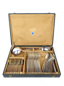
Andriveau-Goujon (Eugene) [Composit Atlas]Andriveau-Goujon (Eugene) [Composite Atlas], comprising 11 large engraved maps by Andriveau, Brue and Dufour, (of 15), as called for in manuscript index, mainly double-page, with original outlSee Sold Price
SoldBig coloured map of United States 1867 Copper etchingBeautiful coloured map of United States of 1867 engraved after Andriveau Coujon. Date: 1867 Author: engraved after Andriveau Coujon Atlas: Atlas classique et universel de geographie Technique: CopperSee Sold Price
SoldFrance C1840-75 Pair of Large Hand Colored Maps"Carte Compare la Gaule" Large Hand Coloured Steel Engraved Map Published C1875, Paris for "Atlas Universel" by Eugène Andriveau-Goujon. Together with one other by Goujon, "France Historique" From AtSee Sold Price
SoldAndriveau-Goujon (E) États UnisAndriveau-Goujon (Eugène) Carte Générale Des États Unis Et Du Méxique Comprenant L'Amérique Centrale Et Les Antilles,North America, with inset maps of central America, Long Island, and the AtlSee Sold Price
SoldAndriveau-Goujon (E) L'Asie OrientaleAndriveau-Goujon (Eugene) Carte de L'Asie Orientale comprenant L'Empire Chinois,Le Japon, Les Etats De L'Indo-Chine et Le Grand Archipel D'Asie De Malaisie, engraved folding map with hand-coloSee Sold Price
SoldAndriveau-Goujon, J.: Atlas de géographie moderneAndriveau-Goujon, J. Atlas de géographie moderne, contenant les cartes générales et particuliéres des principales divisions du globe. Gr.-folio. Mit 19 doppelblattgr. (1 eingef.) grenzkol. gest. KSee Sold Price
SoldAndriveau-Goujon (J.) Atlas de choix...Andriveau-Goujon (J.) Atlas de choix, ou Recueil de Cartes de Géographie Ancienne et Moderne Dressées par nos Meilleurs Auteurs,26 engraved single sheet maps and 32 double-page map sheets to fSee Sold Price
Eugène Andriveau GoujonEugène Andriveau Goujon, Plan géométral de Paris et des ses agrandissements... 1869 Incisione in acciaio suddivisa in 36 parti. Dimensioni totali: mm 1040x1560. Con titolo in alto al centro; iSee Sold Price
DRIOUX ET CH. LEROY - Atlas classique de géographDRIOUX ET CH. LEROY - Atlas classique de géographie ancienne, romaine, du Moyen Âge, moderne et contemporaine, à l'usage des établissements d'instruction publique. Paris, Eugène Belin, 1882. In-See Sold Price
SoldCarte Genrale Des Etats-Unis Et Du Mexique 1862Map Title: Carte Genrale Des Etats-Unis Et Du Mexique Date: 1862 Publisher: Andriveau-Goujon: Paris Size: 24.3 x 18.25 inches Eastern sheet only. Only east of the Mississippi shown, only Yucatan shownSee Sold Price
MAPS - World. Andriveau-GoujonWorld. E. Andriveau-Goujon, [Lot of 2] Courants et Mouvements Generaux de la Mer d'Apres le Lt. F. Maury [and] Courants de l'Atmosphere d'Apres le Lt. F. Maury, 1850 (circa). Printed Color. These twoSee Sold Price
Carte physique et politique de l’EuropeMap Title: Carte physique et politique de l’Europe Publication Date: 1843Cartographer: Gilbert Gabriel Benjamin Andriveau Publisher: ANDRIVEAU-GOUJON Size: 38.5 X 50.5 par Andriveau-Goujon a PaSee Sold Price
Andriveau-Goujon: Antique Map of Europe, 1843Title/Content of Map: Carte physique et politique de l'Europe Date Printed: 1843 Cartographer: Gilbert Gabriel Benjamin Andriveau Publisher: ANDRIVEAU-GOUJON 1843 PARIS Size: Wall size – 38.50 H x 5See Sold Price
Carte physique et politique de l'EuropeTitle: Carte physique et politique de l'Europe Publication Date: 1843 Cartographer: Gilbert Gabriel Benjamin Andriveau Publisher: Andriveau-Goujon Dimension: 38.5Height - 50.5Width par Andriveau-GoujoSee Sold Price
Andriveau-Goujon: Antique Map of Europe, 1843Map: Carte physique et politique de l’Europe Publication Date: 1843 Authors: ANDRIVEAU-GOUJON, Gilbert Gabriel Benjamin Andriveau, edited by FLAHAUT, P. with P. ROUSSET Publisher: ANDRIVEAU-GOUJON SSee Sold Price
Carte physique et politique de l’EuropeTitle/Content of Map: Carte physique et politique de l’Europe Date Printed: 1843 Cartographer: Gilbert Gabriel Benjamin Andriveau Size: 38.5x50.5 par Andriveau-Goujon a Paris Some browning, tacSee Sold Price
Luc LANEL (1893-1965) pour CHRISTOFLE. Ménagère en métal argenté modèle Atlas comprenant douzeValoir Pousse-Cornet4.3(4)See Sold PriceFeb 24, 2024
De Jode, Rare, pub. 1593 - Map of Africa (Africae Vera Forma, et Situs)Trillium Antique Prints & Rare Books4.5(32)See Sold PriceFeb 24, 2024
1678 EUGENIALOGICAE ET HEROICAE VELLUM BOUND antique in LATIN HERALDRYJasper524.5(9.9k)See Sold PriceFeb 27, 2024
1594 BIBLE in FRENCH antique Tobie Judith et Esther PART OF OLD TESTAMENTJasper524.5(9.9k)See Sold PriceFeb 27, 2024
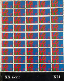
XXe Siecle 41, lithographs by Indiana and Hartung.TheRedFinch Auctions4.4(24)See Sold PriceFeb 29, 2024
Railways & Transport.- [Prospectus] The Dorking, Brighton, and Arundel Atmospheric Railway, byForum Auctions4.3(53)See Sold PriceFeb 29, 2024
1683 Sanson Map of the Caribbean -- Les Isles Antilles, &c Entre Lesquelles sont les Lucayes, et lesJasper524.5(9.9k)See Sold PriceFeb 27, 2024
1764 Bellin Chart of Three South Haitian Bays -- Carte des Bayes du Mesle des Flamands et deJasper524.5(9.9k)See Sold PriceFeb 27, 2024
1764 Bellin Map of Port Antonio, Jamaica -- Plan des Havres de Port Antonio et de Saint FrancoisJasper524.5(9.9k)See Sold PriceFeb 27, 2024
Saul Steinberg - Crayon Et Paysage - 1973 Lithograph 31" x 23"Jasper524.5(9.9k)See Sold PriceFeb 28, 2024
Theodore Chasseriau original lithograph "Apollon et Daphne"Jasper524.5(9.9k)See Sold PriceFeb 28, 2024
GALL, FRANZ JOSEPH. 1758-1828; and JOHANN CASPAR SPURZHEIM. 1776-1832. Anatomie et physiologie d...Bonhams4.1(320)See Sold PriceJun 18, 2024
GAVOY, EMILE. 1836-1896. Atlas d'anatomie topographique du cerveau et des localisations cér...Bonhams4.1(320)See Sold PriceJun 18, 2024


![Andriveau-Goujon (Eugene) [Composit Atlas] (1 of 1)](https://p1.liveauctioneers.com/410/3027/1300110_1_x.jpg?height=282&quality=70)


![Railways & Transport.- [Prospectus] The Dorking, Brighton, and Arundel Atmospheric Railway, by (1 of 1)](https://p1.liveauctioneers.com/5458/319736/171654703_1_x.jpg?height=282&quality=70&version=1708010439)


