ATLAS of ANTIENT GEOGRAPHY by SAMUEL BUTLER 1843John McInnis Auctioneers,LLC4.6(502)See Sold PriceFeb 24, 2024
18TH C. ANTIQUE MAP: FRENCH & INDIAN WAR, FRAMEDThomaston Place Auction Galleries4.4(386)See Sold PriceFeb 24, 2024
Rand McNally Railroad Map Cabinet w/ 21 Railroad MapsRail & Road Auctions4.6(165)See Sold PriceMar 08, 2024
Keith Haring - Ink on New York Map, Best Buddies, Inscribed, Signed, and DatedSapphire Auction Gallery4(67)See Sold PriceMar 02, 2024
LATE 17TH C. FRENCH MAP OF THE NEW WORLD BY ALEXIS-HUBERT JAILLOT (1632-1712)Thomaston Place Auction Galleries4.4(386)See Sold PriceFeb 24, 2024
Central Railroad of New Jersey Map of Sandy Hook Route-ca. 1903JM Hobby Supply and Railroad Artifact Auctions4.4(126)See Sold PriceFeb 24, 2024
Lot of Six Mixed Atlas Box Cars-HO Scale-New in BoxJM Hobby Supply and Railroad Artifact Auctions4.4(126)See Sold PriceFeb 25, 2024
Rand McNally/Santa Fe Railroad Map of Iowa-1912JM Hobby Supply and Railroad Artifact Auctions4.4(126)See Sold PriceFeb 24, 2024
NICOLAES VISSCHER (NETHERLANDS, 1618-1709) MAP OF THE NEW WORLDThomaston Place Auction Galleries4.4(386)See Sold PriceFeb 24, 2024
17TH C. WORLD MAP BY NICOLAES VISSCHER (NETHERLANDS, 1618-1709)Thomaston Place Auction Galleries4.4(386)See Sold PriceFeb 24, 2024
Lot of Six Mixed Atlas Cabooses-HO Scale-New in BoxJM Hobby Supply and Railroad Artifact Auctions4.4(126)See Sold PriceFeb 25, 2024
Carte de la Terre Van Diemen. Tasmania. Adventure Bay.TITLE/CONTENT OF MAP: [Cook 3e Voyage] Carte de la Terre Van Diemen // Plan de la Baye de lAventure, sur la Terre Van-Diemen [Cook's 3rd Voyage - Map of Van Diemen's Land (Tasmania) // Map of AdventurSee Sold Price
Carte De La Terre Van Diemen.Title/Content of Map: Carte De La Terre Van Diemen. Date: c1788 Cartographer: BONNE, Fils./SCATTAGLIA Size: 9Height - 13.3Width Par M.Bonne, ingenieur-Hydrographe de la marine." Detailed chart from CoSee Sold Price
Carte de la Terre Van Diemen. Tasmania. Adventure Bay.TITLE/CONTENT OF MAP: '[Cook 3e Voyage] Carte de la Terre Van Diemen // Plan de la Baye de lAventure, sur la Terre Van-Diemen [Cook's 3rd Voyage - Map of Van Diemen's Land (Tasmania) // Map of AdventuSee Sold Price
Carte De La Terre Van Diemen.Title/Content of Map: Carte De La Terre Van Diemen. Date Printed: 1788 ca. Cartographer: BONNE, Fils./SCATTAGLIA Size: 9X13.3 "Par M.Bonne, ingenieur-Hydrographe de la marine." Detailed chart from CooSee Sold Price
Carte De La Terre Van Diemen.Title: Carte De La Terre Van Diemen. Publication Date: c1788 Cartographer: BONNE, Fils./SCATTAGLIA Size: 9Height - 13.3Width Par M.Bonne, ingenieur-Hydrographe de la marine. Detailed chart from Cook'sSee Sold Price
SoldM BONNE Carte de la Terre, Van Diemen coloured MaM BONNE Carte de la Terre, Van Diemen coloured Map Andre Sculp plate size 25 x 36cmSee Sold Price
Carte De La Terre Van Diemen.Publication Date: c1788 Title: Carte De La Terre Van Diemen. Cartographer: BONNE, Fils./SCATTAGLIA Height: 9 Width: 13.3 "Par M.Bonne, ingenieur-Hydrographe de la marine." Detailed chart from Cook's tSee Sold Price
Carte de la Terre Van Diemen. Tasmania. Adventure Bay.TITLE/CONTENT OF MAP: '[Cook 3e Voyage] Carte de la Terre Van Diemen // Plan de la Baye de lAventure, sur la Terre Van-Diemen [Cook's 3rd Voyage - Map of Van Diemen's Land (Tasmania) // Map of AdventuSee Sold Price
Sold"Carte Generale de la Partie Meridionale de la Nouvelle"Carte Generale de la Partie Meridionale de la Nouvelle Hollande appelee Terre D'Anthony Van Diemen..." by d'Entrecasteaux [Paris, 1807], map of southern Tasmania, size 76 x 49cm. {Tooley 544}See Sold Price
Sold"Plan de la Terre de Van Diemen Reconnue par le Cape"Plan de la Terre de Van Diemen Reconnue par le Cape Furneaux en Mars 1773", from French edition of Cook's Voyages [Paris, 1774-89], eastern Tasmania & Furneaux islands, window mounted, framed & gSee Sold Price
SoldThree various mapsIle Norfolk by Bonard Direx, Oceanie after Raimond Bonheur, and Plan de la Terre de Van Diemen after Furneaux, Bonard DirexSee Sold Price
"Vues De Differentes Parties De La Terre D'Anthony Van"Vues De Differentes Parties De La Terre D'Anthony Van Diemen" [together on one sheet] by d'Entrecasteaux [Paris, 1807], five larger views of the Tasmanian coastline, size 49 x 74cm.See Sold Price
"Vues De Differentes Parties De La Terre D'Anthony Van"Vues De Differentes Parties De La Terre D'Anthony Van Diemen" [together on one sheet] by d'Entrecasteaux [Paris, 1807], seven views of the Tasmanian coastline, window mounted, overall 94 x 68See Sold Price
Evans. Voyage À La Terre De Van DiemenEVANS, George William. Voyage à la terre de Van Diemen, ou description historique, géographique et topographique de cette île. Paris, Bureau des Annales des Voyages, 1823. 8vo. With very fine largeSee Sold Price
-.Evans (G.W.) - Voyage a la Terre de Van Diemen,vol. IX only, folding lithographed plate (repaired with tape along fold) and folding hand-coloured engraved map of Australia, half-title, ink stamps on half-title and title, some ink manuscript nos.See Sold Price
SoldEvans, George William. Voyage à la Terre de VanEvans, George William. Voyage à la Terre de Van Diemen, ou Description historique, géographique et topographique de cette île; par G.W. Evans, Arpenteur Général de la Colonie. Traduit dSee Sold Price
Australia.- Evans (G.W.) Voyage a la Terre de VanAustralia.- Evans (G.W.) Voyage a la Terre de Van Diemen,vol. IX only, folding lithographed plate (repaired with tape along fold) and folding hand-coloured engraved map of Australia, half-titlSee Sold Price
Océanique. Partie… Nlle Hollande #57. Victoria Tasmania. VANDERMAELEN 1827 mapTitle: Océanique. Partie… Nlle Hollande #57. Victoria Tasmania. VANDERMAELEN 1827 map Description: Océanique - Partie de la Nouvelle Hollande [Note sur la Terre de Van Diemen] - No. 57See Sold Price
Océanique. Ile de Diemen #58. South Tasmania. VANDERMAELEN 1827 old mapTitle: Océanique. Ile de Diemen #58. South Tasmania. VANDERMAELEN 1827 old map Description: Océanique - Ile de Diemen [Note sur la Terre de Van Diemen] - No. 58 by Philippe Marie Guillaume VSee Sold Price
Sold[MAP] DELISLE, GUILLAUME Carte de la Terre Ferme[MAP] DELISLE, GUILLAUME Carte de la Terre Ferme du Perou, du Bresil at du Pays Des Amazones Engraved map, colored by hand. 28 1/2 x 35 inches. Framed. Paris: Dezauche, 1782See Sold Price
SoldMap, ''Carte de la Terre Sainte...''Antiquarian map, ''Carte de la Terre Sainte Divisee Selon les Douze Tribus D'Israel'', published by Homann Heirs, circa 1757, depicts the Holy Land with the territories of the Twelve Tribes of Israel,See Sold Price
SoldCarte de la Terre Sainte - Map of the Holy Land, 1668.Carte de la Terre Sainte - Map of the Holy Land, 1668. 34cm X 44cm / 13.38in X 17.3in. foxing, cut margins.See Sold Price
SoldCarte de la Terre Sainte - Map of the Holy Land, 1668.Carte de la Terre Sainte - Map of the Holy Land, 1668. 34cm X 44cm / 13.38in X 17.3in.See Sold Price
SoldDELISLE, GUILLAUME. Carte de la Terre Ferme duDELISLE, GUILLAUME. Carte de la Terre Ferme du Perou, du Bresil, et du Pays des Amazones. Double-page engraved map, 495x580 mm, wide margins; hand-colored in outline; slight toning; inked number in toSee Sold Price
RIGOBERT BONNE c1787 Original Colored Map Germany & Region 15" x 12"Luis Porretta Fine Arts4.3(10)See Sold PriceMar 02, 2024
[MAPS]. DUFOUR, Auguste-Henri (1795-1865). Bound Volume of ...Potter & Potter Auctions4.6(539)See Sold PriceMar 07, 2024
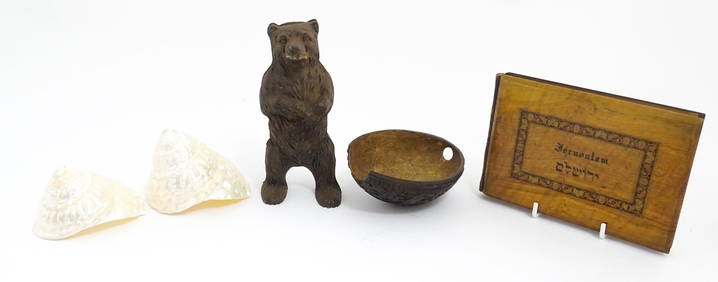
A quantity of assorted items to include a souvenir album of Jerusalem with Flowers of the Holy LandClaydon Auctioneers Ltd4.3(125)See Sold PriceFeb 26, 2024
1749 MAP CARTE DE LA TARTARIE ORIENTALE RUSSIA & CHINA antique EASTERN TARTARYJasper524.5(9.8k)See Sold PriceFeb 27, 2024
1764 Bellin Map of St. Kitts -- Carte de l'Isle St. ChristopheJasper524.5(9.8k)See Sold PriceFeb 27, 2024
Carte de la Barbarie… l'empire de Maroc… North Africa Morocco. LAPIE 1829 mapJasper524.5(9.8k)See Sold PriceFeb 28, 2024
Coste Occidentale d’Afrique…' Arguin Bay Cap Blanc Mauritania. BELLIN 1746 mapJasper524.5(9.8k)See Sold PriceFeb 28, 2024
La Barbarie de la Nigritie et de la Guinée'. West Africa. DE L’ISLE 1745 mapJasper524.5(9.8k)See Sold PriceFeb 28, 2024
Carte de la Guinée, contenant…'. Guinea & Cape Verde islands. BONNE 1771 mapJasper524.5(9.8k)See Sold PriceFeb 28, 2024
Coste Orientale d’Afrique…' South Africa. Mozambique channel. BELLIN 1746 mapJasper524.5(9.8k)See Sold PriceFeb 28, 2024
Coste Occidentale d’Afrique'. Bay of Arguin, Mauritania. BELLIN/SCHLEY 1747 mapJasper524.5(9.8k)See Sold PriceFeb 28, 2024
Coste Occidentale d’Afrique…' West Africa. Gulf of Guinea. BELLIN 1746 mapJasper524.5(9.8k)See Sold PriceFeb 28, 2024
Carte de la partie septentrionale d'Afrique, ou de la Barbarie… BONNE 1780 mapJasper524.5(9.8k)See Sold PriceFeb 28, 2024
Coste Orientale d’Afrique'. South Africa Mozambique BELLIN/SCHLEY 1747 mapJasper524.5(9.8k)See Sold PriceFeb 28, 2024
Coste Orientale d’Afrique…' East Africa Kenya Tanzania Somalia. BELLIN 1746 mapJasper524.5(9.8k)See Sold PriceFeb 28, 2024
Carte de la Haute et de la Basse Guinée. Gulf of Guinea Africa. BONNE 1780 mapJasper524.5(9.8k)See Sold PriceFeb 28, 2024
Coste Occidentale d’Afrique…' Namibia South Africa Angola coast BELLIN 1746 mapJasper524.5(9.8k)See Sold PriceFeb 28, 2024
Jules Verne, De La Terre a La Lune, Au Steamer Red MacaronLion and Unicorn4.7(1.8k)See Sold PriceMar 10, 2024


![[MAP] DELISLE, GUILLAUME Carte de la Terre Ferme (1 of 1)](https://p1.liveauctioneers.com/292/8142/1390877_1_x.jpg?height=282&quality=70)


![[MAPS]. DUFOUR, Auguste-Henri (1795-1865). Bound Volume of ... (1 of 2)](https://p1.liveauctioneers.com/928/318880/171361279_1_x.jpg?height=282&quality=70&version=1707501302)