ATLAS of ANTIENT GEOGRAPHY by SAMUEL BUTLER 1843John McInnis Auctioneers,LLC4.6(502)See Sold PriceFeb 24, 2024
18TH C. ANTIQUE MAP: FRENCH & INDIAN WAR, FRAMEDThomaston Place Auction Galleries4.4(386)See Sold PriceFeb 24, 2024
Rand McNally Railroad Map Cabinet w/ 21 Railroad MapsRail & Road Auctions4.6(165)See Sold PriceMar 08, 2024
Keith Haring - Ink on New York Map, Best Buddies, Inscribed, Signed, and DatedSapphire Auction Gallery4(67)See Sold PriceMar 02, 2024
LATE 17TH C. FRENCH MAP OF THE NEW WORLD BY ALEXIS-HUBERT JAILLOT (1632-1712)Thomaston Place Auction Galleries4.4(386)See Sold PriceFeb 24, 2024
Central Railroad of New Jersey Map of Sandy Hook Route-ca. 1903JM Hobby Supply and Railroad Artifact Auctions4.4(126)See Sold PriceFeb 24, 2024
Lot of Six Mixed Atlas Box Cars-HO Scale-New in BoxJM Hobby Supply and Railroad Artifact Auctions4.4(126)See Sold PriceFeb 25, 2024
Rand McNally/Santa Fe Railroad Map of Iowa-1912JM Hobby Supply and Railroad Artifact Auctions4.4(126)See Sold PriceFeb 24, 2024
NICOLAES VISSCHER (NETHERLANDS, 1618-1709) MAP OF THE NEW WORLDThomaston Place Auction Galleries4.4(386)See Sold PriceFeb 24, 2024
17TH C. WORLD MAP BY NICOLAES VISSCHER (NETHERLANDS, 1618-1709)Thomaston Place Auction Galleries4.4(386)See Sold PriceFeb 24, 2024
Lot of Six Mixed Atlas Cabooses-HO Scale-New in BoxJM Hobby Supply and Railroad Artifact Auctions4.4(126)See Sold PriceFeb 25, 2024
Ranally Physical-Political North AmericaTitle: Ranally Physical-Political North America Publication Date: 4/1/1937 Cartographer: RAND MCNALLY & COMPANY Dimensions: 55.5Height - 29.5Width Publisher: RAND MCNALLY & COMPANY Dissected schoolrooSee Sold Price
Ranally Physical-Political North AmericaTitle: Ranally Physical-Political North America Publication Date: 4/1/1937 Cartographer: RAND MCNALLY & COMPANY Publisher: RAND MCNALLY & COMPANY Size: 55.5Height - 29.5Width Dissected schoolroom wallSee Sold Price
Ranally Physical-Political North AmericaPublication Date: 4/1/1937 Title: Ranally Physical-Political North America Cartographer: RAND MCNALLY & COMPANY Publisher: RAND MCNALLY & COMPANY Height: 55.5 Width: 29.5 Dissected schoolroom wall mapSee Sold Price
Ranally Physical-Political South AmericaTitle: Ranally Physical-Political South America Publication Date: 1947 Cartographer: RAND MCNALLY & COMPANY Publisher: RAND MCNALLY & COMPANY Size: 55.25Height - 39.25Width Schoolroom map dissected anSee Sold Price
SoldGross, Alexander 1920 Pair of Maps of North AmericaNorth America Physical and Political. Large Lithograph Maps Published 1920, London for "The Daily Telegraph Victory Atlas of the World" by Alexander Gross. Centre fold as published. Paper Size: 25 x 1See Sold Price
SoldColton (George Woolworth) - Colton's Atlas of America,Illustrating the Physical and Political Geography of North and South America and the West India Islands , lithographed frontispiece, title and 59 maps, comparative diagram and city plans, including 6See Sold Price
MAPS IN BOOK, Atlases, ColtonAtlases. Joseph Hutchins Colton, Colton's Atlas of America, Illustrating the Physical and Political Geography of North and South America and the West India Islands..., 1857 (published). Hand Color. ThSee Sold Price
Colton (George Woolworth) - Colton's Atlas of America,Illustrating the Physical and Political Geography of North and South America and the West India Islands , lithographed frontispiece, title and 59 maps, comparative diagram and city plans, including 6See Sold Price
SoldGeorge W. Colton. Colton's Atlas of the World, IGeorge W. Colton. Colton's Atlas of the World, Illustrating Physical and PoliticalSee Sold Price
Map of North America...Title/Content of Map: Map of North America... Date Printed: 1856 ca. Cartographer: BOYNTON, G. W. Size: 12X9.1 "... designed to illustrate Cartee's Physical & Political Geography." Details mountain raSee Sold Price
SoldSalesman Sample Denoyer Geppert School Maps on RackTwo small (17" L x 8.25" W) rolling school maps in rack. North and South America physical & political. Original oak wall rack (18.75" x 10" x 3.75" D). Excellent condition. Rack 18.75" W x 3.75" D x 1See Sold Price
Map of the North America. 1871.Political and physical map of the North America. 1871.Print from steel engraving titled „Carte physique et politique de L‘Amerique du Nord“.Author/compiler - MM. Drioux et Ch. Leroy.Engraved bySee Sold Price
SoldColton's Atlas Vol. 1 North 7 South America 1856Title: Colton's Atlas of the World, Illustrating Physical and Political Geography by George W. Colton. Accompanied by Descriptions, Geographical, Statistical, and Historical, by Richard Swainson FisheSee Sold Price
Ranally Physical-Political Africa ...Title/Content of Map: Ranally Physical-Political Africa ... Date: 9/1/1948 Cartographer: RAND MCNALLY & CO. Size: 55.5Height - 39Width Publisher: RAND MCNALLY & CO. Wall size Africa map prior to indepSee Sold Price
Ranally Physical-Political Africa.Title/Content of Map: Ranally Physical-Political Africa. Date: 1948 Cartographer: RAND MCNALLY & COMPANY Size: 55.5Height - 39.5Width Publisher: RAND MCNALLY & COMPANY Schoolroom map dissected and susSee Sold Price
Ranally Physical-Political EuropeTitle/Content of Map: Ranally Physical-Political Europe Date: 1950 Cartographer: RAND MCNALLY & COMPANY Size: 55.6Height - 39.75Width Publisher: RAND MCNALLY & COMPANY Schoolroom map dissected and susSee Sold Price
Ranally Physical-Political AsiaTitle/Content of Map: Ranally Physical-Political Asia Date: 1935 Cartographer: RAND MCNALLY & COMPANY Size: 51Height - 38.5Width Publisher: RAND MCNALLY & COMPANY Schoolroom map dissected and suspendeSee Sold Price
Ranally Physical-Political Eastern HemisphereTitle: Ranally Physical-Political Eastern Hemisphere Cartographer: RAND MCNALLY & COMPANY Date: 09 01 1934 Publisher: RAND MCNALLY & COMPANY Size: 54.75Height - 39Width Additional Info: Schoolroom mapSee Sold Price
Ranally Physical-Political EuropePublication Date: 1950 Title: Ranally Physical-Political Europe Cartographer: RAND MCNALLY & COMPANY Publisher: RAND MCNALLY & COMPANY Height: 55.6 Width: 39.75 Schoolroom map dissected and suspendedSee Sold Price
Ranally Physical-Political Europe.Title: Ranally Physical-Political Europe. Publication Date: 1937 Cartographer: RAND MCNALLY & COMPANY Publisher: RAND MCNALLY & COMPANY Dimension: 55.5Height - 39.5Width Schoolroom map dissected and sSee Sold Price
Ranally Physical-Political EuropeTitle: Ranally Physical-Political Europe Publication Date: 1950 Cartographer: RAND MCNALLY & COMPANY Publisher: RAND MCNALLY & COMPANY Dimension: 55.6Height - 39.75Width Schoolroom map dissected and sSee Sold Price
SoldEARLY MCNALLY LIBRARY GLOBE WITH STAND 16" DIAMETEEARLY MCNALLY LIBRARY GLOBE WITH STAND 16" DIAMETER - "SPECIAL RANALLY PHYSICAL POLITICAL GLOBE", OVERALL WITH WOOD STAND 20 X 19See Sold Price
LARGE EARLY 18TH C. DUTCH CHART OF UPPER NORTH AMERICA, PIERRE MORTIER (1661-1711), FRAMEDThomaston Place Auction Galleries4.4(386)See Sold PriceFeb 24, 2024
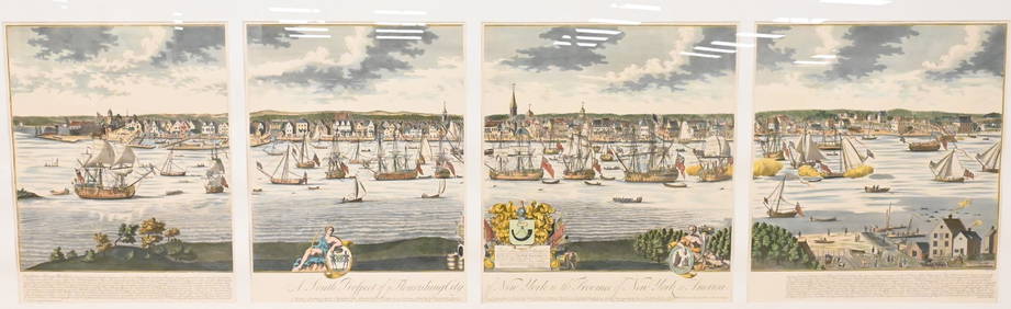
A South Prospect of Ye Flourishing City of New York in the Province of New York, North AmericaNadeau's Auction Gallery4.7(401)See Sold PriceFeb 24, 2024
Audubon's Animals - The Quadrupeds of North America 1954 Folio Size BookNorth American Artifact Auctions4.6(182)See Sold PriceApr 20, 2024
Arrowsmith & Lewis - Map of North AmericaTrillium Antique Prints & Rare Books4.5(30)See Sold PriceFeb 24, 2024
Map: An 18thC engraved and hand coloured map of North America and South America, titled DeClaydon Auctioneers Ltd4.3(125)See Sold PriceFeb 26, 2024
1862 North America Anthony Trollope West Indies AND Spanish Main CANADA NIAGARAJasper524.5(9.8k)See Sold PriceFeb 27, 2024
New and Correct Map of North America With the West India Islands,Jasper524.5(9.8k)See Sold PriceFeb 27, 2024
Mexico, Central America and West Indies Physical PoliticalJasper524.5(9.8k)See Sold PriceFeb 27, 2024
Map of United States of North America, 1785Antiques Online Auctions4.6(407)See Sold PriceMar 14, 2024