1813 Melish Map of Southern US & Caribbean"Map of the Southern Section of the United States including The Floridas & Bahama Islands Showing the Seat of War in that Department" Drawn by John Melish, March 1813. 19.5" x 24". Descending in the DSee Sold Price
Sold1680 Handcolored Map of America by VisscherAuthentic antique hand-tinted map of the (now) southern U.S., Caribbean, Central America and part of South America. Made circa 1680 by Nicholas Visscher. Unframed. Nice condition, with some edge toninSee Sold Price
SoldMAP, Southern US, CareySouthern United States. Carey & Warner, The Southern States and Missisippi Territory, 1814 (circa). Hand Color. This is a scarce map that covers current-day Tennessee, North Carolina, South Carolina,See Sold Price
SoldMAP - Southern US. Van der AaColonial Southern United States. Pieter van der Aa, La Floride, Suivant les Nouvelles Observations de Messrs. de l'Academie Royale des Sciences, Etc., 1713 (circa). Black & White. This handsome map ofSee Sold Price
SoldMAP - Southern US & Mexico. D'AnvilleSouthern United States, Mexico & Central America. D'Anville/Santini, Carte du Mexique, et de la Nouvelle Espagne, Contenant la Partie Australe de l'Amerique Septentle., 1779 (dated). Hand Color. A lovSee Sold Price
SoldMap, Southern U.S. , 1839Map, Southern U.S. , 1839 - Hand-tinted paper map, flat-mounted on art canvas backing. Rests in a rolled position. From Roswell C. Smith 'Smith's Geography for Schools', (Hartford, 1839)' Drawn & EngrSee Sold Price
MAP, Southern US, LucasSouthern United States. Fielding Lucas Jr., Mississippi Territory, 1816 (circa). Black & White. This early map of Mississippi Territory covers the region of present-day Mississippi and Alabama. At theSee Sold Price
MAP - Southern US & Mexico. D'AnvilleSouthern United States, Mexico & Central America. D'Anville/Santini, Carte du Mexique, et de la Nouvelle Espagne, Contenant la Partie Australe de l'Amerique Septentle., 1779 (dated). Black & White. ASee Sold Price
SoldThree (3) 19th C. Maps, Paris, Southern USThree (3) maps, including: 1834 map, Southern US, 17" x 13 1/2", framed 27" x 23", good condition; 1834 map printed Paris, 17" x 13 1/2", framed 27" x 23", good condition; 19th Century dated 1834 PariSee Sold Price
Sold18TH CENTURY MAP OF SOUTHERN US & SPANISH FLORIDAPrinted map of the early US-Spanish border in the south. It shows US states of Virginia, North Carolina and Georgia extending all the way to the Mississippi River. Also portrays the borders of East anSee Sold Price
Sold18TH CENTURY MAP OF SOUTHERN US & SPANISH FLORIDAPrinted map of the early US-Spanish border in the south. It shows US states of Virginia, North Carolina and Georgia extending all the way to the Mississippi River. Also portrays the borders of East anSee Sold Price
Sold1872 Warner Beers Map of Southern US -- Map of theReserve Reduced! Title/Content of Map: 1872 Warner Beers Map of Southern US -- Map of the Southern States Date: 1872, Chicago Cartographer: Warner Beers Size: 16.7 x 27.3 in. This is a nice large doubSee Sold Price
Sold1st Ed Map of Southern U.S. States Eastern Section 1898Antique 19th Century First Edition Color Map Entitled SOUTHERN STATES - EASTERN SECTION, From the Home & School Atlas By Alex Everett Frye | Published Boston, U.S.A. and London, Ginn & Company PublishSee Sold Price
SoldRare Melish map of U.S. 1818Heading: Author: Melish, John Title: Map of the United States with the contiguous British & Spanish Possessions Compiled from the latest & best Authorities Place Published: Philadelphia Publisher:See Sold Price
Sold[Maps] Pair of Maps of Southern U.S.Pair of folding maps, late 18th century, both folded (as bound in Morse's American Gazetteer at some point). On laid. Includes: * "A Correct Map of the Georgia Western Territory." Sheet 8.25" x 7.5".See Sold Price
SoldBonne Map of southern U.S. c.1780Title: Carte de la Partie Sud des Etats Unis de l'Amerique Septentrionale Author: Bonne, Rigobert Description: Copper-engraved map, later hand-coloring. 21x32 cm. (8½x12½").The southern states justSee Sold Price
1872 Warner Beers Map of Southern US -- Map of theTitle/Content of Map: 1872 Warner Beers Map of Southern US -- Map of the Southern States Date: 1872, Chicago Cartographer: Warner Beers Size: 16.7 x 27.3 in. This is a nice large double page map of moSee Sold Price
1865 Mithell Map of Southern US -- Map of the SouthernTitle/Content of Map: 1865 Mithell Map of Southern US -- Map of the Southern States with Arkansas & Tennessee Date: 1865, Philadelphia Cartographer: S Mitchell Size: 8.8 X 10.5 in. This is a handsomeSee Sold Price
SoldBonne Map of southern U.S. c.1780Title: Carte de la Partie Sud des Etats Unis de l'Amerique Septentrionale Author: Bonne, Rigobert Description: Copper-engraved map. 21x32 cm. (8½x12½"). The southern states just as independence fromSee Sold Price
1865 Mithell Map of Southern US -- Map of the SouthernReserve Reduced! Title/Content of Map: 1865 Mithell Map of Southern US -- Map of the Southern States with Arkansas & Tennessee Date: 1865, Philadelphia Cartographer: S Mitchell Size: 8.8 X 10.5 in. ThSee Sold Price
1865 Mithell Map of Southern US -- Map of the SouthernReserve Reduced! Title/Content of Map: 1865 Mithell Map of Southern US -- Map of the Southern States with Arkansas & Tennessee Date: 1865, Philadelphia Cartographer: S Mitchell Size: 8.8 X 10.5 in. ThSee Sold Price
1872 Warner Beers Map of Southern US -- Map of theTitle/Content of Map: 1872 Warner Beers Map of Southern US -- Map of the Southern States Date: 1872, Chicago Cartographer: Warner Beers Size: 16.7 x 27.3 in. This is a nice large double page map of moSee Sold Price
1872 Warner Beers Map of Southern US -- Map of theTitle/Content of Map: 1872 Warner Beers Map of Southern US -- Map of the Southern States Date Printed: 1872, Chicago Cartographer: Warner Beers Size: 16.7 x 27.3 in. This is a nice large double page mSee Sold Price
1838 Colton Map of Southern US -- Southern StatesTitle/Content of Map: 1838 Colton Map of Southern US -- Southern States Date Printed: 1838, New York Cartographer: J Colton Size: 10 x 16.3 in. This is a nice seldom seen double page map of most of thSee Sold Price
Michigan Southern and Northern Indiana RR 14th Annual Report-February 28, 1869JM Hobby Supply and Railroad Artifact Auctions4.4(126)See Sold PriceFeb 24, 2024
Central Railroad of New Jersey Map of Sandy Hook Route-ca. 1903JM Hobby Supply and Railroad Artifact Auctions4.4(126)See Sold PriceFeb 24, 2024
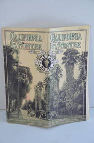
Los Angeles and Salt Lake RR California in Winter Brochure-October 1912JM Hobby Supply and Railroad Artifact Auctions4.4(126)See Sold PriceFeb 24, 2024
Santa Fe RR Summer in Southern California Book-1895JM Hobby Supply and Railroad Artifact Auctions4.4(126)See Sold PriceFeb 24, 2024
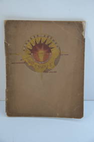
Southern Pacific RR Book West By South-Half South-1890JM Hobby Supply and Railroad Artifact Auctions4.4(126)See Sold PriceFeb 24, 2024
Southern Pacific RR Four Gateways to the Pacific Coast Brochure-1917JM Hobby Supply and Railroad Artifact Auctions4.4(126)See Sold PriceFeb 24, 2024
Southern Pacific RR Oregon Outdoors Brochure-May 1916JM Hobby Supply and Railroad Artifact Auctions4.4(126)See Sold PriceFeb 24, 2024
FLYING A TOURING SERVICE U.S. ROAD MAPS TIN WALL DISPLAY.Dan Morphy Auctions4.2(1.3k)See Sold PriceFeb 25, 2024
1885 CIVIL WAR 1ed Famous Memoirs US Grant Sheridan Sherman 6v RARE LOT MapsSchilb Antiquarian Rare Books4.8(421)See Sold PriceMar 10, 2024
LATE 16TH C. MAP OF SCOTLAND BY MERCATOR, FRAMEDThomaston Place Auction Galleries4.4(386)See Sold PriceFeb 24, 2024
1863 CONSPIRACY 1ed Unveiled Southern Confederate Secession US Civil War SlaverySchilb Antiquarian Rare Books4.8(421)See Sold PriceMar 31, 2024
[VIETNAM]. A group of approx. 120 photographs assembled by African American soldier Vernon CliftonFreeman's | Hindman4.4(1.6k)See Sold PriceFeb 27, 2024
GEORGE ANDREW CORLEY (DATES UNKNOWN) U.S. TEAM SKI TRYOUTS / MT. HOOD OREGON. 1939.Swann Auction Galleries4.4(65)See Sold PriceFeb 29, 2024
1683 Sanson Map of the Caribbean -- Les Isles Antilles, &c Entre Lesquelles sont les Lucayes, et lesJasper524.5(9.8k)See Sold PriceFeb 27, 2024
1764 Bellin Map of Southern Portion of Martinique -- Partie Meridionale de la MartiniqueJasper524.5(9.8k)See Sold PriceFeb 27, 2024
Map of Part of the West Indies, Etc., Showing the Exact Position Of The U.S. War Steamer SanJasper524.5(9.8k)See Sold PriceFeb 27, 2024
1764 Bellin Chart of Three South Haitian Bays -- Carte des Bayes du Mesle des Flamands et deJasper524.5(9.8k)See Sold PriceFeb 27, 2024
Mexico, Central America and West Indies Physical PoliticalJasper524.5(9.8k)See Sold PriceFeb 27, 2024


![[Maps] Pair of Maps of Southern U.S. (1 of 3)](https://p1.liveauctioneers.com/3532/146911/74242637_1_x.jpg?height=282&quality=70&version=1564368564)


![[VIETNAM]. A group of approx. 120 photographs assembled by African American soldier Vernon Clifton (1 of 6)](https://p1.liveauctioneers.com/197/319238/171468143_1_x.jpg?height=282&quality=70&version=1707520367)


