ATLAS of ANTIENT GEOGRAPHY by SAMUEL BUTLER 1843John McInnis Auctioneers,LLC4.5(505)See Sold PriceFeb 24, 2024
18TH C. ANTIQUE MAP: FRENCH & INDIAN WAR, FRAMEDThomaston Place Auction Galleries4.4(393)See Sold PriceFeb 24, 2024
Rand McNally Railroad Map Cabinet w/ 21 Railroad MapsRail & Road Auctions4.6(165)See Sold PriceMar 08, 2024
Keith Haring - Ink on New York Map, Best Buddies, Inscribed, Signed, and DatedSapphire Auction GallerySee Sold PriceMar 02, 2024
LATE 17TH C. FRENCH MAP OF THE NEW WORLD BY ALEXIS-HUBERT JAILLOT (1632-1712)Thomaston Place Auction Galleries4.4(393)See Sold PriceFeb 24, 2024
Central Railroad of New Jersey Map of Sandy Hook Route-ca. 1903JM Hobby Supply and Railroad Artifact Auctions4.4(127)See Sold PriceFeb 24, 2024
Lot of Six Mixed Atlas Box Cars-HO Scale-New in BoxJM Hobby Supply and Railroad Artifact Auctions4.4(127)See Sold PriceFeb 25, 2024
Rand McNally/Santa Fe Railroad Map of Iowa-1912JM Hobby Supply and Railroad Artifact Auctions4.4(127)See Sold PriceFeb 24, 2024
NICOLAES VISSCHER (NETHERLANDS, 1618-1709) MAP OF THE NEW WORLDThomaston Place Auction Galleries4.4(393)See Sold PriceFeb 24, 2024
17TH C. WORLD MAP BY NICOLAES VISSCHER (NETHERLANDS, 1618-1709)Thomaston Place Auction Galleries4.4(393)See Sold PriceFeb 24, 2024
Lot of Six Mixed Atlas Cabooses-HO Scale-New in BoxJM Hobby Supply and Railroad Artifact Auctions4.4(127)See Sold PriceFeb 25, 2024
SoldA large quantity of ordnance survey maps, includingA large quantity of ordnance survey maps, including Peak District National Park examples.See Sold Price
SoldLarge quantity of Ordnance Survey maps with variousLarge quantity of Ordnance Survey maps with various dates circa 1910 to '74See Sold Price
SoldA large quantity of Ordnance Survey maps 1933 - 1990'sA large quantity of Ordnance Survey maps 1933 - 1990's also maps by Bartholomew, Bacon etc. (approx. 120)See Sold Price
SoldA quantity of folding ordnance survey maps, includingA quantity of folding ordnance survey maps, including examples by Bacon, Ward, Lock & Co., Gall & Inglis and Bartholomew. To include, Motoring and Touring Map of England, Map and Guide to London, HertSee Sold Price
SoldMaps : A quantity of early to mid 20thC Ordnance SurveyMaps : A quantity of early to mid 20thC Ordnance Survey maps including British County maps for Gloucester, Middlesex etc., and for Ireland and America, Michelin French maps, a number of Air Force WarSee Sold Price
SoldA large quantity of early to mid 20thC one inch to oneA large quantity of early to mid 20thC one inch to one miles Ordnance Survey maps of Great Britain, Wales and Scotland. Many War Office Editions. To include Buckingham, Banbury, Gainsborough, Sound ofSee Sold Price
SoldA large quantity of Ordinance Survey map covering mostA large quantity of Ordinance Survey map covering most of the British Isles other maps including Batchelors Leisure guides some laminated maps and others (qty)See Sold Price
SoldMaps : A quantity of mid to late 20thC illustrated mapsMaps : A quantity of mid to late 20thC illustrated maps and touring guides for the USA, Australia, Europe, Great Britain, including Bartholomew's guides and Ordnance Survey maps. (approx. 26) £25 - 3See Sold Price
SoldBENG A large mixed group of maps of the U.K.BENG A large mixed group of maps of the U.K.including editions of Bartholomew's Half-Inch to Mile Map of England & Wales, with editions of Ordnance Survey New Popular Edition One-Inch MapsSee Sold Price
Sold2 boxes of ordnance survey maps including library2 boxes of ordnance survey maps including library editions.See Sold Price
SoldEngland.- A group of 16 Ordnance Survey maps, mainlyEngland.- A group of 16 Ordnance Survey maps, including a Col. Mudge map of Kent showing Whitstable, Ramsgate and Dover, 4 Col. Colby maps sold by Letts, Son & Co. of Essex, Kent, Berkshire, and HampsSee Sold Price
Maps – A Selection of various Ordnance Survey...Maps – A Selection of various Ordnance Survey maps/plans including Lancashire 1932 Ribbleton, Hothersall, Osbaldeston, Balderstone, Ribchester and Fulwood Row, some tears to edges, otherwise A/G conSee Sold Price
SoldLarge quantity of various Ordnance Survey plansLarge quantity of various Ordnance Survey plans relating to Dagenham Borough constituencySee Sold Price
SoldA large collection of 1920's ordnance survey maps, predA large collection of 1920's ordnance survey maps, predominantly South Essex, some 25 inches some 50 inches.See Sold Price
SoldA quantity of assorted 20thC Ordnance Survey maps.A quantity of assorted 20thC Ordnance Survey maps.See Sold Price
SoldEphemera / Travel - A large quantity of tourist travelEphemera / Travel - A large quantity of tourist travel maps including national park guides, city guides and road maps from many countries including the UK, Austria, South Africa, Libya and South KoreaSee Sold Price
Allied Advance 1918 - World War One MapAllied Advance 1918 - World War One World War I One. Linen backed. Map 9 - Ordnance Survey - Large Map with Scale Publisher British Dated: 1919 Type:See Sold Price
Third Battle of Ypres 1917 MapThird Battle of Ypres - Summer and Autumn 1917 World War I One. Linen backed. Map 4 - Ordnance Survey - Large Map with Scale Publisher British Dated: 1919<See Sold Price
Battle of Cambrai - Nov. Dec. 1917 MapBattle of Cambrai - November December 1917 World War I One. Linen backed. Map 5 - Ordnance Survey - Large Map with Scale Publisher British Dated: 1919See Sold Price
Final British Offensive August - November 1918 MapFinal British Offensive August to November 1918 World War I One. Linen backed. Map 8 - Ordnance Survey - Large Map with Scale Publisher British Dated: 1919See Sold Price
German Offensive On the Somme - March 1916 MapGerman Offensive On the Somme - March 1916 World War I One. Linen backed. Map 6 - Ordnance Survey - Large Map with Scale Publisher British Dated: 1919 TSee Sold Price
The Battle of Arras - Spring 1917 MapThe Battle of Arras - Spring 1917 World War I One. Linen backed. Map 3 - Ordnance Survey - Large Map with Scale Publisher British Dated: 1919 Type: CSee Sold Price
Jerusalem Map for British Soldiers in Palestine - WW2Levy Auction House4.3(11)See Sold PriceFeb 27, 2024
Pair of Early Railroad Maps - 1862 Pittsburgh, Ft. Wayne & Chicago Railway and 1873 PennsylvaniaRail & Road Auctions4.6(165)See Sold PriceMar 07, 2024
[MAP]. NICHOLLS, Sutton (1668-1729). An Epitome of Sr. Will...Potter & Potter Auctions4.6(545)See Sold PriceMar 07, 2024
Nottingham.- Ordnance Survey Office (publisher) Collection 8 geological maps on the environs ofForum Auctions4.3(53)See Sold PriceFeb 29, 2024
Emory's Notes of a Military Reconnoissance larger issuePBA Galleries4.7(385)See Sold PriceMar 07, 2024
A LARGE ERRATA BOOK INDIAN MAPS AND STUDIES including the provinces of Bengal, Cossimbuzar Island, THannam's Auctioneers Ltd4.3(396)See Sold PriceFeb 27, 2024
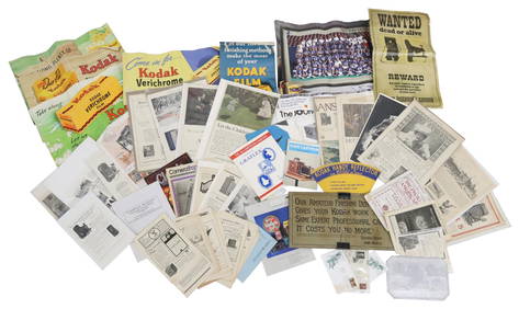
(LOT) LARGE QUANTITY OF KODAK ADVERTISING, MOREAustin Auction Gallery4.7(1.2k)See Sold PriceApr 12, 2024
(LOT) LARGE QUANTITY PHOTOGRAPHY PUBLICATIONSAustin Auction Gallery4.7(1.2k)See Sold PriceApr 12, 2024


![[MAP]. NICHOLLS, Sutton (1668-1729). An Epitome of Sr. Will... (1 of 1)](https://p1.liveauctioneers.com/928/318880/171361281_1_x.jpg?height=282&quality=70&version=1707501302)