ATLAS of ANTIENT GEOGRAPHY by SAMUEL BUTLER 1843John McInnis Auctioneers,LLC4.6(502)See Sold PriceFeb 24, 2024
18TH C. ANTIQUE MAP: FRENCH & INDIAN WAR, FRAMEDThomaston Place Auction Galleries4.4(386)See Sold PriceFeb 24, 2024
Rand McNally Railroad Map Cabinet w/ 21 Railroad MapsRail & Road Auctions4.6(165)See Sold PriceMar 08, 2024
Keith Haring - Ink on New York Map, Best Buddies, Inscribed, Signed, and DatedSapphire Auction Gallery4(67)See Sold PriceMar 02, 2024
LATE 17TH C. FRENCH MAP OF THE NEW WORLD BY ALEXIS-HUBERT JAILLOT (1632-1712)Thomaston Place Auction Galleries4.4(386)See Sold PriceFeb 24, 2024
Central Railroad of New Jersey Map of Sandy Hook Route-ca. 1903JM Hobby Supply and Railroad Artifact Auctions4.4(126)See Sold PriceFeb 24, 2024
Lot of Six Mixed Atlas Box Cars-HO Scale-New in BoxJM Hobby Supply and Railroad Artifact Auctions4.4(126)See Sold PriceFeb 25, 2024
Rand McNally/Santa Fe Railroad Map of Iowa-1912JM Hobby Supply and Railroad Artifact Auctions4.4(126)See Sold PriceFeb 24, 2024
NICOLAES VISSCHER (NETHERLANDS, 1618-1709) MAP OF THE NEW WORLDThomaston Place Auction Galleries4.4(386)See Sold PriceFeb 24, 2024
17TH C. WORLD MAP BY NICOLAES VISSCHER (NETHERLANDS, 1618-1709)Thomaston Place Auction Galleries4.4(386)See Sold PriceFeb 24, 2024
Lot of Six Mixed Atlas Cabooses-HO Scale-New in BoxJM Hobby Supply and Railroad Artifact Auctions4.4(126)See Sold PriceFeb 25, 2024
SoldBowles Map of the East CoastAfter Lewis Evans (c. 1700-1756). Bowle's New Pocket Map of the Following Independent States... Engraved map with original hand color in part. London, 1780. 21 1/4" x 27 1/2" sheet. Evans’ mapSee Sold Price
Sold1778 NORD MAP - EAST COAST USAntique framed colord map of the eastern seaboard from CT to Nova Scotia circa 1778. Titled NORD...L'ACADIA LE PROVINCIE DI SAGADAHOOK…FOGL. VI. (Author: Zatta, Antonio ; Mitchell, John ; Raynal, G.See Sold Price
SoldUS MAP EAST COAST CAPITAL SCENES by J. RapkinUS MAP EAST COAST CAPITAL SCENES by J. Rapkin illustrations by f Rogers, 13 x 10 inches, overall framed size 18 x 21-1/4 inchesSee Sold Price
SoldPair of Antique Maps, East Coast and New York HarborLot 10 Pair of Antique Maps, East Coast and New York Harbor engraving with aquatint illegible (faded) watermarks New York Harbor: 17 1/2 x 20 1/2 inches New Netherlands: 24 x 18 1/4 inches ProvenanceSee Sold Price
SoldBrazil. South America East Coast. Bahia. Rio deTITLE/CONTENT OF MAP: 'East Coast of South America; Brazil, Middle Provinces // East coast of Brazil; Bahia, Sergipe, Alagoas and part of Pernambuco // Province of Rio de Janeiro Brazil from the map oSee Sold Price
Swanston: Map of East Coast of South America, 1850Map: East Coast of South America Brazil Middle Provinces Maker: Bartholomew, J. / G.H. Swanston Published: 1850 Publisher: A. Fullarton & Co. Size: Folio, 18.5 x 12 inches From Mahlmann's maps of BrazSee Sold Price
Bartholomew: Map of East Coast of South America, 1850Map: East Coast of South America Brazil Middle Provinces Date: 1850 Authors: A. Fullarton & Co., BARTHOLOMEW, J./G. H. SWANSTON Publisher: A. Fullarton & Co. 1850 ca. LONDON/EDINBURGH/DUBLIN Size: FolSee Sold Price
SoldEast coast of Italy. Ancona coastline, gulf of VeniceTitle/Content of Map: East coast of Italy. Ancona coastline, gulf of Venice with sea monster Date: 1598/99 Cartographer: Ruscelli Size: 11x9” Provenance: Venice Additional Info: Copperplate engravedSee Sold Price
Bartholomew: Map of East Coast of South America, 1850Map: East Coast of South America Brazil Middle Provinces Date: 1850 Authors: A. Fullarton & Co., BARTHOLOMEW, J./G. H. SWANSTON Publisher: A. Fullarton & Co. Size: Folio – 18.50 H x 12.00 W Inches FSee Sold Price
East coast of Italy. Ancona coastline, gulf of VeniceTitle/Content of Map: East coast of Italy. Ancona coastline, gulf of Venice with sea monster Date: 1598/99 Cartographer: By Ruscelli Size: 11x9” Provenance: Venice Reserve: $45.00 Shipping: DomesticSee Sold Price
East coast of Italy. Ancona coastline, gulf of VeniceTitle/Content of Map: East coast of Italy. Ancona coastline, gulf of Venice with sea monster Date: 1598/99. Cartographer: Ruscelli Size: 11x9”. Provenance: Venice. Reserve: $50.00 Shipping: DomestiSee Sold Price
East Coast of South America. Rio De La Plata andTitle/Content of Map: East Coast of South America. Rio De La Plata and Approaches Date Printed: 1896-08-08 Cartographer: FILLMORE, JOHN H./H. G. BREWER Size: 24.5X45.5 "Compiled from the latest informSee Sold Price
Sold1639 Janssen Map of East Coast of North America -- NovaTitle/Content of Map: 1639 Janssen Map of East Coast of North America -- Nova Anglia Novum Belgium et Virginia Date: 1639 c. Amsterdam Cartographer: J Janssen Size: 15.3 x 19.7 in. This is an importanSee Sold Price
SoldJanssonius Map of East coastJANSSONIUS, Joannes. Nova Anglia Novum Belgium et Virginia. Copperplate engraving. Amsterdam, 1636 (first State). Burden 247. 18 3/4 x 22 1/2 inches sheetSee Sold Price
Bayfield: Antique Map of East Coast North America, 1890Map: North America East Coast Sheet II Bay of Fundy Digby Gut to the Head of Navigation Publication Date: 1890 Cartographer: BAYFIELD, H. W., et al. Publisher: THE ADMIRALTY Size: Wall – 26.00 H x 3See Sold Price
Mount & Page: Antique Map of East Coast of England 1740A chart for the Newcastle Trade describing the sea coasts of England from the South Foreland to Newcastle with the soundings, sands, shoals, harbours, buoys, beacons and seamarks, upon ye said coasts.See Sold Price
SoldAntique Framed map of east coast of North AmericaAntique Framed map of east coast of North America, dated 1783, 23" x 20"See Sold Price
1757 French Map of East CoastColonial Era Map of the East Coast from New York to Canada, Featuring Inset of the Boston Harbor 1757, "CARTE REDUITE DES COSTES ORIENTALES DE L'AMERIQUE SEPTENTRIONALE," & "PLAN DU HAVRE DE BASTON,"See Sold Price
1639 Janssen Map of East Coast of North AmericaTitle/Content of Map: 1639 Janssen Map of East Coast of North America -- Nova Anglia Novum Belgium et Virginia Date: 1639 c. Amsterdam Cartographer: J Janssen Size: 15.3 x 19.7 in. This is an importanSee Sold Price
Vischer Novi Belgi Map of East CoastNovi Belgii Novaeque Angliae Nec Non partis Virginiae Tabula multis in locis emendata...Nicolas Joannis Visscher II (1587-1652). Engraved map with original hand color in full. Amsterdam, 1684. 20 x 23See Sold Price
Visscher Map of East Coast, 1715Nova Tabula Geographica complectens Borealiorem Americae Partem.... Nicholas Visscher (1587 – 1652). Engraved map with original hand color. Amsterdam: P. Schenk, c. 1715. 23 1/4 x 20 1/4 inches sheeSee Sold Price
SoldPerley Lithograph Map of East Coast of CanadaMap of the Eastern Portion of British America, Gulf of Lawrence. Henry F. Perley (fl. Late-19th century). Lithograph. Israel D. Andrews, 1853. 27 x 47 1/2 inches inches sheet. A rare, beautiful and laSee Sold Price
SoldMortier Map of East Coast 1700MORTIER, Pierre (1661-1711). Carte Particuliere de Virginie, Maryland, Pennsilvanie, La Nouvelle Jarsey... Engraved map with original hand color in outline. Amsterdam and Paris, c. 1700. 24 3/4” x 3See Sold Price
1760 MAP CARTE PARTICULIERE DE L'ISLE DE JUAN FERNANDES antique Robinson CrusoeJasper524.5(9.8k)See Sold PriceFeb 27, 2024
Southern Africa Cape of Good Hope-Madagascar ADMIRALTY sea chart 1935 (1955) mapJasper524.5(9.8k)See Sold PriceFeb 28, 2024
Coste Orientale d’Afrique…' South Africa. Mozambique channel. BELLIN 1746 mapJasper524.5(9.8k)See Sold PriceFeb 28, 2024
WEST AFRICA I Explorers' routes Senegal Ashanti Ivory Gold Coast. SDUK 1851 mapJasper524.5(9.8k)See Sold PriceFeb 28, 2024
East coast of Africa from the Cape… South Africa Mozambique. CHILD 1745 mapJasper524.5(9.8k)See Sold PriceFeb 28, 2024
Coste Orientale d’Afrique'. South Africa Mozambique BELLIN/SCHLEY 1747 mapJasper524.5(9.8k)See Sold PriceFeb 28, 2024
Coste Orientale d’Afrique…' East Africa Kenya Tanzania Somalia. BELLIN 1746 mapJasper524.5(9.8k)See Sold PriceFeb 28, 2024
CHARTS: United States - East Coast New Jersey/ PASSAIC AND HACKENSACK RIVERSChurchill Galleries3.7(213)See Sold PriceFeb 26, 2024
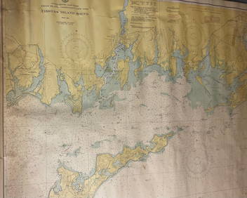
CHART: UNITED STATES - EAST COAST/ RHODE ISLAND - CONNECTICUT - NEW YORK/ Fishers IslandChurchill Galleries3.7(213)See Sold PriceFeb 26, 2024
CHART: UNITED STATES - EAST COAST MASSACHUSETTS/ HYANNIS HARBORAND VICINITYChurchill Galleries3.7(213)See Sold PriceFeb 26, 2024
Chart: United States- East Coast/ NORTH CAROLINA/ RIVER INLET TO CAPE FEAR.Churchill Galleries3.7(213)See Sold PriceFeb 26, 2024
CHART: UNITED STATES - EAST COAST NEW YORK/ HUDSON RIVER/ POUGHKEEPSIE TO HUDSONChurchill Galleries3.7(213)See Sold PriceFeb 26, 2024
Blackie (Pub) 1882 Folio Map. East Indies - Indian ArchipelagoAlbion Auctions4.6(336)See Sold PriceMar 01, 2024