ATLAS of ANTIENT GEOGRAPHY by SAMUEL BUTLER 1843John McInnis Auctioneers,LLC4.6(502)See Sold PriceFeb 24, 2024
18TH C. ANTIQUE MAP: FRENCH & INDIAN WAR, FRAMEDThomaston Place Auction Galleries4.4(386)See Sold PriceFeb 24, 2024
Rand McNally Railroad Map Cabinet w/ 21 Railroad MapsRail & Road Auctions4.6(165)See Sold PriceMar 08, 2024
Keith Haring - Ink on New York Map, Best Buddies, Inscribed, Signed, and DatedSapphire Auction Gallery4(67)See Sold PriceMar 02, 2024
LATE 17TH C. FRENCH MAP OF THE NEW WORLD BY ALEXIS-HUBERT JAILLOT (1632-1712)Thomaston Place Auction Galleries4.4(386)See Sold PriceFeb 24, 2024
Central Railroad of New Jersey Map of Sandy Hook Route-ca. 1903JM Hobby Supply and Railroad Artifact Auctions4.4(126)See Sold PriceFeb 24, 2024
Lot of Six Mixed Atlas Box Cars-HO Scale-New in BoxJM Hobby Supply and Railroad Artifact Auctions4.4(126)See Sold PriceFeb 25, 2024
Rand McNally/Santa Fe Railroad Map of Iowa-1912JM Hobby Supply and Railroad Artifact Auctions4.4(126)See Sold PriceFeb 24, 2024
NICOLAES VISSCHER (NETHERLANDS, 1618-1709) MAP OF THE NEW WORLDThomaston Place Auction Galleries4.4(386)See Sold PriceFeb 24, 2024
17TH C. WORLD MAP BY NICOLAES VISSCHER (NETHERLANDS, 1618-1709)Thomaston Place Auction Galleries4.4(386)See Sold PriceFeb 24, 2024
Lot of Six Mixed Atlas Cabooses-HO Scale-New in BoxJM Hobby Supply and Railroad Artifact Auctions4.4(126)See Sold PriceFeb 25, 2024
SoldWestern Canada MapColor map of Canada West, including Manitoba, British Columbia, etc. by Hunt & Eaton, New YorkSee Sold Price
AUTHENTIC VINTAGE1888 - Western Canada MapAUTHENTIC VINTAGE1888 - Western Canada Map **|**|** This is a beautiful, 127 year old map of Western Canada - published in New York by George Routledge & Sons. The map is on a high quality, matte papeSee Sold Price
AUTHENTIC VINTAGE1888 - Western Canada MapAUTHENTIC VINTAGE1888 - Western Canada Map **|**|** This is a beautiful, 127 year old map of Western Canada - published in New York by George Routledge & Sons. The map is on a high quality, matte papeSee Sold Price
Vintage Texaco Products Manual & Old Road Maps1975 Texaco products manual in good, used condition. 3 1950s Western Canada maps. 3 1950s OR, WA, ID, MT & WY maps. 3 1930s ID, MT & WY maps. All maps look like they have not been used, one has some wSee Sold Price
Tallis: Antique Map of Western Canada, 1853Map: Western Canada: Ontario, Great Lakes & Niagara Falls Date Printed: 1853 Cartographer: Tallis Material/Medium: lithograph Size: 10 3/4" x 14" Original lithograph by John Tallis & Company of LondonSee Sold Price
SoldHand-colored map of Western Canada and ThHand-colored map of Western Canada and The Great Lakes from Mitchell's Atlas, c. 1860, in archival frame.See Sold Price
Lovely 1855 map of Western CanadaHighly detailed vintage map of Canada from J. H. Colton’s impressive Atlas of the World. Finely drawn map shows exquisite detailing of the coastal areas including islands, bays, inlets and more.See Sold Price
SoldScarce map of western Canada 1913Heading: (Canada) Author: Title: The Canadian West. Compiled from the Government Maps and Revised to January 1913 Place Published: No place Publisher:The Canadian Bank of Commerce Date PublishedSee Sold Price
SoldVintage Railroad Map & Time Table ChartsVintage Railroad Map and Time Table Charts includes: (2) Bessemer and Lake Erie Railroad Time Table Charts Dated 1929 and 1919, Canadian Pacific Railway Map of Western Canada Land Survey and Lines. COSee Sold Price
WESTERN CANADA showing Canadian Pacific Railway linesTITLE/CONTENT OF MAP: 'Map of Western Canada. Manitoba, Alberta, Saskatchewan and part of British Columbia, showing system of land Survey and lines of the Canadian Pacific Railway Company' DATE: CorreSee Sold Price
Dominion of Canada (West). Ontario Quebec. 50x60cm.TITLE/CONTENT OF MAP: 'Dominion of Canada (Western Sheet)' DATE PRINTED: 1879 IMAGE SIZE: Approx 47.5 x 60.5cm, 18.5 x 23.75 inches (Large); Please note that this is a folding map. TYPE: Large, folioSee Sold Price
Bonne Map of Great Lakes & Western CanadaTitle: Partie Occidentale du Canada, contenant les cinq Grand Lacs, avec les Pays Circonvoisins Author: Bonne, Rigobert Description: Copper-engraved map. 20.6x31.2 cm. (8½x12½").From Lake Ontario weSee Sold Price
SoldAmericana. - A mixed group of United States and Canadaincluding city maps of Detroit, Omaha City, Honolulu and San Francisco, state and regional maps of Nevada, Newfoundland, the Great Lakes, Western Canada, and several others, folding pocket maps and coSee Sold Price
SoldKeith Johnston Map [Map of Canada]Keith Johnston (cartographer) map of Canada in two sheets, Western Sheet and Eastern Sheet. Title 'Province of Canada'. Circa 1862. Each sheet measures 19.375-in. x 24.5-in. sheet size. Gold-gilt edgeSee Sold Price
SoldMorden (Robert) - A small group of maps of the Americasincluding the insular California map, 'New Mexico vel New Granata et Marata et California', also 'A Map of Florida and ye Great Lakes of Canada', 'A Map of the Western Islands', Chili and Paragay', anSee Sold Price
"La parte Occidentale della Nuova Francia o Canada". QCTITLE/CONTENT OF MAP: 'La parte Occidentale della Nuova Francia o Canada' "The western part of New France or Canada". The map shows part of western Quebec and north eastern Ontario between James Bay,See Sold Price
La parte Occidentale della Nuova Francia o Canada. QCReserve Reduced! TITLE/CONTENT OF MAP: 'La parte Occidentale della Nuova Francia o Canada' "The western part of New France or Canada". The map shows part of western Quebec and north eastern Ontario beSee Sold Price
La parte Occidentale della Nuova Francia o Canada. QCReserve Reduced! TITLE/CONTENT OF MAP: 'La parte Occidentale della Nuova Francia o Canada' "The western part of New France or Canada". The map shows part of western Quebec and north eastern Ontario beSee Sold Price
SoldBartholomew, John 1922 Lot of 8 Maps of CanadaIncl Political, British Columbia, Alberta/Saskatchewan, Manitoba/North West Ontario, Ontario/Quebec, Maritime Provinces/Newfoundland, Western Canada, and North Eastern Canada. Large Lithograph Maps PuSee Sold Price
SoldWestern Canada Showing Provinces of Alberta andTitle: Western Canada Showing Provinces of Alberta and Saskatchewan. Rand, McNally & Co.'s New Business Atlas Map of Western Canada Publication Date: 1910 Cartographer: RAND, MCNALLY & CO. Publisher:See Sold Price
Map of Dominion of CanadaTitle: Map of Dominion of Canada Date: 1906 Cartographer: TORONTO LITHOGRAPHING CO., LTD. Publisher: DOMINION OF CANADA Size: 12.5Height - 21.75Width Provenance: Free 160 acres western Canada farm lanSee Sold Price
SoldGRP OF ROAD MAPSGRP OF ROAD MAPS TO INC: (6) FRANCE 1940'S MAPS BY MICHELIN; (9) ESSO/IMPERIAL MAPS OF CANADA, ITALY, ENGLAND, FRANCE, SWITZERLAND, & WESTERN EUROPE; (8) CANADIAN 1952, 1973, 1990-91 MAPS.See Sold Price
SoldJACQUES NICOLAS BELLIN MAP OF THE GREAT LAKESJACQUES NICOLAS BELLIN, FRENCH MAP OF THE GREAT LAKES REGION, H 17", W 21":French map entitled:French map entitled: "Partie Occidentale de la Nouvelle France ou du Canada" (Western Part of New FranceSee Sold Price
Report on Great Western Railway Canada w/ Colored Plan“Report on the Great Western Railway Canada West to the President and Directors”, by Charles Stuart, Chief Engineer. 47 pages. Colored folding map at beginning very good, map at rear damaged. PampSee Sold Price
1875 Rand Avery and Co. Map of Express Companies and Railroads of the USA and CanadaJM Hobby Supply and Railroad Artifact Auctions4.4(126)See Sold PriceFeb 24, 2024
Map UNITED COUNTIES LEEDS & GRENVILLE by Walling 1861 Rare Canada Map 5ft x 5ftLuis Porretta Fine Arts4.3(10)See Sold PriceMar 02, 2024
1887 Appletons' General Guide to the United State and Canada Part IIRail & Road Auctions4.6(165)See Sold PriceMar 08, 2024
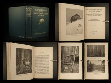
1912 HUNTING Alaska Vancouver Sheldon Wilderness of North Pacific Canada BearSchilb Antiquarian Rare Books4.8(421)See Sold PriceMar 31, 2024
[MAP]. [ALBRIZZI, Giambatista, 1698-1777]. Carta Geografica...Potter & Potter Auctions4.6(539)See Sold PriceMar 07, 2024
1764 Bellin Map of Western Guadeloupe in the Lesser Antilles -- Partie Occidentale de l'Isle de laJasper524.5(9.8k)See Sold PriceFeb 27, 2024
EARLY COLONIAL WEST AFRICA. Empires of Sokoto Gando Mas.Tribes.Fellatah 1882 mapJasper524.5(9.8k)See Sold PriceFeb 28, 2024
WESTERN AFRICA.Kong Mountains.Caravan routes.Slave Coast.TALLIS/RAPKIN 1849 mapJasper524.5(9.8k)See Sold PriceFeb 28, 2024
Western Sahara. Africa 1885 old antique vintage map plan chartJasper524.5(9.8k)See Sold PriceFeb 28, 2024
WESTERN AFRICA.Kong Mountains.Caravan routes.Slave Coast.TALLIS/RAPKIN 1851 mapJasper524.5(9.8k)See Sold PriceFeb 28, 2024
Operation Torch Nov 1942-May 1943. World War 2. Western Mediterranean 1966 mapJasper524.5(9.8k)See Sold PriceFeb 28, 2024
PRE COLONIAL WESTERN AFRICA. Shows Mountains of Kong. Tribes. WELLER 1863 mapJasper524.5(9.8k)See Sold PriceFeb 28, 2024
Robert de Vaugondy - Map of Canada - Mer de l' Ouest or Sea of the West and a Northwest PassageProverde Auctions4.3(3)See Sold PriceFeb 28, 2024
Mostly U.S., Some Canada Maps etc (40 Pcs)Grant Zahajko Auctions, LLC4.8(1k)See Sold PriceMar 06, 2024


![Keith Johnston Map [Map of Canada] (1 of 3)](https://p1.liveauctioneers.com/5755/147592/74586284_1_x.jpg?height=282&quality=70&version=1565735214)


![[MAP]. [ALBRIZZI, Giambatista, 1698-1777]. Carta Geografica... (1 of 1)](https://p1.liveauctioneers.com/928/318880/171361280_1_x.jpg?height=282&quality=70&version=1707501302)


