ATLAS of ANTIENT GEOGRAPHY by SAMUEL BUTLER 1843John McInnis Auctioneers,LLC4.6(502)See Sold PriceFeb 24, 2024
18TH C. ANTIQUE MAP: FRENCH & INDIAN WAR, FRAMEDThomaston Place Auction Galleries4.4(386)See Sold PriceFeb 24, 2024
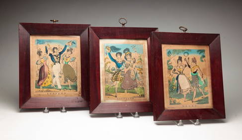
Rand McNally Railroad Map Cabinet w/ 21 Railroad MapsRail & Road Auctions4.6(165)See Sold PriceMar 08, 2024
Keith Haring - Ink on New York Map, Best Buddies, Inscribed, Signed, and DatedSapphire Auction Gallery4(67)See Sold PriceMar 02, 2024
LATE 17TH C. FRENCH MAP OF THE NEW WORLD BY ALEXIS-HUBERT JAILLOT (1632-1712)Thomaston Place Auction Galleries4.4(386)See Sold PriceFeb 24, 2024
Central Railroad of New Jersey Map of Sandy Hook Route-ca. 1903JM Hobby Supply and Railroad Artifact Auctions4.4(126)See Sold PriceFeb 24, 2024
Lot of Six Mixed Atlas Box Cars-HO Scale-New in BoxJM Hobby Supply and Railroad Artifact Auctions4.4(126)See Sold PriceFeb 25, 2024
Rand McNally/Santa Fe Railroad Map of Iowa-1912JM Hobby Supply and Railroad Artifact Auctions4.4(126)See Sold PriceFeb 24, 2024
NICOLAES VISSCHER (NETHERLANDS, 1618-1709) MAP OF THE NEW WORLDThomaston Place Auction Galleries4.4(386)See Sold PriceFeb 24, 2024
17TH C. WORLD MAP BY NICOLAES VISSCHER (NETHERLANDS, 1618-1709)Thomaston Place Auction Galleries4.4(386)See Sold PriceFeb 24, 2024
Lot of Six Mixed Atlas Cabooses-HO Scale-New in BoxJM Hobby Supply and Railroad Artifact Auctions4.4(126)See Sold PriceFeb 25, 2024
Wyld's Road Director Through England And WalesMap: Wyld's Road Director Through England And Wales Publication Date: 1836 ca. Cartographer: WYLD, JAMES, ELDER Publisher: JAMES WYLD, geographer to the Queen. Size (inches): 26.6X20.1 being a new andSee Sold Price
Wyld (James) Wyld's Road DirectorWyld (James) Wyld's Road Director through England and Wales...,folding engraved map with original hand-colouring in outline, dissected and linen-backed, some sections with minor creasing at edSee Sold Price
SoldWyld (James) Railway Map of England, Wales andWyld (James) Railway Map of England, Wales and Scotland...shewing the Lines of Railways with their Stations...the Inland Navigation, Great and Cross Roads, Cities, Market Towns & Villages, ?first issuSee Sold Price
1802 Cary’s New Itinerary Roads England Wales“Cary’s New Itinerary or an Accurate Delineation of the Great Roads both Direct and Cross Throughout England and Wales With Many of the Principal Roads of Scotland…”, by John Cary, Second EditSee Sold Price
1802 Cary’s New Itinerary Roads England WalesCary’s New Itinerary or an Accurate Delineation of the Great Roads both Direct and Cross Throughout England and Wales With Many of the Principal Roads of Scotland…, by John Cary, Second Edition, pSee Sold Price
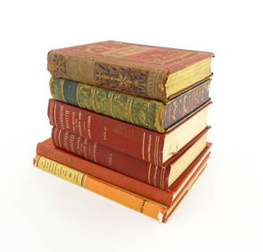
Sold[Binding, Maps] Paterson's Roads, England & WalesMogg, Edward. PATERSON'S ROADS: BEING AN ENTIRELY ORIGINAL AND ACCURATE DESCRIPTION OF ALL THE DIRECT AND PRINCIPAL CROSS ROADS IN ENGLAND AND WALES, WITH PART OF THE ROADS IN SCOTLAND. London: LongmaSee Sold Price
1802 Cary’s New Itinerary Roads England WalesCary’s New Itinerary or an Accurate Delineation of the Great Roads both Direct and Cross Throughout England and Wales With Many of the Principal Roads of Scotland…, by John Cary, Second Edition, pSee Sold Price
SoldCoach Roads.- Coltman (Nathaniel) A New Map of all theNO RESERVE Coach Roads.- Coltman (Nathaniel) A New Map of all the Coach Roads...of England & Wales..., folding hand-coloured engraved map, c.810 x 665mm., contemporary ink signatures of James Aitken tSee Sold Price
SoldBacons Motor Road Map: England & Wales, North. c.1920sTitle/Content of Map:Bacons Motor Road Map: England & Wales, North. c.1920s Date: c.1920s Cartographer: Bacons Motor Road Maps Material/Medium: Folded in boards color map reinforced with original gauzSee Sold Price
Bacons Motor Road Map: England & Wales. South c.1920sBacons Motor Road Map. England & Wales. South Sheet. Scale Eight Miles to One Inch Publisher. G.W. Bacon & Co, Ltd. Showing Roads, Railways, & Distances. Folding, gauze mounted color road map in greySee Sold Price
Bacons Motor Road Map: England & Wales, North. c.1920sBacons Motor Road Map. North Sheet. England & Wales. Scale. 8 miles = 1 inch Publisher. G.W. Bacon & Co, Ltd. Price on cover 5/=. Folded colour map 29 x 39. Grey/Blue cloth boards 7.5x4.5x0.5 inches (See Sold Price
Bacons Motor Road Map: England & Wales. South c.1920sTitle/Content of Map:Bacons Motor Road Map: England & Wales. South c.1920s Date: c.1920s Cartographer: Material/Medium: Folded in boards color map reinforced with original gauze. Size: folder 7.5x4.5xSee Sold Price
Bacons Motor Road Map: England & Wales. South c.1920sBacons Motor Road Map. England & Wales. South Sheet. Scale Eight Miles to One Inch Publisher. G.W. Bacon & Co, Ltd. Showing Roads, Railways, & Distances. Folding, gauze mounted color road map in greySee Sold Price
Bacons Motor Road Map: England & Wales, North. c.1920sBacons Motor Road Map. North Sheet. England & Wales. Scale. 8 miles = 1 inch Publisher. G.W. Bacon & Co, Ltd. Price on cover 5/=. Folded colour map 29 x 39. Grey/Blue cloth boards 7.5x4.5x0.5 inches (See Sold Price
Bacons Motor Road Map: England & Wales, North. c.1920sBacons Motor Road Map. North Sheet. England & Wales. Scale. 8 miles = 1 inch Publisher. G.W. Bacon & Co, Ltd. Price on cover 5/=. Folded colour map 29 x 39. Grey/Blue cloth boards 7.5x4.5x0.5 inches (See Sold Price
Bacons Motor Road Map: England & Wales, North. c.1920sBacons Motor Road Map. North Sheet. England & Wales. Scale. 8 miles = 1 inch Publisher. G.W. Bacon & Co, Ltd. Price on cover 5/=. Folded colour map 29 x 39. Grey/Blue cloth boards 7.5x4.5x0.5 inches (See Sold Price
Bacons Motor Road Map: England & Wales. South c.1920sBacons Motor Road Map. England & Wales. South Sheet. Scale Eight Miles to One Inch Publisher. G.W. Bacon & Co, Ltd. Showing Roads, Railways, & Distances. Folding, gauze mounted color road map in greySee Sold Price
Bacons Motor Road Map: England & Wales. South c.1920sBacons Motor Road Map. England & Wales. South Sheet. Scale Eight Miles to One Inch Publisher. G.W. Bacon & Co, Ltd. Showing Roads, Railways, & Distances. Folding, gauze mounted color road map in greySee Sold Price
Bacons Motor Road Map: England & Wales. South c.1920sBacons Motor Road Map. England & Wales. South Sheet. Scale Eight Miles to One Inch Publisher. G.W. Bacon & Co, Ltd. Showing Roads, Railways, & Distances. Folding, gauze mounted color road map in greySee Sold Price
Bacons Motor Road Map: England & Wales. South c.1920sBacons Motor Road Map. England & Wales. South Sheet. Scale Eight Miles to One Inch Publisher. G.W. Bacon & Co, Ltd. Showing Roads, Railways, & Distances. Folding, gauze mounted color road map in greySee Sold Price
Bacons Motor Road Map: England & Wales, North. c.1920sBacons Motor Road Map. North Sheet. England & Wales. Scale. 8 miles = 1 inch Publisher. G.W. Bacon & Co, Ltd. Price on cover 5/=. Folded colour map 29 x 39. Grey/Blue cloth boards 7.5x4.5x0.5 inches (See Sold Price
Bacons Motor Road Map: England & Wales, North. c.1920sBacons Motor Road Map. North Sheet. England & Wales. Scale. 8 miles = 1 inch Publisher. G.W. Bacon & Co, Ltd. Price on cover 5/=. Folded colour map 29 x 39. Grey/Blue cloth boards 7.5x4.5x0.5 inches (See Sold Price
Principal Roads of England & Wales 1756 with mapHeading: (England) Author: Title: A New and Accurate Description of the Present Great Roads and the Principal Cross Roads of England and Wales. Place Published: London Publisher:R. and J. Dodsley <See Sold Price
Principal Roads of England & Wales 1756 with mapHeading: (England) Author: Title: A New and Accurate Description of the Present Great Roads and the Principal Cross Roads of England and Wales. Place Published: London Publisher:R. and J. Dodsley <See Sold Price
OGILVY & BOWEN c1736 Original Map of Oxfordshire Berkshire Etc.Luis Porretta Fine Arts4.3(10)See Sold PriceMar 02, 2024
Numismatic Books - Boyne - Tokens Issued in the Seventeenth Century in England, Wales, and IrelandTimeLine Auctions Ltd.4.5(183)See Sold PriceMar 09, 2024
1861 ARCHITECTURE 1ed Handbook to Cathedrals England 100+ Full Page EngravingsSchilb Antiquarian Rare Books4.8(421)See Sold PriceMar 31, 2024
1939 Argentina Airmail Cover Buenos Aires to Mold North Wales EnglandMynt Auctions4.6(680)See Sold PriceFeb 26, 2024
[ENGLISH REFORMATION]. An Inventory of the Plate Belonging ...Potter & Potter Auctions4.6(539)See Sold PriceMar 07, 2024
THREE HAND COLORED AND ADORNED PRINTS.Amelia Jeffers, Auctioneers & Appraisers4.6(101)See Sold PriceMar 08, 2024
Books: A quantity of assorted books on the subject of Women, to include The Life of Catherine BoothClaydon Auctioneers Ltd4.3(125)See Sold PriceFeb 26, 2024
Book: The Romantic and Picturesque Scenery of England and Wales, by P. J. Loutherbourg. ReproducedClaydon Auctioneers Ltd4.3(125)See Sold PriceFeb 26, 2024
Late 18th century map of England and Wales sampler and two printsFellows4.3(159)See Sold PriceMar 05, 2024
2.3 ctw Certified VS/SI Diamond Halo Ring 18k Yellow GoldPacific Global Auction3.9(272)See Sold PriceJul 27, 2024


![[Binding, Maps] Paterson's Roads, England & Wales (1 of 7)](https://p1.liveauctioneers.com/3532/154050/77745121_1_x.jpg?height=282&quality=70&version=1572759985)


![[ENGLISH REFORMATION]. An Inventory of the Plate Belonging ... (1 of 2)](https://p1.liveauctioneers.com/928/318880/171360970_1_x.jpg?height=282&quality=70&version=1707501302)