ATLAS of ANTIENT GEOGRAPHY by SAMUEL BUTLER 1843John McInnis Auctioneers,LLC4.5(494)See Sold PriceFeb 24, 2024
18TH C. ANTIQUE MAP: FRENCH & INDIAN WAR, FRAMEDThomaston Place Auction Galleries4.4(386)See Sold PriceFeb 24, 2024
Rand McNally Railroad Map Cabinet w/ 21 Railroad MapsRail & Road Auctions4.6(165)See Sold PriceMar 08, 2024
Keith Haring - Ink on New York Map, Best Buddies, Inscribed, Signed, and DatedSapphire Auction Gallery3.9(67)See Sold PriceMar 02, 2024
LATE 17TH C. FRENCH MAP OF THE NEW WORLD BY ALEXIS-HUBERT JAILLOT (1632-1712)Thomaston Place Auction Galleries4.4(386)See Sold PriceFeb 24, 2024
Central Railroad of New Jersey Map of Sandy Hook Route-ca. 1903JM Hobby Supply and Railroad Artifact Auctions4.4(126)See Sold PriceFeb 24, 2024
Lot of Six Mixed Atlas Box Cars-HO Scale-New in BoxJM Hobby Supply and Railroad Artifact Auctions4.4(126)See Sold PriceFeb 25, 2024
Rand McNally/Santa Fe Railroad Map of Iowa-1912JM Hobby Supply and Railroad Artifact Auctions4.4(126)See Sold PriceFeb 24, 2024
NICOLAES VISSCHER (NETHERLANDS, 1618-1709) MAP OF THE NEW WORLDThomaston Place Auction Galleries4.4(386)See Sold PriceFeb 24, 2024
17TH C. WORLD MAP BY NICOLAES VISSCHER (NETHERLANDS, 1618-1709)Thomaston Place Auction Galleries4.4(386)See Sold PriceFeb 24, 2024
Lot of Six Mixed Atlas Cabooses-HO Scale-New in BoxJM Hobby Supply and Railroad Artifact Auctions4.4(126)See Sold PriceFeb 25, 2024
1st Edition of Colton's State Map of OhioHeading: Author: Colton, G.W. Title: Colton's Township Map of the State of Ohio Place Published: New York Publisher:J. H. Colton Date Published: 1851 Description: Folding pSee Sold Price
SoldJ.H. Colton Map of the United States of America, c 1849J.H. Colton Map of the United States of America, c 1849. 1st edition wall version drawn by George W. Colton and engraved by John M. Atwood with the grapevine border design with small vignettes done anSee Sold Price
SoldRare 1st ed/1st state NYC map by ColtonA rare and beautiful example of J. H. Colton map of New York City and vicinity, including Manhattan as well as parts of Brooklyn, Jersey City, Hoboken, and Queens. This is the first edition, first staSee Sold Price
1856 Colton Hand-colored Map of Northern ItalyOriginal, 1st edition 1856 map published by J. H. Colton & Co, New York. Northern Italy, Lombardy & Venice, Sardinia, Tuscany, Parna, Modena, Lucca, & the State of the Church. Also includes Corsica, pSee Sold Price
Near Fine example 1st ed. of Colton’s 1855 map of New YorkNear fine 1855 first edition example of Colton's map of New York from the first edition of Colton’s Atlas of the World. Covers the entire state as well as adjacent parts of Vermont, MassachusettSee Sold Price
Sold19thc Map of Palestine, Judea,Samaria, Jerusalem1855 1st edition Colton's Atlas map, published by J. H. Colton & Co., New York, pg no. 26. Features Palestine, Arabia, Judea, Jerusalem, Samaria, Galilee, The Mediterranean Sea, The Dead Sea. 15" X 18See Sold Price
Sold19thc Map of Palestine, Judea,Samaria, Jerusalem1855 1st edition Colton's Atlas map, published by J. H. Colton & Co., New York, pg no. 26. Features Palestine, Arabia, Judea, Jerusalem, Samaria, Galilee, The Mediterranean Sea, The Dead Sea. 15"See Sold Price
19thc Map of Palestine, Judea,Samaria, Jerusalem1855 1st edition Colton's Atlas map, published by J. H. Colton & Co., New York, pg no. 26. Features Palestine, Arabia, Judea, Jerusalem, Samaria, Galilee, The Mediterranean Sea, The Dead Sea. 15" X 18See Sold Price
19thc Map of Palestine, Judea,Samaria, Jerusalem1855 1st edition Colton's Atlas map, published by J. H. Colton & Co., New York, pg no. 26. Features Palestine, Arabia, Judea, Jerusalem, Samaria, Galilee, The Mediterranean Sea, The Dead Sea. 15" X 18See Sold Price
19thc Map of Palestine, Judea,Samaria, Jerusalem1855 1st edition Colton's Atlas map, published by J. H. Colton & Co., New York, pg no. 26. Features Palestine, Arabia, Judea, Jerusalem, Samaria, Galilee, The Mediterranean Sea, The Dead Sea. 15" X 18See Sold Price
19thc Map of Palestine, Judea,Samaria, Jerusalem1855 1st edition Colton's Atlas map, published by J. H. Colton & Co., New York, pg no. 26. Features Palestine, Arabia, Judea, Jerusalem, Samaria, Galilee, The Mediterranean Sea, The Dead Sea. 15" X 18See Sold Price
19thc Map of Palestine, Judea,Samaria, Jerusalem1855 1st edition Colton's Atlas map, published by J. H. Colton & Co., New York, pg no. 26. Features Palestine, Arabia, Judea, Jerusalem, Samaria, Galilee, The Mediterranean Sea, The Dead Sea. 15"See Sold Price
19thc Map of Palestine, Judea,Samaria, Jerusalem1855 1st edition Colton's Atlas map, published by J. H. Colton & Co., New York, pg no. 26. Features Palestine, Arabia, Judea, Jerusalem, Samaria, Galilee, The Mediterranean Sea, The Dead Sea. 15" X 18See Sold Price
19thc Map of Palestine, Judea,Samaria, Jerusalem1855 1st edition Colton's Atlas map, published by J. H. Colton & Co., New York, pg no. 26. Features Palestine, Arabia, Judea, Jerusalem, Samaria, Galilee, The Mediterranean Sea, The Dead Sea. 15" X 18See Sold Price
1850's J. H. Colton Map of RussiaAn excellent 1st edition example of Colton's Map of Russia from Colton's Atlas of The World c. 1855. 15" X 18".See Sold Price
1850's J. H. Colton Map of RussiaAn excellent 1st edition example of Colton's Map of Russia from Colton's Atlas of The World c. 1855. 15" X 18".See Sold Price
Sold1855 Hand-Colored Map of Ohio [Antique Map]A nice pre-Civil War 1855 first edition example of Colton's map of Ohio. Hand-colored. Measures 14 x 17. [Cartography]See Sold Price
Sold1835 1st Edition Large United States Atlas America Map80-1752 1835 1st Edition Large United States Atlas America Map. Measures 29 x 25 in. framed and 22 x 17 in. unframed.See Sold Price
SoldColton's Ohio Map [Midwestern States]Colton's Ohio Map. J. H. Colton Cartographer. Inset of 'Vicinity of Cleveland' lower right. Published by J. H. Colton, New York. Stamped 'Entered according to Act of Congress in the Year 1855 by J. H.See Sold Price
HIGHLANDS & ISLANDS Small collection ofHIGHLANDS & ISLANDS Small collection of works on the Highlands and Islands, to include: TUDOR [J.R.] The Orkneys and Shetland: their past and present state ... 1st edition, illus., plates, maps (incluSee Sold Price
Great Colton map of IowaAn excellent 1855 first edition example of Colton's map of Iowa. Like most of Colton's state maps, this map was derived from an earlier wall map of North America produced by Colton and D. Griffing JohSee Sold Price
Great Colton map of IowaAn excellent 1855 first edition example of Colton's map of Iowa. Like most of Colton's state maps, this map was derived from an earlier wall map of North America produced by Colton and D. Griffing JohSee Sold Price
Sold1909-1914 Homeopathic Medical Society Annual SessionsProceedings of the 45th through the 50th (1909-1914) Annual Session of the Homeopathic Medical Society of the State Ohio. Published by The Publishing Committee 1909-1914. 1st Editions all. Most are inSee Sold Price
SoldWilliam's Ohio State Dicrectory & Shippers Guide''William's Ohio State Dicrectory and Shippers Guide'', Vol. I for the year 1866, Williams & Company, Cincinnati, Ohio, 1866, 1st edition, 870 pp, 8vo, hard bound in printed cardboard and quarter leatSee Sold Price
ALEXANDER BALD 1780 1st Edition Scotland Corn Dealer Agriculture AssistantLuis Porretta Fine Arts4.3(10)See Sold PriceMar 02, 2024
DUNLEVIE c1856 Map Counties Of Gaspe & Bonaventure Quebec Canada SCARCE! #2Luis Porretta Fine Arts4.3(10)See Sold PriceMar 02, 2024
DEVINE c1856 Dr Salters Map Of Lake Huron Ontario Indian Lands etc. No. 7 ScarceLuis Porretta Fine Arts4.3(10)See Sold PriceMar 02, 2024
DUNLEVIE c1856 Map Counties Of Gaspe & Bonaventure Quebec Canada SCARCE! #1Luis Porretta Fine Arts4.3(10)See Sold PriceMar 02, 2024
OGILVY & BOWEN c1736 Original Map of Oxfordshire Berkshire Etc.Luis Porretta Fine Arts4.3(10)See Sold PriceMar 02, 2024
Leo Heinrich c1837 Register of German Italian States Tan Calf Scarce!Luis Porretta Fine Arts4.3(10)See Sold PriceMar 02, 2024
History of the Great Rebellion 1865 1st EditionNorth American Artifact Auctions4.7(175)See Sold PriceApr 20, 2024
1886 A Larger History of the United States 1st EditionNorth American Artifact Auctions4.7(175)See Sold PriceApr 20, 2024
A "Red Book" of the Greatest War of History 1914North American Artifact Auctions4.7(175)See Sold PriceApr 20, 2024
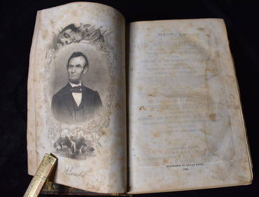
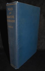
MAN AN ADAPTIVE MECHANISM 1916 Crile 1st EditionNorth American Artifact Auctions4.7(175)See Sold PriceApr 20, 2024
1870 Commentary on the Gospels Vol I St Mathew & Vol II St Mark 1st EditionsNorth American Artifact Auctions4.7(175)See Sold PriceApr 20, 2024
They Were Expendable 1944 1st EditionNorth American Artifact Auctions4.7(175)See Sold PriceApr 20, 2024
Putnam - First Map of the State of Ohio by Rufus PutnamTrillium Antique Prints & Rare Books4.5(28)See Sold PriceFeb 24, 2024
1999 Pokemon Fossil 1st Ed. Magneton CGC 9.5Bruneau & Co. Auctioneers4.5(491)See Sold PriceFeb 24, 2024
SIGNED. ROBERTSON DAVIES: THE MANTICORE. 1972. 1ST ED.Toronto Book Auctions4.3(13)See Sold PriceMar 07, 2024
SIGNED. ROBERTSON DAVIES: THE DIARY OF SAMUEL MARCHBANKS.Toronto Book Auctions4.3(13)See Sold PriceMar 07, 2024


![1855 Hand-Colored Map of Ohio [Antique Map] (1 of 1)](https://p1.liveauctioneers.com/7226/190854/96150594_1_x.jpg?height=282&quality=70&version=1610140980)

![Colton's Ohio Map [Midwestern States] (1 of 3)](https://p1.liveauctioneers.com/5755/154409/77936939_1_x.jpg?height=282&quality=70&version=1573094011)