ATLAS of ANTIENT GEOGRAPHY by SAMUEL BUTLER 1843John McInnis Auctioneers,LLC4.6(502)See Sold PriceFeb 24, 2024
18TH C. ANTIQUE MAP: FRENCH & INDIAN WAR, FRAMEDThomaston Place Auction Galleries4.4(386)See Sold PriceFeb 24, 2024
Rand McNally Railroad Map Cabinet w/ 21 Railroad MapsRail & Road Auctions4.6(165)See Sold PriceMar 08, 2024
Keith Haring - Ink on New York Map, Best Buddies, Inscribed, Signed, and DatedSapphire Auction Gallery4(67)See Sold PriceMar 02, 2024
LATE 17TH C. FRENCH MAP OF THE NEW WORLD BY ALEXIS-HUBERT JAILLOT (1632-1712)Thomaston Place Auction Galleries4.4(386)See Sold PriceFeb 24, 2024
Central Railroad of New Jersey Map of Sandy Hook Route-ca. 1903JM Hobby Supply and Railroad Artifact Auctions4.4(126)See Sold PriceFeb 24, 2024
Lot of Six Mixed Atlas Box Cars-HO Scale-New in BoxJM Hobby Supply and Railroad Artifact Auctions4.4(126)See Sold PriceFeb 25, 2024
Rand McNally/Santa Fe Railroad Map of Iowa-1912JM Hobby Supply and Railroad Artifact Auctions4.4(126)See Sold PriceFeb 24, 2024
NICOLAES VISSCHER (NETHERLANDS, 1618-1709) MAP OF THE NEW WORLDThomaston Place Auction Galleries4.4(386)See Sold PriceFeb 24, 2024
17TH C. WORLD MAP BY NICOLAES VISSCHER (NETHERLANDS, 1618-1709)Thomaston Place Auction Galleries4.4(386)See Sold PriceFeb 24, 2024
Lot of Six Mixed Atlas Cabooses-HO Scale-New in BoxJM Hobby Supply and Railroad Artifact Auctions4.4(126)See Sold PriceFeb 25, 2024
Sold1855 Hand-Colored Map of Ohio [Antique Map]A nice pre-Civil War 1855 first edition example of Colton's map of Ohio. Hand-colored. Measures 14 x 17. [Cartography]See Sold Price
SoldBradford: Antique Map of Ohio, 1838Title/Content of Map: Ohio by Bradford Date Printed: 1838/1841 Cartographer: Thomas G. Bradford Material/Medium: Paper Size: 13" x 16 1/2" Hand colored. A General Atlas of the World with a Separate MaSee Sold Price
SoldTanner: Antique Map of Ohio, 1843Title/Content of Map: Ohio by Tanner Date Printed: 1843 Cartographer: based on the work of H.C. Tanner Material/Medium: Paper Size: 17" x 14" Hand colored engraved Map. From the first edition publisheSee Sold Price
SoldColton: Antique Map of Ohio, 1871Title/Content of Map: Ohio by Colton Date Printed: 1871 Cartographer: G. W. Colton Material/Medium: Paper Size: 17" x 14" Hand colored lithograph. From 'Colton's American Atlas.' Published in New YorkSee Sold Price
Johnson: Antique Map of Ohio, 1868Title/Content of Map: Ohio by Johnson Date Printed: 1868 Cartographer: A.J. Johnson Material/Medium: Paper Size: 18" x 24" Hand colored steel engraved Map. From Johnson's New Illustrated Family AtlasSee Sold Price
SoldMap Of Philadelphia Pennsylvania 1855 ColtonAntique map of Philadelphia, published by J. H. Colton. Nice overall. Hand colored. Dated 1855See Sold Price
SoldLARGE ANTIQUE HAND COLORED MAP JEFFERSON COUNTY NYLarge antique hand colored map of Jefferson County, New York. Circa 1855. Framed in large wooden frame and laid down to canvas backing. Condition: mounted/laid on canvas for preservation, some areas rSee Sold Price
LARGE ANTIQUE HAND COLORED MAP JEFFERSON COUNTY NYLarge antique hand colored map of Jefferson County, New York. Circa 1855. Framed in large wooden frame and laid down to canvas backing. Condition: mounted/laid on canvas for preservation, some areas rSee Sold Price
LARGE ANTIQUE HAND COLORED MAP JEFFERSON COUNTY NYLarge antique hand colored map of Jefferson County, New York. Circa 1855. Framed in large wooden frame and laid down to canvas backing. Condition: mounted/laid on canvas for preservation, some areas rSee Sold Price
LARGE ANTIQUE HAND COLORED MAP JEFFERSON COUNTY NYLarge antique hand colored map of Jefferson County, New York. Circa 1855. Framed in large wooden frame and laid down to canvas backing. Condition: mounted/laid on canvas for preservation, some areas rSee Sold Price
SoldATLAS OF CUYAHOGA COUNTY OHIO 1874 Complete Antique 82ATLAS OF CUYAHOGA COUNTY OHIO 1874 Complete Antique 82 Hand-Colored Maps 119 Views Many Fold-Outs Railroad and Township Map of Ohio US Map Engraved by Worley and Bracher Printed by Fred Bourquin TitusSee Sold Price
SoldMitchell: Antique Map of Indiana & Ohio, 1869Title/Content of Map: Indiana & Ohio by Mitchell Date Printed: 1869 Cartographer: Augustus S. Mitchell Material/Medium: Paper Size: 15" x 12" Hand colored steel engraved Map. Published in PhiladelphiaSee Sold Price
SoldHand Colored Map, James Wyld (1812-1887)Antique c. 1855 map published by James Wyld entitled: "Parliamentary Representation" and "A Map Shewing the Places in England & Wales Sending Members to Parliament with the Numbers Returned. DivisionsSee Sold Price
SoldA Handcolored Map, Height 6 x width 8 inches.A Handcolored Map, 19th century, depicting Germany, matted and framed. Height 6 x width 8 inches. Property from the Estate of Robert and Eileen Degner, of RJ Degner Antiques, Maumee, OhioSee Sold Price
SoldScarce 1848 Mitchell map of OhioFully hand-colored authentic, antique and scarce map. Early map of Ohio from the increasingly scarce 1848 Mitchell New Universal Atlas. Contains an interesting depiction of the burgeoning transportatiSee Sold Price
Scarce 1848 Mitchell map of OhioFully hand-colored authentic, antique and scarce map. Early map of Ohio from the increasingly scarce 1848 Mitchell New Universal Atlas. Contains an interesting depiction of the burgeoning transportatiSee Sold Price
Carey & Lea - Ohio. 26This hand-colored map engraving was part of the atlas titled A Complete Historical, Chronological, and Geographical American Atlas, being A Guide to the History of North and South America, and the WesSee Sold Price
Sold(3) Assorted 19th C. Engraving and Litho MapsThree (3) maps, including: circa 1838 hand-colored copper plate engraving, "Ohio", publisher T.G. Bradford, 16 1/4" x 13 1/4", unframed, small edge tears; circa 1855 lithograph, "Colton, Virginia & WeSee Sold Price
SoldHand Colored Antique Map Of New Amsterdam (New York)Map of the Original Grants of Village Lots from the Dutch West India Company to the inhabitant of New-Amsterdam, (now New-York) living below the present line of Wall Street. 19 1/2 x 17 in. (Framed),See Sold Price
SoldHAND COLORED ENGRAVED MAP ANTIQUEHAND COLORED ENGRAVED MAP, ANTIQUE, H 16", W 19", "MOREA OLIM PELOPONNESUS":Framed. For a high resolution photo CLICK HERESee Sold Price
SoldHAND COLORED ANTIQUE MAP COMORRA RIVERMeasures 24 1/2" wide by 13" tall. Map appears to be in good condition with one fold mark and small wave, small stain on right margin. Loose from matting and sliding in frame. Back not removed.See Sold Price
SoldHAND COLORED ENGRAVED MAPS ANTIQUE 2HAND COLORED ENGRAVED MAPS, ANTIQUE, 2:Framed. Date of printings unknown.See Sold Price
SoldHAND COLORED ANTIQUE MAPS, EUROPE & THE WORLDHAND COLORED ANTIQUE MAPS, 3, INCLUDING JOHANN BAPTIST HOMANN & JACOBO MARCELLO, EUROPE & THE WORLD:11 1/8" x 20 1/4", 19" x 22 1/8", 19" x 23 1/4"; unframed. Ex. Collection Nancy and the late G. MennSee Sold Price
SoldANTIQUE HAND COLORED HEINRICH SCHERER MAP 1702Scarce hand colored antique map of Europe by the Jesuit Heinrich Scherer, printed in 1702. Copper engraving with later hand coloring. Professionally framed and matted. The overall size of the map is 1See Sold Price
18TH C. ANTIQUE MAP: FRENCH & INDIAN WAR, FRAMEDThomaston Place Auction Galleries4.4(386)See Sold PriceFeb 24, 2024
Early 1900's Railway Service Map, Illinois, Ohio, Indiana, Kentucky, TennesseeConnoisseur Auctions4(333)See Sold PriceFeb 24, 2024
Johann Homann Hand-Colored Map Engraving, c. 1730Auctions at Showplace4.5(726)See Sold PriceMar 17, 2024
Framed Hand Colored Antique Map of the Department of Nord, FranceDonny Malone Auctions4.5(1.7k)See Sold PriceMar 04, 2024
William Simpson's Sketches at the Seat of War - Two Volumes with 81 Hand-colored LithographsTrillium Antique Prints & Rare Books4.5(30)See Sold PriceFeb 24, 2024
Mitchell - Map of the City of Washington (Washington, DC)Trillium Antique Prints & Rare Books4.5(30)See Sold PriceFeb 24, 2024
Wilson - Wood Thrush, Red-breasted Thrush or Robin, & Nuthatches. 2Trillium Antique Prints & Rare Books4.5(30)See Sold PriceFeb 24, 2024
Wilson - Grosbeak, Warbler, Siskin, & Flycatcher. 17Trillium Antique Prints & Rare Books4.5(30)See Sold PriceFeb 24, 2024
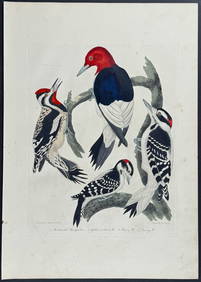
Wilson - Woodpeckers - Red-headed, Yellow-bellied, Hairy, & Downy. 9Trillium Antique Prints & Rare Books4.5(30)See Sold PriceFeb 24, 2024
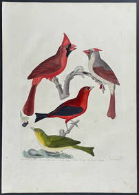
Wilson - Cardinal Grosbeak & Red Tanager. 11Trillium Antique Prints & Rare Books4.5(30)See Sold PriceFeb 24, 2024
Wilson - Mottled Owl, Lark, Creeper, & Warbler. 19Trillium Antique Prints & Rare Books4.5(30)See Sold PriceFeb 24, 2024
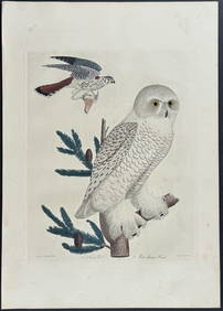
Wilson - Snow Owl (Snowy Owl) & Sparrow Hawk. 32Trillium Antique Prints & Rare Books4.5(30)See Sold PriceFeb 24, 2024
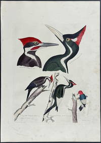
Wilson - Ivory-billed Woodpecker, Red-headed & Pileated Woodpeckers. 29Trillium Antique Prints & Rare Books4.5(30)See Sold PriceFeb 24, 2024
Wilson - Carolina Parrot & Flycatchers. 26Trillium Antique Prints & Rare Books4.5(30)See Sold PriceFeb 24, 2024
Africa inc. discoveries of Livingstone Barth Vogel Chadda Exp. SWANSTON 1860 mapJasper524.5(9.8k)See Sold PriceFeb 28, 2024
1849 Hand Colored Blair Map of World in HemispheresMatthew Bullock Auctioneers4.7(1.8k)See Sold PriceMar 02, 2024
Rare 19thc Colton Map, Argentine Republic, Chile, Uruguay, PataguayConnoisseur Auctions4(333)See Sold PriceMar 16, 2024
![1855 Hand-Colored Map of Ohio [Antique Map] First Image](https://p1.liveauctioneers.com/7226/190854/96150594_1_x.jpg?height=282&quality=95&version=1610140980&width=282)

![1855 Hand-Colored Map of Ohio [Antique Map] First Image](https://p1.liveauctioneers.com/7226/190854/96150594_1_x.jpg?height=282&quality=1&version=1610140980&width=282)


![1855 Hand-Colored Map of Ohio [Antique Map] (1 of 1)](https://p1.liveauctioneers.com/7226/190854/96150594_1_x.jpg?height=282&quality=70&version=1610140980)