ATLAS of ANTIENT GEOGRAPHY by SAMUEL BUTLER 1843John McInnis Auctioneers,LLC4.5(505)See Sold PriceFeb 24, 2024
18TH C. ANTIQUE MAP: FRENCH & INDIAN WAR, FRAMEDThomaston Place Auction Galleries4.4(393)See Sold PriceFeb 24, 2024
Rand McNally Railroad Map Cabinet w/ 21 Railroad MapsRail & Road Auctions4.6(165)See Sold PriceMar 08, 2024
Keith Haring - Ink on New York Map, Best Buddies, Inscribed, Signed, and DatedSapphire Auction Gallery4(67)See Sold PriceMar 02, 2024
LATE 17TH C. FRENCH MAP OF THE NEW WORLD BY ALEXIS-HUBERT JAILLOT (1632-1712)Thomaston Place Auction Galleries4.4(393)See Sold PriceFeb 24, 2024
Central Railroad of New Jersey Map of Sandy Hook Route-ca. 1903JM Hobby Supply and Railroad Artifact Auctions4.4(127)See Sold PriceFeb 24, 2024
Lot of Six Mixed Atlas Box Cars-HO Scale-New in BoxJM Hobby Supply and Railroad Artifact Auctions4.4(127)See Sold PriceFeb 25, 2024
Rand McNally/Santa Fe Railroad Map of Iowa-1912JM Hobby Supply and Railroad Artifact Auctions4.4(127)See Sold PriceFeb 24, 2024
NICOLAES VISSCHER (NETHERLANDS, 1618-1709) MAP OF THE NEW WORLDThomaston Place Auction Galleries4.4(393)See Sold PriceFeb 24, 2024
17TH C. WORLD MAP BY NICOLAES VISSCHER (NETHERLANDS, 1618-1709)Thomaston Place Auction Galleries4.4(393)See Sold PriceFeb 24, 2024
Lot of Six Mixed Atlas Cabooses-HO Scale-New in BoxJM Hobby Supply and Railroad Artifact Auctions4.4(127)See Sold PriceFeb 25, 2024
SoldSAMUEL LEWIS (C. 1782 TO 1865) MAP OF VIRGINIASAMUEL LEWIS (C. 1782 TO 1865) MAP OF VIRGINIA, on laid paper, title in octagonal cartouche to upper left corner "VIRGINIA", above "S. Lewis, del." and scale, lettered "Tanner, Sc." to lower right corSee Sold Price
Lewis Map of Virginia, 1795Lewis, Samuel (1782-1865). The State of Virginia from the Best Authorities. Engraved map. Matthew Carey, c. 1795. 13 ¾" x 20 ¼" sheet. Engraved for an atlas by Carey and still bearing notation aSee Sold Price
SoldLouisiana, after Soulard, ca. 1804-1812"Louisiana", Charted After the Antoine Soulard Map by Samuel Lewis (British, 1782-1865) and Aaron Arrowsmith (British, 1750-1823), hand-colored engraving, published Boston, ca. 1804-1812. Unframed. shSee Sold Price
SoldLouisiana, Charted After the A. Soulard Map"Louisiana", Charted After the Antoine Soulard Map by Samuel Lewis (British, 1782-1865) and Aaron Arrowsmith (British, 1750-1823), hand-colored engraving, published Boston, ca. 1804-1812. Unframed. shSee Sold Price
SoldFirst U.S. Atlas Map of North Carolina 1795Lewis, Samuel (1782-1865). State of North Carolina from Best Authorities. Engraved map. Matthew Carey, 1795. 11" x 18 ½" sheet.See Sold Price
Lewis Map of New York, 1809Lewis, Samuel (1782-1865). State of New York. Engravedmap. Mathew Carey, 1809. 16 â…›" x 20 â…" sheet. compiled from the best authorities. 1809… Interesting early state map showing someSee Sold Price
SoldFirst U.S.-Produced Map of MaineLewis, Samuel (1782-1865). Province of Maine, from the Best Authorities. Engraved map. Matthew Carey, 1795. 14 ½" x 9 ½" sheet. Engraved for atlas by Carey and bearing notation along upper margiSee Sold Price
SoldSAMUEL LEWIS MAP OF VIRGINIA 1794MAP STATE OF VIRGINIA FROM THE BEST AUTHORITIES, BY SAMUEL LEWIS, 1794. CAREY, MATHEW. PHILA. 1794. Engraved for the first American commercial atlas with reading, "Engraved for Carey's American EditioSee Sold Price
SoldSAMUEL LEWIS (AMERICAN, B. 1757) MAP OF VIRGINIASAMUEL LEWIS (AMERICAN, B. 1757) MAP OF VIRGINIA, engraving on laid paper, an important topographical record of the time, includes a designation for "Federal City / Washington", published in PhiladelpSee Sold Price
Sold1809 Map of Virginia, Samuel LewisThe State of Virginia from the Best Authorities by Samuel Lewis, published Philadelphia 1809, engraved for Carey's American Edition of Guthrie's Geography Improved. (One of the earliest obtainable mapSee Sold Price
FRAMED MAP, ENGLAND & WALES, SAMUEL LEWIS, C. 1849Framed "Map of England & Wales", Topographical Dictionary, Samuel Lewis & Co., London, c. 1849, lightly hand colored, book folds, sight: 19"h, 15.75"w, overall: 26"h, 22"w, 5.5lbs Start Price: $80.00See Sold Price
Attributed to Jose Francisco Xavier deAttributed to Jose Francisco Xavier de Salazar y Mendoza (Mexico, c. mid-1700's-1802, active New Orleans c. 1782-1802) , "Captain Samuel Lewis (1764-1820), oil on canvas, unsigned, found written in olSee Sold Price
SoldMap of Virginia by Samuel Lewis, 1794 from Jefferson'sMap of Virginia by Samuel Lewis, 1794 from Jefferson's Notes on Virginia Overal toning, framed under glass. Descended in the Pollard family. 14 1/4" x 20 1/2"; frame: 18 3/4" x 25 1/4"See Sold Price
SoldJefferson, [State of Virginia,] 1801Thomas Jefferson, [Notes on the State of Virginia, With An Appendix,] printed by M.L. & W.A. Davis., for Furman & Loudon, 1801, eighth edition, 392 pp., with fold-out map of Virginia by Samuel Lewis,See Sold Price
1840 LEWIS MAP of ENGLAND & WALES on LINEN 4 PARTS antiqueLondon: Samuel Lewis, c.1839-1840. Complete in four sheets, dissected and laid on linen, each 35 x 41.5" Bound into original morocco gilt covers, with elaborate gilt tooling. Very good condition of thSee Sold Price
1840 LEWIS MAP of ENGLAND & WALES on LINEN 4 PARTS antiqueLondon: Samuel Lewis, c.1839-1840. Complete in four sheets, dissected and laid on linen, each 35 x 41.5" Bound into original morocco gilt covers, with elaborate gilt tooling. Very good condition of thSee Sold Price
1840 LEWIS MAP of ENGLAND & WALES on LINEN 4 PARTS antiqueLondon: Samuel Lewis, c.1839-1840. Complete in four sheets, dissected and laid on linen, each 35 x 41.5" Bound into original morocco gilt covers, with elaborate gilt tooling. Very good condition of thSee Sold Price
1840 LEWIS MAP of ENGLAND & WALES on LINEN 4 PARTS antiqueLondon: Samuel Lewis, c.1839-1840. Complete in four sheets, dissected and laid on linen, each 35 x 41.5" Bound into original morocco gilt covers, with elaborate gilt tooling. Very good condition of thSee Sold Price
SoldTwo Framed 18th c. Maps Maryland - DelawareTWO framed 18th century maps of Maryland & Delaware 1) Maryland and Delaware together: "J. Denison" c. 1796 at 8" high by 10" wide inside matting.2) "State of Maryland by Samuel Lewis" measuring 11.5"See Sold Price
SoldCarrington, F.A.Carrington, F.A. A map of Scotland divided into counties, shewing the principal roads, railways, rivers, canals, etc. London: Samuel Lewis, [c.1846], 3 sheets, each approx 67cm high by 127cm wide, hanSee Sold Price
Sold18th Century Map of VirginiaThe State of Virginia, from the best Authorities, by Samuel Lewis, 1794, probably from Carey's American edition of [Guthrie's Geography Improved,] from the eastern seaboard to the Appalachian mountainSee Sold Price
Sold5 American Maps c. 1795: Carey, LewisFive (5) 18th century Maps by Samuel Lewis: Maine, Massachusetts, Pennsylvania, New York and New Jersey, from The General Atlas for CareyÕs Edition of GuthrieÕs Geography Improved. Note: The GeneralSee Sold Price
SoldSamuel Lewis Map of South CarolinaEarly 19th C. hand-colored map by Samuel Lewis, engraved by Henry Schenck Tanner. With minor foxing and discoloration, not examined out of frame / in as-found condition.Visible image: approx. 11" x 8See Sold Price
Sold3 hand colored maps: Virginia [c1849]-1864.[Virginia]. 3 hand-colored maps. ++ A New Map Of Virginia With its Canals, Roads & Distances from place to place, along the Stage & Steam Boat Routes. Phila: Samuel Augustus Mitchell, c.1849. 11 3/8 xSee Sold Price
EARLY 18TH C. MAP OF ITALY, FRAMEDThomaston Place Auction Galleries4.4(393)See Sold PriceFeb 24, 2024
LATE 16TH C. MAP OF SCOTLAND BY MERCATOR, FRAMEDThomaston Place Auction Galleries4.4(393)See Sold PriceFeb 24, 2024
17TH C. MAP OF THE BERKSHIRES BY JOHN SPEED, FRAMEDThomaston Place Auction Galleries4.4(393)See Sold PriceFeb 24, 2024
18TH C. ANTIQUE MAP: FRENCH & INDIAN WAR, FRAMEDThomaston Place Auction Galleries4.4(393)See Sold PriceFeb 24, 2024
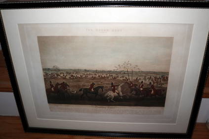
HENRY ALKEN / LEWIS Original 1835 Hand Colored Engraving Quorn Hunt DrawingLuis Porretta Fine Arts4.3(10)See Sold PriceMar 02, 2024
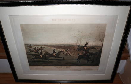
HENRY ALKEN / LEWIS Original 1835 Hand Colored Engraving Quron Hunt Snob Is BeatLuis Porretta Fine Arts4.3(10)See Sold PriceMar 02, 2024
[ENSLAVEMENT & ABOLITION]. Letter from a Virginia enslaver describing the management of a plantationFreeman's | Hindman4.4(1.6k)See Sold PriceFeb 27, 2024
Arrowsmith & Lewis - Map of PolynesiaTrillium Antique Prints & Rare Books4.5(32)See Sold PriceFeb 24, 2024
Arrowsmith & Lewis - Map of North AmericaTrillium Antique Prints & Rare Books4.5(32)See Sold PriceFeb 24, 2024
Arrowsmith & Lewis - Map of the World on Mercator's ProjectionTrillium Antique Prints & Rare Books4.5(32)See Sold PriceFeb 24, 2024
Arrowsmith & Lewis - Map of LouisianaTrillium Antique Prints & Rare Books4.5(32)See Sold PriceFeb 24, 2024
Arrowsmith & Lewis - Map of the United StatesTrillium Antique Prints & Rare Books4.5(32)See Sold PriceFeb 24, 2024
Lewis (Lady Theresa) Extracts of the Journals and Correspondence of Miss Berry, 1865; and c.60Forum Auctions4.3(53)See Sold PriceFeb 29, 2024
Perry, Matthew C. 1856 Large Map. Shah Bay, Lew Chew I. JapanAlbion Auctions4.6(341)See Sold PriceMar 01, 2024
DODGSON CHARLES LUTWIDGE: (1832-1898) Dodgson sends his 'Love to any daughters not too old'International Autograph Auctions Europe S.L.4.5(52)See Sold PriceMar 14, 2024


![Jefferson, [State of Virginia,] 1801 (1 of 4)](https://p1.liveauctioneers.com/33/18948/6418719_1_x.jpg?height=282&quality=70)


![3 hand colored maps: Virginia [c1849]-1864. (1 of 3)](https://p1.liveauctioneers.com/179/14187/4432499_1_x.jpg?height=282&quality=70&version=1193335524)


![[ENSLAVEMENT & ABOLITION]. Letter from a Virginia enslaver describing the management of a plantation (1 of 3)](https://p1.liveauctioneers.com/197/319238/171468028_1_x.jpg?height=282&quality=70&version=1707520367)