ATLAS of ANTIENT GEOGRAPHY by SAMUEL BUTLER 1843John McInnis Auctioneers,LLC4.6(502)See Sold PriceFeb 24, 2024
18TH C. ANTIQUE MAP: FRENCH & INDIAN WAR, FRAMEDThomaston Place Auction Galleries4.4(386)See Sold PriceFeb 24, 2024
Rand McNally Railroad Map Cabinet w/ 21 Railroad MapsRail & Road Auctions4.6(165)See Sold PriceMar 08, 2024
Keith Haring - Ink on New York Map, Best Buddies, Inscribed, Signed, and DatedSapphire Auction Gallery4(67)See Sold PriceMar 02, 2024
LATE 17TH C. FRENCH MAP OF THE NEW WORLD BY ALEXIS-HUBERT JAILLOT (1632-1712)Thomaston Place Auction Galleries4.4(386)See Sold PriceFeb 24, 2024
Central Railroad of New Jersey Map of Sandy Hook Route-ca. 1903JM Hobby Supply and Railroad Artifact Auctions4.4(126)See Sold PriceFeb 24, 2024
Lot of Six Mixed Atlas Box Cars-HO Scale-New in BoxJM Hobby Supply and Railroad Artifact Auctions4.4(126)See Sold PriceFeb 25, 2024
Rand McNally/Santa Fe Railroad Map of Iowa-1912JM Hobby Supply and Railroad Artifact Auctions4.4(126)See Sold PriceFeb 24, 2024
NICOLAES VISSCHER (NETHERLANDS, 1618-1709) MAP OF THE NEW WORLDThomaston Place Auction Galleries4.4(386)See Sold PriceFeb 24, 2024
17TH C. WORLD MAP BY NICOLAES VISSCHER (NETHERLANDS, 1618-1709)Thomaston Place Auction Galleries4.4(386)See Sold PriceFeb 24, 2024
Lot of Six Mixed Atlas Cabooses-HO Scale-New in BoxJM Hobby Supply and Railroad Artifact Auctions4.4(126)See Sold PriceFeb 25, 2024
SoldSayer: Antique Map of Africa, 1787Title/Content of Map: 1787 Sayer Map of Africa -- Africa with All its States, Kingdoms, Republics, Regions, Islands &c. Improved and Inlarged from D'Anville's Map: To which have been Added a ParticulaSee Sold Price
Sayer: Antique Map of Poland, 1787Title/Content of Map: 1787 Sayer Map of Poland -- A New Map of the Kingdom of Poland, with its Dismembered Provinces Date Printed: 1787, London Cartographer: R Sayer Size: 18.9 x 25.6 in. This is a hiSee Sold Price
Sayer: Antique Map of Asia, 1787Title/Content of Map: 1787 Sayer Map of Asia -- Asia and Its Islands According to D'Anville; Divided Into Empires, Kingdoms, States, Regions &ca... Date Printed: 1787, London Cartographer: R Sayer SizSee Sold Price
Sayer: Antique Map of Scandinavia, 1787Title/Content of Map: 1787 Sayer Map of Scandinavia -- The Northern States, Containing the Kingdoms of Sweden, Denmark, and Norway, Divided into Provinces and Governments Date Printed: 1787, London CaSee Sold Price
Sayer: Antique Map of Belgium, Northern France, 1787Title/Content of Map: 1787 Sayer Map of Belgium and Northern France -- Robert Sayer: The Catholic Netherlands, Divided into their Several Provinces with the Roads Date Printed: 1787, London CartographSee Sold Price
SoldAntique Austrian Map of North East AfricaAntique Austrian Map of North East Africa Engraving, Karte von Africa, Including Egypt and Israel 1787. Robert Vaugondy, F. A. Schraembl. Used condition. 28" x 30"See Sold Price
SoldBoulton's Africa - Oversized 1787 Map Well FramedS. Boulton's Africa Map after the original by D'Anville, this edition enlarged and updated with English texts, as published by Robert Sayer London 1787. boundaries hand-colored, archivally mounted onSee Sold Price
Orbis Antiquus. The Ancient World. Europe Africa Asia. BONNE 1787 old mapTITLE/CONTENT OF MAP: Orbis Antiquus [The Ancient World] DATE PRINTED: 1787 IMAGE SIZE: Approx 24.5 x 35.5cm, 9.75 x 14 inches (Large); Please note that this is a folding map. TYPE: Antique 18th centuSee Sold Price
SoldTwo Antique MapsMap of Mediterranean and N. Africa by G. de L'Isle, c. 1700, engraved by Jean Baptist Liebaux, Paris, double page 18.25" x 30.5", framed. Britain Antique, c. 1775, hand colored by Robert Sayer & BenneSee Sold Price
Africa, With All Its States,Title/Content of Map: Africa, With All Its States, Cartographer: BOULTON, S. Date: 1787-01-06 Publisher: ROBERT SAYER, Size: 41Height - 48Width kingdoms, republics, regions, islands, &ca. Improved andSee Sold Price
Africa, With All Its States,Publication Date: 1787-01-06 Title: Africa, With All Its States, Cartographer: BOULTON, S. Publisher: ROBERT SAYER, Height: 41 Width: 48 kingdoms, republics, regions, islands, &ca. Improved and InlargSee Sold Price
Africa, With All Its States,Title: Africa, With All Its States, Publication Date: 1787-01-06 Cartographer: BOULTON, S. Publisher: ROBERT SAYER, Description: kingdoms, republics, regions, islands, &ca. Improved and Inlarged fromSee Sold Price
Gibson / Sayer: Antique Map of Western Hemisphere, 1786Map: A New Map of the Whole Continent of America Divided into North and South and West Indies wherein are exactly Described the United States of North America Cartographer: J. Gibson / R. Sayer PlaceSee Sold Price
Sayer: Antique Map of North British Colonies in AmericaMap: A General Map of the Northern British Colonies in America Date Printed: 1776 Cartographer: Sayer, Robert and Bennett, John Size: 26 x 20 Condition: Fair. Lined for strength with a full sheet of JSee Sold Price
Jefferys / Sayer: Antique Map of Cuba, 1775Title: The Island of Cuba with part of the Bahama Banks and the Martrys. Scarce, authoritative 1775 British map and sea chart covering most of Cuba, the Cayman Islands, the Strait of Florida, and theSee Sold Price
Jefferys / Sayer: Antique Map Nicaragua/Costa Rica 1775Title/Content of Map: Part of the Provinces of Costa Rica and Nicaragua with the Lagunas Cartographer: Thomas Jefferys / Robert Sayer Place & Date: London / 1775 Size: 24 3/4" x 19 1/4" Condition: wasSee Sold Price
SoldJefferys / Sayer: Antique Map of Bay of Honduras, 1775Map: The Bay of Honduras Cartographer: Thomas Jefferys/Robert Sayer Place & Date: London / 1775 Size: 24 3/4" x 19 1/4" Condition: outline color; light overall age toning; several repaired marginal teSee Sold Price
SoldSayer: Antique Map of Spain & Portugal, 1780Map: Kingdoms of Spain and Portugal, Divided Into Their Great Provinces Publication Date: 1780-03-02 Cartographer: SAYER, ROBERT Publisher: ROBERT SAYER Size: Folio – 18.50 H x 25.25 W Inches ShortSee Sold Price
Sayer: Antique Map of the Netherlands, 1772Title/Content of Map: 1772 Sayer Map of the Netherlands -- The Seven United Provinces, with their Roads and Divisions Date Printed: 1772, London Cartographer: R Sayer Size: 18.5 x 22.5 in. A highly deSee Sold Price
Sayer: Antique Map of Dutch United Provinces, 1772Map: Seven [Dutch] United Provinces With Their Roads and Divisions. Publication Date: 1772-03-02 Cartographer: SAYER, ROBERT Publisher: ROBERT SAYER Size: Quarto – 19.30 H x 23.25 W Inches DissectedSee Sold Price
SoldAntique Map, Africa Secundum Legitimas Projectionis,Antique Map, Africa Secundum Legitimas Projectionis, 1739, paper backed, 20x23See Sold Price
SoldJefferys / Sayer: Antique Map of Guadeloupe, 1775Map: Guadeloupe, Done from Actual Surveys and Observations of the English Cartographer: Jefferys / Sayer Place & Date: London / 1775 Size: 24 1/8" x 18 1/4" Condition: b&w; a split in the upper marginSee Sold Price
Sayer: Antique Map of Russia, 1772Title/Content of Map: 1772 Sayer Map of Russia -- The European Part of the Russian Empire... [joined with] The Asiatic Part of the Russian Empire… [Also Titled as] The Whole Russian Empire Date PrinSee Sold Price
Sayer: Antique Map of South America' Southern PortionTitle/Content of Map: 1779 Sayer Map of South America' Southern Portion -- A Map of South America Containing Tierra-Firma, Guyana, New Granada, Amazonia, Brasil, Peru, Paraguay, Chaco, Tucuman, Chili,See Sold Price
NORTHERN AFRICA. Morocco Tunisia Algeria. Caravan routes. RAPKIN/TALLIS 1851 mapJasper524.5(9.8k)See Sold PriceFeb 28, 2024
WEST AFRICA Explorers' routes Senegal Ashanti. Mountains of Kong. SDUK 1857 mapJasper524.5(9.8k)See Sold PriceFeb 28, 2024
COLONIAL NIGERIA & CAMEROON. "Sudan" Dahomey (Benin) Togo, Kamerun 1906 mapJasper524.5(9.8k)See Sold PriceFeb 28, 2024
WEST AFRICA Niger/Gambia rivers tribes towns. 'Pays des Negres'. MALLET 1683 mapJasper524.5(9.8k)See Sold PriceFeb 28, 2024
NORTH & WEST AFRICA. Sahara Niger river 'Zaara ou le Desert'. MALLET 1683 mapJasper524.5(9.8k)See Sold PriceFeb 28, 2024
CENTRAL EAST AFRICA French Belgian Congo British German Kenya Tanzania 1909 mapJasper524.5(9.8k)See Sold PriceFeb 28, 2024
EARLY COLONIAL WEST AFRICA. Empires of Sokoto Gando Mas.Tribes.Fellatah 1882 mapJasper524.5(9.8k)See Sold PriceFeb 28, 2024
COLONIAL AFRICA Afrique. League of Nations Mandates. Ethnicity 1938 old mapJasper524.5(9.8k)See Sold PriceFeb 28, 2024
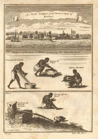
Guinea-Bissau Cacheu town Fortaleza de São José da Amura Preparing cassava 1745Jasper524.5(9.8k)See Sold PriceFeb 28, 2024
NORTH & COLONIAL WEST AFRICA. Nigeria marked as "Royal Niger Company" 1898 mapJasper524.5(9.8k)See Sold PriceFeb 28, 2024
AFRICA. Antiqua; Rome Carthage, start Punic War 1908 old antique map chartJasper524.5(9.8k)See Sold PriceFeb 28, 2024
Pre-colonial Africa. Mountains of Kong/Moon. Caravan routes. THOMSON 1817 mapJasper524.5(9.8k)See Sold PriceFeb 28, 2024
AFRICA. Pre 'Scramble for Africa'. BARTHOLOMEW 1876 old antique map plan chartJasper524.5(9.8k)See Sold PriceFeb 28, 2024
La Barbarie de la Nigritie et de la Guinée'. West Africa. DE L’ISLE 1745 mapJasper524.5(9.8k)See Sold PriceFeb 28, 2024
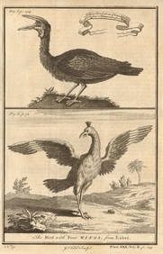
Gambian birds. Monoceros. A bird with four wings. CHILD 1745 old antique printJasper524.5(9.8k)See Sold PriceFeb 28, 2024
WEST CENTRAL AFRICA. Congo Angola Gabon Cameroon Sao Tome. MALLET 1683 old mapJasper524.5(9.8k)See Sold PriceFeb 28, 2024
NORTH AFRICA. 'Biledulgerid', a former North African country. MALLET 1683 mapJasper524.5(9.8k)See Sold PriceFeb 28, 2024
Pre-SECOND WORLD WAR AFRICA. European colonies & German mandates 1942 old mapJasper524.5(9.8k)See Sold PriceFeb 28, 2024
NILE VALLEY. Upper & Lower. Egypt Sinai Nubia Sudan Abyssinia. BLACKIE 1882 mapJasper524.5(9.8k)See Sold PriceFeb 28, 2024
SUB-SAHARAN AFRICA. 'Ancienne Ethiopie'. Ancient Ethiopia. MALLET 1683 old mapJasper524.5(9.8k)See Sold PriceFeb 28, 2024
AFRICA. French North Africa and Morocco 1907 old antique map plan chartJasper524.5(9.8k)See Sold PriceFeb 28, 2024
SOUTHERN AFRICA Monomotapa (Mutapa Kingdom) Cafrerie (Kaffraria) MALLET 1683 mapJasper524.5(9.8k)See Sold PriceFeb 28, 2024