ATLAS of ANTIENT GEOGRAPHY by SAMUEL BUTLER 1843John McInnis Auctioneers,LLC4.5(505)See Sold PriceFeb 24, 2024
18TH C. ANTIQUE MAP: FRENCH & INDIAN WAR, FRAMEDThomaston Place Auction Galleries4.4(393)See Sold PriceFeb 24, 2024
Rand McNally Railroad Map Cabinet w/ 21 Railroad MapsRail & Road Auctions4.6(165)See Sold PriceMar 08, 2024
Keith Haring - Ink on New York Map, Best Buddies, Inscribed, Signed, and DatedSapphire Auction Gallery4(67)See Sold PriceMar 02, 2024
LATE 17TH C. FRENCH MAP OF THE NEW WORLD BY ALEXIS-HUBERT JAILLOT (1632-1712)Thomaston Place Auction Galleries4.4(393)See Sold PriceFeb 24, 2024
Central Railroad of New Jersey Map of Sandy Hook Route-ca. 1903JM Hobby Supply and Railroad Artifact Auctions4.4(127)See Sold PriceFeb 24, 2024
Lot of Six Mixed Atlas Box Cars-HO Scale-New in BoxJM Hobby Supply and Railroad Artifact Auctions4.4(127)See Sold PriceFeb 25, 2024
Rand McNally/Santa Fe Railroad Map of Iowa-1912JM Hobby Supply and Railroad Artifact Auctions4.4(127)See Sold PriceFeb 24, 2024
NICOLAES VISSCHER (NETHERLANDS, 1618-1709) MAP OF THE NEW WORLDThomaston Place Auction Galleries4.4(393)See Sold PriceFeb 24, 2024
17TH C. WORLD MAP BY NICOLAES VISSCHER (NETHERLANDS, 1618-1709)Thomaston Place Auction Galleries4.4(393)See Sold PriceFeb 24, 2024
Lot of Six Mixed Atlas Cabooses-HO Scale-New in BoxJM Hobby Supply and Railroad Artifact Auctions4.4(127)See Sold PriceFeb 25, 2024
d'Anville: Antique Map of Great Lakes Midwest, 1784TITLE/CONTENT OF MAP: 'Partie Occidentale du Canada et Septentrionale de la Louisiane avec une Partie de la Pensilvanie par le Sr. d'Anville de l'Academie Rle. des Inscriptions et Belles-Lettres et deSee Sold Price
Santini / d'Anville: Antique Map of Great Lakes, 1784Partie Occidentale du Canada et Septentrionale de la Louisiane avec une Partie de la Pensilvanie par le Sr. d'Anville de l'Academie Rle. des Inscriptions et Belles-Lettres et de celle des Sciences deSee Sold Price
Soldd'Anville / Santini: Antique Map of Great Lakes, 1775Map: Partie Occidentale du Canada et Septentrionale de la Louisiane Cartographer: d'Anville / Santini Place & Date: Venice / 1775 Size: 22 1/4" x 19" Condition: outline color; light overall age toningSee Sold Price
Bonne: Antique Map of the Great Lakes & Canada, 1780Title/Content of Map: 'Partie Occidentale du Canada, Contenant les Cinq Grand Lacs, avec les Pays circonvoisins' A map of the North American Great Lakes, the Mid-West, the Plains States and much of OnSee Sold Price
Bonne: Antique Map of the Great Lakes & Canada, 1780Title/Content of Map: 'Partie Occidentale du Canada, Contenant les Cinq Grand Lacs, avec les Pays circonvoisins' A map of the North American Great Lakes, the Mid-West, the Plains States and much of OnSee Sold Price
Bonne: Antique Map North American Great Lakes, 1780Title/Content of Map: 'Partie Occidentale du Canada, Contenant les Cinq Grand Lacs, avec les Pays circonvoisins' A map of the North American Great Lakes, the Mid-West, the Plains States and much of OnSee Sold Price
Bonne: Antique Map of North American Great LakesTITLE/CONTENT OF MAP: 'Partie Occidentale du Canada, Contenant les Cinq Grand Lacs, avec les Pays circonvoisins' A map of the North American Great Lakes, the Mid-West, the Plains States and much of OnSee Sold Price
Santini/d'Anville: Map of Canada Great Lakes, 1784TITLE/CONTENT OF MAP: 'Partie Occidentale du Canada et Septentrionale de la Louisiane avec une Partie de la Pensilvanie par le Sr. d'Anville de l'Academie Rle. des Inscriptions et Belles-Lettres et deSee Sold Price
SoldPartie Occidentale du Canada Great Lakes Midwest.Reserve Reduced! TITLE/CONTENT OF MAP: 'Partie Occidentale du Canada et Septentrionale de la Louisiane avec une Partie de la Pensilvanie par le Sr. d'Anville de l'Academie Rle. des Inscriptions et BelSee Sold Price
"Partie Occidentale du Canada" Great Lakes Midwest.TITLE/CONTENT OF MAP: 'Partie Occidentale du Canada et Septentrionale de la Louisiane avec une Partie de la Pensilvanie par le Sr. d'Anville de l'Academie Rle. des Inscriptions et Belles-Lettres et deSee Sold Price
"Partie Occidentale du Canada" Great Lakes Midwest.Reserve Reduced! TITLE/CONTENT OF MAP: 'Partie Occidentale du Canada et Septentrionale de la Louisiane avec une Partie de la Pensilvanie par le Sr. d'Anville de l'Academie Rle. des Inscriptions et BelSee Sold Price
"Partie Occidentale du Canada" Great Lakes Midwest.TITLE/CONTENT OF MAP: 'Partie Occidentale du Canada et Septentrionale de la Louisiane avec une Partie de la Pensilvanie par le Sr. d'Anville de l'Academie Rle. des Inscriptions et Belles-Lettres et deSee Sold Price
Partie Occidentale du Canada Great Lakes Midwest.TITLE/CONTENT OF MAP: 'Partie Occidentale du Canada et Septentrionale de la Louisiane avec une Partie de la Pensilvanie par le Sr. d'Anville de l'Academie Rle. des Inscriptions et Belles-Lettres et deSee Sold Price
SoldMathew Carey map of the MidwestMathew Carey, Philadelphia, circa 1818. Hand colored lithograph map entitled "Upper Territories of the United States". Depicts the upper Midwestern States and the Great Lakes. Slight toning. Image 8 3See Sold Price
SoldBellin: Antique Map of the Great Lakes, 1755Map: 1755 Bellin Map of Great Lakes -- Partie Occidentale de la Nouvelle France… Cartographer: J N Bellin, Homann issue Year / Place: 1755, Nurnberg Map Dimensions: 24 x 19 in. Condition: Very goodSee Sold Price
Santini / d'Anville: Antique Map of Africa, 1784Afrique publiée sous les auspices de Monseigneur le Duc d'Orléans Prémier Prince du Sang. Par le Sr. d'Anvillé. À Venise, Chez Remondini [Africa published under the auspices of Monseigneur the DuSee Sold Price
Santini / d'Anville: Antique Map of Africa, 1784TITLE/CONTENT OF MAP: 'Afrique publiée sous les auspices de Monseigneur le Duc d'Orléans Prémier Prince du Sang. Par le Sr. d'Anvillé. À Venise, Chez Remondini [Africa published under the auspiceSee Sold Price
Santini / d'Anville: Antique Map of Mexico, 1784Title/Content of Map: 'Carte du Mexique et de la Nouvelle Espagne, contenant la partie australe de l'Amérique Septentle. par Mr. d'Anville. À Venise par P. Santini 1779. Chez Mr. Remondini [Map of MSee Sold Price
Santini / d'Anville: Antique Map of Africa, 1784Title/Content of Map: 'Afrique publiée sous les auspices de Monseigneur le Duc d'Orléans Prémier Prince du Sang. Par le Sr. d'Anvillé. À Venise, Chez Remondini [Africa published under the auspiceSee Sold Price
SoldMorden: Antique Map of Florida & Great Lakes, 16931693 map of Florida and the Great Lakes by Robert Morden. Measures 5" x 5". One of the very earliest English maps of the American colonies. Titled "A Map of Florida and Ye Great Lakes of Canada." FullSee Sold Price
Santini / d'Anville: Antique Map of Palestine, 1784Title/Content of Map: 'La Palestine, les Tribus, et Jerusalem. Par le Sr. d'Anville. À Venise Chez Remondini 1783 [Palestine, the tribes, and Jerusalem]' A decorative 18th century map of Palestine, wSee Sold Price
SDUK: Antique Map of the Great Lakes, Canada, 1846Title/Content of Map: 'NORTH AMERICA, SHEET III., Upper Canada and New Brunswick with parts of New York, Pennsylvania and Michigan'. The map shows the historic districts of Upper Canada (Ontario) as tSee Sold Price
d'Anville: Antique Map of Mexico, 1784TITLE/CONTENT OF MAP: 'Carte du Mexique et de la Nouvelle Espagne, contenant la partie australe de l'Amérique Septentle. par Mr. d'Anville. À Venise par P. Santini 1779. Chez Mr. Remondini [Map of MSee Sold Price
SDUK: Antique Map of the Great Lakes, Canada, 1844Title/Content of Map: 'NORTH AMERICA, SHEET III., Upper Canada and New Brunswick with parts of New York, Pennsylvania and Michigan' The map shows the historic districts of Upper Canada (Ontario) as thSee Sold Price
Canadian Pacific RY Great Lakes Steamship 1919 Brochure and TimetableJM Hobby Supply and Railroad Artifact Auctions4.4(127)See Sold PriceFeb 24, 2024
LARGE LATE 17TH C. DUTCH CHART OF CANADA, GREAT LAKES, NEW FRANCE, LABRADOR, HUDSON BAY, BY PIERREThomaston Place Auction Galleries4.4(393)See Sold PriceFeb 24, 2024
LATE 17TH C. FRENCH MAP OF THE NEW WORLD BY ALEXIS-HUBERT JAILLOT (1632-1712)Thomaston Place Auction Galleries4.4(393)See Sold PriceFeb 24, 2024
5 Native American Quill Covered BasketsEpic Auctions and Estate Sales4.6(210)See Sold PriceMar 02, 2024
[MAP]. [ALBRIZZI, Giambatista, 1698-1777]. Carta Geografica...Potter & Potter Auctions4.6(545)See Sold PriceMar 07, 2024
Schomburgk - Pirara and Lake Amucu, The Site of El DoradoTrillium Antique Prints & Rare Books4.5(32)See Sold PriceFeb 24, 2024
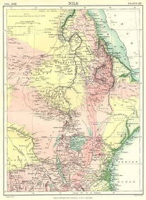
NILE VALLEY. Sudan Tanzania Ethiopia Uganda Lake Victoria. Britannica. 1898 mapJasper524.5(9.9k)See Sold PriceFeb 28, 2024
NIGERIA early explorers' routes. Lake Chad. Yariba Houssa Borgou SDUK 1844 mapJasper524.5(9.9k)See Sold PriceFeb 28, 2024
Central Africa. Map showing great forest traversed by Mr Stanley, 1890Jasper524.5(9.9k)See Sold PriceFeb 28, 2024
NUBIA. 'Nubie'. Nile Valley. Sudan Ethiopia Egypt. MALLET 1683 old antique mapJasper524.5(9.9k)See Sold PriceFeb 28, 2024
NIGERIA w/ early explorers' routes. Lake Chad Yariba Houssa Borgou.SDUK 1844 mapJasper524.5(9.9k)See Sold PriceFeb 28, 2024


![[MAP]. [ALBRIZZI, Giambatista, 1698-1777]. Carta Geografica... (1 of 1)](https://p1.liveauctioneers.com/928/318880/171361280_1_x.jpg?height=282&quality=70&version=1707501302)