ATLAS of ANTIENT GEOGRAPHY by SAMUEL BUTLER 1843John McInnis Auctioneers,LLC4.6(502)See Sold PriceFeb 24, 2024
18TH C. ANTIQUE MAP: FRENCH & INDIAN WAR, FRAMEDThomaston Place Auction Galleries4.4(386)See Sold PriceFeb 24, 2024
Rand McNally Railroad Map Cabinet w/ 21 Railroad MapsRail & Road Auctions4.6(165)See Sold PriceMar 08, 2024
Keith Haring - Ink on New York Map, Best Buddies, Inscribed, Signed, and DatedSapphire Auction Gallery4(67)See Sold PriceMar 02, 2024
LATE 17TH C. FRENCH MAP OF THE NEW WORLD BY ALEXIS-HUBERT JAILLOT (1632-1712)Thomaston Place Auction Galleries4.4(386)See Sold PriceFeb 24, 2024
Central Railroad of New Jersey Map of Sandy Hook Route-ca. 1903JM Hobby Supply and Railroad Artifact Auctions4.4(126)See Sold PriceFeb 24, 2024
Lot of Six Mixed Atlas Box Cars-HO Scale-New in BoxJM Hobby Supply and Railroad Artifact Auctions4.4(126)See Sold PriceFeb 25, 2024
Rand McNally/Santa Fe Railroad Map of Iowa-1912JM Hobby Supply and Railroad Artifact Auctions4.4(126)See Sold PriceFeb 24, 2024
NICOLAES VISSCHER (NETHERLANDS, 1618-1709) MAP OF THE NEW WORLDThomaston Place Auction Galleries4.4(386)See Sold PriceFeb 24, 2024
17TH C. WORLD MAP BY NICOLAES VISSCHER (NETHERLANDS, 1618-1709)Thomaston Place Auction Galleries4.4(386)See Sold PriceFeb 24, 2024
Lot of Six Mixed Atlas Cabooses-HO Scale-New in BoxJM Hobby Supply and Railroad Artifact Auctions4.4(126)See Sold PriceFeb 25, 2024
Schraembl: Antique Map of Cape of Good Hope, 1789Map: Das Vorgebirg der guten Hoffnung Cartographer: Schraembl Place & Date: Vienna / 1789 Size: 13" x 19 1/2" Condition: wash color; overall age toning, tiny repaired hole in cartouche Schraembl's draSee Sold Price
Schraembl: Map of Cape of Good Hope, 1789Map: Das Vorgebirg der guten Hoffnung Cartographer: Schraembl Place & Date: Vienna / 1789 Size: 13" x 19 1/2" Schraembl's dramatic, and beautifully engraved and colored map of the Cape of Good Hope, aSee Sold Price
Schraembl: Map of the Cape of Good Hope, 1789Das Vorgebirg der guten Hoffnung. Schraembl's dramatic, and beautifully engraved and colored map of the Cape of Good Hope, after de la Rochette, with many place names and topographical details, two keSee Sold Price
Schraembl: Cape of Good HopeCartographer: Schraembl Place & Date: Vienna / 1789 Size: 13" x 19 1/2" Condition: tiny repaired hole in cartouche Schraembl's dramatic, and beautifully engraved and colored map of the Cape of Good HoSee Sold Price
SoldWeller: Antique Map of Cape of Good Hope, 1863TITLE/CONTENT OF MAP: 'Cape of Good Hope Natal &c.' Districts municipalities. South Africa. DATE PRINTED: 1863 IMAGE SIZE: Approx 44.5 x 66.0cm, 17.5 x 26 inches (Large); Please note that this is a foSee Sold Price
Weller: Antique Map of Cape of Good Hope, 1863Title/Content of Map: 'Cape of Good Hope Natal &c.' Districts municipalities. South Africa. Date Printed: 1863 Image Size: Approx 44.5 x 66.0cm, 17.5 x 26 inches (Large); Please note that this is a foSee Sold Price
SoldMaps C1840-1905 Mixed Lot of 10 Antique MapsIncl Cape of Good Hope, Monmouthshire, South America, North Asia, East Canada, West Siberia, Scotland, Greece, Russia, and Turkey. Examples by Encyclopaedia Brittannica, Stieler, Butler, and Moule. PaSee Sold Price
CAPE OF GOOD HOPE/NATAL Districts municipalities. SouthTITLE/CONTENT OF MAP: 'Cape of Good Hope Natal &c.' DATE PRINTED: 1863 IMAGE SIZE: Approx 44.5 x 66.0cm, 17.5 x 26 inches (Large); Please note that this is a folding map. TYPE: Antique map with originSee Sold Price
CAPE OF GOOD HOPE/NATAL Districts municipalities. SouthTITLE/CONTENT OF MAP: 'Cape of Good Hope Natal &c.' DATE PRINTED: 1863 IMAGE SIZE: Approx 44.5 x 66.0cm, 17.5 x 26 inches (Large); Please note that this is a folding map. TYPE: Antique map with originSee Sold Price
-. Schraembl (E. A.) Das Vorgebirg Der Guten Hofnu-. Schraembl (E. A.) Das Vorgebirg Der Guten Hofnungmap of South America illustrating the Cape of Good Hope, with decorative title cartouche showing an elephant hunt, engraved map, with originSee Sold Price
SoldFAMRS Schraembl (E. A.) Das Vorgebirg Der Guten HoFAMRS Schraembl (E. A.) Das Vorgebirg Der Guten Hofnungmap of South America illustrating the Cape of Good Hope, with decorative title cartouche showing an elephant hunt, engraved map, with oriSee Sold Price
Weller: Map of Cape of Good Hope/Natal Districts, 1863TITLE/CONTENT OF MAP: 'CAPE OF GOOD HOPE/NATAL Districts municipalities. South Africa.' This map is folding hence the centrefold line may show on the image below DATE PRINTED: 1863 IMAGE SIZE: ApproxSee Sold Price
CAPE OF GOOD HOPE/NATAL Districts municipalities. SouthTITLE/CONTENT OF MAP: 'Cape of Good Hope Natal &c.' This map is folding hence the centrefold line may show on the image below DATE PRINTED: 1863 IMAGE SIZE: Approx 44.5 x 66.0cm, 17.5 x 26 inches (LarSee Sold Price
Didot/Bellin: Map of Cape of Good Hope, 1748Map: Carte De La Baye De La Table Et Rade Du Cap Du Bon Esperance Dressee Sur Divers Manuscrits..." Publication Date: 1748 Size: Quarto – 10.50 H x 6.80 W Inches Authors: Didot, Bellin, N. PublisherSee Sold Price
1726 Valentyn Map of the Cape of Good Hope -- Nieuwe Kaart van Caap der Goede Hoop…Title: 1726 Valentyn Map of the Cape of Good Hope -- Nieuwe Kaart van Caap der Goede Hoop… Cartographer: F Valentyn Year / Place: 1726 c. Dordrecht and Amsterdam Map Dimension (in.): 22.3 X 17.6See Sold Price
1726 Valentyn Map of the Cape of Good Hope -- Nieuwe Kaart van Caap der Goede Hoop…Title: 1726 Valentyn Map of the Cape of Good Hope -- Nieuwe Kaart van Caap der Goede Hoop… Cartographer: F Valentyn Date/Place: 1726 c. Dordrecht and Amsterdam Dimensions: 22.3 X 17.6 in. DescriSee Sold Price
1726 Valentyn Map of the Cape of Good Hope -- Nieuwe Kaart van Caap der Goede Hoop…Title: 1726 Valentyn Map of the Cape of Good Hope -- Nieuwe Kaart van Caap der Goede Hoop… Cartographer: F Valentyn Year / Place: 1726 c. Dordrecht and Amsterdam Map Dimension (in.): 22.3 X 17.6See Sold Price
1800s Map of the Cape of Good Hope19th century. A map of the Cape of Good Hope; very good condition. Measures 17 x 11 inches.See Sold Price
Sold2 Various Early Maps of the Cape of Good Hope Inc2 Various Early Maps of the Cape of Good Hope Including 'General Chart in the Years 1797 & 1798' published 1800 by Cadell & Davies; & 'A Plan of the Town… taken by Mons Bourset Dec, 1770,' publishedSee Sold Price
SoldLakeman (Balthazar, Publisher) Nieuwe Caarte van KLakeman (Balthazar, Publisher) Nieuwe Caarte van Kaap de Goede Hoop en't Zuyderdeel van Africa ...,map of Africa, with an inset map of the Cape of Good Hope and an inset plan of it's fortificaSee Sold Price
SoldVisscher (Nicolas) Carte de l'Afrique MeridionaleVisscher (Nicolas) Carte de l'Afrique Meridionale ou Pays entre la Ligne ... et l'Isle de Madagascar,map of Africa and Madagascar, with inset maps of the Cape of Good Hope, and Table Mountain,See Sold Price
1886 South Africa MapAuthor: Blackie Title: 1886 South Africa Map Medium: Ink on Paper Dimensions: 21"X15" Map of the Cape of Good Hope-modern day South Africa dated 1886. Considered one of the most important trade routesSee Sold Price
SoldSchraembl: Antique Map of Gulf of Mexico, 1789Map: Untitled map of the Gulf of Mexico and Central America Cartographer: F.A. Schraembl Place & Date: Vienna / 1789 Size: 23 1/4" x 20" Condition: outline color; light overall age toning A scarce andSee Sold Price
Map of Colony of the Cape of Good Hope, 1805Map: Colony of the Cape of Good Hope Maker: Arrowsmith & Lewis, Arrowsmith & Lewis Publication Date: 1805 Publisher: Arrowsmith & LewisSize: Quarto – 8.00 H x 9.90 W Inches "From Mr. Barrow's SurveySee Sold Price
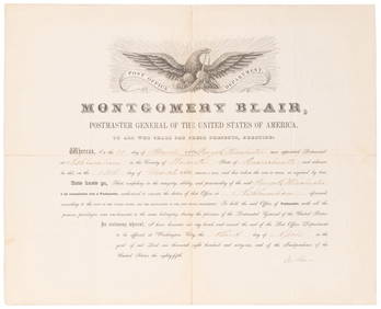
SOMERSET, Lord Charles (1767-1831) and BLAIR, Montgomery (1...Potter & Potter Auctions4.6(539)See Sold PriceMar 07, 2024
AFRICAN PORTS.Alexandria Cape Town Cairo Port Natal(Durban).JOHNSTON 1906 mapJasper524.5(9.8k)See Sold PriceFeb 28, 2024
Southern Africa Cape of Good Hope-Madagascar ADMIRALTY sea chart 1935 (1955) mapJasper524.5(9.8k)See Sold PriceFeb 28, 2024
Coste Occidentale d’Afrique…' Arguin Bay Cap Blanc Mauritania. BELLIN 1746 mapJasper524.5(9.8k)See Sold PriceFeb 28, 2024
SOUTHERN AFRICA. Congo British/Portuguese/German East Africa Rhodesia 1912 mapJasper524.5(9.8k)See Sold PriceFeb 28, 2024
West coast of Africa from Cape Blanco… Arguin bay, Mauritania. LABAT 1745 mapJasper524.5(9.8k)See Sold PriceFeb 28, 2024
Coast & Islands between Cape Roxo. Guinea-Bissau & Bissagos. KITCHIN 1745 mapJasper524.5(9.8k)See Sold PriceFeb 28, 2024
Carte du Canal de Mosambique…. Madagascar Bonne Esperance. BONNE 1780 mapJasper524.5(9.8k)See Sold PriceFeb 28, 2024
Coste Orientale d’Afrique…' South Africa. Mozambique channel. BELLIN 1746 mapJasper524.5(9.8k)See Sold PriceFeb 28, 2024
Bougainville's 1766 circumnavigation. France-Africa-Réunion. GENTS MAG 1774 mapJasper524.5(9.8k)See Sold PriceFeb 28, 2024
Coste Occidentale d’Afrique'. Bay of Arguin, Mauritania. BELLIN/SCHLEY 1747 mapJasper524.5(9.8k)See Sold PriceFeb 28, 2024
Bougainville's 1766 circumnavigation. France-Africa-Réunion. GENTS MAG 1774 mapJasper524.5(9.8k)See Sold PriceFeb 28, 2024
Oiseaux de Guinée'. West African birds. Parrots. Cape Coast eagle 1748 printJasper524.5(9.8k)See Sold PriceFeb 28, 2024
Johnson's Africa. Colonies & tribes. Liberia Nile Delta Cape Colony 1866 mapJasper524.5(9.8k)See Sold PriceFeb 28, 2024
East coast of Africa from the Cape… South Africa Mozambique. CHILD 1745 mapJasper524.5(9.8k)See Sold PriceFeb 28, 2024
AFRICA NW & SOUTH. Maghreb. Cape Colony electoral divisions. JOHNSTON 1906 mapJasper524.5(9.8k)See Sold PriceFeb 28, 2024
Partie de la Coste de Guinée'. Sierra Leone & Liberia coast. BELLIN 1747 mapJasper524.5(9.8k)See Sold PriceFeb 28, 2024
Coste Orientale d’Afrique'. South Africa Mozambique BELLIN/SCHLEY 1747 mapJasper524.5(9.8k)See Sold PriceFeb 28, 2024
SOUTHERN AFRICA & MALAY ARCHIPELAGO. Cape Colony Indonesia &c. BUTLER 1888 mapJasper524.5(9.8k)See Sold PriceFeb 28, 2024
French West Africa. Gold Coast. Sahara desert sand dunes. TIMES 1956 mapJasper524.5(9.8k)See Sold PriceFeb 28, 2024
SOUTHERN AFRICA Monomotapa (Mutapa Kingdom) Cafrerie (Kaffraria) MALLET 1683 mapJasper524.5(9.8k)See Sold PriceFeb 28, 2024
AFRICAN ISLANDS.Mauritius Madagascar Madeira Canaries St Helena 1897 old mapJasper524.5(9.8k)See Sold PriceFeb 28, 2024
Coste Occidentale d’Afrique…' Namibia South Africa Angola coast BELLIN 1746 mapJasper524.5(9.8k)See Sold PriceFeb 28, 2024
Churchill & Nieuhof 1744 Folio Map. Cape of Good Hope, South AfricaAlbion Auctions4.6(336)See Sold PriceMar 01, 2024