ATLAS of ANTIENT GEOGRAPHY by SAMUEL BUTLER 1843John McInnis Auctioneers,LLC4.5(505)See Sold PriceFeb 24, 2024
18TH C. ANTIQUE MAP: FRENCH & INDIAN WAR, FRAMEDThomaston Place Auction Galleries4.4(394)See Sold PriceFeb 24, 2024
Rand McNally Railroad Map Cabinet w/ 21 Railroad MapsRail & Road Auctions4.6(165)See Sold PriceMar 08, 2024
Keith Haring - Ink on New York Map, Best Buddies, Inscribed, Signed, and DatedSapphire Auction Gallery4.1(67)See Sold PriceMar 02, 2024
LATE 17TH C. FRENCH MAP OF THE NEW WORLD BY ALEXIS-HUBERT JAILLOT (1632-1712)Thomaston Place Auction Galleries4.4(394)See Sold PriceFeb 24, 2024
Central Railroad of New Jersey Map of Sandy Hook Route-ca. 1903JM Hobby Supply and Railroad Artifact Auctions4.4(127)See Sold PriceFeb 24, 2024
Lot of Six Mixed Atlas Box Cars-HO Scale-New in BoxJM Hobby Supply and Railroad Artifact Auctions4.4(127)See Sold PriceFeb 25, 2024
Rand McNally/Santa Fe Railroad Map of Iowa-1912JM Hobby Supply and Railroad Artifact Auctions4.4(127)See Sold PriceFeb 24, 2024
NICOLAES VISSCHER (NETHERLANDS, 1618-1709) MAP OF THE NEW WORLDThomaston Place Auction Galleries4.4(394)See Sold PriceFeb 24, 2024
17TH C. WORLD MAP BY NICOLAES VISSCHER (NETHERLANDS, 1618-1709)Thomaston Place Auction Galleries4.4(394)See Sold PriceFeb 24, 2024
Lot of Six Mixed Atlas Cabooses-HO Scale-New in BoxJM Hobby Supply and Railroad Artifact Auctions4.4(127)See Sold PriceFeb 25, 2024
SoldMap of Palestine in Three Sections, 1947Map of Palestine in three sections. Published by the Palestine Surveys Department, Government of Palestine, Jaffa, 1947. 3 large maps, each containing a different section of Palestine. Average dimensiSee Sold Price
Large Palestine Map Poster - Land in Dispute - 1947Large double sided poster showing a map of the partition plan for Palestine, suggested by the United Nations, together with two other related maps. The other side shows three items of current affairs,See Sold Price
SoldLarge Palestine Map Poster - Land in Dispute - 1947Large double sided poster showing a map of the partition plan for Palestine, suggested by the United Nations, together with two other related maps. The other side shows three items of current affairs,See Sold Price
SoldColorado Central Railroad Map 1885 (121151)This is a map of three sections of the Colorado Central Railroad depicting the Colorado Central from Denver west; The Georgetown Loop, and Georgetown Breckenridge and Leadville RR. Scales vary on eachSee Sold Price
SoldSurvey of Palestine. - A Map of Palestine in Three3 Ordnance Survey maps with accompanying sheet of 'List of Jewish settlements, established before November 1, 1946, but not yet shown on the 1:250 000 map', 3 colour-printed map sheets, each c.795 x 6See Sold Price
SoldIntroduction A Leeriture Sainte…Lyon, 1699.Introduction A Leeriture Sainte – preface to the holy scriptures – by Bernard Lamy. Lyon, 1699. Three sections. Maps, engravings. [2], 8, [20], 423, [60] pages, 26 cm. French. Quality paSee Sold Price
SoldHistoire Des Juifs. Amsterdam, 1728. Maps (3)Jewish history. With three maps. Section two of three. Original leather binding. Moderate condition.See Sold Price
Sold15-drawer map caseHeading: (Map Case) Author: Title: Fifteen-drawer map case in three stacking sections Place Published: No place Publisher: Date Published: No date Description: Overall 131See Sold Price
SoldStages in fulfilling the Zionist dream - JNF, 1947.Stages in fulfilling the Zionist dream - JNF, 1947. Poster-map. (Three maps, in different stages) 40x55 cm. Excellent condition! Hebrew: שלבים בהגשSee Sold Price
SoldMAP OF THE WORLD IN THREE SECTIONS 1777With tracks of Lord Mulgrave and Captain Cook, engraved by A. Bell. Matted, 9.5 x 16.75 inch sight size. Not examined outside of wrappings, appears excellent.See Sold Price
SoldA Map of the World in Three SectionsEngraved map marked plate CCXIII, titled "Geography A Map of the World in Three Sections Describing the Polar Regions to The Tropics. In Which Are Traced the Tracts of Lord Mulgrave and Captain Cook.See Sold Price
SoldPalestine Map - Partition Plan - 1947Map of the partition plan for Palestine, as suggested by the United Nations. Published by the Education Department, Zionist Organization of America. NY, USA. Apparently 1947. Approximately 69X34 cm. GSee Sold Price
Sold1782 New Map of the World Navigation Routes“A New Map of the World in Three Sections wherein the several tracks and discoveries of the British Navigators to the present time are distinctly and accurately laid down”, by J. Bayly, printed atSee Sold Price
SoldMap of the World, Bell, 1778Map, double hemisphere, a Map of the World in three Sections, London 1778, Describing the Polar Regions to the tropics which trace the travels of Lord Mulgrave and Captain Cook, the map depicts theirSee Sold Price
Polar.- Captain Cook.- Bell (Andrew) Geography A Map ofPolar.- Captain Cook.- Bell (Andrew) Geography A Map of the World in Three Sections, Describing the Polar Regions to the Tropics In Which Are Traced the Tracts of Lord Mulgrave and Captain Cook TowardSee Sold Price
Statistique Et Historique De La Jamaique, 1825Map: Carte Geographique, Statistique Et Historique De La Jamaique Maker: Buchon Date: 1825 Size: Folio, 11.3 inches high x 11.8 inches wide Map showing island divided into three sections separately coSee Sold Price
Part of Section Three, New York City MapDepicts Gramercy. Plate 14. 1902. G.W. Bromley & Co. Philadelphia. Hand-colored lithograph.; 22 1/2" x 32"See Sold Price
Part of Section Three, New York City MapDepicts lower midtown. Plate 17. 1902. G.W. Bromley & Co. Philadelphia. Hand-colored lithograph. Condition: Discoloration.; 22 1/2" x 32"See Sold Price
SoldIsaak Tirion (1705-1765, Dutch), "Grondvlatke van NieuwIsaak Tirion (1705-1765, Dutch), "Grondvlatke van Nieuw Orleans, de Hoofstad van Louisiana...", Amsterdam, 1769, three engraved maps on one sheet, divided into three sections, the first is one of theSee Sold Price
SoldGrp: 6 Maps of South AmericaGroup of six maps of South America. Includes two maps of the continent overall; three maps of the southern section of South America, including Argentina, Chile, Paraguay, Uruguay, Bolivia, and in oneSee Sold Price
SoldBritain.- Cary (John, publisher) Cary's New Map ofBritain.- Cary (John, publisher) Cary's New Map of England and Wales with Part of Scotland, complete with all 81 sheets, engraved map hand-coloured in outline, divided into three sections, each approxSee Sold Price
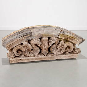
SoldThree Sided Serving Bowl Empire EnglandThree-Section Serving Dish, Empire Porcelain Co., England, 1947. This open handled sectioned dish is ivory ground with a gold filigree overlay. It also has three different scenes depicting Greek mythoSee Sold Price
SoldOak 12 drawer 3 section map case.Oak 12 drawer map case with original hardware signed "Library Bureau - Makers". Three sections plus lid. Clean overall condition - slight lifting to oak veneer top,See Sold Price
SoldOlive Wood Spice Tower. Jerusalem, Palestine, Beginning24 cm. tall; 5 cm. wide. Three sections that screw together. 4 sides of the case feature carving and engraving work of holy sites: the Western Wall, Davidian Dynasty, Temple Mount, Rachel's Tomb. StamSee Sold Price
Egg Sorting Cards - Tnuva Company - Palestine, 1947Levy Auction House4.3(11)See Sold PriceFeb 27, 2024
Rand McNally Railroad Map Cabinet w/ 21 Railroad MapsRail & Road Auctions4.6(165)See Sold PriceMar 08, 2024
Maciel Large Sterling Silver Three Section Bowl Floral Design Hand HammeredMynt Auctions4.6(711)See Sold PriceMar 01, 2024
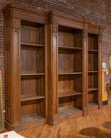
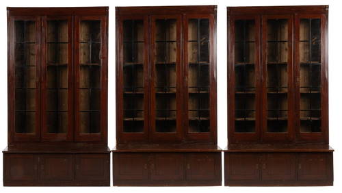
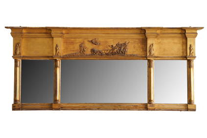
Three Sections of French Tin Painted Iron Crown Wall Molding, 19th c., H.- 11 in., W.- Longer- 57Crescent City Auction Gallery4.3(233)See Sold PriceMar 08, 2024
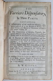
FIRST EDITION, ENGLISH-LANGUAGE MEDICAL BOOK ON HORSE DISEASES PUBLISHED IN 1721 BY FARRIERS.NY Elizabeth 4.1(88)See Sold PriceMar 03, 2024
Book Of North American Birds by The Readers DigestRapid Estate Liquidators and Auction Gallery4.5(1.1k)See Sold PriceFeb 27, 2024