ATLAS of ANTIENT GEOGRAPHY by SAMUEL BUTLER 1843John McInnis Auctioneers,LLC4.5(505)See Sold PriceFeb 24, 2024
18TH C. ANTIQUE MAP: FRENCH & INDIAN WAR, FRAMEDThomaston Place Auction Galleries4.4(393)See Sold PriceFeb 24, 2024
Rand McNally Railroad Map Cabinet w/ 21 Railroad MapsRail & Road Auctions4.6(165)See Sold PriceMar 08, 2024
Keith Haring - Ink on New York Map, Best Buddies, Inscribed, Signed, and DatedSapphire Auction Gallery4(67)See Sold PriceMar 02, 2024
LATE 17TH C. FRENCH MAP OF THE NEW WORLD BY ALEXIS-HUBERT JAILLOT (1632-1712)Thomaston Place Auction Galleries4.4(393)See Sold PriceFeb 24, 2024
Central Railroad of New Jersey Map of Sandy Hook Route-ca. 1903JM Hobby Supply and Railroad Artifact Auctions4.4(127)See Sold PriceFeb 24, 2024
Lot of Six Mixed Atlas Box Cars-HO Scale-New in BoxJM Hobby Supply and Railroad Artifact Auctions4.4(127)See Sold PriceFeb 25, 2024
Rand McNally/Santa Fe Railroad Map of Iowa-1912JM Hobby Supply and Railroad Artifact Auctions4.4(127)See Sold PriceFeb 24, 2024
NICOLAES VISSCHER (NETHERLANDS, 1618-1709) MAP OF THE NEW WORLDThomaston Place Auction Galleries4.4(393)See Sold PriceFeb 24, 2024
17TH C. WORLD MAP BY NICOLAES VISSCHER (NETHERLANDS, 1618-1709)Thomaston Place Auction Galleries4.4(393)See Sold PriceFeb 24, 2024
Lot of Six Mixed Atlas Cabooses-HO Scale-New in BoxJM Hobby Supply and Railroad Artifact Auctions4.4(127)See Sold PriceFeb 25, 2024
SoldJ & C Walker World Folding Map, laid on canvas andJ & C Walker World Folding Map, laid on canvas and framed, "To her most Gracious Majesty, Queen Victoria. This map of the world on mercator's projection is most respectfully dedicated by her devoted sSee Sold Price
SoldIndia.- Allen & Co. (William H.) Map of the WesternIndia.- Allen & Co. (William H.) Map of the Western Provinces of Hindoostan, The Punjab, Rajpootana, Sinde, Kabool &c., large and impressive folding map by J. & C. Walker, including parts of AfghanistSee Sold Price
Walker World Map, 1840J. & C. Walker To Her Most Gracious Majesty Queen Victoria... Hand-colored Copperplate Engraving London, 1840 Sheet: 56" x 63 3/4"; Framed: 61 1/2" x 70" Decorative large format case map of the World,See Sold Price
SoldJ & C Walker Map of the County Palatine of DurhamJ & C Walker coloured engraving, Map of the County Palatine of Durham, 1840, 32 x 40 ins. canvas backed, slip case.See Sold Price
SoldMaps (5)Folding map of, Isle of Wight, Hampshire, by J. & C. Walker, printed Longman Thirsk Rose Orme & Co., July 1st 1840; a folding map of Surrey published George Phillip & Son London & Liverpool; an 18th cSee Sold Price
Sold1845 HOBSON1845 HOBSON'S NEW SURVEY OF YORKSHIRE, FOLDING MAPS IN BOOK, ENGRAVED BY J & C WALKER, PUBLISHED BY WILLIAM COLLING HOBSON, NICE ESTATE CONDITION, WHEN OPENED EACH MAP MEASURES 50" X 33", AS PICTUREDSee Sold Price
SoldMaps (5)Folding map of, Isle of Wight, Hampshire, by J. & C. Walker, printed Longman Thirsk Rose Orme & Co., July 1st 1840; a folding map of Surrey published George Phillip & Son London & Liverpool; an 18th cSee Sold Price
SoldWorld On Mercator's ProjectionReserve Reduced! Title/Content of Map: World On Mercator's Projection Date: c1870 Cartographer: WALKER, J. & C. Material/Medium: EDWARD STANFORD/S.D.U.K. Size: 15.5Height - 24Width Two sheets joined.See Sold Price
SoldJ.&C. Walker hand-colored world map 1855Heading: Author: Walker, J. and C. Title: To Her Most Gracious Majesty Queen Victoria, This Map of the World on Mercator's Projection is Most Respectfully Dedicated... Place Published: Holborn, [LondSee Sold Price
World On Mercator's ProjectionTitle/Content of Map: World On Mercator's Projection Date Printed: 1840-03-15 Cartographer: WALKER, J. & C. Material/Medium: SOCIETY FOR THE DIFFUSION OF USEFUL KNOWLEDGE Size: 15.3X24 Two sheet worldSee Sold Price
World On Mercator's ProjectionTitle/Content of Map: World On Mercator's Projection Date: 1841-03-15 Cartographer: WALKER, J. & C. Size: 15.3Height - 23.8Width Publisher: SOCIETY FOR THE DIFFUSION OF USEFUL KNOWLEDGE/S.D.U.K. MisfoSee Sold Price
World On Mercator's ProjectionReserve Reduced! Title/Content of Map: World On Mercator's Projection Date: 1840-03-15 Cartographer: WALKER, J. & C. Material/Medium: SOCIETY FOR THE DIFFUSION OF USEFUL KNOWLEDGE Size: 15.3Height - 2See Sold Price
SoldLieut. William Lord RN, A Chart of the Approaches toLieut. William Lord RN, A Chart of the Approaches to Liverpool, coloured folding engraving by J & C Walker for Daniel Mason, 1854, the large dissected map in slip case, 124 x 145cmSee Sold Price
Sold2 Steel engraved mapsMap of Ancient Greek engraved by J. & C. Walker, laid down. 9 1/2 x 14'' together with an engraved map of ''Constantinople with Its Suburbs''- engraved by J. Dover, good condition. 9 x 11''See Sold Price
SDUK Principal Rivers of the World“A map of the Principal Rivers shewing Their Courses, Countries, and Comparative Lengths.” London: Baldwin & Gradock, 1834. 15 1/2 x 12 1/4. Engraving by J.&C. Walker. Original outline color. VerySee Sold Price
AMERICAS. Gnomonic Projection. Texas Republic. USA Mexico. SDUK 1846 old mapTitle: AMERICAS. Gnomonic Projection. Texas Republic. USA Mexico. SDUK 1846 old map Description: WORLD ON GNOMONIC PROJECTION, II., America' by Engraved by J & C Walker (1846). Antique steel engravedSee Sold Price
SoldWalker (J. & C.) - Walker's Map of the Great Westernshowing from London to Bristol, lithographed map, 150 x 760 mm., light offsetting, spotting and surface dirt, folding concertina style into contemporary cloth covered boards, with printed label attachSee Sold Price
SoldLOT (6) MAPS-WORLD AND THE CONTINENTS, JOHN WALKERLOT (6) MAPS-WORLD AND THE CONTINENTS, JOHN WALKER DUBLIN, C.1788. (1) 7 3/8 X 12 1/2"; FRAMED AND GLAZED 15 X 20"; (5) 7 1/2 X 9", FRAMED AND GLAZED 15 X 16 1/2"See Sold Price
SoldWalker (J. & C.) A Geological Map of England and Wales,Walker (J. & C.) A Geological Map of England and Wales, showing also the Inland Navigation by means of Rivers & Canals, with their Elevation in feet above the Sea, later issue, large folding hand-coloSee Sold Price
SoldWyld (James) Wyld's Map of the Superficial GeologyWyld (James) Wyld's Map of the Superficial Geology of London and its Environs,dissected onto linen, coloured, folding into cloth binder, 530 x 700mm, [c.1890] § Walker (J. & C.) Cumberland, enSee Sold Price
SoldRussia.- Walker (J. & C.) The Euxine or Black Sea fromNO RESERVE Russia.- Walker (J. & C.) The Euxine or Black Sea from the Russian Survey of 1836, engraving on laid paper, 690 x 980 mm. (27 1/4 x 38 5/8 in), several large tears well into the map, roughSee Sold Price
World On Mercator's ProjectionTitle: World On Mercator's Projection Publication Date: 1841-03-15 Cartographer:WALKER, J. & C. Publisher: SOCIETY FOR THE DIFFUSION OF USEFUL KNOWLEDGE/S.D.U.K. Brief Description: Misfolded at centerSee Sold Price
SoldRoost, Gronen, Wenng, ''Wand~Karte von Asien,'' 1[Asia/Old World]. J.B. Roost, Eduard Gronen, and C. Wenng. Wand~Karte Von Asien, Europa u. der Nord-ostl. Kuste von Africa. Lithographed folding map of the Eurasian continent, from Scandanavia to IndoSee Sold Price
SoldLavoisne (C.V.) Chart of the World[Lavoisne (C.V.)] Chart of the World, as known to the Ancients,... Division of the Earth among the Posterity of Noah, 2 maps on one sheet, engraved by J. Walker, with full original hand-colourSee Sold Price
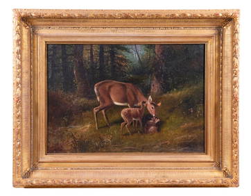
LATE 19TH C. AMERICAN WILDLIFE PAINTINGThomaston Place Auction Galleries4.4(393)See Sold PriceFeb 24, 2024
17TH C. WORLD MAP BY NICOLAES VISSCHER (NETHERLANDS, 1618-1709)Thomaston Place Auction Galleries4.4(393)See Sold PriceFeb 24, 2024
LATE 17TH C. FRENCH MAP OF THE NEW WORLD BY ALEXIS-HUBERT JAILLOT (1632-1712)Thomaston Place Auction Galleries4.4(393)See Sold PriceFeb 24, 2024
18TH C. ANTIQUE MAP: FRENCH & INDIAN WAR, FRAMEDThomaston Place Auction Galleries4.4(393)See Sold PriceFeb 24, 2024
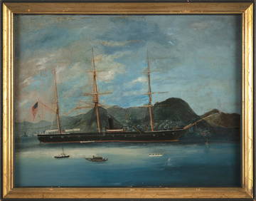
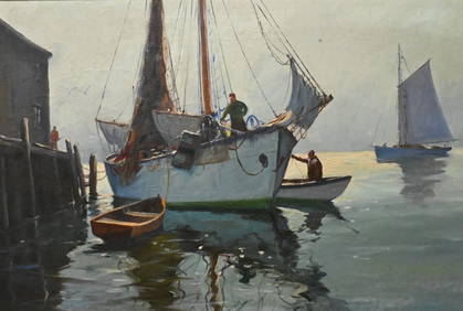
CHINESE SCHOOL (19th Century,), An American ship entering Hong Kong., Oil on canvas laid down onEldred's4.7(419)See Sold PriceFeb 27, 2024
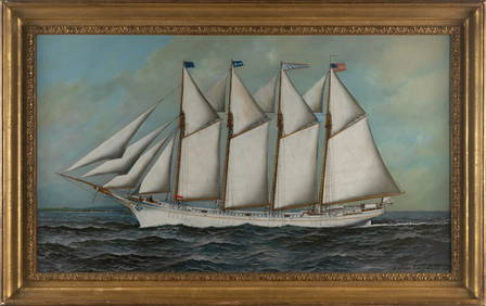
ANTONIO NICOLO GASPARO JACOBSEN (New York/New Jersey/Denmark, 1850-1921), The Jessie A. Bishop atEldred's4.7(419)See Sold PriceFeb 27, 2024
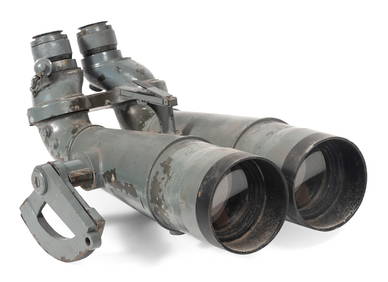
PAIR OF WORLD WAR II JAPANESE NAVAL BINOCULARS CAPTURED BY H.M.S. "EURYALUS" 1943-1945 Case heightEldred's4.7(419)See Sold PriceFeb 27, 2024
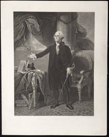
George Washington. 5 prints. 19th century. To include: 1) Large engraved portrait after StuartTremont Auctions4.5(297)See Sold PriceFeb 25, 2024
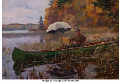
J.J. Enwright (C. Hjalmar Amundsen) (American 1911-2001)Nadeau's Auction Gallery4.7(409)See Sold PriceFeb 24, 2024
William Merritt Chase (American, 1849-1916) - Tony with a Red CapFreeman's | Hindman4.5(158)See Sold PriceFeb 28, 2024
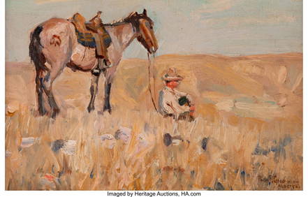
46002: Philip Russell Goodwin (American, 1881-1935) A QHeritage Auctions4.1(510)See Sold PriceMar 20, 2024
46028: Philip Russell Goodwin (American, 1881-1935) A CHeritage Auctions4.1(510)See Sold PriceMar 20, 2024
1675 ELZEVIER JULIUS CAESAR antique ILLUSTRATED w/ MAPS ROMAN HISTORYJasper524.5(9.9k)See Sold PriceFeb 27, 2024
Railways & Transport.- [Prospectus] The Dorking, Brighton, and Arundel Atmospheric Railway, byForum Auctions4.3(53)See Sold PriceFeb 29, 2024
Macena Alberta Barton (American, 1901-1986) Self-PortraitFreeman's | Hindman4.4(1.6k)See Sold PriceMar 07, 2024
The Otis Lithograph Company, Carter the GreatToomey & Co. Auctioneers4.7(392)See Sold PriceFeb 29, 2024
THE WHOLE CHRONICLE OF POLYBIUS ANCIENT IN ENGLISH, 1756NY Elizabeth 4.2(86)See Sold PriceMar 03, 2024
1675: ANTIQUE ILLUSTRATED JULIUS CAESAR MAPS OF ROMAN HISTORYNY Elizabeth 4.2(86)See Sold PriceMar 03, 2024


![Railways & Transport.- [Prospectus] The Dorking, Brighton, and Arundel Atmospheric Railway, by (1 of 1)](https://p1.liveauctioneers.com/5458/319736/171654703_1_x.jpg?height=282&quality=70&version=1708010439)