ATLAS of ANTIENT GEOGRAPHY by SAMUEL BUTLER 1843John McInnis Auctioneers,LLC4.6(502)See Sold PriceFeb 24, 2024
18TH C. ANTIQUE MAP: FRENCH & INDIAN WAR, FRAMEDThomaston Place Auction Galleries4.4(386)See Sold PriceFeb 24, 2024
Rand McNally Railroad Map Cabinet w/ 21 Railroad MapsRail & Road Auctions4.6(165)See Sold PriceMar 08, 2024
Keith Haring - Ink on New York Map, Best Buddies, Inscribed, Signed, and DatedSapphire Auction Gallery4(67)See Sold PriceMar 02, 2024
LATE 17TH C. FRENCH MAP OF THE NEW WORLD BY ALEXIS-HUBERT JAILLOT (1632-1712)Thomaston Place Auction Galleries4.4(386)See Sold PriceFeb 24, 2024
Central Railroad of New Jersey Map of Sandy Hook Route-ca. 1903JM Hobby Supply and Railroad Artifact Auctions4.4(126)See Sold PriceFeb 24, 2024
Lot of Six Mixed Atlas Box Cars-HO Scale-New in BoxJM Hobby Supply and Railroad Artifact Auctions4.4(126)See Sold PriceFeb 25, 2024
Rand McNally/Santa Fe Railroad Map of Iowa-1912JM Hobby Supply and Railroad Artifact Auctions4.4(126)See Sold PriceFeb 24, 2024
NICOLAES VISSCHER (NETHERLANDS, 1618-1709) MAP OF THE NEW WORLDThomaston Place Auction Galleries4.4(386)See Sold PriceFeb 24, 2024
17TH C. WORLD MAP BY NICOLAES VISSCHER (NETHERLANDS, 1618-1709)Thomaston Place Auction Galleries4.4(386)See Sold PriceFeb 24, 2024
Lot of Six Mixed Atlas Cabooses-HO Scale-New in BoxJM Hobby Supply and Railroad Artifact Auctions4.4(126)See Sold PriceFeb 25, 2024
d'Anville: Antique Map of Africa, 1749Afrique publiée sous les auspices [du] Duc d'Orleans. This large eighteenth century map of Africa includes the "Pays des Hotentots" (in modern South Africa), "Etat de Manomotapa" (Mozambique), AbyssiSee Sold Price
d'Anville: Antique Map of Africa, 1749This large eighteenth century map of Africa includes the "Pays des Hotentots" (in modern South Africa), "Etat de Manomotapa" (Mozambique), Abyssinia, Egpyt, Nubia, the Kingdoms of Morocco, Fez, AlgierSee Sold Price
Santini / d'Anville: Antique Map of Africa, 1784Afrique publiée sous les auspices de Monseigneur le Duc d'Orléans Prémier Prince du Sang. Par le Sr. d'Anvillé. À Venise, Chez Remondini [Africa published under the auspices of Monseigneur the DuSee Sold Price
Santini / d'Anville: Antique Map of Africa, 1784TITLE/CONTENT OF MAP: 'Afrique publiée sous les auspices de Monseigneur le Duc d'Orléans Prémier Prince du Sang. Par le Sr. d'Anvillé. À Venise, Chez Remondini [Africa published under the auspiceSee Sold Price
Santini / d'Anville: Antique Map of Africa, 1784Title/Content of Map: 'Afrique publiée sous les auspices de Monseigneur le Duc d'Orléans Prémier Prince du Sang. Par le Sr. d'Anvillé. À Venise, Chez Remondini [Africa published under the auspiceSee Sold Price
d'Anville: Antique Map of Coast of West Africa, 1751This large eighteenth century map shows the coast of West Africa between Ras Nouadhibou (marked with its French name of Cap Blanc) which is today on the border between Mauritania and Western Sahara, aSee Sold Price
Africa. Danville 1749 MapThis Large Eighteenth Century Map of Africa Includes the "pays Des Hotentots" (in Modern South Africa), "etat De Manomotapa" (mozambique), Abyssinia, Egpyt, Nubia, the Kingdoms of Morocco, Fez, AlgierSee Sold Price
d'Anville: Antique Map of Eastern Europe, 1764Map: Orbis Romani Pars Orientalis Publication Date: 1764 Authors: D'Anville, D’Anville, J.B.B. Publisher: D'Anville Size: Double Folio – 27.00 H x 21.50 W Inches Map showing eastern Europe or RomaSee Sold Price
Santini / d'Anville: Antique Map of Great Lakes, 1784Partie Occidentale du Canada et Septentrionale de la Louisiane avec une Partie de la Pensilvanie par le Sr. d'Anville de l'Academie Rle. des Inscriptions et Belles-Lettres et de celle des Sciences deSee Sold Price
Soldd’Anville: Antique Map of Yunnan Province, China, 1737Map: Province de Yun-nan Cartographer: d'Anville / du Halde Place & Date: Paris / 1737 Size: 17" x 14 1/2" Condition: with magnificent original color and gold highlights in the cartouches; some browniSee Sold Price
d'Anville: Antique Map of Western Europe, 1815Title/Content of Map: 'Germany, France, Italy, Spain, & the British Isles during the age between the Ancient and Modern Geography by d'Anville' Date Printed: 1815 Image Size: Approx 56.5 x 50.5cm, 22.See Sold Price
Soldd'Anville: Antique Map of the Red Sea & Islands, 1789Map: Red Sea & It's Islands Date Printed: 1789 Cartographer: Harrison D' Anville Material/Medium: Paper Size: 15" x 21" Condition: Very Good. Small tear on top. Tear does not affect the Map. Printed iSee Sold Price
d'Anville: Antique Map of Eastern Europe, 1764Title/Content of Map: Orbis Romani Pars Orientalis Date Printed: 1764 Cartographer: D'Anville, J.B.B. Publisher/Place: D'Anville 1764 Paris Size: Double Folio – 27.00 H x 21.50 W Inches Map showingSee Sold Price
Santini / d'Anville: Antique Map of Mexico, 1784Title/Content of Map: 'Carte du Mexique et de la Nouvelle Espagne, contenant la partie australe de l'Amérique Septentle. par Mr. d'Anville. À Venise par P. Santini 1779. Chez Mr. Remondini [Map of MSee Sold Price
d'Anville: Antique Map of the Persian Empire, 1784TITLE/CONTENT OF MAP: 'Carte de l'Empire de Perse dressée sur les Cartes du Sr. d'Anville. À Venise par P. Santini 1779. Chez Mr. Remondini [Map of the Persian Empire]' A decorative 18th century mapSee Sold Price
Santini / d'Anville: Antique Map of Louisiana & FloridaTitle/Content of Map: 'Partie Méridionale de la Louisiane, avec la Floride, la Caroline et la Virginie par le Sr. d'Anville. À Venise par P. Santini. Chez Mr. Remondini [Southern part of Louisiana,See Sold Price
d’Anville: Antique Map of Guangxi Province, China, 1737Map: Province de Quang-si Cartographer: d'Anville / du Halde Place & Date: Paris / 1737 Size: 16" x 10 3/8" Condition: with magnificent original color and gold highlights in the cartouches; some brownSee Sold Price
d/Anville: Antique Map of Ancient Turkey & Syria, 1764Map: Asiae, Quae Vulgo Minor Dicitur, Et Syriae Tabula Geographica... Publication Date: 1764 Cartographer: D'ANVILLE, J.B.B. Publisher: D'ANVILLE 1764 PARIS Size: Double Folio – 19.75 H x 24.25 W InSee Sold Price
Soldd’Anville: Antique Map of Shandong Province, China 1737Title/Content of Map: Province de Chan-tong Cartographer: d'Anville / du Halde Place & Date: Paris / 1737 Size: 14 5/8" x 9 1/8" Condition: beautifully colored; light offsetting D'Anville's highly detSee Sold Price
Soldd'Anville: Antique Map of Brazil, 1758Map: Suite Du Bresil Publication Date: 1758 Authors: DIDOT, ANVILLE, J. B. B. d' Publisher: DIDOT Size: Octavo – 9.25 H x 6.60 W Inches "depuis la Baye de Tous les Saints jusqu'a St. Paul pour serviSee Sold Price
Santini / d'Anville: Antique Map Southern South AmericaTitle/Content of Map: 'Carte de Chili Méridional, du Rio de la Plata, des Patagons, et du Détroit de Magellan; Ce qui fait l'extremité Australe de l'Amérique Méridle. par le Sr. d'Anville. À VenSee Sold Price
d'Anville: Antique Map of Louisiana Florida Gulf CoastTitle/Content of Map: Partie Superieur de la Louisiane Date Printed: 1752 Cartographer: Anville, Jean Baptiste Bourguignon d' Size (inches): 12 x 20 The east-most sheet of d'Anville's three-sheet mapSee Sold Price
d'Anville: Antique Map of Ancient France, 1764Map: Gallia Antiqua Ex Aevi Romani Monumentis Eruta... Publication Date: 1764 Cartographer: D'ANVILLE, J.B.B. Publisher: D'ANVILLE Size: Double Folio – 27.00 H x 21.75 W Inches Map showing ancient FSee Sold Price
d'Anville: Antique Map of Great Lakes Midwest, 1784TITLE/CONTENT OF MAP: 'Partie Occidentale du Canada et Septentrionale de la Louisiane avec une Partie de la Pensilvanie par le Sr. d'Anville de l'Academie Rle. des Inscriptions et Belles-Lettres et deSee Sold Price
NORTHERN AFRICA. Morocco Tunisia Algeria. Caravan routes. RAPKIN/TALLIS 1851 mapJasper524.5(9.8k)See Sold PriceFeb 28, 2024
WEST AFRICA Explorers' routes Senegal Ashanti. Mountains of Kong. SDUK 1857 mapJasper524.5(9.8k)See Sold PriceFeb 28, 2024
COLONIAL NIGERIA & CAMEROON. "Sudan" Dahomey (Benin) Togo, Kamerun 1906 mapJasper524.5(9.8k)See Sold PriceFeb 28, 2024
WEST AFRICA Niger/Gambia rivers tribes towns. 'Pays des Negres'. MALLET 1683 mapJasper524.5(9.8k)See Sold PriceFeb 28, 2024
NORTH & WEST AFRICA. Sahara Niger river 'Zaara ou le Desert'. MALLET 1683 mapJasper524.5(9.8k)See Sold PriceFeb 28, 2024
CENTRAL EAST AFRICA French Belgian Congo British German Kenya Tanzania 1909 mapJasper524.5(9.8k)See Sold PriceFeb 28, 2024
EARLY COLONIAL WEST AFRICA. Empires of Sokoto Gando Mas.Tribes.Fellatah 1882 mapJasper524.5(9.8k)See Sold PriceFeb 28, 2024
COLONIAL AFRICA Afrique. League of Nations Mandates. Ethnicity 1938 old mapJasper524.5(9.8k)See Sold PriceFeb 28, 2024
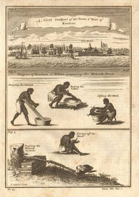
Guinea-Bissau Cacheu town Fortaleza de São José da Amura Preparing cassava 1745Jasper524.5(9.8k)See Sold PriceFeb 28, 2024
NORTH & COLONIAL WEST AFRICA. Nigeria marked as "Royal Niger Company" 1898 mapJasper524.5(9.8k)See Sold PriceFeb 28, 2024
AFRICA. Antiqua; Rome Carthage, start Punic War 1908 old antique map chartJasper524.5(9.8k)See Sold PriceFeb 28, 2024
Pre-colonial Africa. Mountains of Kong/Moon. Caravan routes. THOMSON 1817 mapJasper524.5(9.8k)See Sold PriceFeb 28, 2024
AFRICA. Pre 'Scramble for Africa'. BARTHOLOMEW 1876 old antique map plan chartJasper524.5(9.8k)See Sold PriceFeb 28, 2024
La Barbarie de la Nigritie et de la Guinée'. West Africa. DE L’ISLE 1745 mapJasper524.5(9.8k)See Sold PriceFeb 28, 2024
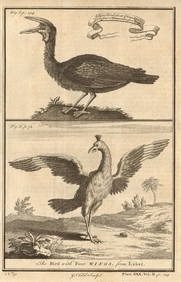
Gambian birds. Monoceros. A bird with four wings. CHILD 1745 old antique printJasper524.5(9.8k)See Sold PriceFeb 28, 2024
NORTH AFRICA. 'Biledulgerid', a former North African country. MALLET 1683 mapJasper524.5(9.8k)See Sold PriceFeb 28, 2024
Pre-SECOND WORLD WAR AFRICA. European colonies & German mandates 1942 old mapJasper524.5(9.8k)See Sold PriceFeb 28, 2024
NILE VALLEY. Upper & Lower. Egypt Sinai Nubia Sudan Abyssinia. BLACKIE 1882 mapJasper524.5(9.8k)See Sold PriceFeb 28, 2024
SUB-SAHARAN AFRICA. 'Ancienne Ethiopie'. Ancient Ethiopia. MALLET 1683 old mapJasper524.5(9.8k)See Sold PriceFeb 28, 2024
AFRICA. French North Africa and Morocco 1907 old antique map plan chartJasper524.5(9.8k)See Sold PriceFeb 28, 2024
SOUTHERN AFRICA Monomotapa (Mutapa Kingdom) Cafrerie (Kaffraria) MALLET 1683 mapJasper524.5(9.8k)See Sold PriceFeb 28, 2024