ATLAS of ANTIENT GEOGRAPHY by SAMUEL BUTLER 1843John McInnis Auctioneers,LLC4.5(505)See Sold PriceFeb 24, 2024
18TH C. ANTIQUE MAP: FRENCH & INDIAN WAR, FRAMEDThomaston Place Auction Galleries4.4(393)See Sold PriceFeb 24, 2024
Rand McNally Railroad Map Cabinet w/ 21 Railroad MapsRail & Road Auctions4.6(165)See Sold PriceMar 08, 2024
Keith Haring - Ink on New York Map, Best Buddies, Inscribed, Signed, and DatedSapphire Auction Gallery4(67)See Sold PriceMar 02, 2024
LATE 17TH C. FRENCH MAP OF THE NEW WORLD BY ALEXIS-HUBERT JAILLOT (1632-1712)Thomaston Place Auction Galleries4.4(393)See Sold PriceFeb 24, 2024
Central Railroad of New Jersey Map of Sandy Hook Route-ca. 1903JM Hobby Supply and Railroad Artifact Auctions4.4(127)See Sold PriceFeb 24, 2024
Lot of Six Mixed Atlas Box Cars-HO Scale-New in BoxJM Hobby Supply and Railroad Artifact Auctions4.4(127)See Sold PriceFeb 25, 2024
Rand McNally/Santa Fe Railroad Map of Iowa-1912JM Hobby Supply and Railroad Artifact Auctions4.4(127)See Sold PriceFeb 24, 2024
NICOLAES VISSCHER (NETHERLANDS, 1618-1709) MAP OF THE NEW WORLDThomaston Place Auction Galleries4.4(393)See Sold PriceFeb 24, 2024
17TH C. WORLD MAP BY NICOLAES VISSCHER (NETHERLANDS, 1618-1709)Thomaston Place Auction Galleries4.4(393)See Sold PriceFeb 24, 2024
Lot of Six Mixed Atlas Cabooses-HO Scale-New in BoxJM Hobby Supply and Railroad Artifact Auctions4.4(127)See Sold PriceFeb 25, 2024
SoldYorkshire.- - A bound group of 8 maps and plans,comprising 2 county maps, North and East Ridings, and West Riding, by Edward Baines, plans of York, Sheffield and Kingston upon Hull, also by Edward Baines, and Leeds by Charles Fowler, also 2 distancSee Sold Price
Sold(ROMAN EMPIRE.) Cepparuli, Francisco; engraver. Bound(ROMAN EMPIRE.) Cepparuli, Francisco; engraver. Bound group of Italian-engraved maps and plates. 9 leaves of distance tables in Italian and 64 engraved genealogy charts, views, maps and plans of EgyptSee Sold Price
Walter Raleigh's History of the World 1614 1st edTitle: The History of the World Author: Raleigh, Walter Description: Bound in two volumes. [2], [80], 492, 491-651; 776, [60] pp. With 8 double-page copper-engraved maps & plans, engraved by William HSee Sold Price
SoldWalter Raleigh's History of the World 1614 1st edTitle: The History of the World Author: Raleigh, Walter Description: Bound in two volumes. [2], [80], 492, 491-651; 776, [60] pp. With 8 double-page copper-engraved maps & plans, engraved by William HSee Sold Price
Fokke (Simon) - A bound group of scenes from Dutch8 views of riots", sieges, floods and other incidents in various cities, including Amsterdam, Haarlem, Delft and elsewhere, and 6 historical interior views, for Vaderlandsche Historie Vervattende de GSee Sold Price
SoldGROUP OF 8 TOOLED FULL LEATHER BOUND BOOKSGROUP OF 8 GOLD TOOLED 18TH C. FULL LEATHER BOUND BOOKS HAVING ONE TITLED "AVANT DE TELEMAQUE A PARIS" ILLUSTRATED WITH MULTIPLE ENGRAVINGS AND MAP, "LUCRETUS DE RERUM NATURA LIBRI SEX" HAVING GOLD EDSee Sold Price
SoldNICHOLS (John)The History and Antiquities of the County of Leicester, 4 vols in 8, London: for the author, 1795-1815, folio, all plates, plans and maps as called for (one or two mis-bound), occasional staining or fSee Sold Price
SoldA Mixed Group of Town Plansincluding Birmingham, Cheltenham, Oxford, Exeter by J. Roper, Manchester by C. Laurent and other, 13 engraved maps, 1 duplicate, 8 coloured, some staining, occasional tear along central vertical foldsSee Sold Price
SoldMoule (Thomas) - A Group of English Country Maps,including Yorkshire, Cornwall, Gloucestershire, Lancashire, 24 engraved maps plus 5 duplicates, 8 hand-coloured, engraved vignettes, each c.270 x 200mm., occasional browning at edges, occasional spottSee Sold Price
SoldBENG Moule (Thomas) a group of 15 decorative countBENG Moule (Thomas) a group of 15 decorative county maps,including Surrey, Sussex, Kent, the Isle of Wight, Yorkshire and elsewhere, also plans of Bath, Oxford and Cambridge, engraved maps witSee Sold Price
SoldRare Top Secret Bigot XIX Corps D-Day OperationRare Top Secret Bigot XIX Corps D-Day Operation Plan Neptune, Copy No. 114 of 1,000. 8 ¼ x 10 ¾-inches, 54 pages printed on the recto and verso; 5 large folding maps, bound in a folder wSee Sold Price
SoldConder Tent Work in PalestineConder (Claude Reignier) Tent Work in Palestine,2 vol., first edition, half-titles, wood-engraved frontispieces, title vignettes and 8 maps, plans and plates, 1 folding, original pictorial cloSee Sold Price
Sold[BOSTON]. A group of 8 maps and directories for Boston[BOSTON]. A group of 8 maps and directories for Boston and Cambridge, comprising: DICKINSON, S. N. The Boston Almanac for the Year 1844. Boston: Thomas Groom & Co. -- DICKINSON. The Boston AlmanaSee Sold Price
Sold(MISCELLANEOUS.) Group of 8 maps of North and(MISCELLANEOUS.) Group of 8 maps of North and South America, most defective. sold as is. Vp, 18th century Homann Heirs. Dominia Anglorum * Homann. Virginia Marylandia et Carolina * Dezauche. Carte d'ASee Sold Price
SoldFuller (Thomas) - A group of 8 maps of the Holy Land,for A Pisgah-Sight of Palestine, engraved maps by Goddard, Marshall, Vaughan and others, all with hand-colouring, each average 290 x 340mm., all with a central vertical fold, occasional slight browninSee Sold Price
SoldMAPS: Group of 8 maps of Australia including c1839MAPS: Group of 8 maps of Australia including c1839 showing the Colony of South Australia. 19th & 20th century. Varying sizesSee Sold Price
Sold-. large mixed group of maps, plans, and topograp-. large mixed group of maps, plans, and topographical views (A)including maps of Europe, Asia Minor, and with plans of Venice and Rome, an elevation of the facade of the Orangery at VersaillSee Sold Price
Sold[Staunton (Sir George)] Maps, Plans[Staunton (Sir George)] A small group of maps, plans, and plates from An Authentic Account of an Embassy from the King of Great Britain to the Emperor of China,including Plans, ...of the GreatSee Sold Price
SoldSanson (Nicolas) maps of northern EuropeSanson (Nicolas) a bound group of maps of northern Europe,21 double-page maps of France, Germany and the Low Countries, national and regional, also the city of Namur, and French military postsSee Sold Price
SoldAmericas.- North America.- Bouchette (Joseph) AAmericas.- North America.- Bouchette (Joseph) A Topographical Description of the Province of Lower Canada, with Remarks upon Upper Canada, first edition, engraved portrait, 8 maps and plans (4 foldingSee Sold Price
SoldBouchette (Joseph) A Topographical Description ofBouchette (Joseph) A Topographical Description of the Province of Lower Canada...,engraved portrait frontispiece, 8 maps or plans (some folding) and 2 tables (1 folding), 7 aquatint plates, soSee Sold Price
Saxton (Christopher) and William Kip. A good groupSaxton (Christopher) and William Kip. A good group of 8 maps of Wales,including Anglesey, Brecknoc, Cardigan, Denbigh, Merionith and Mongomery, with Monumethensis and Glamorgan by William HoleSee Sold Price
SoldGreek Islands.- a mixed group of maps and plansGreek Islands.- a mixed group of maps and plans,including Tobias Conrad Lotter's Graeciae Antiquae Designatio Nova ..., and with maps by or after Kauffer, Tardieu, d'Anville, and others, engraSee Sold Price
SoldMediterranean.- A mixed group of maps and plansMediterranean.- A mixed group of maps and plans,including 43 maps by Joseph Roux, from 'Plans et Rades de la Méditerraneé', and others by or after Tardieu, Bernard, Gouffier, and others, engraSee Sold Price
Group of Ten Railroad Photographs, Maps, and Prints - New Jersey, Long Island, and New YorkRail & Road Auctions4.6(165)See Sold PriceMar 07, 2024
[MAPS]. DUFOUR, Auguste-Henri (1795-1865). Bound Volume of ...Potter & Potter Auctions4.6(545)See Sold PriceMar 07, 2024
A Disneyland Easter Sunday Entertainment Schedule.Van Eaton Galleries4.6(99)See Sold PriceMar 02, 2024
[ENSLAVEMENT & ABOLITION]. A group of 3 prints related to the Atlantic slave trade, including plansFreeman's | Hindman4.4(1.6k)See Sold PriceFeb 27, 2024
Group of Three Decorative Accessories, Trinket Box, Carved Lion, Jim Beam WagonNorthgate Gallery, Inc.4.5(36)See Sold PriceMar 02, 2024
1711 GREEK BIBLE ILLUSTRATED w/ MAPS VELLUM BOUND antique NEW TESTAMENTJasper524.5(9.9k)See Sold PriceFeb 27, 2024
1738 BIBLE in DUTCH ILLUSTRATED w/ MAPS antique MASSIVE FOLIO BIBLIAJasper524.5(9.9k)See Sold PriceFeb 27, 2024
1749-59 21 volumes NETHERLANDS HISTORY ILLUSTRATED antique VELLUM BOUNDJasper524.5(9.9k)See Sold PriceFeb 27, 2024
1730 BIBLE in DUTCH ILLUSTRATED w/ MAPS antique MASSIVE FOLIO BIBLIAJasper524.5(9.9k)See Sold PriceFeb 27, 2024
1764 Bellin Map of Port Antonio, Jamaica -- Plan des Havres de Port Antonio et de Saint FrancoisJasper524.5(9.9k)See Sold PriceFeb 27, 2024
West Africa by Arrowsmith & Lewis 1812 old antique vintage map plan chartJasper524.5(9.9k)See Sold PriceFeb 28, 2024
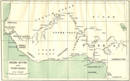
AFRICA. Niger River and Tributaries 1936 old vintage map plan chartJasper524.5(9.9k)See Sold PriceFeb 28, 2024
AFRICA. French North Africa and Morocco 1907 old antique map plan chartJasper524.5(9.9k)See Sold PriceFeb 28, 2024
Africa by Arrowsmith & Lewis 1812 old antique vintage map plan chartJasper524.5(9.9k)See Sold PriceFeb 28, 2024
[Constructivism]. The general plan of reconstruction of Moscow. - Moscow: Moscow Worker, 1936. -ARTMAXIMUM4.3(4)See Sold PriceMar 14, 2024


![[BOSTON]. A group of 8 maps and directories for Boston (1 of 1)](https://p1.liveauctioneers.com/197/168691/85058461_1_x.jpg?height=282&quality=70&version=1589391499)


![[MAPS]. DUFOUR, Auguste-Henri (1795-1865). Bound Volume of ... (1 of 2)](https://p1.liveauctioneers.com/928/318880/171361279_1_x.jpg?height=282&quality=70&version=1707501302)

![[ENSLAVEMENT & ABOLITION]. A group of 3 prints related to the Atlantic slave trade, including plans (1 of 3)](https://p1.liveauctioneers.com/197/319238/171468007_1_x.jpg?height=282&quality=70&version=1707520367)


![[Constructivism]. The general plan of reconstruction of Moscow. - Moscow: Moscow Worker, 1936. - (1 of 6)](https://p1.liveauctioneers.com/6171/320219/172084257_1_x.jpg?height=282&quality=70&version=1708525949)