VINTAGE 1944 MAP OF NORTH AMERICAVINTAGE 1944 MAP OF NORTH AMERICA **|**|** AUTHENTIC 1944 MAP OF NORTH AMERICA 9" X 12" #42925v2See Sold Price
VINTAGE 1944 MAP OF NORTH AMERICAVINTAGE 1944 MAP OF NORTH AMERICA **|**|** AUTHENTIC 1944 MAP OF NORTH AMERICA 9" X 12" #42925v2See Sold Price
VINTAGE 1944 MAP OF NORTH AMERICAVINTAGE 1944 MAP OF NORTH AMERICA **|**|** AUTHENTIC 1944 MAP OF NORTH AMERICA 9" X 12" #42925v2See Sold Price
VINTAGE 1944 MAP OF NORTH AMERICAVINTAGE 1944 MAP OF NORTH AMERICA **|**|** AUTHENTIC 1944 MAP OF NORTH AMERICA 9" X 12" #42925v2See Sold Price
VINTAGE 1944 MAP OF NORTH AMERICAVINTAGE 1944 MAP OF NORTH AMERICA **|**|** AUTHENTIC 1944 MAP OF NORTH AMERICA 9" X 12"See Sold Price
SoldVINTAGE REPRO MAP NORTH AMERICA IN 1700 BY DELISLEVintage Rand McNally reproduction map of North American from printed maps in the Library of Congress originally drawn by Guillaume DeLisle in 1700 A.D. It is in good condition with small puncture 0.5See Sold Price
SoldVINTAGE REPRO MAP NORTH AMERICA IN 1700 BY DELISLEVintage Rand McNally reproduction map of North American from printed maps in the Library of Congress originally drawn by Guillaume DeLisle in 1700 A.D. It is in good condition with small puncture 0.5See Sold Price
Sharp and clean vintage map of North America, Mitchell 1860Beautiful map of North America showing the entire continent along with Greenland, Central America, the West Indies and Iceland. Shows the routes of various arctic explorers. Mitchell’s unique flSee Sold Price
VINTAGE REPRO MAP NORTH AMERICA IN 1700 BY DELISLEVintage Rand McNally reproduction map of North American from printed maps in the Library of Congress originally drawn by Guillaume DeLisle in 1700 A.D. It is in good condition with small puncture 0.5See Sold Price
VINTAGE REPRO MAP NORTH AMERICA IN 1700 BY DELISLEVintage Rand McNally reproduction map of North American from printed maps in the Library of Congress originally drawn by Guillaume DeLisle in 1700 A.D. It is in good condition with small puncture 0.5See Sold Price
VINTAGE REPRO MAP NORTH AMERICA IN 1700 BY DELISLEVintage Rand McNally reproduction map of North American from printed maps in the Library of Congress originally drawn by Guillaume DeLisle in 1700 A.D. It is in good condition with small puncture 0.5See Sold Price
VINTAGE REPRO MAP NORTH AMERICA IN 1700 BY DELISLEVintage Rand McNally reproduction map of North American from printed maps in the Library of Congress originally drawn by Guillaume DeLisle in 1700 A.D. It is in good condition with small puncture 0.5See Sold Price
SoldTWO VINTAGE MAPS OF NORTH AMERICA & CALIFORNIATWO VINTAGE MAPS OF NORTH AMERICA & CALIFORNIA. NORTH AMERICAN PUBLISHED: A.T.C. BLACK EDINBURGH, CALIFORNIA & UTAH, 1860: AUGUSTUS MITCHELL. Height: 24 in. by Width: 18 in. by Depth: 1 in.See Sold Price
Vintage 1860s school atlas map of North AmericaNice clean vintage map of North America with full, original hand coloring. Most of British Possessions labeled as “Hudson Bay Territory.” Canada denoted as minor part of upper North AmericSee Sold Price
PanAm: Vintage Pictorial Map of North America, 1967Title/Content of Map: 1967 PanAm Pictorial Map of North America -- Amerique du Nord et Centrale Date Printed: 1967 Cartographer: J Liozu / PanAm Size: 8.1 x 5.6 in. Two very attractive pictorial mapsSee Sold Price
PanAm: Vintage Pictorial Map of North America, 1967Map: 1967 PanAm Pictorial Map of North America -- Amerique du Nord et Centrale Cartographer: J Liozu / PanAm Year / Place: 1966 Map Dimensions: 8.1 x 5.6 in. Condition: Excellent. Nice, sharp image anSee Sold Price
PanAm: Vintage Pictorial Map of North America, 1967Title/Content of Map: 1967 PanAm Pictorial Map of North America -- Amerique du Nord et Centrale Date Printed: 1967 Cartographer: J Liozu / PanAm Size: 8.1 x 5.6 in. Two very attractive pictorial mapsSee Sold Price
SoldVintage Bacons Excelsior Map of North America 1880sPrinted in London by G. W. Bacon & Co., Ltd., circa 1880. Chromolithograph laid on canvas with both original wood hangers. Approx. 38 in. H x 30 in. WSee Sold Price
SoldVINTAGE MAP OF NEW YORK & NORTH AMERICA MAP BOXVINTAGE MAP OF NEW YORK & NORTH AMERICA MAP BOX. Height: 15 1/2 and 13 in. by Width: 12 1/2 and 15 1/2 in. in. by Depth: 1 1/2 and 4 in.See Sold Price
Vintage Toys, Games moreVintage Teaching Easel Chalkboard maps of North America, Skee ball game, Viewmaster, carved animals much moreSee Sold Price
Vintage Map of the USA - Indians of North America - National Geographic 1972Title/Artist: Vintage Map of the USA - Indians of North America - National Geographic 1972 Date: 1972 Material: Paper Dimensions: 82 cm x 95 cm Additional Information: A wonderful lithographic map froSee Sold Price
SoldLOT ASSORTED VINTAGE AND ANTIQUE MAPS INCLUDING UNITEDLOT ASSORTED VINTAGE AND ANTIQUE MAPS INCLUDING UNITED STATES OF NORTH AMERICASee Sold Price
SoldLot 3 Vintage Map And EtchingsLot 3 Vintage Map And Etchings. Unframed and unmatted paper with reproduction of color map of the North American continent, marked as North America, by Matthew Seutter, 1735. Print date unknown. Two rSee Sold Price
Sold12 pcs Antique Vintage Paper Book Pages. Mostly m12 pcs Antique Vintage Paper Book Pages. Mostly maps. "Die Statt Strakburg" book page. Bowle's New Pocket Map NORTH AMERICA. "Veduta Scenographica a Ponente Della Citta di Napoli in Campagna Felice. (See Sold Price
5 Dollars - Elizabeth II Map of North AmericaWeatherham Estate Treasures3.9(157)See Sold PriceMar 07, 2024
Brave Men by Ernie Pyle 1944 WWII Correspondent StoriesNorth American Artifact Auctions4.6(182)See Sold PriceApr 20, 2024
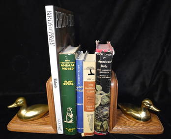
5 Vintage Books About Birds, Fish & Animals all in Excellent ConditionNorth American Artifact Auctions4.6(182)See Sold PriceApr 20, 2024
Arrowsmith & Lewis - Map of North AmericaTrillium Antique Prints & Rare Books4.5(30)See Sold PriceFeb 24, 2024
Map: An 18thC engraved and hand coloured map of North America and South America, titled DeClaydon Auctioneers Ltd4.3(125)See Sold PriceFeb 26, 2024
1822 MAP of NORTH & SOUTH AMERICA GEOGRAPHICAL STATISTICAL HISTORICAL antiqueJasper524.5(9.8k)See Sold PriceFeb 27, 2024
New and Correct Map of North America With the West India Islands,Jasper524.5(9.8k)See Sold PriceFeb 27, 2024
Italian edition of Sanson's map of North America, 1677PBA Galleries4.7(381)See Sold PriceMar 07, 2024
Blackie (Pub) 1882 Folio Map. United States of North AmericaAlbion Auctions4.6(336)See Sold PriceMar 01, 2024