Sold4V Travelogues ENGLAND SCOTLAND WALES Maps PhotosThis auction lot includes the following group of titles: - Four on a Tour by Robert and Elizabeth Shackleton - Dated 1914 by Hearst's International Library Co. - Color map frontispiece and extensiveSee Sold Price
SoldLyttleton, George 1810 Map of England, Scotland, Wales"An Accurate Map of England, Scotland, and Wales" Copper Engraved Map Published 1810, London for "The History of England..." by George Courtney Lyttleton. Folds as issued. Paper Size: 18 x 14 inch (46See Sold Price
SoldLyttleton, George 1810 Map of England, Scotland, Wales"An Accurate Map of England, Scotland, and Wales" Copper Engraved Map Published 1810, London for "The History of England..." by George Courtney Lyttleton. Folds as issued. Paper Size: 18 x 14 inch (46See Sold Price
SoldFoldex England, Scotland and Wales complete road mFoldex England, Scotland and Wales complete road map, housed in a blue leather case, belonging to the late Dr John Bodkin Adams, 25cm x 15cm: NB. All items are sold as is. Please contact the auctioneeSee Sold Price
SoldLyttleton, George 1810 Map of England, Scotland, Wales"An Accurate Map of England, Scotland, and Wales" Copper Engraved Map Published 1810, London for "The History of England..." by George Courtney Lyttleton. Folds as issued. Paper Size: 18 x 14 inch (46See Sold Price
Lyttleton, George 1810 Map of England, Scotland, Wales"An Accurate Map of England, Scotland, and Wales" Copper Engraved Map Published 1810, London for "The History of England..." by George Courtney Lyttleton. Folds as issued. Paper Size: 18 x 14 inch (46See Sold Price
SoldBritish Isles: C England Wales Scotland Ireland MapBritish Isles: Counties. England Wales Scotland Ireland. Tallis/rapkin 1851 Map. Vignettes: London; Edinburgh; Dublin. Approx 36.5 x 26.5cm, 14.5 x 10.25 inches (Large). Antique engraved map by J RapkSee Sold Price
SoldMap of England, Scotland, Wales and IrelandMagna Britannia Complectens Angliae Scotiae Hiberniae Regna, hand colored. Sight size 19 1/4 x 23 inches. Matted and framed. Notice to bidders: Condition reports and additional photographs are provideSee Sold Price
Map of England, Scotland, Wales and IrelandMagna Britannia Complectens Angliae Scotiae Hiberniae Regna, hand colored. Sight size 19 1/4 x 23 inches. Matted and framed. Notice to bidders: Condition reports and additional photographs are provideSee Sold Price
Sold4V Touring Map England Wales AVIATION AUTO ManualThis auction lot includes the following group of titles: - The Royal Automobile Club Official Touring Map of England and Wales - Dated c1920 by George Philip & Son - large color foldout map - OfficSee Sold Price
SoldWalpoole.New British Traveller,1784Walpoole (George Augustus) The New British Traveller,engraved frontispiece and 89 plates, 21 engraved maps, 3 folding (?of 22, ?lacking folding map, England & Wales, Scotland, Ireland presSee Sold Price
Sold1814 ATLAS Maps of England & Wales Scotland Color Nav1814 ATLAS Maps of England & Wales Scotland Color Navigation Travel John Cary An incredible atlas consisting of 42 color maps of Great Britain by John Cary. The atlas covers cities in England, Wales,See Sold Price
Cary: Large Map of England, Wales, Scotland, 1796Map: Cary’s reduction of his Large Map of England and Wales, with part of Scotland; Publication Date: 1796-02-20 Maker: John Cary, John Cary Publisher: John Cary Size: Elephant Folio – 29.3 H x 24See Sold Price
A map of England, Wales & Scotland describing the crossTITLE/CONTENT OF MAP: 'A map of England, Wales & Scotland describing all the direct and principal cross roads in Great Britain with the distances measured between the Market Towns and from London; toSee Sold Price
A map of England, Wales & Scotland describing the crossTITLE/CONTENT OF MAP: 'A map of England, Wales & Scotland describing all the direct and principal cross roads in Great Britain with the distances measured between the Market Towns and from London; toSee Sold Price
A map of England, Wales & Scotland describing the crossTITLE/CONTENT OF MAP: 'A map of England, Wales & Scotland describing all the direct and principal cross roads in Great Britain with the distances measured between the Market Towns and from London; toSee Sold Price
A map of England, Wales & Scotland describing the crossTITLE/CONTENT OF MAP: 'A map of England, Wales & Scotland describing all the direct and principal cross roads in Great Britain with the distances measured between the Market Towns and from London; toSee Sold Price
SoldBryce, James 1881 Lot of 3 Maps of the British IslesEngland & Wales, Scotland and Physical Map of the British Isles. Lithograph Maps Published 1881, London for ""The International Atlas and Geography..." by James Bryce. Maps by Edward Weller & John BarSee Sold Price
SoldBryce, James 1881 Pair of Maps England/Wales & ScotlandEngland & Wales, Scotland and Physical Map of the British Isles. Lithograph Maps Published 1881, London for ""The International Atlas and Geography..." by James Bryce. Maps by Edward Weller & John BarSee Sold Price
SoldBlaeu's Atlas of England, Scotland, Wales and Ireland,Blaeu's Atlas of England, Scotland, Wales and Ireland, facsimile reprint, 115 maps (5 colour), two colour titles, original crimson half morocco, folio, Thames and Hudson, [1970]; and c. 40 others, BibSee Sold Price
ROMAN BRITAIN. Names of Tribes & Roman towns. 'IsleTITLE OF THE MAP: 'Isle d'Albion' England. Scotland. Wales and part of Ireland. The top image on the right hand side shows the entire map. To view a close up of the map showing the level of printed deSee Sold Price
SoldJigsaw Maps.- Geo. Philip & SonJigsaw Maps.- Geo. Philip & Son, Philips' Map Building Puzzle. England & Wales; Scotland,2 coloured maps mounted on wood and dissected as jigsaw puzzles, each 315 x 240mm., in original cardboSee Sold Price
SoldA quantity of Victorian sepia photographs depictingA quantity of Victorian sepia photographs depicting houses, interior scenes and landscapes, possibly estate agent's house reference photos, to include England, Scotland, Wales, Ireland, Guernsey. HousSee Sold Price
SoldChad Valley Wooden Promotional Jigsaw PuzzleChad Valley wooden Promotional Jigsaw Puzzle for "British Tourist & Holidays Board", a pair including - "Royal Britain". This is a colourful and detailed map of England, Wales & Scotland, with many inSee Sold Price
OGILVY & BOWEN c1736 Original Map of Oxfordshire Berkshire Etc.Luis Porretta Fine Arts4.3(10)See Sold PriceMar 02, 2024
Portfolio of 15 County Maps by Robert Morden (English 1650-1703)Nadeau's Auction Gallery4.7(405)See Sold PriceFeb 24, 2024
Chatelain - 3 Maps of the British Isles (England, Ireland, Scotland)Trillium Antique Prints & Rare Books4.5(30)See Sold PriceFeb 24, 2024
De Jode, Rare, pub. 1593 - Map of the British Isles [England, Scotland, Ireland] (Angliae Scotiae etTrillium Antique Prints & Rare Books4.5(30)See Sold PriceFeb 24, 2024
THREE HAND COLORED AND ADORNED PRINTS.Amelia Jeffers, Auctioneers & Appraisers4.5(116)See Sold PriceMar 08, 2024
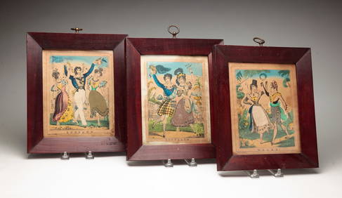
VARIOUS ARTISTS [BRITISH TRAVEL GUIDES]. Group of 6 map booklets and flyers. 1930s.Swann Auction Galleries4.4(69)See Sold PriceFeb 29, 2024
Late 18th century map of England and Wales sampler and two printsFellows4.3(159)See Sold PriceMar 05, 2024
Benjamin Fawcett - Alexander Francis Lydon - British Fish - Bull TroutProverde Auctions4.3(3)See Sold PriceFeb 28, 2024
Benjamin Fawcett - Alexander Francis Lydon - British Fish - Allis Shad - Twaite ShadProverde Auctions4.3(3)See Sold PriceFeb 28, 2024
Brass Rubbing Art, Simon De WensleyRapid Estate Liquidators and Auction Gallery4.5(1.1k)See Sold PriceFeb 28, 2024


![De Jode, Rare, pub. 1593 - Map of the British Isles [England, Scotland, Ireland] (Angliae Scotiae et (1 of 2)](https://p1.liveauctioneers.com/6581/319571/171593327_1_x.jpg?height=282&quality=70&version=1707853304)
![VARIOUS ARTISTS [BRITISH TRAVEL GUIDES]. Group of 6 map booklets and flyers. 1930s. (1 of 2)](https://p1.liveauctioneers.com/199/319703/171640571_1_x.jpg?height=282&quality=70&version=1707943705)


