Map of the Near East. Giovanni Albrizzi. Venice, 1740.Irak Arabi Kurdistan Diarbek Turcomannia Siria e Palestina. Copperplate engraving. Black and white. By Giovanni Albrizzi. Venice, 1740.Latin. 27×33.5 cm. (38.5×48.5 inclusive). Very fine condiSee Sold Price
Map of the Near East. Giovanni Albrizzi. Venice, 1740.Irak Arabi Kurdistan Diarbek Turcomannia Siria e Palestina. Copperplate engraving. Black and white. By Giovanni Albrizzi. Venice, 1740. Latin. 27x33.5 cm. (38.5x48.5 inclusive). Very fine condition. QSee Sold Price
Map of the Near East. Giovanni Batista & GiorgioTabula Asiae IIII. Map of the Near East. According to Ptolemy. By Giovanni Batista & Giorgio Galignani. From: Geografia cioe Descrittione Universale della Terra. Venice, 1598, 12. Page spread. The HolSee Sold Price
SoldMap of the Near East. Giovanni Batista & GiorgioTabula Asiae IIII. Map of the Near East. According to Ptolemy. By Giovanni Batista & Giorgio Galignani. From: Geografia cioe Descrittione Universale della Terra. Venice, 1598, 12. Page spread. The HolSee Sold Price
Map of the Near East. Girolamo Ruscelli. Venice, 1562.Tabula Asiae IIII. Map of the Near East according to Ptolemy. By Giorlamo Ruscelli. From: Ptolemaeus Claudius, Geographia. Venice, 1562. P. 46-47. Page spread from the Holy Land in the west through BaSee Sold Price
Map of the Near East. Gastaldi Giacomo. Venice, 1599.Tabula Asiae IIII. Map of the Near East. According to Ptolemy. By Giacomo Gastaldi. From: Ptolemaeus Claudius, Geographia. Venice, 1599, p 129. Published by Heredi di Melchior Sessa. Page spread. TheSee Sold Price
SoldMAP Carte de Geographica dell' America SettentrionMAP Carte de Geographica dell' America Settentrionale by De L'Lsle. Printed by J. Albrizzi Venice 1740. Dimensions: H: 13 inches: W: 17 inches Condition: Professionally Restored and Framed US ShippingSee Sold Price
SoldAlbrizzi (Giovanni Battista) - Forestieretitle in red and black, engraved frontispiece and 43 plates, some double-page, 19th century vellum, upper joint cracked, 8vo, Venice, 1740.See Sold Price
SoldVenice.- Albrizzi (Giovanni Battista) ForestiereVenice.- Albrizzi (Giovanni Battista) Forestiere Illuminato intorno le cose piu' rare e curiose, antiche, e moderne, della Citta di Venezia, first edition, engraved frontispiece with the arms of the dSee Sold Price
SoldAlbrizzi (G. B.) America SettentrionaleAlbrizzi (Giovanni Battista) Carta Geografica Dell' America Settentrionale,engraved map of the east coast of North America, from Greenland to Brazil, and the Caribean, with decorative title caSee Sold Price
SoldAbrizzi, Giovanni Battista Forestiere IlluminatoAbrizzi, Giovanni Battista Forestiere Illuminato intorno le cose piu rare, e curiose, antiche, e moderne della Citta de Venezia. Venice: G. Albrizzi, 1740. 8vo, engraved frontispiece and 44 plates, soSee Sold Price
SoldGiovanni Battista Albrizzi (1698-1777) Map of CanadaA hand colored engraving, from "Atlante Novissimo che Contiene Tutte le Parti del Mondo", circa 1740, after Guillaume de L'Isle (1675 - 1726). Dimensions: Sight 14 1/4" x 18 1/4", the frame 24 3/4" xSee Sold Price
Sold1740 Detailed Hand-Colored Map of Early AmericaHistoric Maps 1740 Detailed Hand-Colored Map of Early America c. 1740, Hand-Colored Engraved Copper Plate Map title, “CARTA GEOGRAFICA DELL AMERICA SETTENTRIONALE” by G. Albrizzi, Venice, ExtremelSee Sold Price
Soldc 1740 Handcolored Engraved Colonial America MapHistoric Maps 1740 Hand-Colored Engraved Map of Colonial Era America c. 1740, Hand-Colored Engraved Copper-Plate Map title, "CARTA GEOGRAFICA DELL AMERICA SETTENTRIONALE" by G. Albrizzi, Venice, FrameSee Sold Price
SoldItalian Map of Eastern CanadaALBRIZZI, Giambattista (1698-1777). Carte Geografica del Canada Nell' America Settentrionale. Engraved map with hand color in outline. Venice, 1740. 15 3/8" x 21" sheet. Striking map of the Great LakeSee Sold Price
Soldc 1740 Handcolored Engraved Colonial America MapHistoric Maps 1740 Hand-Colored Engraved Map of Colonial Era America c. 1740, Hand-Colored Engraved Copper-Plate Map title, “CARTA GEOGRAFICA DELL AMERICA SETTENTRIONALE” by G. Albrizzi, Venice, ESee Sold Price
SoldMap of U.S. Southeast c.1740Heading: (North America - Souteast) Author: Albrizzi, Giambatista Title: Carta Geografica Della Florida Nell' America Settentrionale Place Published: Venice Publisher: Date Published: c.1740<See Sold Price
ASIA. The Near East. Industries and Communications 1907 old antique map chartTITLE/CONTENT OF MAP: 'The Near East: Industries and Communications' DATE PRINTED: 1907 IMAGE SIZE: Approx 36.0 x 48.5cm, 14 x 19 inches (Large); Please note that this is a folding map. TYPE: Colour aSee Sold Price
Sold12 Mid Century Educational Wall Maps,12 Mid Century Educational Wall Maps Mostly historical European Maps and Near East/ Mesopotamian Topics, All approx 47" Two With Spring loaded hangers,See Sold Price
SoldVenice.- Albrizzi (Giovanni Battista) ForestieroVenice.- Albrizzi (Giovanni Battista) Forestiero Illuminato...della Citta' de Venezia, second edition, engraved armorial frontispiece, double-page panoramic view of Venice and 72 views on 46 plates, 2See Sold Price
SoldSeutter: Antique Map of East Prussia, 1740Title/Content of Map: Today's northern Poland. East Prussia. Poland and Baltic regions by Seutter Date Printed: c1740 Cartographer: Mattaus Seutter Material/Medium: Paper Size: 19" x 23" Original handSee Sold Price
Blaeu 1647 Map of Near & Middle EastDESCRIPTION: This map, created by Willem Blaeu and Joan Blaeu, features a title cartouche "Turcicum Imperium" showing a Turkish Sultan on his throne, flanked by armed allegorical figures. Also includeSee Sold Price
SoldMap of the Near East through Muscovy. 19th Century?Map of the Near East. The Holy Land, Egypt, Antolia, the Black Sea in the west; Georgia, Astrakhan in the east; Muscovy in the north; and the Arabian Peninsula in the south. Copperplate engraving. BlaSee Sold Price
SoldMap of the Near East. Halma Francois. Holland, 1707Descriptio Paradisi et Terrae Canaan regionumque a Patriachis primum habitatarum. Map of the Garden of Eden and the Holy Land. Includes the Holy Land in the west through Babylon and the Euphrates in tSee Sold Price
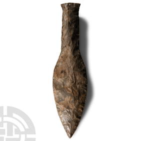
Stone Age Classic British Teardrop-Shaped Knapped Flint HandaxeTimeLine Auctions Ltd.4.5(183)See Sold PriceMar 05, 2024
Stone Age Classic Teardrop-Shaped Knapped Flint HandaxeTimeLine Auctions Ltd.4.5(183)See Sold PriceMar 05, 2024
[MAP]. [ALBRIZZI, Giambatista, 1698-1777]. Carta Geografica...Potter & Potter Auctions4.6(539)See Sold PriceMar 07, 2024
WEST AFRICA Explorers' routes Senegal Ashanti. Mountains of Kong. SDUK 1857 mapJasper524.5(9.8k)See Sold PriceFeb 28, 2024
WEST AFRICA explorers' routes. Beaufort Gray Park Dochard Caillie. SDUK 1874 mapJasper524.5(9.8k)See Sold PriceFeb 28, 2024
Coste Orientale d’Afrique…' South Africa. Mozambique channel. BELLIN 1746 mapJasper524.5(9.8k)See Sold PriceFeb 28, 2024
WEST AFRICA I Explorers' routes Senegal Ashanti Ivory Gold Coast. SDUK 1851 mapJasper524.5(9.8k)See Sold PriceFeb 28, 2024
WEST AFRICA showing early explorers' routes & Mountains of Kong. SDUK 1844 mapJasper524.5(9.8k)See Sold PriceFeb 28, 2024
PRE COLONIAL WESTERN AFRICA. Shows Mountains of Kong. Tribes. WELLER 1863 mapJasper524.5(9.8k)See Sold PriceFeb 28, 2024
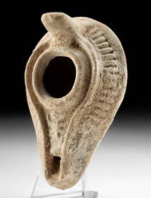
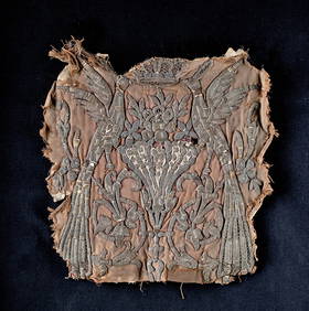
12th C. Egyptian Mamluk Linen / Silk Textile PanelArtemis Fine Arts4.8(1.4k)See Sold PriceFeb 26, 2024
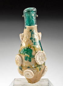
Roman / Byzantine Oil Lamp - Interesting IconographyArtemis Fine Arts4.8(1.4k)See Sold PriceFeb 26, 2024


![[MAP]. [ALBRIZZI, Giambatista, 1698-1777]. Carta Geografica... (1 of 1)](https://p1.liveauctioneers.com/928/318880/171361280_1_x.jpg?height=282&quality=70&version=1707501302)