1854, CARTE D’AFRIQUE.Print from steel engraving titled, “CARTE D’AFRIQUE”. Longitude du Méridien de l’ll de Fer. Longitude Est du Meridien dé Paris. From VOSGIEN OU NOUVEAU DICTIONNAIRE UNIVERSEL DE GEOGRAPHIE MSee Sold Price
Map of Africa in 1854. 1859.Print from steel engraving titled, “CARTE D’AFRIQUE”. From VOSGIEN OU NOUVEAU DICTIONNAIRE UNIVERSEL DE GEOGRAPHIE MODERNE. Paris. Bernardin Béchet, Libraire, Quai des Augustins, 31. 1859. NotSee Sold Price
SoldAntique Hand Colored Map - Carte D'AfriqueParisian hand colored map of Africa 1772; 20in. X 25.25in.See Sold Price
Sold[AFRIQUE] Guillaume DELISLE - Carte d'Afrique dressée[AFRIQUE] Guillaume DELISLE - Carte d'Afrique dressée pour l'usage du Roi. Revue et augmentée par DEZAUCHE. Paris, chez l'Auteur, 1787. Carte en couleurs. 490 x 634 mm au TC. Placée sous cadre en bSee Sold Price
SoldClouet (Jean Baptiste Louis) Carte d'AfriqueClouet (L'Abbé Jean Baptiste Louis) Carte d'Afrique, divisée en ses principaux Etats,wall map of the African continent, large French title cartouche of exotic animals and allegorical figures lSee Sold Price
SoldDe l'Isle (Guillaume) Carte d'AfriqueDe l'Isle (Guillaume) Carte d'Afrique,the continent of Africa, with the coast of Brazil, southern Europe and the Middle East, decorative title cartouche upper left, engraved map with extensiveSee Sold Price
SoldCarte d'Afrique, Dressee pour l'Usage du RoyAuthor: De l'Isle, Guillaume Description: Copper-engraved map, hand-colored in outline. 49.2x64 cm. (19¼x25¼"). The mysterious dark continent, with much detail in the interior, little of it accurateSee Sold Price
Carte d'Afrique, Dressee pour l'Usage du RoyCopper-engraved map, hand-colored in outline. 49.2x64 cm. (19¼x25¼"). The mysterious dark continent, with much detail in the interior, little of it accurate. The Niger River is shown, but it meanderSee Sold Price
1854, CARTE D’EUROPE.Print from steel engraving titled, “CARTE D’EUROPE”. Longitude du Méridien de l’ll de Fer. Longitude Est du Meridien dé Paris. Longitude vuest.From VOSGIEN OU NOUVEAU DICTIONNAIRE UNIVERSELSee Sold Price
SoldLapie map of Africa 1831Heading: Author: Lapie, Le Chevalier Title: Carte d'Afrique Place Published: Paris Publisher: Date Published: 1831 Description: Engraved map, hand-colored in outline. 39.2xSee Sold Price
Sold[Wall map] AfricaCarte d’Afrique, 1797.Incisione in coloritura coeva su supporto ligneo coevo, 550x655 mm.See Sold Price
Soldtwo early 19th c French maps of Africatwo early 19th c French maps of Africa- 1820 Carte de L'Afrique by Brue, 2 sheet hand colored map of Africa, 21" x 26 3/4", 7& 1837 Carte D'Afrique by Lapie, 2 sheet hand colored map of Africa, 19 3/4See Sold Price
MAP - Africa. DelisleAfrica. Delisle/Dezauche, Carte d'Afrique Dressee pour l'Instruction par Guillaume Delisle..., 1787 (dated). Hand Color. This is a later edition of Delisle's 1722 map of the continent and Madagascar dSee Sold Price
SoldFramed MapFramed map "CARTE / D" AFRIQUE....". Sight 19 1/2" x 25 1/2", frame overall 21 1/2" x 27 1/2".See Sold Price
WALL MAP OF AFRICA 1797Wall map of Africa. Philippe Buache. Carte d’ Afrique. Paris, 1797.Engraving in contemporary coloring on wood support, 550x655 mm.See Sold Price
SoldCharles Francis de Beaupre (1766-1854, Paris), "CarteCharles Francis de Beaupre (1766-1854, Paris), "Carte Geographique, Statistique, et Historioque de Porto-Rico et lies Vierges Louis Guillaume (extensive history)," 1822, H. -20 3/4 in., W. - 27 in.See Sold Price
SoldOriginal poster by Pierre MortierOriginal poster by Pierre Mortier, Carte General d'Afrique, Amsterdam, 1700 or later, 23.5" x 34"See Sold Price
Sold1780 map D'Afrique by Philippe1780 "Carte Nouvelle D'Afrique" by Philippe, Paris, hand-colored map of Africa, sheet size 11 1/4" x 17 1/4"See Sold Price
SoldDepot de la Marine Carte des Iles CanariesDepot de la Marine Carte des Iles Canaries et d'une Partie des Cotes Occidentales D'Afrique; Carte Particuliere des Isles Canaries et des Cotes Voisines d'Afrique, 2 engraved charts of the CanSee Sold Price
FLORENCE NIGHTINGALE SIGNED.An original 1854 ( circa ) C.D.V. Carte de Visite of Florence Nightingale by Mr Kilburn of 222 Regent Street London which is signed from the bottom left hand corner to the upper right hand corner in bSee Sold Price
Sold[Mannevillette] Carte de la Côte d'Afrique[Apres de Mannevillette (Jean Baptiste N D d)] Carte de la Côte d'Afrique, depuis le Cap Blanc jusqu'à la Rivière de Gambie,west coast of Africa, showing the mouths of the rivers Gambia and SeSee Sold Price
CARTE DE L'EXTREMITE MERIDIONALE D'AFRIQUEReserve Reduced! Title: CARTE DE L'EXTREMITE MERIDIONALE D'AFRIQUE Maker: PATERSON Origin: UK Date/Period: 1789 Materials: COPPER ENGRAVING Dimensions: 33X56CM MAP SHOWING LIEUTENANT PATERSON'S EXPLORSee Sold Price
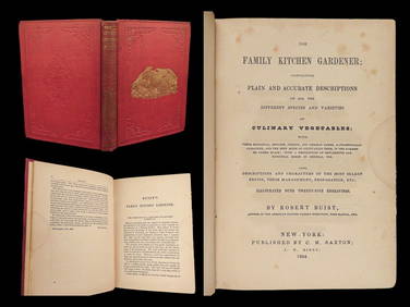
1854 Family Kitchen GARDENER Vegetables Fruits Culinary Cuisine Recipes CookingSchilb Antiquarian Rare Books4.8(421)See Sold PriceMar 10, 2024
1854 Life of Martin Luther Protestant Reformation Lutheran Illustrated BibleSchilb Antiquarian Rare Books4.8(421)See Sold PriceMar 10, 2024
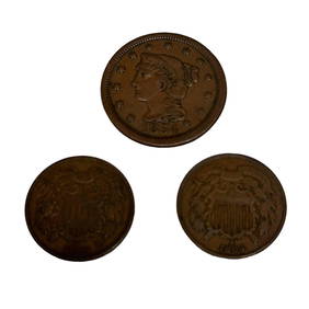
Two US 2 Cent Coins and 1854 Large One CentPremier Auction Galleries4.3(329)See Sold PriceMar 09, 2024
[BASEBALL]. Carte de Visite Full-Length Portrait of...Potter & Potter Auctions4.6(539)See Sold PriceMar 07, 2024
[BASEBALL CARTE DE VISITE ]. Carte de Visite Photograph of ...Potter & Potter Auctions4.6(539)See Sold PriceMar 07, 2024
[BASEBALL CARTE DE VISITE]. Carte de Visite Photograph of a...Potter & Potter Auctions4.6(539)See Sold PriceMar 07, 2024
[BASEBALL CARTE DE VISITE]. Carte de Visite Photograph of F...Potter & Potter Auctions4.6(539)See Sold PriceMar 07, 2024
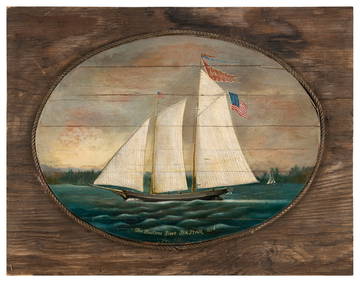
FOLK ART PAINTING "THE HUDSON RIVER SEA STAR 1854" 20th Century Oil on panel, 14" x 19". BackboardEldred's4.7(409)See Sold PriceMar 07, 2024
Coste Occidentale d’Afrique…' Arguin Bay Cap Blanc Mauritania. BELLIN 1746 mapJasper524.5(9.8k)See Sold PriceFeb 28, 2024
Partie de la Coste d'Afrique depuis Tanit…' Southern Mauritania BELLIN 1746 mapJasper524.5(9.8k)See Sold PriceFeb 28, 2024
Partie de la Coste d'Afrique'. Southern Mauritania BELLIN/SCHLEY 1747 old mapJasper524.5(9.8k)See Sold PriceFeb 28, 2024
Carte du Canal de Mosambique…. Madagascar Bonne Esperance. BONNE 1780 mapJasper524.5(9.8k)See Sold PriceFeb 28, 2024
Coste Orientale d’Afrique…' South Africa. Mozambique channel. BELLIN 1746 mapJasper524.5(9.8k)See Sold PriceFeb 28, 2024
Coste Occidentale d’Afrique'. Bay of Arguin, Mauritania. BELLIN/SCHLEY 1747 mapJasper524.5(9.8k)See Sold PriceFeb 28, 2024
Carte d'Afrique. Africa Soudan Zanzibar. LAPIE 1831 old antique map plan chartJasper524.5(9.8k)See Sold PriceFeb 28, 2024
Coste Occidentale d’Afrique…' West Africa. Gulf of Guinea. BELLIN 1746 mapJasper524.5(9.8k)See Sold PriceFeb 28, 2024
Carte de la partie septentrionale d'Afrique, ou de la Barbarie… BONNE 1780 mapJasper524.5(9.8k)See Sold PriceFeb 28, 2024
Coste Orientale d’Afrique'. South Africa Mozambique BELLIN/SCHLEY 1747 mapJasper524.5(9.8k)See Sold PriceFeb 28, 2024
Coste Orientale d’Afrique…' East Africa Kenya Tanzania Somalia. BELLIN 1746 mapJasper524.5(9.8k)See Sold PriceFeb 28, 2024
Carte de L'Algérie et de la Régence de Tunis' ANDRIVEAU-GOUJON Algeria 1850 mapJasper524.5(9.8k)See Sold PriceFeb 28, 2024
Coste Occidentale d’Afrique…' Namibia South Africa Angola coast BELLIN 1746 mapJasper524.5(9.8k)See Sold PriceFeb 28, 2024
Birge (Lovell Birge) Harrison (1854 - 1929) AmericanCutler Bay Auctions4.5(168)See Sold PriceFeb 29, 2024


![[AFRIQUE] Guillaume DELISLE - Carte d'Afrique dressée (1 of 1)](https://p1.liveauctioneers.com/828/115875/59545815_1_x.jpg?height=282&quality=70&version=1517257188)


![[Wall map] Africa (1 of 1)](https://p1.liveauctioneers.com/3336/90951/46934966_1_x.jpg?height=282&quality=70&version=1473763184)


![[Mannevillette] Carte de la Côte d'Afrique (1 of 1)](https://p1.liveauctioneers.com/410/10165/2288934_1_x.jpg?height=282&quality=70)


![[BASEBALL]. Carte de Visite Full-Length Portrait of... (1 of 1)](https://p1.liveauctioneers.com/928/318880/171361328_1_x.jpg?height=282&quality=70&version=1707501302)
![[BASEBALL CARTE DE VISITE ]. Carte de Visite Photograph of ... (1 of 2)](https://p1.liveauctioneers.com/928/318880/171361404_1_x.jpg?height=282&quality=70&version=1707501302)
![[BASEBALL CARTE DE VISITE]. Carte de Visite Photograph of a... (1 of 2)](https://p1.liveauctioneers.com/928/318880/171361405_1_x.jpg?height=282&quality=70&version=1707501302)
![[BASEBALL CARTE DE VISITE]. Carte de Visite Photograph of F... (1 of 2)](https://p1.liveauctioneers.com/928/318880/171361408_1_x.jpg?height=282&quality=70&version=1707501302)