SoldJohn Pinkerton, map of East IndiesJohn Pinkerton, map of East Indies, John Pinkerton (Scottish, 1758-1826), "East India Isles", c. 1818, map of the East Indies and Southeast Asia (Singapore, Borneo, Java, Sumatra, Thailand), 21.5"h xSee Sold Price
SoldANTIQUE "KAUAI TERRITORY OF HAWAII" LITHOGRAPH MAP C.TRACED FROM GOV'T. SURVEY REG. MAP NO. 1395 BY HERBET E. NEWTON AUG. 1901 - JULIUS BIEN & CO. PHOTO. LITH. (1826 - 1909)See Sold Price
SoldModern Atlas Of 14 Maps-1826,14 hand colored fldg mapsTitle: Modern Atlas Of 14 Maps-1826,14 hand colored fldg maps Provenance: By Hart, Joseph C. About this Item: R. Lockwood, New York, 1826. Hardcover. Condition: VG. Second Edition. Very rare in this cSee Sold Price
A Modern Atlas, Of Fourteen MapsTitle: A Modern Atlas, Of Fourteen Maps Provenance: By Hart, Joseph C. About this Item: R. Lockwood, New York, 1826. Hardcover. Condition: VG. Second Edition. Very rare in this condition and edition.See Sold Price
SoldExtremely Rare British Admiralty Map Surveyed DuringThe Strait of Magalhaens commonly called Magellan Surveyed in His Majesty's Ships Adventure and Beagle by Captain Phillip Parkerking, R. N. F. R. S., &c. and Captain Robert Fitz Roy, R. N. 1826-30, 18See Sold Price
SoldANTIQUE HAWAIIAN GOVERNMENT SURVEY C. 1881 OAHU"FINISHED MAP BY RICH'D. COVINGTON 1881" - W.D. ALEXANDER, SURVEYOR GENERAL - "JULIUS BIEN & CO. PHOTO. LITH." (1826 - 1909)See Sold Price
SoldLithographed Map of State of OregonState of Oregon. C. Roeser. Hand-colored Lithograph. New York, Bien, 1826. 26 x 32 3/4 inches. Compiled from the official Records of the General Land Office and other sources by C. Roeser, Principal DSee Sold Price
Antique 19th c 1826 original Needle point SamplerFine old American Sampler c.1826 no fading incredible pictures by Ann Warman 12 yrs old; Dimensions 13" x 9". The frame measures 18" x 14".; Good antique condition.; This sampler is near 200 years oldSee Sold Price
SoldAntique C 1826 L V & W Sterling VinaigretteAntique C 1826 L V & W Sterling Vinaigrette. Antique English sterling silver vinaigrette by Ledsam Valet & Wheeler. Hallmarked. Measures 7/8ths of an inch in length.See Sold Price
SoldANTIQUE NORTH AMERICA MAP C. 1780, WILLIAM GUTHRIEFramed antique map, c. 1780, "A General Map of North America from the best Authorities", believed to be from "A New Geographical, Historical, and Commercial Grammar and Present State of the Several KiSee Sold Price
Sold2 Antique Maps, c. 1600, Florence & YorkshireTwo Antique Handcolored Maps, c. 1600, Florence by Don Stephano, late 16th c. & Yorkshire by John Speed, early 17th c. {ACGQ7041/2} (TC ) Dimensions: Florence 13.5 x 18.5, framed 20x25; the YorkshireSee Sold Price
SoldOriginal Harper's Southern States Civil War Map, C 1863Antique original Harper's Southern States Civil War Map, Ca.1863. On Top reads, “Map Of The Southern States, including rail roads, country towns, state capital, country roads, the southern coast froSee Sold Price
Sold(16) 19TH C. BRADLEY & BROS. MAPS C. 1889(16) maps. Maps of the United States including one railway map. Dimensions: H 19.25" x W 26.5" Condition: Normal age related toning. Each with creases at center.See Sold Price
SoldVintage New Canaan Map C 1868Vintage New Canaan map, 1868, framed. 13 1/4" H x 10" W.See Sold Price
Sold5 American Maps c. 1795: Carey, LewisFive (5) 18th century Maps by Samuel Lewis: Maine, Massachusetts, Pennsylvania, New York and New Jersey, from The General Atlas for CareyÕs Edition of GuthrieÕs Geography Improved. Note: The GeneralSee Sold Price
Willem Blaue, Carribean Map, C. 1635"Insulae Americanae in Oceano Septentrionali" 15" x 20.5" plate marks plus full margins. Light spot at center, but very good condition. An elegant sea chart of the Carribean region from the Dutch firmSee Sold Price
SoldNova Virginiae Tabula. Map. C. 1630-1663.[Virginia]. Nova Virginiae Tabula. Double-page map of the Chesapeake and its surroundings, oriented to the West. "Taken from the first state of the Smith [map of Virginia], it continues the coastlinesSee Sold Price
SoldMatthaus Seutter, Map, c. 1740Matthaus Seutter, "Mappa Geographica Regionem Mexicanam et Floridam...", Augsburg, c. 1740, hand-colored, with inset maps of Havana, Portobell, Cartagena and Vera Cruz, with vignettes of a sea battleSee Sold Price
Sold1944 British Air Force Escape Map (C & D) of France,Reserve Reduced! Title/Content of Map:1944 British Air Force Escape Map (C & D) of France, Benelux, Switzerland and Germany -- Sheet C Holland, Belgium, France (Northeast), Germany (West & Central) [vSee Sold Price
SoldJapanese 6-Panel Screen Map, c. 19th CenturyA Japanese hand painted screen possibly depicting a map of bay regions in Japan. The piece is presented predominantly in shades of blue and brown with vibrant gilt detailing. The screen features six pSee Sold Price
SoldOriginal Harper's Southern States Civil War Map, C 1863Antique original Harper's Southern States Civil War Map, Ca.1863. On Top reads, “Map Of The Southern States, including rail roads, country towns, state capital, country roads, the southern coast froSee Sold Price
SoldP. CORONELLI MAP C. 1695P. CORONELLI, MAP, C. 1695 H 20" W 28" NORTH AND SOUTH AMERICA:"Vincenzo Coronelli (1650-1718) was a geographer, Doctor of Theology, and an ordained Franciscan monk who lived for most of his life in VSee Sold Price
SoldMANUSCRIPT DOCUMENT SIGNED H. CLAY (HENRY) C.1826MANUSCRIPT DOCUMENT SIGNED H. CLAY (HENRY- 1777-1852 VIRGINIA) DATED FEB. 15, 1826See Sold Price
SoldM. SEUTTER JERUSALEM CUM SURBURBIIS, MAP C. 1756Full title, 'Jerusalem, cum Suburbiis, Prout Tempore Christi Florint.' Published by Tobias Conrad Lotter circa 1756. An imaginative aerial map of ancient Jerusalem during the time of Christ. Based upoSee Sold Price
17TH C. WORLD MAP BY NICOLAES VISSCHER (NETHERLANDS, 1618-1709)Thomaston Place Auction Galleries4.4(386)See Sold PriceFeb 24, 2024
LATE 17TH C. FRENCH MAP OF THE NEW WORLD BY ALEXIS-HUBERT JAILLOT (1632-1712)Thomaston Place Auction Galleries4.4(386)See Sold PriceFeb 24, 2024
17TH C. ANTIQUE MAP SIEGE OF LA ROCHELLE, FRANCE, FRAMEDThomaston Place Auction Galleries4.4(386)See Sold PriceFeb 24, 2024
EARLY 18TH C. MAP OF ITALY, FRAMEDThomaston Place Auction Galleries4.4(386)See Sold PriceFeb 24, 2024
LATE 16TH C. MAP OF SCOTLAND BY MERCATOR, FRAMEDThomaston Place Auction Galleries4.4(386)See Sold PriceFeb 24, 2024
17TH C. MAP OF THE BERKSHIRES BY JOHN SPEED, FRAMEDThomaston Place Auction Galleries4.4(386)See Sold PriceFeb 24, 2024
18TH C. ANTIQUE MAP: FRENCH & INDIAN WAR, FRAMEDThomaston Place Auction Galleries4.4(386)See Sold PriceFeb 24, 2024
17TH C. ENGLISH LINEAR MAP BY OGILBY, FRAMEDThomaston Place Auction Galleries4.4(386)See Sold PriceFeb 24, 2024
HAMMOND'S READY REFERENCE HISTORICAL ATLAS 1920North American Artifact Auctions4.6(182)See Sold PriceApr 20, 2024
Johann Homann Hand-Colored Map Engraving, c. 1730Auctions at Showplace4.5(726)See Sold PriceMar 17, 2024
Willem Blaeu, Etc. 17th C. Antiquarian Maps, 2Auctions at Showplace4.5(726)See Sold PriceMar 17, 2024
Kunisada Woodblock - Hanamurasaki of the TamayaFloating World Auctions4.7(233)See Sold PriceMar 01, 2024
Railways & Transport.- [Prospectus] The Dorking, Brighton, and Arundel Atmospheric Railway, byForum Auctions4.3(52)See Sold PriceFeb 29, 2024
SOUTHERN AFRICA & MALAY ARCHIPELAGO. Cape Colony Indonesia &c. BUTLER 1888 mapJasper524.5(9.8k)See Sold PriceFeb 28, 2024
SIGNED 1800s PHILIP REINAGLE Engraving Greenland Dog FRAMEDKCM Galleries4.7(164)See Sold PriceFeb 25, 2024
Perry, Matthew C. 1856 Large Map. Shah Bay, Lew Chew I. JapanAlbion Auctions4.6(336)See Sold PriceMar 01, 2024
"The Complete Angler" I. Walton & C. Cotton - 1826Rapid Estate Liquidators and Auction Gallery4.5(1.1k)See Sold PriceMar 01, 2024
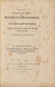
MUELLER, JOHANNES. 1801-1858. Ueber die phantastischen Gesichtserscheinungen. Koblenz: Jacob Hoe...Bonhams4.1(305)See Sold PriceJun 18, 2024


![Railways & Transport.- [Prospectus] The Dorking, Brighton, and Arundel Atmospheric Railway, by (1 of 1)](https://p1.liveauctioneers.com/5458/319736/171654703_1_x.jpg?height=282&quality=70&version=1708010439)