ATLAS of ANTIENT GEOGRAPHY by SAMUEL BUTLER 1843John McInnis Auctioneers,LLC4.6(502)See Sold PriceFeb 24, 2024
18TH C. ANTIQUE MAP: FRENCH & INDIAN WAR, FRAMEDThomaston Place Auction Galleries4.4(386)See Sold PriceFeb 24, 2024
Rand McNally Railroad Map Cabinet w/ 21 Railroad MapsRail & Road Auctions4.6(165)See Sold PriceMar 08, 2024
Keith Haring - Ink on New York Map, Best Buddies, Inscribed, Signed, and DatedSapphire Auction Gallery4(67)See Sold PriceMar 02, 2024
LATE 17TH C. FRENCH MAP OF THE NEW WORLD BY ALEXIS-HUBERT JAILLOT (1632-1712)Thomaston Place Auction Galleries4.4(386)See Sold PriceFeb 24, 2024
Central Railroad of New Jersey Map of Sandy Hook Route-ca. 1903JM Hobby Supply and Railroad Artifact Auctions4.4(126)See Sold PriceFeb 24, 2024
Lot of Six Mixed Atlas Box Cars-HO Scale-New in BoxJM Hobby Supply and Railroad Artifact Auctions4.4(126)See Sold PriceFeb 25, 2024
Rand McNally/Santa Fe Railroad Map of Iowa-1912JM Hobby Supply and Railroad Artifact Auctions4.4(126)See Sold PriceFeb 24, 2024
NICOLAES VISSCHER (NETHERLANDS, 1618-1709) MAP OF THE NEW WORLDThomaston Place Auction Galleries4.4(386)See Sold PriceFeb 24, 2024
17TH C. WORLD MAP BY NICOLAES VISSCHER (NETHERLANDS, 1618-1709)Thomaston Place Auction Galleries4.4(386)See Sold PriceFeb 24, 2024
Lot of Six Mixed Atlas Cabooses-HO Scale-New in BoxJM Hobby Supply and Railroad Artifact Auctions4.4(126)See Sold PriceFeb 25, 2024
SoldSENEX, JOHN. A New General Atlas.SENEX, JOHN. A New General Atlas. 34 double-page engraved maps, all but city maps hand-colored in outline, 7 engraved sheets of subscriber's arms. Folio, 540x365 mm, contemporary panelled calf, darkenSee Sold Price
Sold* [SENEX, John]. A New General Atlas. London: for* [SENEX, John]. A New General Atlas, Containing a Geographical and Historical Account of All the Empires, Kingdoms and other Dominions of the World. London: for Daniel Browne, Thomas Taylor, et al, 1See Sold Price
SoldSENEX, JOHN. A New General Atlas.SENEX, JOHN. A New General Atlas. 9 (of 34) double-page engraved maps, each hand-colored in outline. Folio, contemporary panelled sheep, very worn; browning and foxing throughout, some gatherings spruSee Sold Price
SENEX, John. A New General AtlasLondon, 1721. Large folio, partially disbound, lacking rear cover. Some heraldic plates present, but lacking all maps. #BooksSee Sold Price
SENEX, John. A New General AtlasLondon, 1721. Large folio, partially disbound, lacking rear cover. Some heraldic plates present, but lacking all maps. #BooksSee Sold Price
SENEX, John. A New General AtlasLondon, 1721. Large folio, partially disbound, lacking rear cover. Some heraldic plates present, but lacking all maps.See Sold Price
SoldWith Large Hand-Coloured Folding Maps Senex (John)With Large Hand-Coloured Folding Maps Senex (John) A New General Atlas, Containing a Geographical and Historical Account of All the Empires. Lg. Atlas folio L. 1721. Red & bl. title with engd. vignettSee Sold Price
SoldMap Early 18th Century "A New Map of the World",Most Humbly Inscribed to his Royal Highness George Prince of Wales", by John Senex, c.1721, from the New General Atlas of the World, handcoloured etching, framed, 42cm x 52cmSee Sold Price
SoldA New General Atlas, containing a Geographical and...A New General Atlas, containing a Geographical and Historical Account of all the Empires, Kingdoms and other Dominions of the World. SENEX, John (1678-1740). London: Daniel Browne, Thomas Taylor, JohnSee Sold Price
SoldMap of Turky, Arabia and Persia. Corrected from the[In A New general atlas : containing a geographical and historical account of all the empires, kingdoms and other dominions of the world, by John Senex][London, 1721]47 cm x 57 cm Watermarked paper. OSee Sold Price
SoldSenex, A New Map Of China & India c.1721[Asia/Indonesia]. John Senex. A New Map Of India & China From the latest Observations. Double-page engraved map, from ''A New General Atlas,'' Lon: c.1721. Early outline hand-coloring, 19 3/8 x 22 7/8See Sold Price
1721 Map of Turky, Arabia and Persia. & 1814 Arabia,Map of Turky, Arabia and Persia. Corrected from the latest Travels & from ye Observations of ye Royal Societys of London & Paris by G. de L’Isle Revised by I. John Senex In A New general atlas :See Sold Price
SoldJohn Senex Map of North and South America 1719-17John Senex (1678–1740), "A New Map of America from the Latest Observations," London, ca. 1719-1721. Hand colored copperplate engraved map of North and South America, from Senex's "New General ASee Sold Price
SoldTHOMSON, JOHN. A New General Atlas.THOMSON, JOHN. A New General Atlas. 77 engraved mapsheets, with 2-sheet and 3-sheet maps counted by sheet. Folio, early 1/2 morocco, quite worn, covers will be loose; considerable browning and offsettSee Sold Price
SoldTHOMSON, JOHN. A New General Atlas.THOMSON, JOHN. A New General Atlas. 64 (of 74) hand-colored mapsheets, plus engraved chart. Folio, contemporary 1/2 diced calf, defective; serious defects throughout but many surviving without problemSee Sold Price
SoldAtlases.- Thomson (John) [A new general atlas,Atlases.- Thomson (John) [A new general atlas, consisting of a series of geographical designs, on various projections, exhibiting the form and component parts of the globe; and a collection of maps anSee Sold Price
SoldThomson (John) A New General AtlasThomson (John) A New General Atlas,folding engraved frontispiece, dedication, folding table and 73 double-page hand-coloured maps (13 folding and 60 double-page), title and frontispiece and soSee Sold Price
SoldThomson (John) A New General AtlasThomson (John) A New General Atlas,folding engraved frontispiece of comparative elevations, engraved dedication, folding engraved plan of the lengths of principal rivers (all uncoloured), 76 eSee Sold Price
SoldDower (John) A New General Atlas...Dower (John) A New General Atlas...,double-page engraved title, 45 double-page or folding hand-coloured engraved maps as called for, 1 hand-coloured thematic plate, ms. number on blank recto oSee Sold Price
SoldTHOMSON, JOHN. A New General Atlas,THOMSON, JOHN. A New General Atlas, Consisting of a Series of Geographical Designs, on Various Projections, Exhibiting the Form and Component Parts of the Globe. Letterpress title, engraved dedicationSee Sold Price
SoldDower (John) A New General Atlas of the World…, doubleDower (John) A New General Atlas of the World…, double page decorative calligraphic title, contents list, 47 engraved maps (one folding), outlined in colour, contemporary half green morocco, a.e.g.,See Sold Price
SoldWorld.- Dower (John) A New General Atlas of the WoWorld.- Dower (John) A New General Atlas of the World,engraved hand-coloured maps, ownership inscriptions, contemporary half morocco, covers detached, worn, [c.1840]; and an 18th century editiSee Sold Price
SoldTwo Maps from John Thomson's New General Atlas, "NorthTwo Maps from John Thomson's New General Atlas, "North America," 1814, and "Poland," America- H. - 21 1/2 in., W. - 28 1/2 in., Poland- H.- 21 in., W.- 27 1/2 in.See Sold Price
Sold-. Thomson (John) A New General Atlas-. Thomson (John) A New General Atlas,engraved dedication, one plate of Comparative Elevations (uncoloured), 75 engraved maps, (numbered 1-74 with one on 2 sheets), double-page and folding, wiSee Sold Price
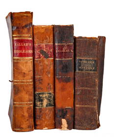
BOOKS on AMERICAN-EUROPEAN HISTORY & KING CHARLESJohn McInnis Auctioneers,LLC4.6(502)See Sold PriceFeb 24, 2024
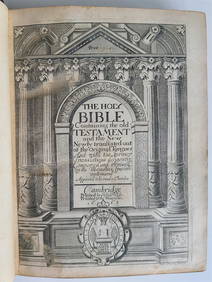
General Books - Nicolson - The Counties of Britain - A Tudor Atlas by John SpeedTimeLine Auctions Ltd.4.5(183)See Sold PriceMar 08, 2024
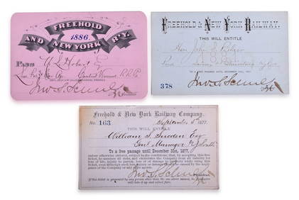
Three Freehold & New York Railway Annual Passes - 1877, 1881, and 1886Rail & Road Auctions4.6(165)See Sold PriceMar 08, 2024
Battle of the Nile: Disposition of the English & French Fleets, at the Commencement of the Action,Trillium Antique Prints & Rare Books4.5(30)See Sold PriceFeb 24, 2024
Arrowsmith & Lewis - Map of PolynesiaTrillium Antique Prints & Rare Books4.5(30)See Sold PriceFeb 24, 2024
Arrowsmith & Lewis - Map of North AmericaTrillium Antique Prints & Rare Books4.5(30)See Sold PriceFeb 24, 2024
Arrowsmith & Lewis - Map of the World on Mercator's ProjectionTrillium Antique Prints & Rare Books4.5(30)See Sold PriceFeb 24, 2024
Arrowsmith & Lewis - Map of LouisianaTrillium Antique Prints & Rare Books4.5(30)See Sold PriceFeb 24, 2024
Arrowsmith & Lewis - Map of the United StatesTrillium Antique Prints & Rare Books4.5(30)See Sold PriceFeb 24, 2024
JOHN FLEMING GOULD (1906-1996) SOUTHERN PACIFIC RAILROAD. Gouache maquette.Swann Auction Galleries4.4(65)See Sold PriceFeb 29, 2024
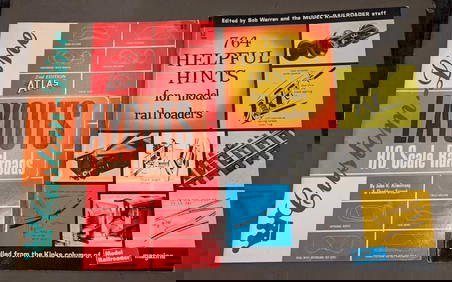
Custom-Line Layouts And Helpful Hints For Model RailroadersRapid Estate Liquidators and Auction Gallery4.5(1.1k)See Sold PriceFeb 24, 2024
West Indies Islands. Guadaloupe. | Mariegalante &C. | Antigua.Jasper524.5(9.8k)See Sold PriceFeb 27, 2024
Guthrie, William 1812 Antique Map. Spain and PortugalAlbion Auctions4.6(336)See Sold PriceMar 01, 2024
Robert H Labberton - Map of The Territory of the Present United States - The territory of theProverde Auctions4.3(3)See Sold PriceFeb 28, 2024


![* [SENEX, John]. A New General Atlas. London: for (1 of 2)](https://p1.liveauctioneers.com/197/129259/65743314_1_x.jpg?height=282&quality=70&version=1539206179)