ATLAS of ANTIENT GEOGRAPHY by SAMUEL BUTLER 1843John McInnis Auctioneers,LLC4.6(502)See Sold PriceFeb 24, 2024
18TH C. ANTIQUE MAP: FRENCH & INDIAN WAR, FRAMEDThomaston Place Auction Galleries4.4(386)See Sold PriceFeb 24, 2024
Rand McNally Railroad Map Cabinet w/ 21 Railroad MapsRail & Road Auctions4.6(165)See Sold PriceMar 08, 2024
Keith Haring - Ink on New York Map, Best Buddies, Inscribed, Signed, and DatedSapphire Auction Gallery4(67)See Sold PriceMar 02, 2024
LATE 17TH C. FRENCH MAP OF THE NEW WORLD BY ALEXIS-HUBERT JAILLOT (1632-1712)Thomaston Place Auction Galleries4.4(386)See Sold PriceFeb 24, 2024
Central Railroad of New Jersey Map of Sandy Hook Route-ca. 1903JM Hobby Supply and Railroad Artifact Auctions4.4(126)See Sold PriceFeb 24, 2024
Lot of Six Mixed Atlas Box Cars-HO Scale-New in BoxJM Hobby Supply and Railroad Artifact Auctions4.4(126)See Sold PriceFeb 25, 2024
Rand McNally/Santa Fe Railroad Map of Iowa-1912JM Hobby Supply and Railroad Artifact Auctions4.4(126)See Sold PriceFeb 24, 2024
NICOLAES VISSCHER (NETHERLANDS, 1618-1709) MAP OF THE NEW WORLDThomaston Place Auction Galleries4.4(386)See Sold PriceFeb 24, 2024
17TH C. WORLD MAP BY NICOLAES VISSCHER (NETHERLANDS, 1618-1709)Thomaston Place Auction Galleries4.4(386)See Sold PriceFeb 24, 2024
Lot of Six Mixed Atlas Cabooses-HO Scale-New in BoxJM Hobby Supply and Railroad Artifact Auctions4.4(126)See Sold PriceFeb 25, 2024
SoldTHOMSON, JOHN. A New General Atlas.THOMSON, JOHN. A New General Atlas. 77 engraved mapsheets, with 2-sheet and 3-sheet maps counted by sheet. Folio, early 1/2 morocco, quite worn, covers will be loose; considerable browning and offsettSee Sold Price
SoldTHOMSON, JOHN. A New General Atlas.THOMSON, JOHN. A New General Atlas. 64 (of 74) hand-colored mapsheets, plus engraved chart. Folio, contemporary 1/2 diced calf, defective; serious defects throughout but many surviving without problemSee Sold Price
SoldAtlases.- Thomson (John) [A new general atlas,Atlases.- Thomson (John) [A new general atlas, consisting of a series of geographical designs, on various projections, exhibiting the form and component parts of the globe; and a collection of maps anSee Sold Price
SoldThomson (John) A New General AtlasThomson (John) A New General Atlas,folding engraved frontispiece, dedication, folding table and 73 double-page hand-coloured maps (13 folding and 60 double-page), title and frontispiece and soSee Sold Price
SoldThomson (John) A New General AtlasThomson (John) A New General Atlas,folding engraved frontispiece of comparative elevations, engraved dedication, folding engraved plan of the lengths of principal rivers (all uncoloured), 76 eSee Sold Price
SoldTHOMSON, JOHN. A New General Atlas,THOMSON, JOHN. A New General Atlas, Consisting of a Series of Geographical Designs, on Various Projections, Exhibiting the Form and Component Parts of the Globe. Letterpress title, engraved dedicationSee Sold Price
Sold-. Thomson (John) A New General Atlas-. Thomson (John) A New General Atlas,engraved dedication, one plate of Comparative Elevations (uncoloured), 75 engraved maps, (numbered 1-74 with one on 2 sheets), double-page and folding, wiSee Sold Price
SoldOriginal Copper Engraving ANTIQUE MAP AMERICAS 1817Details: Original Copper Engraving ANTIQUE MAP AMERICAS 1817 John & George Menzies Engravers John Thomson New General Atlas Political Borders British Territory Spain British Canada Atlas Original HanSee Sold Price
Sold19th Century Map of the Eastern UnitedStates [The Southern Provinces of the United States,] from John Thomson's [New General Atlas,] Edinburgh, 1817, showing towns, geographical features, and Native American tribes in the southern and midSee Sold Price
SoldMap, Southern Provinces of the United StatesMap, Southern Provinces of the United Stateshand colored engraving, Plate 57 from John Thomson's NEW GENERAL ATLAS (Edinburgh: John Thomson & Co., 1817), upper left carries Hudson River view. PresenteSee Sold Price
SoldNorth America by John Thomson. Forts, Missions & Indian settlements 1817 mapTitle: "North America" by John Thomson. Forts, Missions & Indian settlements 1817 map Description: North America' by Drawn & engraved by Nathaniel Robert Hewitt for John Thomson's "New General Atlas"See Sold Price
Spanish North America. THOMSON. Texas, Mexico & Southwestern USA 1830 mapTitle: "Spanish North America". THOMSON. Texas, Mexico & Southwestern USA 1830 map Description: Spanish North America [northern part] by Drawn & engraved for John Thomson's "New General Atlas" (1830).See Sold Price
SoldAmerica. North/South Americas. British Florida. Missions. THOMSON 1817 mapTitle: "America". North/South Americas. British Florida. Missions. THOMSON 1817 map Description: America' by Drawn & engraved by John & George Menzies for John Thomson's "New General Atlas" (PublishedSee Sold Price
SoldMap, "The Southern Provinces of the United States"Map, "The Southern Provinces of the United States" hand colored engraving, Plate 57 from John Thomson's NEW GENERAL ATLAS (Edinburgh: John Thomson & Co., 1817). Presented in wooden frame. DOA 22 x 29See Sold Price
SoldTwo Maps from John Thomson's New General Atlas, "NorthTwo Maps from John Thomson's New General Atlas, "North America," 1814, and "Poland," America- H. - 21 1/2 in., W. - 28 1/2 in., Poland- H.- 21 in., W.- 27 1/2 in.See Sold Price
Corea and Japan by John Thomson. East Asia. Korea 1817 old antique map chartTitle: "Corea and Japan" by John Thomson. East Asia. Korea 1817 old antique map chart Description: Corea and Japan' by Drawn & engraved by John & George Menzies for John Thomson's "New General Atlas"See Sold Price
Spanish North America. THOMSON. Texas, Mexico & Southwestern USA 1817 mapTitle: "Spanish North America". THOMSON. Texas, Mexico & Southwestern USA 1817 map Description: Spanish North America [northern part] by Drawn & engraved for John Thomson's "New General Atlas" (PublisSee Sold Price
Ireland by John Thomson. Coach roads 1817 old antique vintage map plan chartTitle: "Ireland" by John Thomson. Coach roads 1817 old antique vintage map plan chart Description: Ireland' by Drawn & engraved by Samuel John Neele for John Thomson's "New General Atlas" (Published iSee Sold Price
New Holland & Asiatic islands Australia New Zealand Melanesia THOMSON 1817 mapTitle: "New Holland & Asiatic islands" Australia New Zealand Melanesia THOMSON 1817 map Description: New Holland and Asiatic islands' by Drawn & engraved for John Thomson's "New General Atlas" (PublisSee Sold Price
Birman Empire. Burma Myanmar. Western Siam/Thailand Bengal. THOMSON 1830 mapTitle: "Birman Empire". Burma Myanmar. Western Siam/Thailand Bengal. THOMSON 1830 map Description: Birman Empire' by Drawn & engraved by Samuel John Neele for John Thomson's "New General Atlas" (1830)See Sold Price
Sold2 maps: ''Africa'' and ''New Holland...,'' 1814.[Miscellany]. 5 Maps and Plates. First two listed from John Thomson, A New General Atlas, [Edin]: 1814. Some posts in margins, images very good, original hand-color outline. ++ New Holland And AsiaticSee Sold Price
SoldMap, Eastern Hemisphere, Thomson [Lon: c1814-1817Eastern Hemisphere. Engraved double page circular hemisphere map, from John Thomson's ''A New General Atlas,'' Lon: c.1814-1817. Original hand-coloring, 19 7/8 in. diameter.See Sold Price
Sold19th C. Western & Northern Hemisphere MapsTwo 19th century maps, including one of the Northern hemisphere, drawn and engraved for John Thomson Co. New General Atlas, 1814 [26" H x 21" W], together with a map of the Western hemisphere, drawn aSee Sold Price
SoldAtlantic Islands. The New General Atlas. John Thomson.Maker: Thomson, John. Origin: Edinburgh, Thomson, 1817. Medium: Original engraving hand-colored at publication. Sheet size: 21 x 26 in. No Reserve: This lot starts at $1 and has no reserve as a courteSee Sold Price
BOOKS on AMERICAN-EUROPEAN HISTORY & KING CHARLESJohn McInnis Auctioneers,LLC4.6(502)See Sold PriceFeb 24, 2024
General Books - Nicolson - The Counties of Britain - A Tudor Atlas by John SpeedTimeLine Auctions Ltd.4.5(183)See Sold PriceMar 08, 2024
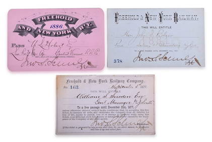
Three Freehold & New York Railway Annual Passes - 1877, 1881, and 1886Rail & Road Auctions4.6(165)See Sold PriceMar 08, 2024
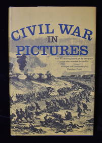
3 Civil War and WWI Books in Excellent ConditionNorth American Artifact Auctions4.6(182)See Sold PriceApr 20, 2024
Battle of the Nile: Disposition of the English & French Fleets, at the Commencement of the Action,Trillium Antique Prints & Rare Books4.5(30)See Sold PriceFeb 24, 2024
Arrowsmith & Lewis - Map of PolynesiaTrillium Antique Prints & Rare Books4.5(30)See Sold PriceFeb 24, 2024
Arrowsmith & Lewis - Map of North AmericaTrillium Antique Prints & Rare Books4.5(30)See Sold PriceFeb 24, 2024
Arrowsmith & Lewis - Map of the World on Mercator's ProjectionTrillium Antique Prints & Rare Books4.5(30)See Sold PriceFeb 24, 2024
Arrowsmith & Lewis - Map of LouisianaTrillium Antique Prints & Rare Books4.5(30)See Sold PriceFeb 24, 2024
Arrowsmith & Lewis - Map of the United StatesTrillium Antique Prints & Rare Books4.5(30)See Sold PriceFeb 24, 2024
JOHN FLEMING GOULD (1906-1996) SOUTHERN PACIFIC RAILROAD. Gouache maquette.Swann Auction Galleries4.4(65)See Sold PriceFeb 29, 2024
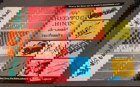
Custom-Line Layouts And Helpful Hints For Model RailroadersRapid Estate Liquidators and Auction Gallery4.5(1.1k)See Sold PriceFeb 24, 2024
West Indies Islands. Guadaloupe. | Mariegalante &C. | Antigua.Jasper524.5(9.8k)See Sold PriceFeb 27, 2024
Robert H Labberton - Map of The Territory of the Present United States - The territory of theProverde Auctions4.3(3)See Sold PriceFeb 28, 2024