Soldc. 1720 Eastern Hemisphere Map of the ContinentsHistoric Maps Eastern Hemisphere Map of the Ancient Continents c. 1720, Hand-colored Map entitled, “DU GLOBE TERRESTRE,” Eastern Hemisphere with Asia, Europe, Africa & Pacific, Choice Near Mint. TSee Sold Price
SoldEastern Hemisphere Map of the Ancient ContinentsHistoric MapsEastern Hemisphere Map of the Ancient Continents c. 1720, Hand-colored Map entitled, "DU GLOBE TERRESTRE," Eastern Hemisphere with Asia, Europe, Africa & Pacific, Choice Near MintSee Sold Price
Walker: Map of Western and Eastern Hemisphere, 1840Map: Western Hemisphere / Eastern Hemisphere Maker: J & C Walker Published: 1840 Publisher: Society for the Diffusion of Useful Knowledge / S.D.U.K Size: Quarto, 12.75 inches J & C Walker were a groupSee Sold Price
1878 Warner Beers Eastern Hemisphere MapMap by Warner Beers, c. 1878, Chicago, 14.5 x 17.5 in. A quite nice and detailed map of the Eastern Hemisphere showing great deal of detail. The countries are color coded. Antarctica's coastline is onSee Sold Price
SoldWestern Hemisphere Map with California as IslandHistoric MapsWestern Hemisphere Map with California as an Island c. 1720, Hand-colored Map entitled, "DU GLOBE TERRESTRE," Western Hemisphere with California as an Island, Choice Near Mint. ThSee Sold Price
Mallet: Map of Eastern Hemisphere, 1683TITLE OF THE MAP: 'Ancien Continent avec plusieurs Isles, Oceans et Mers' Partial outline of Terra Australis, the hypothesised southern continent, is shown DATE PRINTED: 1683 IMAGE SIZE: Approx OveralSee Sold Price
EASTERN HEMISPHERE. Europe Asia Africa. AustraliaTITLE OF THE MAP: 'Ancien Continent avec plusieurs Isles' Australia appears partly outlined. Enhanced with small ships. Partial outline of Terra Australis, the hypothesised southern continent, is showSee Sold Price
Mallet: Antique Map of Eastern Hemisphere, 1683Title/Content of Map: Ancien Continent or Eastern Hemisphere Date Printed: 1683 Cartographer: Mallet, Allain Manesson Size (inches): 4 x 6 Condition: Very Good. Strong impression on laid with no condiSee Sold Price
EASTERN HEMISPHERE. 'Ancien continent'. Asia AfricaReserve Reduced! TITLE OF THE MAP: 'Ancien Continent avec plusieurs Isles, Oceans et Mers' Partial outline of Terra Australis, the hypothesised southern continent, is shown. DATE PRINTED: 1683 IMAGE SSee Sold Price
EASTERN HEMISPHERE. Australia incomplete. Asia AfricaReserve Reduced! TITLE OF THE MAP: 'Ancien Continent avec plusieurs Isles, Oceans, Mers, Golfes' Partial outline of Terra Australis, the hypothesised southern continent, is shown. DATE PRINTED: 1683 ISee Sold Price
EASTERN HEMISPHERE. Australia incomplete. Asia AfricaTITLE OF THE MAP: 'Ancien Continent avec plusieurs Isles, Oceans, Mers, Golfes' Partial outline of Terra Australis, the hypothesised southern continent, is shown. DATE PRINTED: 1683 IMAGE SIZE: ApproxSee Sold Price
Mallet: EASTERN HEMISPHERE. Australia incomplete. AsiaTITLE OF THE MAP: 'Ancien Continent avec plusieurs Isles, Oceans, Mers, Golfes' Partial outline of Terra Australis, the hypothesised southern continent, is shown. DATE PRINTED: 1683 IMAGE SIZE: ApproxSee Sold Price
Mallet: Antique Map of the Eastern Hemisphere, 1683Title/Content of Map: 'Ancien Continent avec plusieurs Isles, Oceans, Mers, Golfes' Partial outline of Terra Australis, the hypothesised southern continent, is shown. Australia incomplete. Asia AfricaSee Sold Price
EASTERN HEMISPHERE Europe Africa Asia Supposed Antarctic Continent SDUK 1857 mapTITLE/CONTENT OF MAP: 'EASTERN HEMISPHERE' The map shows an incomplete coastline of New Guinea, the non-existent Mountains of Kong in West Africa, and small parts of the Antarctic coastline which hadSee Sold Price
EASTERN HEMISPHERE. 'Ancien continent'. Asia AfricaTITLE OF THE MAP: 'Ancien Continent avec plusieurs Isles, Oceans et Mers'Partial outline of Terra Australis, the hypothesised southern continent, is shown. The top image on the right hand side shows tSee Sold Price
EASTERN HEMISPHERE. Europe Asia Africa. AustraliaTITLE OF THE MAP: 'Ancien Continent avec plusieurs Isles' Australia appears partly outlined. Enhanced with small ships. Partial outline of Terra Australis, the hypothesised southern continent, is showSee Sold Price
EASTERN HEMISPHERE. Europe Asia Africa. Australia incomplete. MALLET 1683 mapTITLE OF THE MAP: 'Ancien Continent avec plusieurs Isles' (Du Globe Terrestre) Australia appears partly outlined. Enhanced with small ships. Partial outline of Terra Australis, the hypothesised southeSee Sold Price
EASTERN HEMISPHERE. Australia incomplete. Asia Africa Europe. MALLET 1683 mapTITLE OF THE MAP: 'Ancien Continent avec plusieurs Isles, Oceans, Mers, Golfes' (Du Globe Terrestre) Partial outline of Terra Australis, the hypothesised southern continent, is shown. DATE PRINTED: 16See Sold Price
EASTERN HEMISPHERE. 'Ancien continent'. Asia Africa Europe. MALLET 1683 mapTITLE OF THE MAP: 'Ancien Continent avec plusieurs Isles, Oceans et Mers' (Du Globe Terrestre) Partial outline of Terra Australis, the hypothesised southern continent, is shown. DATE PRINTED: 1683 IMASee Sold Price
EASTERN HEMISPHERE. Shows incomplete Australian coastline. MALLET 1683 old mapTITLE OF THE MAP: 'Ancien Continent' (Du Globe Terrestre) Partial outline of Terra Australis, the hypothesised southern continent, is shown. DATE PRINTED: 1683 IMAGE SIZE: Approx Overall page size 13See Sold Price
EASTERN HEMISPHERE. Australia incomplete. Europe Asia Africa. MALLET 1683 mapTITLE OF THE MAP: 'Ancien Continent avec plusieurs Isles, Oceans et Mers' (Du Globe Terrestre) Partial outline of Terra Australis, the hypothesised southern continent, is shown. DATE PRINTED: 1683 IMASee Sold Price
EASTERN HEMISPHERE. Australia incomplete. Asia Africa Europe. MALLET 1683 mapTITLE OF THE MAP: 'Ancien Continent avec plusieurs Isles, Oceans, Mers, Golfes' (Du Globe Terrestre) Partial outline of Terra Australis, the hypothesised southern continent, is shown. DATE PRINTED: 16See Sold Price
EASTERN HEMISPHERE. 'Ancien continent'. Asia Africa Europe. MALLET 1683 mapTITLE OF THE MAP: 'Ancien Continent avec plusieurs Isles, Oceans et Mers' (Du Globe Terrestre) Partial outline of Terra Australis, the hypothesised southern continent, is shown. DATE PRINTED: 1683 IMASee Sold Price
EASTERN HEMISPHERE. Australia incomplete. Europe Asia Africa. MALLET 1683 mapTITLE OF THE MAP: 'Ancien Continent avec plusieurs Isles, Oceans et Mers' (Du Globe Terrestre) Partial outline of Terra Australis, the hypothesised southern continent, is shown. DATE PRINTED: 1683 IMASee Sold Price
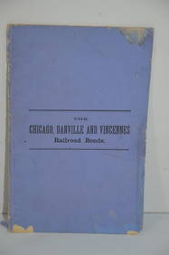
Chicago Danville and Vincennes RR Gold Bond Prospectus Book-1872JM Hobby Supply and Railroad Artifact Auctions4.4(127)See Sold PriceFeb 24, 2024
17TH C. WORLD MAP BY NICOLAES VISSCHER (NETHERLANDS, 1618-1709)Thomaston Place Auction Galleries4.4(393)See Sold PriceFeb 24, 2024
LATE 17TH C. FRENCH MAP OF THE NEW WORLD BY ALEXIS-HUBERT JAILLOT (1632-1712)Thomaston Place Auction Galleries4.4(393)See Sold PriceFeb 24, 2024
18TH C. ANTIQUE MAP: FRENCH & INDIAN WAR, FRAMEDThomaston Place Auction Galleries4.4(393)See Sold PriceFeb 24, 2024
19thc Colton Map, Comparitive Size of Lakes & IslandsConnoisseur Auctions3.9(336)See Sold PriceFeb 24, 2024
Willem Blaeu, Etc. 17th C. Antiquarian Maps, 2Auctions at Showplace4.6(740)See Sold PriceMar 17, 2024
1749 MAP CARTE DE LA TARTARIE ORIENTALE RUSSIA & CHINA antique EASTERN TARTARYJasper524.5(9.9k)See Sold PriceFeb 27, 2024
3 Vintage The World Lithographs, By JanssonThe Benefit Shop Foundation Inc.4.3(2.9k)See Sold PriceMar 13, 2024
Partie Occidentale de l'Ancien Continent… W Africa Macaronesia. BONNE 1780 mapJasper524.5(9.9k)See Sold PriceFeb 28, 2024
Vacheron Constantin Overseas World Time 43.5 mm Steel Mens WatchGolden Gate Auctioneer4.1(278)See Sold PriceFeb 24, 2024