ATLAS of ANTIENT GEOGRAPHY by SAMUEL BUTLER 1843John McInnis Auctioneers,LLC4.5(505)See Sold PriceFeb 24, 2024
18TH C. ANTIQUE MAP: FRENCH & INDIAN WAR, FRAMEDThomaston Place Auction Galleries4.4(393)See Sold PriceFeb 24, 2024
Rand McNally Railroad Map Cabinet w/ 21 Railroad MapsRail & Road Auctions4.6(165)See Sold PriceMar 08, 2024
Keith Haring - Ink on New York Map, Best Buddies, Inscribed, Signed, and DatedSapphire Auction Gallery4(67)See Sold PriceMar 02, 2024
LATE 17TH C. FRENCH MAP OF THE NEW WORLD BY ALEXIS-HUBERT JAILLOT (1632-1712)Thomaston Place Auction Galleries4.4(393)See Sold PriceFeb 24, 2024
Central Railroad of New Jersey Map of Sandy Hook Route-ca. 1903JM Hobby Supply and Railroad Artifact Auctions4.4(127)See Sold PriceFeb 24, 2024
Lot of Six Mixed Atlas Box Cars-HO Scale-New in BoxJM Hobby Supply and Railroad Artifact Auctions4.4(127)See Sold PriceFeb 25, 2024
Rand McNally/Santa Fe Railroad Map of Iowa-1912JM Hobby Supply and Railroad Artifact Auctions4.4(127)See Sold PriceFeb 24, 2024
NICOLAES VISSCHER (NETHERLANDS, 1618-1709) MAP OF THE NEW WORLDThomaston Place Auction Galleries4.4(393)See Sold PriceFeb 24, 2024
17TH C. WORLD MAP BY NICOLAES VISSCHER (NETHERLANDS, 1618-1709)Thomaston Place Auction Galleries4.4(393)See Sold PriceFeb 24, 2024
Lot of Six Mixed Atlas Cabooses-HO Scale-New in BoxJM Hobby Supply and Railroad Artifact Auctions4.4(127)See Sold PriceFeb 25, 2024
Planisphere suivant la projection de Mercator. World. BONNE 1780 old mapTITLE/CONTENT OF MAP: 'Planisphere suivant la Projection de Mercator' A map of the world on Mercator's projection, showing the trade winds DATE PRINTED: 1780 IMAGE SIZE: Approx 23.0 x 35.0cm, 9 x 13.7See Sold Price
Planisphere Suivant La Projection De Mercator 1780 MapPlanisphere Suivant La Projection De Mercator World Bonne 1780 Old Map. Title/content of Map: 'planisphere Suivant La Projection De Mercator' a Map of the World on Mercator's Projection, Showing the TSee Sold Price
SoldBonne: Antique Map of World on Mercator's ProjectionTitle/Content of Map: 'Planisphere suivant la Projection de Mercator' A map of the world on Mercator's projection, showing the trade winds Date Printed: 1780 Image Size: Approx 23.0 x 35.0cm, 9 x 13.7See Sold Price
Bonne: Antique Map of World on Mercator's ProjectionTitle/Content of Map: 'Planisphere suivant la Projection de Mercator' A map of the world on Mercator's projection, showing the trade winds Date Printed: 1780 Image Size: Approx 23.0 x 35.0cm, 9 x 13.7See Sold Price
Bonne: Antique Map of the World, Mercator's ProjectionTitle/Content of Map: 'Planisphere suivant la Projection de Mercator' A map of the world on Mercator's projection, showing the trade winds Date Printed: 1780 Image Size: Approx 23.0 x 35.0cm, 9 x 13.7See Sold Price
Sold2 maps. Inc: Planisphère suivant ... Mercator.[World] 2 maps. (1) Bonne, Rigobert (French, 1727-1795). "Planisphère suivant la projection de Mercator." c.1774. Hand-colored copper plate engraving. 8 1/4" x 12 1/2" Framed: 15 1/2" x 20" (2) MorseSee Sold Price
SoldAttractive map of the world 1774Heading: (World) Author: Bonne, Rigobert Title: Planisphere suivant la Projection de Mercator Place Published: Paris Publisher: Date Published: c.1774 Description: Copper-enSee Sold Price
Mappemonde suivant la Projection de Mercator. World. MALTE-BRUN c1871 oldTITLE/CONTENT OF MAP: 'Mappemonde suivant la Projection de Mercator [World Map following the Mercator Projection]' DATE PRINTED: c1871 IMAGE SIZE: Approx 35.0 x 46.5cm, 13.75 x 18.25 inches (Large); PSee Sold Price
Mappemonde suivant la Projection de Mercator. World.TITLE/CONTENT OF MAP: 'Mappemonde suivant la Projection de Mercator [World Map following the Mercator Projection]' DATE PRINTED: c1871 IMAGE SIZE: Approx 35.0 x 46.5cm, 13.75 x 18.25 inches (Large); PSee Sold Price
Malte-Brun: Antique Map of the World, 1846TITLE/CONTENT OF MAP: 'Mappemonde suivant la Projection de Mercator' DATE PRINTED: c1846 IMAGE SIZE: Approx 32.5 x 43.5cm, 12.75 x 17.25 inches (Large); Please note that this is a folding map. TYPE: ASee Sold Price
World Mappemonde Suivant La Projection Mercator C1846World. Mappemonde Suivant La Projection De Mercator. Malte-brun, C1846. World. Mappemonde Suivant La Projection De Mercator. Malte-brun, C1846. Title/content of Map: 'mappemonde Suivant La ProjectionSee Sold Price
WORLD. Mappemonde suivant la Projection de Mercator.TITLE/CONTENT OF MAP: 'Mappemonde suivant la Projection de Mercator' Date: c1846 IMAGE SIZE: Approx 32.5 x 43.5cm, 12.75 x 17.25 inches (Large); Please note that this is a folding map. TYPE: Antique eSee Sold Price
WORLD. Mappemonde suivant la Projection de Mercator.TITLE/CONTENT OF MAP: 'Mappemonde suivant la Projection de Mercator' DATE PRINTED: c1846 IMAGE SIZE: Approx 32.5 x 43.5cm, 12.75 x 17.25 inches (Large); Please note that this is a folding map. TYPE: ASee Sold Price
World.- Vaugondy (Giles Robert de) Mappe Monde suivantWorld.- Vaugondy (Giles Robert de) Mappe Monde suivant la projection des cartes reduites, world map on Mercator's projection, with the northwest in North America blank except for a notation regardingSee Sold Price
SoldWorld.- Vaugondy (Robert de) Mappe Monde suivant laWorld.- Robert de Vaugondy (publisher) Mappe Monde suivant la projection des cartes rediutes, world map on Mercator's projection, with most of the northwest in North America remaining blank except forSee Sold Price
MAPS, Brazil, BonneBrazil. Rigobert Bonne, [Lot of 2] Carte de la Partie Septentrionale du Bresil [and] Carte de la Partie Meridionale du Bresil, avec les Possessions Espagnoles Voisines qui en sont a l'Ouest, 1780 (cirSee Sold Price
MAPS - Brazil. BonneBrazil. Rigobert Bonne, [Lot of 2] Carte de la Partie Septentrionale du Bresil [and] Carte de la Partie Meridional du Bresil avec les Possessions Espagnoles Voisines qui en sont a l'Ouest, 1780 (circaSee Sold Price
Carte de l'Isle de la Jamaique. Jamaica. BONNE 1780 old antique map chartTITLE/CONTENT OF MAP: 'Carte de l'Isle de la Jamaique' A map of Jamaica DATE PRINTED: 1780 IMAGE SIZE: Approx 23.0 x 34.0cm, 9 x 13.25 inches (Large); Please note that this is a folding map. TYPE: AntSee Sold Price
Carte de l'Isle de la Jamaique. Jamaica. BONNE 1780 old antique map chartTITLE/CONTENT OF MAP: 'Carte de l'Isle de la Jamaique' A map of Jamaica DATE PRINTED: 1780 IMAGE SIZE: Approx 23.0 x 34.0cm, 9 x 13.25 inches (Large); Please note that this is a folding map. TYPE: AntSee Sold Price
Antique World Map, Mercator’s Projection, 1835“Carte Hydrographique des parties Connues de la Terre Dressee sur la Projection de Mercator” by C. L. Gressier. Published by the Depot-General de la Marine, Paris, 1835. Measures 23” tall, 34 3/See Sold Price
SoldPlanisphere, Direction of Ocean CurrentsTitle: Planisphere Suivant La Projection De Mecator Maker: Rigobert Bonne Origin: Paris,1780 For Guillaume Raynal's Atlas de Toutes les Parties Connues du Globe Terrestre' Arrows showing the directionSee Sold Price
SoldMap of world by Chamouin 1805Heading: Author: Chamouin, Jean Baptiste Marie Title: Mappe-Monde sur la Projection Reduite de Mercator Place Published: Paris Publisher: Date Published: 1806 Description:See Sold Price
Map of world by Chamouin 1805Title: Mappe-Monde sur la Projection Reduite de Mercator Author: Chamouin, Jean Baptiste Marie Description: Copper-engraved map, hand-colored in outline; uncolored pictorial cartouche. 29x45 cm. (11½See Sold Price
Map of world by Chamouin 1805Title: Mappe-Monde sur la Projection Reduite de Mercator Author: Chamouin, Jean Baptiste Marie Description: Copper-engraved map, hand-colored in outline; uncolored pictorial cartouche. 29x45 cm. (11½See Sold Price
Royaumes, Etats et Pays de la Haute Guinée. Gulf of Guinea. BONNE 1788 old mapJasper524.5(9.9k)See Sold PriceFeb 28, 2024
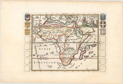
Carte de la partie septentrionale d'Afrique, ou de la Barbarie… BONNE 1780 mapJasper524.5(9.9k)See Sold PriceFeb 28, 2024
Carte de la Haute et de la Basse Guinée. Gulf of Guinea Africa. BONNE 1780 mapJasper524.5(9.9k)See Sold PriceFeb 28, 2024
Partie Occidentale de l'Ancien Continent… W Africa Macaronesia. BONNE 1780 mapJasper524.5(9.9k)See Sold PriceFeb 28, 2024