ATLAS of ANTIENT GEOGRAPHY by SAMUEL BUTLER 1843John McInnis Auctioneers,LLC4.5(505)See Sold PriceFeb 24, 2024
18TH C. ANTIQUE MAP: FRENCH & INDIAN WAR, FRAMEDThomaston Place Auction Galleries4.4(393)See Sold PriceFeb 24, 2024
Rand McNally Railroad Map Cabinet w/ 21 Railroad MapsRail & Road Auctions4.6(165)See Sold PriceMar 08, 2024
Keith Haring - Ink on New York Map, Best Buddies, Inscribed, Signed, and DatedSapphire Auction Gallery4.1(67)See Sold PriceMar 02, 2024
LATE 17TH C. FRENCH MAP OF THE NEW WORLD BY ALEXIS-HUBERT JAILLOT (1632-1712)Thomaston Place Auction Galleries4.4(393)See Sold PriceFeb 24, 2024
Central Railroad of New Jersey Map of Sandy Hook Route-ca. 1903JM Hobby Supply and Railroad Artifact Auctions4.4(127)See Sold PriceFeb 24, 2024
Lot of Six Mixed Atlas Box Cars-HO Scale-New in BoxJM Hobby Supply and Railroad Artifact Auctions4.4(127)See Sold PriceFeb 25, 2024
Rand McNally/Santa Fe Railroad Map of Iowa-1912JM Hobby Supply and Railroad Artifact Auctions4.4(127)See Sold PriceFeb 24, 2024
NICOLAES VISSCHER (NETHERLANDS, 1618-1709) MAP OF THE NEW WORLDThomaston Place Auction Galleries4.4(393)See Sold PriceFeb 24, 2024
17TH C. WORLD MAP BY NICOLAES VISSCHER (NETHERLANDS, 1618-1709)Thomaston Place Auction Galleries4.4(393)See Sold PriceFeb 24, 2024
Lot of Six Mixed Atlas Cabooses-HO Scale-New in BoxJM Hobby Supply and Railroad Artifact Auctions4.4(127)See Sold PriceFeb 25, 2024
Mortier & Jaillot Map of the Chesapeake BayMORTIER, Pierre (1661-1711), After JAILLOT, Alexis-Hubert (1632-1712). Carte Particuliere de Virginie, Maryland, Pennslyvanie, La Nouvelle Jarsey. . . Engraved map with original hand color in full. AmSee Sold Price
SoldJaillot Chesapeake Bay MapAfter Jaillot, Alexis-Hubert (1632-1712). Carte Particuliere de Virginie, Maryland, Pennsilvanie, la Nouvelle Iarsey. Engraved map with original color in outline. Amsterdam: Mortier, 1708. 24 3/4" x 3See Sold Price
SoldMortier Map of Chesapeake BayCarte Particuliere de Virginie, Maryland, Pennsilvanie, La Nouvelle Jarsey. Orient et Occidentale. Pierre Mortier (1661–1711). Engraving with original handcolor. Amsterdam, c. 1700. 21 1/2 x 32 inchSee Sold Price
Mortier Map of Chesapeake BayCarte Particuliere Virginie, Maryland, Pennsilvanie, La Nouvelle Jarsey Orient et Occidentale. Pierre Mortier (1661-1711). Engraved map with original hand color in outline. Amsterdam, c. 1700. 24 x 36See Sold Price
SoldMortier Map of Chesapeake BayMORTIER, Pierre (1661-1711). Carte Particuliere de Virginie, Maryland, Pennsilvanie, La Nouvelle Jarsey...Engraved map with original hand color in outline. Amsterdam and Paris, c. 1700. 25 x 34 inchesSee Sold Price
SoldMortier Map of the ChesapeakeMORTIER, Pierre (1661-1711), After JAILLOT, Alexis-Hubert (1632-1712).Carte Particuliere de Virginie, Maryland, Pennslyvanie, La Nouvelle Jarsey...Engraved map with original hand color in outline.AmstSee Sold Price
SoldMORTIER, PIERRE. Carte Particuliere de Virginie,MORTIER, PIERRE. Carte Particuliere de Virginie, Maryland, Pennsilvanie, la Nouvelle Jarsey Orient et Occidentale. Large double-page engraved chart of the Chesapeake Bay. 25x37 inches sheet size, wideSee Sold Price
Sold[Map] Chesapeake Bay1923; US Coast and Geodetic Survey, framed 37 in. L., 34 in. H.See Sold Price
Mortier & Jaillot Map of The Red SeaMORTIER, Pieter (1661-1711), after JAILLOT, Alexis-Hubert (1632-1712). Carte Particuliere de la Mer Rouge &c. Leve par Ordre Expres des Roys de Portugal sous qui on en a Fait la Decouverte. Engraved mSee Sold Price
Chesapeake Bay Sheet No.4 & 6 from the Potomac River toTitle/Content of Map: Chesapeake Bay Sheet No.4 & 6 from the Potomac River to Atlantic Ocean Cartographer: CUTTS, R.D./J. SEIB/I. HULL ADAMS/S.A. WAINWRIGHT Date: 1859 Publisher: U.S. COAST SURVEY SizSee Sold Price
Chesapeake Bay Sheet No.1 from the Head of the Bay toTitle/Content of Map: Chesapeake Bay Sheet No.1 from the Head of the Bay to The Mouth of The Magothy River Cartographer: WERNER, T.W./J.J.S. HASSLER,R.D. CUTTS/G.D. WISE, etc. Date: 1857 Publisher: U.See Sold Price
SoldBellin: Antique Map of Chesapeake Bay, 1757Map: Carte de la Baye de Chesapeack et Pays Voisins Cartographer: Bellin Place & Date: Paris / 1757/1760 Size: 11 1/8" x 7 3/8" Condition: b&w; overall age toning; some minor spotting; a tiny repairedSee Sold Price
Sold1853 Survey Map of Chesapeake BayUS Coast survey, A.D. Bache Superintendent sketch C, from 1843 to 1853. Size 33.5h x 23wSee Sold Price
SoldBlunt Map of Chesapeake BayThe Bay of Chesapeake from its enterance to the Bay of Baltimore. Edward M. Blunt (1770-1862). Engraving from the American Coast Pilot. New York: W. Hooker, 1815. 9 x 18 inches sheetSee Sold Price
Sold1769 Map of Chesapeake BayMaps1769 Map of Chesapeake Bay & Engraving of the “Ibis” December 1769, THE GENTLEMAN’S MAGAZINE, London, England, Choice Extremely Fine. 8” x 5,” 2-column layout, pp. 56See Sold Price
Sold1671 Colored Map of Chesapeake Bay and VirginiaHistoric Maps Rare 1671 Hand-Colored Map of Chesapeake Bay and Virginia Titled “Nova Virginia Tabula” by John Ogilby (1671) Hand-Colored Engraved Map Titled, “Nova Virginia Tabula,” by John OgSee Sold Price
Map of Chesapeake BayPublished by National Brewing Company, Baltimore, Maryland, 1959. Features vignettes of Maryland, Delaware and Virginia historical events and significant ships. Unframed. Dimensions: 21.5" L x 28.5" WSee Sold Price
Sold1671 Colored Map of Chesapeake Bay and VirginiaHistoric Maps 1671 Hand-Colored Map of Chesapeake Bay and Virginia Titled “Nova Virginia Tabula” by John Ogilby, London (1671) Hand-Colored Engraved Map Titled, “Nova Virginia Tabula” by JohnSee Sold Price
FRAMED NEEDLEPOINT MAP OF CHESAPEAKE BAYFramed needlepoint map of Chesapeake bay, measuring with frame 17 inches by 17 inches, without frame 9 inches by 8.75 inches, in very good condition.See Sold Price
FRAMED CROSS STITCH MAP OF CHESAPEAKE BAYFramed needlepoint map of Chesapeake bay, measuring with frame 17 inches by 17 inches, without frame 9 inches by 8.75 inches, in very good condition.See Sold Price
Sold3 Prints - Geo Washington, and 2 Maps3 Framed Prints- Declaration of Independence with George Washington, 20" x w25", a map of Chesapeake Bay, 19.5" x 14.5", and a map of the York River, 35.5" x 19".See Sold Price
SoldJACQUES NICOLAS BELLIN (FRANCE 1702-1873), MAP OFJACQUES NICOLAS BELLIN (FRANCE 1702-1873), MAP OF CHESAPEAKE BAY, 1ST EDITION, "CARTE DE LA BAYE DE CHESAPEACK ET PAYS VOISINS...", C.1757. SIGHT 8 1/4 X 12"; FRAMED AND GLAZED 12 X 15 3/4"See Sold Price
WILLIAM HEATHER (ENGLISH, 1766-1812) MAP OF CHESAPEAKEWILLIAM HEATHER (ENGLISH, 1766-1812) MAP OF CHESAPEAKE BAY AND THE ATLANTIC SEABOARD, on laid paper, lacking title, most likely a companion or continuation of William Heather's "A New Chart of AmericaSee Sold Price
SoldTwo Framed Maps Of The Chesapeake Bay AreaEnglish 18th century; map of Delmar Peninsula, 4 1/4 x 7 in. and map of Chesapeake Bay and adjoining area, hand colored, 5 1/2 x 8 1/2 in., both framed.See Sold Price
6-Pack of Chesapeake and Ohio/Berwind RR 2 Bay Hoppers-Bowser-HO Scale-New in BoxJM Hobby Supply and Railroad Artifact Auctions4.4(127)See Sold PriceFeb 25, 2024
LARGE LATE 17TH C. DUTCH CHART OF CANADA, GREAT LAKES, NEW FRANCE, LABRADOR, HUDSON BAY, BY PIERREThomaston Place Auction Galleries4.4(393)See Sold PriceFeb 24, 2024
COVENS & MORTIER 1745 MAP OF THE GLOBEThomaston Place Auction Galleries4.4(393)See Sold PriceFeb 24, 2024
Proposed Sportsground Map - Haifa, Palestine - 1926Levy Auction House4.3(11)See Sold PriceFeb 27, 2024
1764 Bellin Chart of Three South Haitian Bays -- Carte des Bayes du Mesle des Flamands et deJasper524.5(9.9k)See Sold PriceFeb 27, 2024
West coast of Africa from Cape Blanco… Arguin bay, Mauritania. LABAT 1745 mapJasper524.5(9.9k)See Sold PriceFeb 28, 2024
Perry, Matthew C. 1856 Large Map. Shah Bay, Lew Chew I. JapanAlbion Auctions4.7(341)See Sold PriceMar 01, 2024
2021-P American Innovation $1 Chesapeake Bay BU (VA)Golden Air Auctions4.3(265)See Sold PriceFeb 26, 2024
Peter Barrett (UK,b 1935) watercolor paintingBroward Auction Gallery4.7(292)See Sold PriceMay 19, 2024
Mary Jane Thomas Stokes - Map of Lighthouses of the Chesapeake Bay. Past and PresentProverde Auctions4.3(3)See Sold PriceFeb 28, 2024
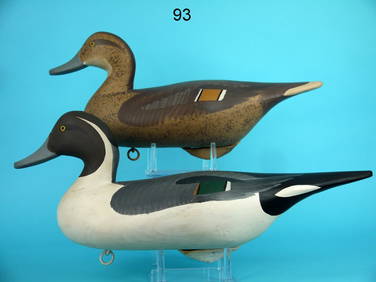
BLUEBILL HEN, CHESAPEAKE BAYFrank and Frank Sporting Collectibles LLC4.7(167)See Sold PriceMar 10, 2024
PINTAIL PAIR, R.M. MITCHELLFrank and Frank Sporting Collectibles LLC4.7(167)See Sold PriceMar 10, 2024
Framed Jane Partin Adorable Puppy Labrador PrintRapid Estate Liquidators and Auction Gallery4.5(1.1k)See Sold PriceMar 03, 2024


![[Map] Chesapeake Bay (1 of 5)](https://p1.liveauctioneers.com/523/84219/43476531_1_x.jpg?height=282&quality=70&version=1453240168)