ATLAS of ANTIENT GEOGRAPHY by SAMUEL BUTLER 1843John McInnis Auctioneers,LLC4.6(502)See Sold PriceFeb 24, 2024
18TH C. ANTIQUE MAP: FRENCH & INDIAN WAR, FRAMEDThomaston Place Auction Galleries4.4(386)See Sold PriceFeb 24, 2024
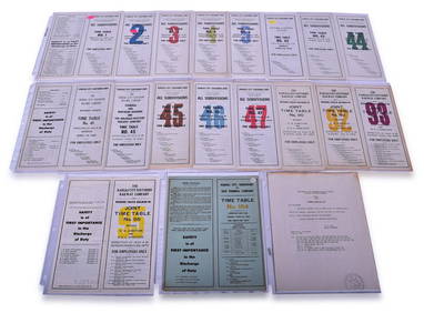
Rand McNally Railroad Map Cabinet w/ 21 Railroad MapsRail & Road Auctions4.6(165)See Sold PriceMar 08, 2024
Keith Haring - Ink on New York Map, Best Buddies, Inscribed, Signed, and DatedSapphire Auction Gallery4(67)See Sold PriceMar 02, 2024
LATE 17TH C. FRENCH MAP OF THE NEW WORLD BY ALEXIS-HUBERT JAILLOT (1632-1712)Thomaston Place Auction Galleries4.4(386)See Sold PriceFeb 24, 2024
Central Railroad of New Jersey Map of Sandy Hook Route-ca. 1903JM Hobby Supply and Railroad Artifact Auctions4.4(126)See Sold PriceFeb 24, 2024
Lot of Six Mixed Atlas Box Cars-HO Scale-New in BoxJM Hobby Supply and Railroad Artifact Auctions4.4(126)See Sold PriceFeb 25, 2024
Rand McNally/Santa Fe Railroad Map of Iowa-1912JM Hobby Supply and Railroad Artifact Auctions4.4(126)See Sold PriceFeb 24, 2024
NICOLAES VISSCHER (NETHERLANDS, 1618-1709) MAP OF THE NEW WORLDThomaston Place Auction Galleries4.4(386)See Sold PriceFeb 24, 2024
17TH C. WORLD MAP BY NICOLAES VISSCHER (NETHERLANDS, 1618-1709)Thomaston Place Auction Galleries4.4(386)See Sold PriceFeb 24, 2024
Lot of Six Mixed Atlas Cabooses-HO Scale-New in BoxJM Hobby Supply and Railroad Artifact Auctions4.4(126)See Sold PriceFeb 25, 2024
Map of Arkansas, Louisiana, Mississippi 1853Map of Arkansas, Louisiana, Mississippi and partials of Indian Territory and Texas Hand colored. Map No 6 United States Cartographer: Jules Sherman Smith Publisher Daniel Burgess DSee Sold Price
Antique Map of Pre-Civil War Deep South, 1853Map: Die Staaten von Arkansas, Mississippi, Louisiana & Alabama Cartographer: Bibliographischen Instituts. Place & Date: Hildburghausen / 1853 Size: 10 5/8" x 7 7/8" Condition: original color; overallSee Sold Price
SoldMeyer: Antique Pre-Civil War Map of Deep South, 1853Map: Die Staaten von Arkansas, Mississippi, Louisiana & Alabama Cartographer: Bibliographischen Instituts. Place & Date: Hildburghausen / 1853 Size: 10 5/8" x 7 7/8" Condition: original color; overallSee Sold Price
SoldTUNISONS MAP ARKANSAS, LOUISIANA, FLORIDA, GEORGIA(lot) Tunison's map of "Arkansas, Louisiana, Mississippi" , the verso with maps of "Florida with inset showing "Mouths of the Mississippi River", Georgia, South Carolina:, c. 1903, repair at center foSee Sold Price
Scarce early Cram RR map of the Deep SouthFrom a very scarce Cram atlas comes this map of the Deep South showing the areas railway system in place in 1882. ”New Railroad and County Map of Arkansas, Louisiana & Mississippi.” The 18See Sold Price
1872 Map of Arkansas, Louisiana and MississippiTitle: 1872 Map of Arkansas, Louisiana and Mississippi Medium: Ink on Paper Dimensions: 15"X23" Description: Map dated 1872 engraved by W.H. Gamble. It captures the Southern states of Arkansas, MissisSee Sold Price
SoldMitchell: Antique Map of Mississippi Louisiana, 1869Title/Content of Map: Arkansas, Mississippi & Louisiana by Mitchell Date Printed: 1869 Cartographer: Augustus S. Mitchell Material/Medium: Paper Size: 23 1/2" x 15" Hand colored engraved Map. From 'MiSee Sold Price
SoldThree 19th C. Maps of U.S. StatesLot of three 19th C. maps of Arkansas, Louisiana, and Mississippi. Various dates and publishers.See Sold Price
SoldThree Maps by Samuel Augustus Mitchell (1790-1868), "Three Maps by Samuel Augustus Mitchell (1790-1868), " County Maps of Arkansas, Louisiana and Mississippi, Verso with Florida, and a Plan of New Orleans" 1882, hand colored, on two pages, H.-24 in., W.See Sold Price
SoldMap of Arkansas, Mississippi & Louisiana #59627Civil war era map, double truck, pp. 44,45. Copper engraved & hand colored by Johnson with Rail & Wagon Roads. 2 very small tears (.25" at upper left of border, does not encroach on map). Vivid color.See Sold Price
Map of Arkansas, Mississippi & Louisiana, 1868Original engraving from Johnson's Atlas of the World, 1868. Map details cities, towns and territories. Dimensions: 18" x 26". This item ships from Ocean View, DE.See Sold Price
Antique Map of Arkansas, Mississippi, LouisianaAntique regional map of Arkansas, Mississippi, and Louisiana, on parchment paper, with pink and blue, by Johnson and Ward, image size 24 x 17, framedSee Sold Price
Map of Arkansas, Mississippi & Louisiana, 1868Original engraving from Johnson's Atlas of the World, 1868. Map details cities, towns and territories. Dimensions: 18" x 26". This item ships from Ocean View, DE.See Sold Price
Sold1872 Louisiana, Mississippi, Arkansas MapAuthor: Gamble Title: 1872 Louisiana, Mississippi, Arkansas Map Medium: Ink on Paper Dimensions: 15"X23" Map dated 1872 engraved by W.H. Gamble. It captures the Southern states of Arkansas, MississippSee Sold Price
SoldSociety for the Diffusion of Useful Knowledge MapSociety for the Diffusion of Useful Knowledge Engraved, Hand-Colored Map, depicting lower Arkansas, lower Louisiana, Mississippi and Alabama, second quarter 19th century, published as sheet XIII, presSee Sold Price
1860 Mitchell Map of Mississippi, Louisiana andTitle: 1860 Mitchell Map of Mississippi, Louisiana and Arkansas -- Map of Louisiana, Mississippi, Arkansas Cartographer: S Mitchell Year / Place: 1860, Philadelphia Map Dimension (in.): 13.5 X 10.7 inSee Sold Price
Sold(4) 1838 BRADFORD Maps: AL, MS, LA, AR[United States/Southwest] 4 Maps. ++ ALABAMA. ++ MISSISSIPPI.++ LOUISIANA. ++ ARKANSAS. ++ Maps 33, 34, 35, 36 from T. G. Bradford, “An Illustrated Atlas, Geographical, Statistical, And Historical,See Sold Price
Sold1860 MAP LOUISIANA, MISSISSIPPI, ARKANSASFramed hand colored 1860 map, 'Map of Louisiana, Mississippi and Arkansas" by Augustus Mitchell (American, 1790-1868), sight: 14"h, 11.25"w, overall: 21.5"h, 18.75"w, 4.25lbs Start Price: $100.00See Sold Price
Mitchell: Antique Map of Louisiana Arkansas MississippiTitle/Content of Map: 1867 Mitchell Map of Louisiana, Arkansas and Mississippi -- County Map of Louisiana, Mississippi and Arkansas Date Printed: 1867 Philadelphia Cartographer: S Mitchell Size: 21 xSee Sold Price
Mitchell: Map of Louisiana, Arkansas, Mississippi, 1867Map: 1867 Mitchell Map of Louisiana, Arkansas and Mississippi -- County Map of Louisiana, Mississippi and Arkansas Cartographer: S Mitchell Year / Place: 1867 Philadelphia Map Dimensions: 21 x 13.6 inSee Sold Price
Sold(2) 1860 MAP, MOSTLY TEXAS & SOUTHERN STATES MAP(2) Framed Map: Louisiana, Mississippi, Arkansas and Part of Texas, from Smith's New Geography, J.B. Lippincott & Co., 1861, Philadelphia (Roswell C. Smith, 1797-1875), hand colored, sight: 11.75"h, 1See Sold Price
1862 Johnson's Arkansas Mississippi and LouisianaThis is an authentic antique map Arkansas Mississippi and Louisiana of by Johnson & Browning. The map was published in Johnson's Family Atlas in 1862. This map centers on the states of Arkansas MissisSee Sold Price
SoldARKANSA'S, MISSISSIPPI & LOUISIANA MAPARKANSA'S, MISSISSIPPI & LOUISIANA MAP. Height: 29 in. by Width: 20 in.See Sold Price
Sold1866 Johnson Map of Arkansas, Mississippi and LouisianaTitle: 1866 Johnson Map of Arkansas, Mississippi and Louisiana -- Johnson's Arkansas, Mississippi and Louisiana Cartographer: A J Johnson Year / Place: 1866, New York Map Dimension (in.): 17 X 24 in.See Sold Price
Cleveland and Mahoning RR 2nd Annual Report-December 20, 1854JM Hobby Supply and Railroad Artifact Auctions4.4(126)See Sold PriceFeb 24, 2024
Twenty-Three Kansas City Southern Lines Railway Employee Timetables and General Orders - 1960 toRail & Road Auctions4.6(165)See Sold PriceMar 08, 2024
Kansas City Southern and Louisiana & Arkansas Railway Ticket Dater Die Shreveport 105CRail & Road Auctions4.6(165)See Sold PriceMar 08, 2024
Kansas City Southern Lines Cram's Universal Terrestrial Globe 10 1/2"Rail & Road Auctions4.6(165)See Sold PriceMar 08, 2024
Arrowsmith & Lewis - Map of PolynesiaTrillium Antique Prints & Rare Books4.5(30)See Sold PriceFeb 24, 2024
Arrowsmith & Lewis - Map of North AmericaTrillium Antique Prints & Rare Books4.5(30)See Sold PriceFeb 24, 2024
Arrowsmith & Lewis - Map of the World on Mercator's ProjectionTrillium Antique Prints & Rare Books4.5(30)See Sold PriceFeb 24, 2024
Arrowsmith & Lewis - Map of LouisianaTrillium Antique Prints & Rare Books4.5(30)See Sold PriceFeb 24, 2024
Arrowsmith & Lewis - Map of the United StatesTrillium Antique Prints & Rare Books4.5(30)See Sold PriceFeb 24, 2024
7 5/8" Corn God Found in Mississippi Co Arkansas, minor restoration, Ex Byron Knoblock, Ex Kevin FarHeartland Artifact Auctions Inc4.7(780)See Sold PriceMar 10, 2024
8" Mississippian Fish Effigy Pottery Vessel, Solid found in Mississippi Co Arkansas Ex Sam JohnsonHeartland Artifact Auctions Inc4.7(780)See Sold PriceMar 10, 2024
5" Walls Engraved Water Bottle, Solid, found in Mississippi Co ArkansasHeartland Artifact Auctions Inc4.7(780)See Sold PriceMar 10, 2024
7 3/4" Fish Effigy Water Bottle, found at Rose Mound , Mississippi Co Arkansas, near Blytheville,Heartland Artifact Auctions Inc4.7(780)See Sold PriceMar 10, 2024
William Tolliver (American/Louisiana & Mississippi, 1951-2000), "Learning to Play," 20th c., H.- 44Crescent City Auction Gallery4.3(229)See Sold PriceMar 08, 2024
William Tolliver (American/Louisiana & Mississippi, 1951-2000), "Four Musicians," 20th c., H.- 30Crescent City Auction Gallery4.3(229)See Sold PriceMar 08, 2024
William Tolliver (Louisiana/Mississippi, 1951-2000), "Bass Player," 20th c., H.- 24 in., W.- 18 in.Crescent City Auction Gallery4.3(229)See Sold PriceMar 08, 2024
William Tolliver (American/Louisiana & Mississippi, 1951-2000), "Mother and Child," 20th c., H.- 30Crescent City Auction Gallery4.3(229)See Sold PriceMar 08, 2024
Two Hand-Colored 19th Century Maps of New Orleans and Louisiana, Larger- H.- 12 1/2 in., W.- 15 1/2Crescent City Auction Gallery4.3(229)See Sold PriceMar 08, 2024
William Tolliver (Louisiana/Mississippi, 1951-2000), "Jazz Guitarist," 20th c., H.- 26 in., W.- 12Crescent City Auction Gallery4.3(229)See Sold PriceMar 09, 2024
John Senex Map of Louisiana & Mississippi RiverWillow Auction House4.5(283)See Sold PriceMar 14, 2024