ATLAS of ANTIENT GEOGRAPHY by SAMUEL BUTLER 1843John McInnis Auctioneers,LLC4.6(502)See Sold PriceFeb 24, 2024
18TH C. ANTIQUE MAP: FRENCH & INDIAN WAR, FRAMEDThomaston Place Auction Galleries4.4(386)See Sold PriceFeb 24, 2024
Rand McNally Railroad Map Cabinet w/ 21 Railroad MapsRail & Road Auctions4.6(165)See Sold PriceMar 08, 2024
Keith Haring - Ink on New York Map, Best Buddies, Inscribed, Signed, and DatedSapphire Auction Gallery4(67)See Sold PriceMar 02, 2024
LATE 17TH C. FRENCH MAP OF THE NEW WORLD BY ALEXIS-HUBERT JAILLOT (1632-1712)Thomaston Place Auction Galleries4.4(386)See Sold PriceFeb 24, 2024
Central Railroad of New Jersey Map of Sandy Hook Route-ca. 1903JM Hobby Supply and Railroad Artifact Auctions4.4(126)See Sold PriceFeb 24, 2024
Lot of Six Mixed Atlas Box Cars-HO Scale-New in BoxJM Hobby Supply and Railroad Artifact Auctions4.4(126)See Sold PriceFeb 25, 2024
Rand McNally/Santa Fe Railroad Map of Iowa-1912JM Hobby Supply and Railroad Artifact Auctions4.4(126)See Sold PriceFeb 24, 2024
NICOLAES VISSCHER (NETHERLANDS, 1618-1709) MAP OF THE NEW WORLDThomaston Place Auction Galleries4.4(386)See Sold PriceFeb 24, 2024
17TH C. WORLD MAP BY NICOLAES VISSCHER (NETHERLANDS, 1618-1709)Thomaston Place Auction Galleries4.4(386)See Sold PriceFeb 24, 2024
Lot of Six Mixed Atlas Cabooses-HO Scale-New in BoxJM Hobby Supply and Railroad Artifact Auctions4.4(126)See Sold PriceFeb 25, 2024
EUROPE. 'Europe Moderne'. Rivers countries. Very decorative. MALLET 1683 mapTITLE OF THE MAP: 'Europe Moderne' (De L'Europe) DATE PRINTED: 1683 IMAGE SIZE: Approx Overall page size 13 x 21cm approximately (5 x 8 inches); image size 10.5 x 14.5cm approximately (4 x 5.5 inches)See Sold Price
EUROPE. 'Europe Moderne'. Rivers countries. Very decorative. MALLET 1683 mapTITLE/CONTENT OF MAP: 'Part of Europe showing the boundaries of France and adjoining countries before the Revolution of 1789' DATE PRINTED: 1848 IMAGE SIZE: Approx 15.0 x 20.5cm, 5.75 x 8 inches (MediSee Sold Price
EUROPE. 'Europe Moderne'. Rivers countries. Very decorative. MALLET 1683 mapTITLE OF THE MAP: 'Europe Moderne' (De L'Europe) DATE PRINTED: 1683 IMAGE SIZE: Approx Overall page size 13 x 21cm approximately (5 x 8 inches); image size 10.5 x 14.5cm approximately (4 x 5.5 inches)See Sold Price
Mallet: Antique Map of Europe Moderne, 1683Title/Content of Map: 'Europe Moderne'. Rivers countries. Very decorative. Date Printed: 1683. Image Size: Approx Overall page size 13 x 21cm approximately (5 x 8 inches); image size 10.5 x 14.5cm appSee Sold Price
Mallet: Antique Map of Europe Moderne, 1683Title/Content of the Map: 'Europe Moderne' Rivers countries. Very decorative. Date Printed: 1683 Image Size: Approx Overall page size 13 x 21cm approximately (5 x 8 inches); image size 10.5 x 14.5cm aSee Sold Price
ANCIENT EUROPE. Rivers. Latin/Roman names. Decorative. MALLET 1683 old mapTITLE OF THE MAP: 'Europe Ancienne' (De L'Europe) DATE PRINTED: 1683 IMAGE SIZE: Approx Overall page size 13 x 21cm approximately (5 x 8 inches); image size 10.5 x 14.5cm approximately (4 x 5.5 inchesSee Sold Price
ANCIENT EUROPE. Rivers. Latin/Roman names. Decorative. MALLET 1683 old mapTITLE OF THE MAP: 'Europe Ancienne' (De L'Europe) DATE PRINTED: 1683 IMAGE SIZE: Approx Overall page size 13 x 21cm approximately (5 x 8 inches); image size 10.5 x 14.5cm approximately (4 x 5.5 inchesSee Sold Price
EUROPE. 'Europe Moderne'. Rivers countries. VeryTITLE OF THE MAP: 'Europe Moderne' Date: 1683 IMAGE SIZE: Approx Overall page size 13 x 21cm approximately (5 x 8 inches); image size 10.5 x 14.5cm approximately (4 x 5.5 inches) TYPE: Original 17th cSee Sold Price
EUROPE. 'Europe Moderne'. Rivers countries. VeryTITLE OF THE MAP: 'Europe Moderne' DATE PRINTED: 1683 IMAGE SIZE: Approx Overall page size 13 x 21cm approximately (5 x 8 inches); image size 10.5 x 14.5cm approximately (4 x 5.5 inches) TYPE: OriginaSee Sold Price
EUROPE. 'Europe Moderne'. Rivers countries. VeryTITLE OF THE MAP: 'Europe Moderne' DATE PRINTED: 1683 IMAGE SIZE: Approx Overall page size 13 x 21cm approximately (5 x 8 inches); image size 10.5 x 14.5cm approximately (4 x 5.5 inches) TYPE: OriginaSee Sold Price
Map of Ancient EuropeANCIENT EUROPE. Rivers. Latin/Roman names. Decorative. MALLET 1683 old map Size: Approx Overall page size 13 x 21cm approximately (5 x 8 inches); image size 10.5 x 14.5cm approximately (4 x 5.5 inchesSee Sold Price
ANCIENT EUROPE. Rivers. Latin/Roman names. Decorative. MALLET 1683 old mapTITLE/CONTENT OF MAP: 'Index Map' DATE PRINTED: 1800 IMAGE SIZE: Approx 61.5 x 39.0cm, 24.25 x 15.25 inches (Large) TYPE: Large folio antique engraved map CONDITION: Good; suitable for framing. HoweveSee Sold Price
SCOTLAND. Showing rivers. Decorative. 'Escosse'. MALLET 1683 old antique mapTITLE OF THE MAP: 'Escosse' (De L'Europe) DATE PRINTED: 1683 IMAGE SIZE: Approx Overall page size 13 x 21cm approximately (5 x 8 inches); image size 10.5 x 14.5cm approximately (4 x 5.5 inches) TYPE:See Sold Price
BRITISH ISLES. 'Isles Britanniques. Decorative. MALLET 1683 old antique mapTITLE OF THE MAP: 'Isles Britanniques' (De L'Europe) An attractive small map. Shows the British Isles neatly set off the western coast of Europe. DATE PRINTED: 1683 IMAGE SIZE: Approx Overall page sizSee Sold Price
TOWER OF LONDON. 2 Views. River. 'La Tour de Londres' Decorative. MALLET 1683TITLE OF THE PRINT: 'La Tour de Londres; Profil de la Tour de Londres' (De L'Europe) DATE PRINTED: 1683 IMAGE SIZE: Approx Overall page size 13 x 21cm approximately (5 x 8 inches); image size 10.5 x 1See Sold Price
EUROPE showing daylight hours at summer equinox. Sunrise-sunset. MALLET 1683 mapTITLE/CONTENT OF MAP: 'Europe' Curiously, this map shows the Benelux countries united as the "kIngdomn of the Netherlands", while the territory of Switzerland incorporates what is today the French depSee Sold Price
ANCIENT EUROPE. Rivers. Latin/Roman names. Decorative.TITLE OF THE MAP: 'Europe Ancienne' DATE PRINTED: 1683 IMAGE SIZE: Approx Overall page size 13 x 21cm approximately (5 x 8 inches); image size 10.5 x 14.5cm approximately (4 x 5.5 inches) TYPE: OriginSee Sold Price
ANCIENT EUROPE. Rivers. Latin/Roman names. Decorative.Reserve Reduced! TITLE OF THE MAP: 'Europe Ancienne' DATE PRINTED: 1683 IMAGE SIZE: Approx Overall page size 13 x 21cm approximately (5 x 8 inches); image size 10.5 x 14.5cm approximately (4 x 5.5 incSee Sold Price
CHATEAU DU LOUVRE. Decorative view. Paris. River boats carriages. MALLET 1683TITLE OF THE PRINT: 'Ch(ateau) du Louvre' (De L'Europe) DATE PRINTED: 1683 IMAGE SIZE: Approx Overall page size 13 x 21cm approximately (5 x 8 inches); image size 10.5 x 14.5cm approximately (4 x 5.5See Sold Price
MALLET. Description de l'Univers. Europe. Volume 4 title page. MALLET 1683TITLE OF THE PRINT: 'Description de l'Univers - de l'Europe Ancienne et Moderne Tome IV' (De L'Europe) DATE PRINTED: 1683 IMAGE SIZE: Approx Overall page size 13 x 21cm approximately (5 x 8 inches); iSee Sold Price
TURKEY IN EUROPE. Greece & The Balkans. 'Turquie en Europe'. MALLET 1683 mapTITLE OF THE MAP: 'Turquie en Europe' (De L'Europe) The European part of the Turkish (Ottoman) Empire in the Balkans and modern day Greece DATE PRINTED: 1683 IMAGE SIZE: Approx Overall page size 13 xSee Sold Price
POLISH-LITHUANIAN COMMONWEALTH. Poland Belarus. Towns & rivers. MALLET 1683 mapTITLE OF THE MAP: 'Pologne' (De L'Europe) DATE PRINTED: 1683 IMAGE SIZE: Approx Overall page size 13 x 21cm approximately (5 x 8 inches); image size 10.5 x 14.5cm approximately (4 x 5.5 inches) TYPE:See Sold Price
POLISH-LITHUANIAN COMMONWEALTH. Poland Belarus. Towns & rivers. MALLET 1683 mapTITLE OF THE MAP: 'Pologne' (De L'Europe) DATE PRINTED: 1683 IMAGE SIZE: Approx Overall page size 13 x 21cm approximately (5 x 8 inches); image size 10.5 x 14.5cm approximately (4 x 5.5 inches) TYPE:See Sold Price
IBERIA. Spain & Portugal showing regions. 'Espagne Moderne'. MALLET 1683 mapTITLE OF THE MAP: 'Espagne Moderne' (De L'Europe) DATE PRINTED: 1683 IMAGE SIZE: Approx Overall page size 13 x 21cm approximately (5 x 8 inches); image size 10.5 x 14.5cm approximately (4 x 5.5 inchesSee Sold Price
Soren Bjulf (Danish,Dutch,1890-1958) oil paintingBroward Auction Gallery4.8(277)See Sold PriceMar 17, 2024
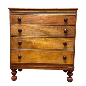
Early American Cherry and Maple Country ChestPremier Auction Galleries4.3(329)See Sold PriceMar 09, 2024
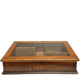
American Oak Country Store Lee's Dressing Advertising ShowcasePremier Auction Galleries4.3(329)See Sold PriceMar 09, 2024
Willem Blaeu, Etc. 17th C. Antiquarian Maps, 2Auctions at Showplace4.5(726)See Sold PriceMar 17, 2024
GROUP OF EARLY GLASS INC. PR OF CAMPHENE PEG LAMPS FLIP GLASS, MALLET SHAPED DECANTER, ETC. (8)Carlsen Gallery, Inc.4.6(163)See Sold PriceMar 03, 2024
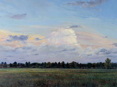
MID 19THC. HUDSON RIVER SCHOOL LANDSCAPE 10 1/2" X 17 1/2"Carlsen Gallery, Inc.4.6(163)See Sold PriceMar 03, 2024
COUNTRY SIDEBOARD/ PEWTER CUPBOARD BASE WITH FREIZE OF 5 DRAWERS OVER SQUARE CHIPPENDALE LEGS (31Carlsen Gallery, Inc.4.6(163)See Sold PriceMar 03, 2024
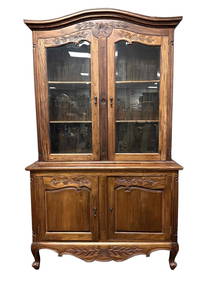
2 DOOR COUNTRY CABINET / SIDEBOARD 34" X 66 3/8" X 24 1/4"Carlsen Gallery, Inc.4.6(163)See Sold PriceMar 03, 2024
Attributed to Theodore Robinson. Houses by the River, oilAlex Cooper4.5(496)See Sold PriceMar 02, 2024
WEST AFRICA Niger/Gambia rivers tribes towns. 'Pays des Negres'. MALLET 1683 mapJasper524.5(9.8k)See Sold PriceFeb 28, 2024
NORTH & WEST AFRICA. Sahara Niger river 'Zaara ou le Desert'. MALLET 1683 mapJasper524.5(9.8k)See Sold PriceFeb 28, 2024
WEST CENTRAL AFRICA. Congo Angola Gabon Cameroon Sao Tome. MALLET 1683 old mapJasper524.5(9.8k)See Sold PriceFeb 28, 2024
NORTH AFRICA. 'Biledulgerid', a former North African country. MALLET 1683 mapJasper524.5(9.8k)See Sold PriceFeb 28, 2024
MALLET. Description de l'Univers. Africa. Volume 3 title page. MALLET 1683Jasper524.5(9.8k)See Sold PriceFeb 28, 2024
SOUTHERN AFRICA Monomotapa (Mutapa Kingdom) Cafrerie (Kaffraria) MALLET 1683 mapJasper524.5(9.8k)See Sold PriceFeb 28, 2024