ATLAS of ANTIENT GEOGRAPHY by SAMUEL BUTLER 1843John McInnis Auctioneers,LLC4.5(505)See Sold PriceFeb 24, 2024
18TH C. ANTIQUE MAP: FRENCH & INDIAN WAR, FRAMEDThomaston Place Auction Galleries4.4(393)See Sold PriceFeb 24, 2024
Rand McNally Railroad Map Cabinet w/ 21 Railroad MapsRail & Road Auctions4.6(165)See Sold PriceMar 08, 2024
Keith Haring - Ink on New York Map, Best Buddies, Inscribed, Signed, and DatedSapphire Auction Gallery4(67)See Sold PriceMar 02, 2024
LATE 17TH C. FRENCH MAP OF THE NEW WORLD BY ALEXIS-HUBERT JAILLOT (1632-1712)Thomaston Place Auction Galleries4.4(393)See Sold PriceFeb 24, 2024
Central Railroad of New Jersey Map of Sandy Hook Route-ca. 1903JM Hobby Supply and Railroad Artifact Auctions4.4(127)See Sold PriceFeb 24, 2024
Lot of Six Mixed Atlas Box Cars-HO Scale-New in BoxJM Hobby Supply and Railroad Artifact Auctions4.4(127)See Sold PriceFeb 25, 2024
Rand McNally/Santa Fe Railroad Map of Iowa-1912JM Hobby Supply and Railroad Artifact Auctions4.4(127)See Sold PriceFeb 24, 2024
NICOLAES VISSCHER (NETHERLANDS, 1618-1709) MAP OF THE NEW WORLDThomaston Place Auction Galleries4.4(393)See Sold PriceFeb 24, 2024
17TH C. WORLD MAP BY NICOLAES VISSCHER (NETHERLANDS, 1618-1709)Thomaston Place Auction Galleries4.4(393)See Sold PriceFeb 24, 2024
Lot of Six Mixed Atlas Cabooses-HO Scale-New in BoxJM Hobby Supply and Railroad Artifact Auctions4.4(127)See Sold PriceFeb 25, 2024
CORSICA. 'Isle de Corse'. Elba. Decorative. France. MALLET 1683 old mapTITLE OF THE MAP: 'I(sle) de Corse' (De L'Europe) DATE PRINTED: 1683 IMAGE SIZE: Approx Overall page size 13 x 21cm approximately (5 x 8 inches); image size 10.5 x 14.5cm approximately (4 x 5.5 inchesSee Sold Price
MALTA GOZO COMINO. 'Isle de Malthe'. Decorative vignette. MALLET 1683 old mapTITLE OF THE MAP: 'Isle de Malthe' (De L'Afrique) DATE PRINTED: 1683 IMAGE SIZE: Approx Overall page size 13 x 21cm approximately (5 x 8 inches); image size 10.5 x 14.5cm approximately (4 x 5.5 inchesSee Sold Price
BRITISH ISLES. 'Isles Britanniques. Decorative. MALLET 1683 old antique mapTITLE OF THE MAP: 'Isles Britanniques' (De L'Europe) An attractive small map. Shows the British Isles neatly set off the western coast of Europe. DATE PRINTED: 1683 IMAGE SIZE: Approx Overall page sizSee Sold Price
ANCIENT ITALY. Decorative. 'Ancienne Italie'. MALLET 1683 old antique mapTITLE OF THE MAP: 'Ancienne Italie' (De L'Europe) Includes Sicily, Sardinia & Corsica DATE PRINTED: 1683 IMAGE SIZE: Approx Overall page size 13 x 21cm approximately (5 x 8 inches); image size 10.5 xSee Sold Price
PARIS. Town city plan. 'Plan de Paris'. Decorative. MALLET 1683 old mapTITLE OF THE MAP: 'Plan de Paris' (De L'Europe) DATE PRINTED: 1683 IMAGE SIZE: Approx Overall page size 13 x 21cm approximately (5 x 8 inches); image size 10.5 x 14.5cm approximately (4 x 5.5 inches)See Sold Price
CYPRUS. 'Isles de Cypre'. Decorative cartouche Nicosia Limassol. MALLET 1683 mapTITLE OF THE MAP: 'Isles de Cypre' (De L'Asie) Marked on the map are, inter alia, the towns of Nicosie (Nicosia), Limisse (Limassol), Salines (Larnaca) & Baffo (Paphos) DATE PRINTED: 1683 IMAGE SIZE:See Sold Price
ANCIENT EUROPE. Rivers. Latin/Roman names. Decorative. MALLET 1683 old mapTITLE OF THE MAP: 'Europe Ancienne' (De L'Europe) DATE PRINTED: 1683 IMAGE SIZE: Approx Overall page size 13 x 21cm approximately (5 x 8 inches); image size 10.5 x 14.5cm approximately (4 x 5.5 inchesSee Sold Price
INDIA. Moghul Mogul Mughal Empire. Goa Kochi Chaul &c. MALLET 1683 old mapTITLE OF THE MAP: 'Presqu-isle de l'Inde deca de Golfe de Bengala' (De L'Asie) Includes Ceylon. DATE PRINTED: 1683 IMAGE SIZE: Approx Overall page size 13 x 21cm approximately (5 x 8 inches); image siSee Sold Price
FRANCE. 'Carte Generale'. Towns, rivers & provinces. MALLET 1683 old mapTITLE OF THE MAP: 'Carte Generale de France' (De L'Europe) DATE PRINTED: 1683 IMAGE SIZE: Approx Overall page size 26 x 21cm approximately (10 x 8 inches); image size 21 x 14.5cm approximately (8 x 5.See Sold Price
CANDIA/CRETE & CYCLADES. Milos Sifnos Astypalaia. Aegean. MALLET 1683 old mapTITLE OF THE MAP: 'Isle de Crete' (De L'Europe) The map depicts Candia (Crete), Dia, and the Cycladic islands of Melos (Milos), Siphus (Sifnos) & Astypalaia with Lagusa DATE PRINTED: 1683 IMAGE SIZE:See Sold Price
ANCIENT EUROPE. Rivers. Latin/Roman names. Decorative. MALLET 1683 old mapTITLE OF THE MAP: 'Europe Ancienne' (De L'Europe) DATE PRINTED: 1683 IMAGE SIZE: Approx Overall page size 13 x 21cm approximately (5 x 8 inches); image size 10.5 x 14.5cm approximately (4 x 5.5 inchesSee Sold Price
EAST INDIES. Sunda Sumatra Java Borneo Malaya. Indonesia. MALLET 1683 old mapTITLE OF THE MAP: 'Isles de la Sonde vers l'Occident' (De L'Asie) Shows the western Sunda Islands, the Malay peninsula and the southern part of Indochina (from Cambodia to Singapore). It includes JavaSee Sold Price
ITALY. Italian states. 'Italie'. Decorative. MALLET 1683 old antique map chartTITLE OF THE MAP: 'Italie' (De L'Europe) DATE PRINTED: 1683 IMAGE SIZE: Approx Overall page size 13 x 21cm approximately (5 x 8 inches); image size 10.5 x 14.5cm approximately (4 x 5.5 inches) TYPE: OSee Sold Price
ASCENSION ISLAND. 'Isle d'Ascencion'. Ships. Decorative. MALLET 1683 old printTITLE OF THE PRINT: 'Isle d'Ascencion' (De L'Afrique) DATE PRINTED: 1683 IMAGE SIZE: Approx Overall page size 13 x 21cm approximately (5 x 8 inches); image size 10.5 x 14.5cm approximately (4 x 5.5 inSee Sold Price
SCOTLAND. Showing rivers. Decorative. 'Escosse'. MALLET 1683 old antique mapTITLE OF THE MAP: 'Escosse' (De L'Europe) DATE PRINTED: 1683 IMAGE SIZE: Approx Overall page size 13 x 21cm approximately (5 x 8 inches); image size 10.5 x 14.5cm approximately (4 x 5.5 inches) TYPE:See Sold Price
JAPAN. 'Isles du Iapon'. Yedo (Tokyo) Miyako (Kyoto). MALLET 1683 old mapTITLE OF THE MAP: 'Isles du Iapon' (De L'Asie) DATE PRINTED: 1683 IMAGE SIZE: Approx Overall page size 13 x 21cm approximately (5 x 8 inches); image size 10.5 x 14.5cm approximately (4 x 5.5 inches) TSee Sold Price
FRANCE. Provinces. 'France par Gouvernmens Generaux'. MALLET 1683 old mapTITLE OF THE MAP: 'France par Gouvernmens Generaux' (De L'Europe) DATE PRINTED: 1683 IMAGE SIZE: Approx Overall page size 13 x 21cm approximately (5 x 8 inches); image size 10.5 x 14.5cm approximatelySee Sold Price
INDIA. Bird's eye view of Goa. Map. Ships. Decorative. MALLET 1683 oldTITLE OF THE MAP: 'Goa' (De L'Asie) DATE PRINTED: 1683 IMAGE SIZE: Approx Overall page size 13 x 21cm approximately (5 x 8 inches); image size 10.5 x 14.5cm approximately (4 x 5.5 inches) TYPE: OriginSee Sold Price
DUBLIN. Decorative town plan/bird's eye view. Ireland. MALLET 1683 old mapTITLE OF THE MAP: 'Dublin' (De L'Europe) DATE PRINTED: 1683 IMAGE SIZE: Approx Overall page size 13 x 21cm approximately (5 x 8 inches); image size 10.5 x 14.5cm approximately (4 x 5.5 inches) TYPE: OSee Sold Price
Isles de Corse et de Sardaigne. Corsica and Sardinia. BONNE 1787 old mapTITLE/CONTENT OF MAP: Isles de Corse et de Sardaigne [The islands of Corsica and Sardinia] DATE PRINTED: 1787 IMAGE SIZE: Approx 36.0 x 24.5cm, 14 x 9.75 inches (Large); Please note that this is a folSee Sold Price
Isles de Corse et de Sardaigne. Corsica and Sardinia. BONNE 1789 old mapTITLE/CONTENT OF MAP: Isles de Corse et de Sardaigne [The islands of Corsica and Sardinia] DATE PRINTED: 1789 IMAGE SIZE: Approx 36.0 x 24.5cm, 14 x 9.75 inches (Large); Please note that this is a folSee Sold Price
SoldMallet: Antique Map of Malta, 1683Title/Content of Map: 'Isle de Malthe' MALTA GOZO COMINO, Decorative vignette. Date Printed: 1683 Image Size: Approx Overall page size 13 x 21cm approximately (5 x 8 inches); image size 10.5 x 14.5cmSee Sold Price
Andrea Civelli (France,1923-2004) oil paintingBroward Auction Gallery4.7(292)See Sold PriceMar 10, 2024
Freddy Wittop (Dutch,NY,1912-2001) oil paintingBroward Auction Gallery4.7(292)See Sold PriceMar 10, 2024
AFTER Tamara De Lempicka (CA,NY,French,1898-1980) oil paintingBroward Auction Gallery4.7(292)See Sold PriceMar 31, 2024
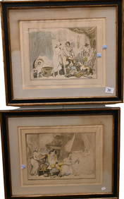
BRONZE DANCER SCULPTURE, AFTER EDGAR DEGAS (FRANCE, 1834-1917)Thomaston Place Auction Galleries4.4(393)See Sold PriceFeb 24, 2024
LARGE LATE 17TH C. DUTCH CHART OF CANADA, GREAT LAKES, NEW FRANCE, LABRADOR, HUDSON BAY, BY PIERREThomaston Place Auction Galleries4.4(393)See Sold PriceFeb 24, 2024
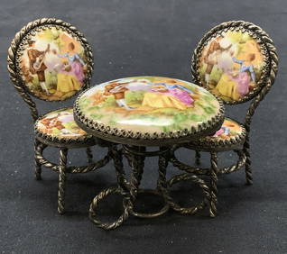
3 Limoges Fragonard Miniature Bistro Set, FRANCEThe Benefit Shop Foundation Inc.4.3(2.9k)See Sold PriceMar 06, 2024
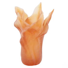
Daum Pate de Verre Crystal Amber Tulip Leaves VaseHill Auction Gallery 4.7(1k)See Sold PriceFeb 28, 2024
WEST CENTRAL AFRICA. Congo Angola Gabon Cameroon Sao Tome. MALLET 1683 old mapJasper524.5(9.9k)See Sold PriceFeb 28, 2024
NUBIA. 'Nubie'. Nile Valley. Sudan Ethiopia Egypt. MALLET 1683 old antique mapJasper524.5(9.9k)See Sold PriceFeb 28, 2024
SUB-SAHARAN AFRICA. 'Ancienne Ethiopie'. Ancient Ethiopia. MALLET 1683 old mapJasper524.5(9.9k)See Sold PriceFeb 28, 2024