Claude Monet French 1840 - 1926 Oil on canvas Painting Impressionism Renoir Manet Pissarro Era.International Art Auction Gallery4.5(154)See Sold PriceFeb 24, 2024
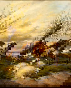
Antique American Hudson River School Sunset Landscape Framed Original Oil PaintingCurated Gallery Auctions4.6(120)See Sold PriceFeb 25, 2024
Robert William Wood (1889 - 1979) Texas BluebonnetsPremier Auction Galleries4.3(329)See Sold PriceMar 09, 2024
BIRGER SANDZEN (1871-1954) COLORADO OIL ON CANVAS 1936Soulis Auctions4.8(953)See Sold PriceFeb 24, 2024
Vincent Van Gogh Dutch 1853-1890 Oil on canvas. Paul Gaugin, Cezanne, Degas EraInternational Art Auction Gallery4.5(154)See Sold PriceFeb 24, 2024
Renaissance Old Master Altarpiece Adoration Magi Oil Painting Christ Child Virgin Mary Wise MenHess Fine Auctions4.5(197)See Sold PriceMar 02, 2024
19TH C GERMAN OIL PAINTING BY EMIL ZSCHIMMER C 1872Antique Arena Inc.4.5(852)See Sold PriceFeb 24, 2024
JOHN CONSTABLE ANTIQUE ENGLISH CLOUDS OIL PAINTINGAntique Arena Inc.4.5(852)See Sold PriceFeb 24, 2024
ATTRIBUTED TO GILBERT STUART (MA/RI/UK, 1755-1828)Thomaston Place Auction Galleries4.4(386)See Sold PriceFeb 24, 2024
Pablo Picasso Spanish 1881-1973 Oil On Canvas Painting Dali Magritte Braque Juan GrisInternational Art Auction Gallery4.5(154)See Sold PriceFeb 24, 2024
ATTRIB Francisco Miralles Y Galup (Spain,France,1848-1901) oil painting antiqueBroward Auction Gallery4.8(277)See Sold PriceMar 10, 2024
AMERICAN SCHOOL (Early 20th c) Two WorksJohn McInnis Auctioneers,LLC4.6(502)See Sold PriceFeb 25, 2024
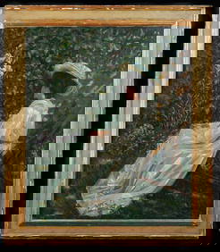
Thomas Sidney Cooper (UK,1803-1902) oil painting antiqueBroward Auction Gallery4.8(277)See Sold PriceMar 10, 2024
SoldEarly Hand-Colored Map of VeniceItaly, ca. 16th-17th century. Fine hand-colored engraved map of "Venetia" with boats in harbor and compass rose. Handsomely framed. MEASUREMENTS Sight wide: 5 7/8 / 15 cm. Sight height: 4 1/2 / 11.5 cSee Sold Price
DOUBLE-PAGE ENGRAVED AND HAND-COLORED EARLY MAPtitled "Anglias Et Hibernia Nova", information verso suggests that the map is from "Ptolemy's Geography issued either in 1598 or 1599, Venice.", 7x9in. The Knoop CollectionSee Sold Price
Sold1740 Detailed Hand-Colored Map of Early AmericaHistoric Maps 1740 Detailed Hand-Colored Map of Early America c. 1740, Hand-Colored Engraved Copper Plate Map title, “CARTA GEOGRAFICA DELL AMERICA SETTENTRIONALE” by G. Albrizzi, Venice, ExtremelSee Sold Price
Sold1778 MICHIGAN REGION HAND-COLORED MAP, "Il Paese1778 MICHIGAN REGION HAND-COLORED MAP, "Il Paese De' Selvaggi Outagamiani, Mascoutensi, Illines, E Parte Delle VI. Nazioni", Antonio Zatta, Venice, includes an early appearance of the name Chicagou, cSee Sold Price
Sold(4) EARLY MAPS OF EUROPE BY CARYHand colored Engraved Atlas Folio Maps of Europe, by John Cary, including: 'Circle of Bavaria', 1799; 'County of Tyrol and the Republic of Venice; Duchy of Mantua &c', 1799; 'Bohemia and Moravia', 180See Sold Price
SoldThree early maps of Arabia,all hand colored, one by Guillamo Ruscelli, "Tabula Asiae VI", published Venice, 1561-64, Italian text verso, creases and minor stains, 8-5/8 x 12-1/8"; 1618 by Petras Bertius, "A Description D'ArabieSee Sold Price
SoldEarly Hand Colored Map North America by T ConderAntique framed hand colored early map of North America. Top left image of Native man and foliage, reads "North America agreeable to the most approved Maps and Charts, by Thomas Condor" Frame: 14 3/4 iSee Sold Price
SoldEarly Hand Colored Map of ScotlandFramed hand colored map of Scotland; 23in. X 19in.See Sold Price
SoldEarly hand-colored map of New Jersey, c.1775. 13.Early hand-colored map of New Jersey, c.1775. 13.75”x11.75”See Sold Price
SoldEARLY HAND COLORED MAP OF FLORENZ/FIERENZE. LATE18TH/EALY 19TH CENTURY. IN ARCHIVAL FRAME AND GLAZED WITH UV GLASS. SIGHT SIZE 19 1/2" X 22 1/2" OVERALL WITH FRAME 24" X 27" EXCELLENT CONDITION.See Sold Price
SoldEARLY HAND COLORED MAP OF DELAWARE"Delaware from the best Authorities", printing/engraving/etc. information is light and illegible; likely copper plate engraving; price tag from Greenwood book shop identifies this as from M. Carey; edSee Sold Price
SoldEarly hand colored map of Stavanger, Bergen, Oslo - GolEarly hand colored map of Stavanger, Bergen, Oslo - Gold lettering and highlights - Probably by J. Janssonius - circa 1650. 20.75" x 24.25". Water stain and dampness marks on right and left margins -See Sold Price
SoldEarly Hand Colored Map of the Ottoman EmpireEarly hand colored map of the Ottoman Empire after Gerardus Mercator (Belgian, 1512-1594) and Jodicus Hondius II (Belgian, 1563-1612), printed c. 1613-1616. Framed, not examined out of frame. Sight siSee Sold Price
SoldEarly Hand Colored Map of the Ottoman EmpireEarly hand colored map of the Ottoman Empire after Gerardus Mercator (Belgian, 1512-1594) and Jodicus Hondius II (Belgian, 1563-1612), printed c. 1613-1616. Framed, not examined out of frame. Sight siSee Sold Price
SoldEarly Hand Colored Map of FranceFramed hand colored map of France; 16.5in. X 22in.(image size)See Sold Price
SoldEarly Hand Colored Map of FranceEarly hand colored map of France dated 1628 covering the provinces Orange and Avignon 15.75"H x 20"WSee Sold Price
SoldEarly Hand colored Map of Palermo some foxing onEarly Hand colored Map of Palermo some foxing on border, frame measures 20 x 23See Sold Price
SoldEARLY HAND COLORED MAP OF CUBA, HISPANOLA & PORTO RICO,"A New and Acurate Map of the Island of Cuba, Drawn from the most approved Maps & Charts, and Regulated by Astron. Observat. By Eman Bowen" & "A New and Accurate Map of Hispaniola or St. Domingo and PSee Sold Price
SoldEarly Hand Colored Map of GreeceEntitled Mappa Geographica Gr ꬱcie Septrionalis Hodiernꬱ sive Provincciarum Macedoniꬱ, Thessallꬱ et Albanꬱ, in qua ultima Provincia Habitationes fiꬱ Gentis MontenegrianêSee Sold Price
SoldTwo Early Hand-Colored Maps, Spain andPortugal including [Portugallia et Algarbia quae olim Lusitania], circa 1646, hand-colored (mostly in outline) engraved map by Jansson, with decorative title cartouche, 15 x 19-1/4 in. (sight), [overaSee Sold Price
SoldEarly Hand Colored Map "Theatrum Historicum,by Guillaume de L'Isle, 1675-1726, image area 27" X 28" plus frame.See Sold Price
SoldEarly hand-colored map of Galicia, Spain and northEarly hand-colored map of Galicia, Spain and northern Portugal. As found. 15"x19.5See Sold Price
SoldEarly Hand Colored Map of India Map in Wood FrameEarly Hand Colored Map of India Map in Wood Frame 12x14 Map in Wood Frame 12x14See Sold Price
SoldEarly Hand Colored Map of FranceFramed hand colored map of France; 20.75in. X 20.25in.(image size)See Sold Price
EARLY 18TH C. DUTCH CHART OF PACIFIC OCEAN BY FREDERIK DE WIT (1629-1706) WITH CALIFORNIA AS ANThomaston Place Auction Galleries4.4(386)See Sold PriceFeb 24, 2024
EARLY 18TH C. MAP OF ITALY, FRAMEDThomaston Place Auction Galleries4.4(386)See Sold PriceFeb 24, 2024
Early 1900's Railway Service Map, Illinois, Ohio, Indiana, Kentucky, TennesseeConnoisseur Auctions4(333)See Sold PriceFeb 24, 2024
An early Dutch hand colored engraving map by Georg Balthasar Probst (1732-1801)Ostantix Auctions4.4(10)See Sold PriceFeb 27, 2024
Audubon - Blue-grey Flycatcher. 70Trillium Antique Prints & Rare Books4.5(30)See Sold PriceFeb 24, 2024
Audubon - Fork-tailed Flycatcher. 52Trillium Antique Prints & Rare Books4.5(30)See Sold PriceFeb 24, 2024
Audubon - Chuck-will's Widow. 41Trillium Antique Prints & Rare Books4.5(30)See Sold PriceFeb 24, 2024
Audubon - Common Osprey Fish Hawk. 15Trillium Antique Prints & Rare Books4.5(30)See Sold PriceFeb 24, 2024
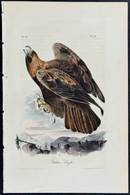
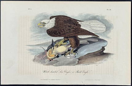
Audubon - White-headed Sea Eagle or Bald Eagle. 14Trillium Antique Prints & Rare Books4.5(30)See Sold PriceFeb 24, 2024
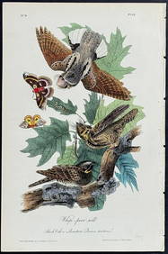
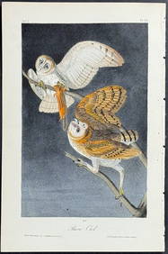
Audubon - Little Screech Owl. 40Trillium Antique Prints & Rare Books4.5(30)See Sold PriceFeb 24, 2024