SoldWit (Frederick de) Utriusque AlsatiæWit (Frederick de) Utriusque Alsatiæ,north-east France, Alsace and Lorraine regions, title cartouche in banner form, with coats-of-arms, and inset map, supported by putti, engraved map with orSee Sold Price
SoldWIT, Frederick de (1630-1706). [Composite Atlas].WIT, Frederick de (1630-1706). [Composite Atlas]. Amsterdam: F. de Wit, [n.d. ma circa 1680]. Bellissimo atlante composito con oltre 117 mappe di cui la maggior parte a doppia pagina e colorate all'epSee Sold Price
SoldWIT, FREDERICK de. Novissima et Accuratissima TotiusWIT, FREDERICK de. Novissima et Accuratissima Totius Americae Descriptio. Double-page engraved map of the Americas showing California as an island. 20x23½ inches sheet size, ample margins; originSee Sold Price
Sold(BRITISH ISLES.) Wit, Frederick de. Novissima Prae(BRITISH ISLES.) Wit, Frederick de. Novissima Prae Caeteris Aliis Accuratissima Regnorum Angliae, Scotiae, Hiberniae. Engraved map of England, Scotland and Ireland. 23¾x20 inches sheet size, narrSee Sold Price
Sold[Wit (Frederick de)] Riga[Wit (Frederick de)] Rigaengraved town plan, with full hand-colouring, 390 x 492mm., slight wear to vertical and horizontal folds, side margins cut close, with a few nicks and short tears, [AmSee Sold Price
SoldWit, Frederick de. General AtlasWit, Frederick de General Atlas 1656-1666 Copperplate engraving; old coloured Printed area: 32.4 x 50.8 cm; 12.6 x 19.6 in An interesting Dutch composite atlas which includes an early dated issue of dSee Sold Price
SoldWIT, FREDERICK de. Russia vulgo Moscovia.WIT, FREDERICK de. Russia vulgo Moscovia. Double-page engraved map, 455x565 mm, wide margins; hand-colored in outline, with topographical elements additionally colored; minor marginal soiling and staiSee Sold Price
SoldWit (Frederick de) GreeceWit (Frederick de) Accurata totius Archipelagi et Græciæ Universæ Tabula,large pictorial title cartoche, lower left, engraved map with original hand-colouring in outline, cartouche fully colouSee Sold Price
SoldWit (Frederick de) Totius AfricaeWit (Frederick de) Totius AfricaeAfrica, with cartoche showing costumed and native figures, 2 lions and an elephant, engraved map with original hand-colouring, 490 x 577mm., central vertical fSee Sold Price
Sold* WIT, Frederick de (1629/30-1706). Novissima et* WIT, Frederick de (1629/30-1706). Novissima et Accuratissima Septentrionalis ac Meridionalis Americae Descriptio. Amsteram, ca 1680. Engraved map of the Americas, image 490 x 582 mm (sheet 538 x 878See Sold Price
SoldWit (Frederick de) Accurata ScaniæWit (Frederick de) Accurata Scaniæ, Blekingiæ, et Hallandiæ descriptio, southern Sweden and eastern regions of Denmark, inset map of Gottenberg and environs, title cartouche in banner held bySee Sold Price
SoldWit (Frederick de) Cimbebas et CaffariæWit (Frederick de) Cimbebas et Caffariæthe south west coast of Africa, oriented with north to the left, from Angola to the Cape of Good Hope, with decorative title cartouche of European figureSee Sold Price
SoldWit (Frederick de) Tractus Littorales GuineæWit (Frederick de) Tractus Littorales Guineæcoastal chart of West Africa from north of Gambia to Angola, with large figurative cartouche of gold- and slave-traders, rhum lines and ships, engrSee Sold Price
SoldWit (Frederick de) Platte Grondt... LondonWit (Frederick de) Platte Grondt der Stadt London met de Aenwysinghe hoe die Afgebrandt is,London, extending from Bunhill to St. George's Southwark, and from St. James's to Redriff, with descrSee Sold Price
SoldWit (Frederick de) Holsatiæ Tabula GeneralisWit (Frederick de) Holsatiæ Tabula Generalis,northern Germany, with decorative title cartouche, engraved map with full original hand-colouring, 502 x 615mm., central vertical fold, a few repaiSee Sold Price
SoldWit (Frederick de) Scotia RegnumWit (Frederick de) Scotia Regnum,all of Scotland, including the Orkneys and Hebrides, with architectural title cartouche and putto, lower left, and national shield supported by putti, upper leSee Sold Price
SoldWIT, FREDERICK de. Septentrionaliora AmericaeWITH ORIGINAL COLOR. WIT, FREDERICK de. Septentrionaliora Americae a Groenlandia. Double-page engraved map, 495x565 mm, wide margins; hand-colored; a few marginal edge tears, minor separation along bSee Sold Price
SoldWit (Frederick de) Traiectum ad Mosam, vulgo MaestWit (Frederick de) Traiectum ad Mosam, vulgo Maestricht,bird's-eye plan of Maastricht, with the city's coat of arms and an ecclesiastical coat of arms, engraving with hand-colouring, 410 x 505See Sold Price
Wit, Frederick de. Nova Orbis Tabula in LucemWit, Frederick de Nova Orbis Tabula in Lucem 1680 Copperplate engraving; coloured Printed area: 57.6 x 48.8 cm; 22.4 x 19.2 in de Wit's striking double hemisphere map of the World is one of the most aSee Sold Price
Wit, Frederick de. World and continents (set)Wit, Frederick de Set of Five Maps (Wit) 1670 Copperplate engraving; coloured Printed area: World: 48.8 x 57.6 cm; 19.2 x 22.7 in Africa: 49.2 x 58 cm; 19.4 x 22.8 in America: 49.2 x 58.3 cm; 19.4 x 2See Sold Price
SoldWit (Frederick de) - Nova Africa Descriptio,carte-à-figures with 6 panels of city views above, and 4 panels of various national costume figures at each side, first issued in 1660, but this state with the date removed, engraved map, 440 x 5See Sold Price
SoldWit (Frederick de) Costes de l'AfriqueWit (Frederick de) Costes de l'Afriquecoastal chart of most of the continent of Africa from the Mediterranean, the Red Sea, Indian Ocean, Cape of Good Hope north to Gabon, with inset plan of FSee Sold Price
INDIA & EAST INDIES - WIT, Frederick de.INDIA & EAST INDIES - WIT, Frederick de. Tabula Indiæ Orientalis. (Amst., Frederick de Wit, 1662). (Ca. 45,5 x 56 cm). Attractive map depicting India, Southern China, the Philippines, the East IndiesSee Sold Price
Wit (Frederick de) Nova Orbis TabulaWit (Frederick de) Nova Orbis Tabula, in lucem edita,engraved map with full orignal hand-colouring, 480 x 570mm., central vertical fold, a little creasing adjacent to fold, uneven damp-staininSee Sold Price
EARLY 18TH C. DUTCH CHART OF PACIFIC OCEAN BY FREDERIK DE WIT (1629-1706) WITH CALIFORNIA AS ANThomaston Place Auction Galleries4.4(386)See Sold PriceFeb 24, 2024
HOFFMANN, Professor (Angelo Lewis, 1839 – 1919). Tricks wit...Potter & Potter Auctions4.6(539)See Sold PriceFeb 24, 2024
Frederick M Perl Germany California 1890 - 1963 Oil Painting Abstract 1956Global Auctions Company4.3(36)See Sold PriceMar 03, 2024
THE WORKS OF CARLYLE, EDITION DE LUXE, 10 VOLUMES, 1900-1910The Rug Life4.3(12)See Sold PriceMar 07, 2024
Map: A 17thC engraved and hand coloured map after Frederik de Wit (1630-1706) titled Nova Persiae,Claydon Auctioneers Ltd4.3(125)See Sold PriceFeb 26, 2024
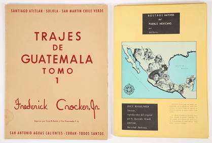
2 color portfolios Natives of Mexico and GuatemalaConcept Art Gallery4.7(508)See Sold PriceMar 06, 2024
Unique collection of 18 carte de visites of Queen Victoria’s familyJasper524.5(9.8k)See Sold PriceFeb 27, 2024
Philip James de Loutherbourg Landscape and Figures 1834 Engraving SignedKCM Galleries4.7(164)See Sold PriceFeb 25, 2024
FREDERICK WILLIAM II: (1744-1797)International Autograph Auctions Europe S.L.4.5(52)See Sold PriceMar 14, 2024


![WIT, Frederick de (1630-1706). [Composite Atlas]. (1 of 4)](https://p1.liveauctioneers.com/3662/102842/52581030_1_x.jpg?height=282&quality=70&version=1492593376)


![[Wit (Frederick de)] Riga (1 of 1)](https://p1.liveauctioneers.com/410/8611/1592347_1_x.jpg?height=282&quality=70)