SoldWIT, Frederick de (1630-1706). [Composite Atlas].WIT, Frederick de (1630-1706). [Composite Atlas]. Amsterdam: F. de Wit, [n.d. ma circa 1680]. Bellissimo atlante composito con oltre 117 mappe di cui la maggior parte a doppia pagina e colorate all'epSee Sold Price
SoldAtlasWIT, Frederick de (1630-1706). Amsterdam: Frederick de Wit, [ca 1680]. Folio (20 4/8 x 12 4/8 inches). Engraved allegorical title-page with letterpress index on verso (re-margined at an early date) anSee Sold Price
SoldDe Wit's Sea Atlas in Original ColorOrbis Maritimus ofte Zee. WIT, Frederick de (1630-1706). Amsterdam: F. de Wit, 1690. Folio (21 x 12 4/8 inches). Engraved allegorical title-page showing the globe surmounted by the figure of Atlas witSee Sold Price
SoldWit Maritime Atlas 1690WIT, Frederick de (1630 - 1706).Orbis Maritimus ofte Zee...Amsterdam: F. de Wit, ca. 1690.Provenance: engraved armorial bookplate of Baron de Launoit on the front free endpaper; Christopher Henry BeauSee Sold Price
SoldAN ANTIQUE MAP, "Occidentalior Tractus IndiarumAN ANTIQUE MAP, "Occidentalior Tractus Indiarum Orientalium à Promontorio Bonæ Spei ad C. Comorin," AMSTERDAM, CIRCA 1675, hand colored engraving on paper, printed by Frederick de Wit (1630-1706), sSee Sold Price
SoldAN ANTIQUE MAP, "Poli Arctici et CircumiacentiumAN ANTIQUE MAP, "Poli Arctici et Circumiacentium Terrarum Descriptio Novissima," CIRCA 1676, hand colored engraving on paper, published by Frederick de Wit (1630-1706), a banner cartouche U/L, "GedrucSee Sold Price
SoldAN ANTIQUE MAP, "Accuratissima Angliæ Regni et WalliæAN ANTIQUE MAP, "Accuratissima Angliæ Regni et Walliæ Principatus," AMSTERDAM, CIRCA 1680, hand colored engraving on paper, published by Frederick de Wit (1630-1706), showing most of the British IslSee Sold Price
De Wit Map of CreteInsula Candia Ejusque Fortificatio. Frederick de Wit (1630–1706). Engraved map with hand color in part. c. 1688. 21 x 24 1/4 inches sheet. This dramatic map of Crete shows the island following the SSee Sold Price
SoldSinus Gangeticus Vulgo Golfo de Bengala Nova DescriptioFrederick De Wit (1630-1706). Amsterdam: F. De Wit, 1710. Engraved map with original hand color in full. 20 3/4 x 24 3/4 inches sheet. Extremely fine sea chart of the Bay of Bengal, showing Ceylon (SrSee Sold Price
De Wit Map of New SpainNovae Hispaniae, Chili, Peruviae, et Guatimalae. Frederick De Wit (1630-1706). Engraved Map with original hand color in outline. Amsterdam: Ottens, 1745. 21 1/2 x 25 inches sheet. Nice example of thisSee Sold Price
SoldMap, Frederick De WitFrederick De Wit (Dutch, 1630-1706), "Nova Tabula in Lucem Edita," circa 1670, hand-colored engraving, sight (image): 18.5"h x 22"w, overall (with frame): 24"h x 29.5"w. Provenance: Estate of Frank J.See Sold Price
Sold1710 Map, de Witt, Nova Persia, Armenia & ArabiaFrederick de Wit (c. 1630-1706). Engraved Map with hand color in full. Amsterdam: F. De Wit, [c. 1710]. Overall framed size is 32 1/2" x 29 1/2". The detail in the Arabian peninsula is based on SansonSee Sold Price
SoldDe Wit Map of HungaryDE WIT, Frederick (1630-1706). Regni Hungariae, et Regionum, quae ei Quondam Fuere Unitae, ut Transilvaniae, Valachiae, Moldaviae, Serviae, Romaniae, Bulgariae, Bessarabiae, Croatiae, Bosniae, DalmatiSee Sold Price
SoldMaps, Matthaus Seutter and Frederick de Wit(lot of 2) Matthaus Seutter (German, 1678-1757), "Europa Religionis Christianae," copper engraved map with hand coloring and Frederick De Wit (Dutch,1630-1706), "Novissima et Accuratissima totius ItalSee Sold Price
SoldDe Wit World Map, 1690Nova Orbis Tabula in Lucem Edita... Frederick De Wit (1629/1630 – 1706). Engraved Map with Orginal Handcolor in Full. Amsterdam, 1690. 19 1/2 x 23 inches visible, 28 1/4 x 32 inches framed. GorgeousSee Sold Price
SoldDe Wit Map of Southeast AsiaDE WIT, Frederick (1630-1706). Tabula Indiae Orientalis... Engraved map with original hand color in outline. Amsterdam, 1662. 21" x 24" sheet. This beautiful map of Southeast Asia was engraved by JoanSee Sold Price
SoldNova Persiae Armeniae Natoliae et ArabiaeFrederick de Wit (c. 1630-1706). Engraved Map with hand color in full. Amsterdam: F. De Wit, [c. 1710]. (20 ¾ x 24 ¾ inches sheet. The detail in the Arabian peninsula is based on Sanson’s map of 1See Sold Price
De Wit Map of North PolePoli Arctici et Circumiacentium Terrarum. Frederick de Wit (1629/1630-1706). Engraved Map with Original Hand color. Amsterdam, c. 1676. 20 3/4 x 24 3/4 inches sheet, 32 1/2 x 36 1/4 inches framedSee Sold Price
SoldDe Wit's Map of the CaribbeanIndiarum Occidentalium Tractus Littorales cum Insulis Caribicis / Pascaert van Westindien ende Caribise Eylanden. Frederick de Wit (1629/1630-1706). Engraving with original hand-color. Amsterdam, c. 1See Sold Price
SoldDe Wit Map of CreteDE WIT, Frederick (1630-1706). Insula Candia Ejusque Fortificatio. Engraved map with hand color in part. Amsterdam, c. 1688. 21 x 24 1/4" sheet.See Sold Price
De Wit Map of ScandinaviaRegni Sueciae Tabula Generalis, Divifa in Sueciae, Gotiae... Frederick de Wit (1629/1630-1706). Copperplate engraving with original color. Amsterdam: Covens & Mortier, c 1680-1725. 21 1/4 x 25 inchesSee Sold Price
A SET OF FOUR DUTCH HAND COLORED COPPER PLATEA SET OF FOUR DUTCH HAND COLORED COPPER PLATE CARTOGRAPHIC ENGRAVINGS BY FREDERICK DE WIT (Dutch 1630-1706), "...REGNI ANGLIAE...," "...BELGII HISPANICI GALLICI...," "DUCATUS SLESVICENSIS...," "INSULASee Sold Price
De Witt Map Terra NovaTerra Nova... Frederick De Wit (c. 1630-1706). Engraved map with original hand color in part. Amsterdam: Louis Renard, 1715. 20 1/4 x 23 3/4 inches sheet. Third State Sea Chart of the Atlantic Ocean tSee Sold Price
SoldDe Wit Map of AfricaTotius Africa Accuratissima Tabula. Frederick de Wit (1629/1630-1706). Engraved map with original hand color. Amsterdam, c. 1660. 19 1/4 x 23 inches visible, 24 3/4 x 28 1/2 inches framedSee Sold Price
EARLY 18TH C. DUTCH CHART OF PACIFIC OCEAN BY FREDERIK DE WIT (1629-1706) WITH CALIFORNIA AS ANThomaston Place Auction Galleries4.4(393)See Sold PriceFeb 24, 2024
LATE 16TH C. MAP OF SCOTLAND BY MERCATOR, FRAMEDThomaston Place Auction Galleries4.4(393)See Sold PriceFeb 24, 2024
1959 PETIT LAROUSSE French Dictionary EncyclopediaThe Benefit Shop Foundation Inc.4.3(2.9k)See Sold PriceMar 06, 2024
Duval - Pair: Map of Georgia & Map of Moscow, RussiaTrillium Antique Prints & Rare Books4.5(32)See Sold PriceFeb 24, 2024
Duval - Pair: Map of India & Map of MaldivesTrillium Antique Prints & Rare Books4.5(32)See Sold PriceFeb 24, 2024
Map: A 17thC engraved and hand coloured map after Frederik de Wit (1630-1706) titled Nova Persiae,Claydon Auctioneers Ltd4.3(125)See Sold PriceFeb 26, 2024
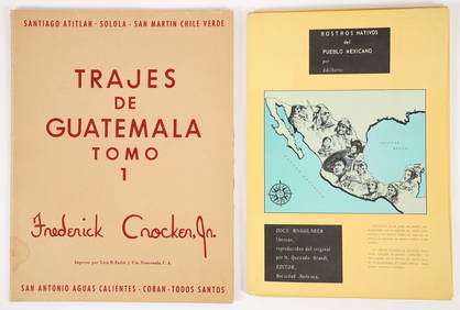
2 color portfolios Natives of Mexico and GuatemalaConcept Art Gallery4.7(510)See Sold PriceMar 06, 2024
1764 Bellin Map of Southern Portion of Martinique -- Partie Meridionale de la MartiniqueJasper524.5(9.9k)See Sold PriceFeb 27, 2024
![WIT, Frederick de (1630-1706). [Composite Atlas]. First Image](https://p1.liveauctioneers.com/3662/102842/52581030_1_x.jpg?height=282&quality=95&version=1492593376&width=282)
![WIT, Frederick de (1630-1706). [Composite Atlas]. (1 of 4)](https://p1.liveauctioneers.com/3662/102842/52581030_1_x.jpg?height=282&quality=70&version=1492593376)
![WIT, Frederick de (1630-1706). [Composite Atlas]. First Image](https://p1.liveauctioneers.com/3662/102842/52581030_1_x.jpg?height=282&quality=1&version=1492593376&width=282)