SoldWalker (J. & C.) IrelandWalker (J. & C.) Ireland, Larne to Bloody Foreland, sheet III, with inset chart of Culdaff Bay and two coastal profiles, engraved chart, with hand-colouring, 650 x 1000mm., small section attacSee Sold Price
SoldOrdnance Survey coastal maps/charts, late 19th century,mostly Ireland, engraved by J & C Walker, Davies et al., sheets 2046 (Waterford Harbour), 1787 (Wexford and Wicklow), 45 & 46 (Larne to Bloody Foreland), 1825B Irish Channel, 44 Dundalk Bay, 1468 (DubSee Sold Price
SoldIrelandTitle: Ireland Publication Date: 1842-01-15 Cartographer: WALKER, J. & C. Publisher: SOCIETY FOR THE DIFFUSION OF USEFUL KNOWLEDGE/S.D.U.K. Size: 15.5Height - 12.3Width Called "Ireland, General" on laSee Sold Price
IRELAND on 2 sheets conjoined 62x50 cm. Round towers Cloigthithe. SDUK 1844 mapTitle: IRELAND on 2 sheets conjoined 62x50 cm. Round towers Cloigthithe. SDUK 1844 map Description: IRELAND' by Engraved by J & C Walker (This map was originally published by The Society for the DiffuSee Sold Price
IRELAND on 2 sheets conjoined 50x62cm. Round towers Cloigthithe. SDUK 1845 mapTitle: IRELAND on 2 sheets conjoined 50x62cm. Round towers Cloigthithe. SDUK 1845 map Description: IRELAND' by Engraved by J & C Walker (1845). Antique steel engraved map with original outline hand coSee Sold Price
IRELAND on 2 sheets conjoined 62x50 cm. Round towers Cloigthithe. SDUK 1844 mapTitle: IRELAND on 2 sheets conjoined 62x50 cm. Round towers Cloigthithe. SDUK 1844 map Description: IRELAND' by Engraved by J & C Walker (This map was originally published by The Society for the DiffuSee Sold Price
Scarce 19th Century Maps Of ScotlandIncluding Scotland - Highlands J & C Walker - circa 1835 Steel engraving published in London by Baldwin & Gadock 1834, Edinburgh map Published by A & C Black, Ireland and Scotland by George F. Cram EnSee Sold Price
SoldMaps, Ireland (North and South)(lot of 2) "Ireland," copper engraved maps with hand coloring, published by The Society for the Diffusion of Useful Knowledge, engraved by J. and C. Walker, overall (with /each): 15"h x 21"wSee Sold Price
SoldWalker (J. & C.) The Strait of Malacca, Sheet 2Walker (J. & C.) The Strait of Malacca, Sheet 2,sea chart showing from the North Sands to Singapore, engraved map, 670 x 980mm., central vertical fold, surface dirt, and stains, with pencil inSee Sold Price
SoldSri Lanka.- East India Company.- Walker (J. & C.)Sri Lanka.- East India Company.- Walker (J & C.) Trigonometrical Survey of the West Coast of Ceylon, Executed by order of the Madras Government, sheet IV only, showing from Dondra Head to Bentotte, enSee Sold Price
SoldWalker (J. & C.) A Geological Map of England, WaleWalker (J. & C.) A Geological Map of England, Wales, and Part of Scotland,with Geological and Mineralogical Section from Land's End to the German Ocean, and St. George's Channel to the GermanSee Sold Price
SoldEngland.- Walker (J. & C.) A Geological Map of England,NO RESERVE England.- Walker (J. & C.) A Geological Map of England, Wales and Part of Scotland, with 24 different geological strata identified by color, and cross-sections showing geological and mineraSee Sold Price
SoldMAPS - IMPERIAL CHINA. WALKER, J. & C. (engraversMAPS - IMPERIAL CHINA. WALKER, J. & C. (engravers) - BEBEROM, K. Gulfs of Pe-Chili & Liau-Tung and Northern Portions of the Yellow Sea; Chifu or Yenti Harbour ... [no. 1260]; Pei-Ho or Peking River,See Sold Price
SoldWalker (J. & C.) A Geological Map of England and Wales,Walker (J. & C.) A Geological Map of England and Wales, showing also the Inland Navigation by means of Rivers & Canals, with their Elevation in feet above the Sea, later issue, large folding hand-coloSee Sold Price
SoldWalker (J & C) Map of the Peninsula of IndiaWalker (John & Charles) engravers. Map of the Peninsula of India, comprising the whole of the Madras Presidency, and portions of the adjacent territories of Bengal and Bombay,second edition, eSee Sold Price
SoldGeological map.- Walker (J. & C.) A Geological Map ofGeological map.- Walker (John & Charles, publishers) A Geological Map of England and Wales, First edition, second state, 'showing also the Inland Navigation by means of Rivers & Canals, with their EleSee Sold Price
Walker (J. & C.) Extra-Peloponnesian GreeceWalker (J. & C.) Map of Extra-Peloponnesian Greece, As it stood at the beginning of the Peloponnesian war, by K.O. Muller, engraved map with original hand-colouring in outline, 590 x 720mm.,See Sold Price
SoldCarrington (R. C., drawn by) & Walker (J. & C.,Carrington (R. C., drawn by) & Walker (J. & C., engravers) Savannah River, Georgia, from the United States Coast Survey 1855, no. 2826, some staining, platemark 670 x 995 mm, 1861; Florida Reefs, CaySee Sold Price
SoldLondon.- Walker (J. & C.) A Plan of London and itsLondon.- Walker (J. & C.) A Plan of London and its Environs, decorative plan centred on Blackfriar's Bridge after Creighton, for Lewis's Topographical Dictionary, lithograph with hand-colouring, sheetSee Sold Price
SoldRussia.- Walker (J. & C.) The Euxine or Black Sea fromNO RESERVE Russia.- Walker (J. & C.) The Euxine or Black Sea from the Russian Survey of 1836, engraving on laid paper, 690 x 980 mm. (27 1/4 x 38 5/8 in), several large tears well into the map, roughSee Sold Price
Walker (J. & C.) - A Plan of London and its Environs,drawn by R.Creighton for Lewis's Topographical Dictionary, from Islington to Kennington and from Limehouse to Hyde Park, engraved plan with hand-colouring, 400 x 480mm., s;ight wear on old folds, 1837See Sold Price
SoldWalker (J. & C.) - Walker's Map of the Great Westernshowing from London to Bristol, lithographed map, 150 x 760 mm., light offsetting, spotting and surface dirt, folding concertina style into contemporary cloth covered boards, with printed label attachSee Sold Price
SoldWalker (J. & C.) - England & Wales, founded upon Theshewing all the Mail Coaches, Turnpike & Rail Roads, engraved map with full original hand-colouring, three sheets joined, 1360 x 1040mm., dissected and mounted on linen, with red covered ends, light sSee Sold Price
SoldWalker (J. & C.) CambridgeshireWalker (J. & C.) Cambridgeshire,map extending from Lincolnshire to Suffolk, showing places of the Meeting of Foxhounds, lithographed map with original outline hand-colouring, 390 x 325mm., cenSee Sold Price
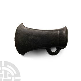
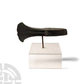
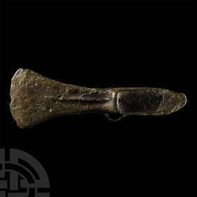
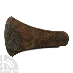
Bronze Age South-Eastern Type Looped and Socketted AxeheadTimeLine Auctions Ltd.4.5(183)See Sold PriceMar 05, 2024
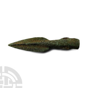
British Bronze Age Basal-Looped and Socketed SpearheadTimeLine Auctions Ltd.4.5(183)See Sold PriceMar 07, 2024
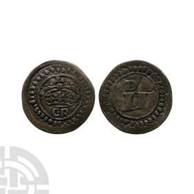
Irish Coins - Ireland - Contemporary Forgery - AR Ormonde Besieged TwopenceTimeLine Auctions Ltd.4.5(183)See Sold PriceMar 09, 2024
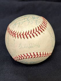
1960's Cleveland Indians Team Signed BaseballDana J. Tharp Auctions4.7(268)See Sold PriceFeb 24, 2024
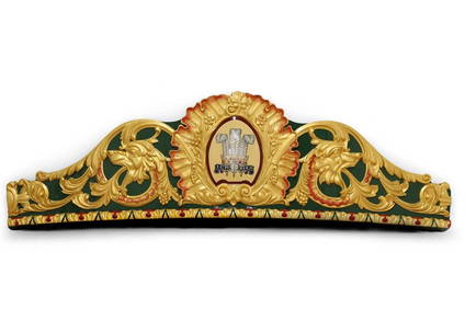
A large and well-carved curving fairground carousel dome panel by C J Spooner,Sworders Fine Art Auctioneers4.4(30)See Sold PriceMar 07, 2024
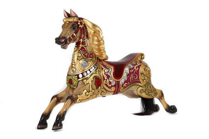
A magnificent large fairground carousel galloper horse by Anderson,Sworders Fine Art Auctioneers4.4(30)See Sold PriceMar 07, 2024
8 Stereoscope Cards - Ships: Columbus Flag Ship, Battleship Indiana 1887-early 1900'sNorth American Artifact Auctions4.6(182)See Sold PriceApr 20, 2024
[BUSINESS -- WALKER, Madam C.J. (born Sarah Breedlove, 1867-1919)]. The Madam C.J. Walker BeautyFreeman's | Hindman4.4(1.6k)See Sold PriceFeb 27, 2024
J. C. Armitage "Ionicus" (British, 1913-1998) Signed Watercolor and Pencil Golf Art IllustrationsHoch LTD.4.5(73)See Sold PriceFeb 25, 2024
Lionel postwar O 19437 J C Penney steam freight set in original boxToystrainsandotheroldstuff LLC4.8(439)See Sold PriceMar 02, 2024


![[BUSINESS -- WALKER, Madam C.J. (born Sarah Breedlove, 1867-1919)]. The Madam C.J. Walker Beauty (1 of 9)](https://p1.liveauctioneers.com/197/319238/171467936_1_x.jpg?height=282&quality=70&version=1708470653)